Just a quick follow up on the little winter event Monday in our region. I have heard from a lot of people thinking this will not happen, simply because we have had two days in the 60s.There have been many times I’ve seen a quick turn of weather like this which is why I wanted to let you know and avoid a surprise.
Notes:
I also want to reiterate that most of our region will likely have roads remain wet, but there could be some slushy coating on the grass west and north of Baltimore.Especially with a burst of snow for at least an hour or two.
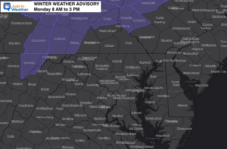
Onset time between 7 to 10 AM.
Frontogenesis: We will be watching rapid development of the precipitation forming over our region as a warm front takes form.
Our temps may drop as it begins, then remain steady into the early afternoon. It will be warm air at cloud level that does all the work.
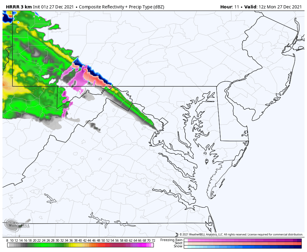
This may begin as rain or sleet, then turn to slushy snow burst, then back to mix and rain.
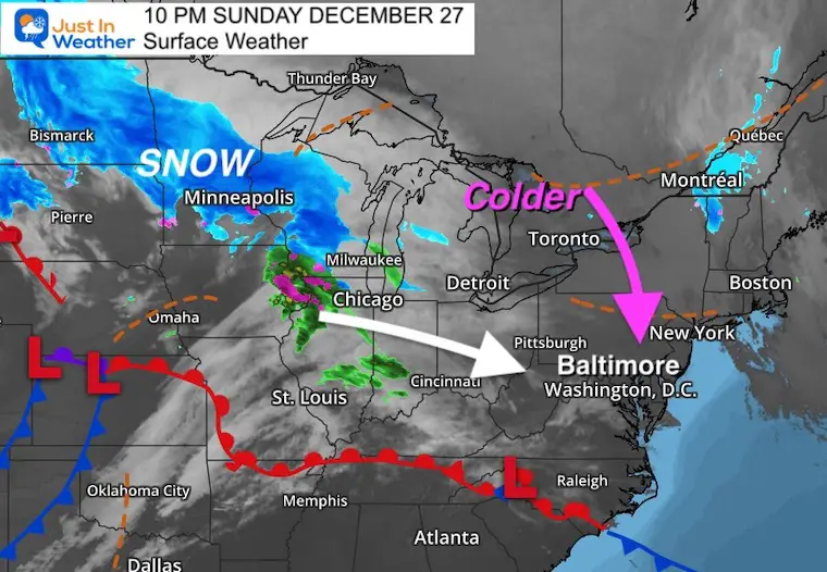
A band of snow if moving through the Northern Plains. Ahead of it, some of the cold air will be dropping south. It now looks like it will arrive just in time Monday morning.
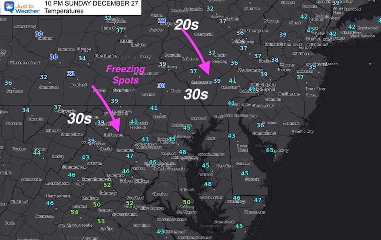
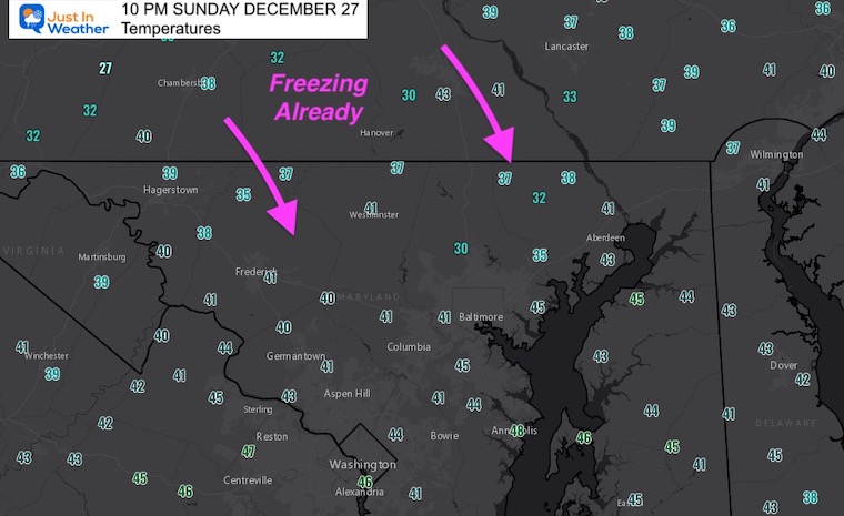
Temperature Update at 10 PM
Regional
The new air mass is trying to build in quickly.
Hyper Local Readings
The 30s are expanding with the help of a clear sky and northerly winds.
Forecast Maps based on the High Resolution Rapid Refresh Model (HRRR)
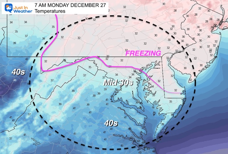
Temperatures At Sunrise
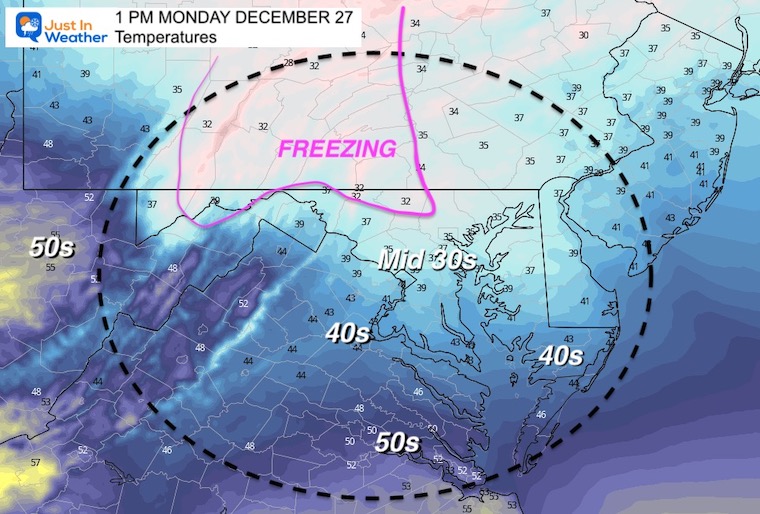
Freezing line now expected to make it in to central Maryland.
Temps may drop a few degrees as the precipitation begins to fall.
This may start as rain or sleet, then turn to snow, before going back to mix and rain.
Radar Simulation —> slider
7 AM to 1 PM
(Animation is below if you prefer to watch in motion)
december-27-weather-snow-sleet-hrrr-Monday-am-7
december-27-weather-snow-sleet-hrrr-Monday-am-8
december-27-weather-snow-sleet-hrrr-Monday-am-9
december-27-weather-snow-sleet-hrrr-Monday-am-10
december-27-weather-snow-sleet-hrrr-Monday-am-11
december-27-weather-snow-sleet-hrrr-Monday-pm-12
december-27-weather-snow-sleet-hrrr-Monday-pm-1
Temperatures at 1 PM
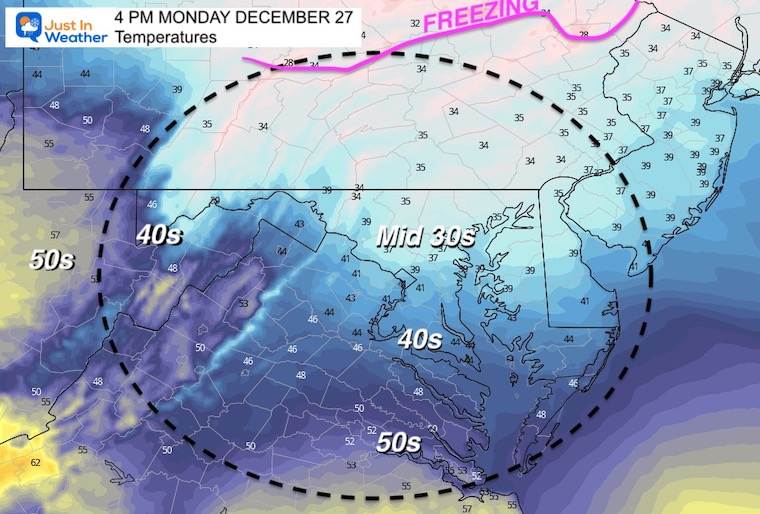
Temperatures at 4 PM
Radar Simulation Animation
7 AM to 3 PM
Here we see the quick burst lasting just a few hours. Most will be done by early afternoon, with only scattered showers left behind.
I will aim for my regular morning update between 6:30 AM and 7 AM Monday morning.