December 26, 2021 Evening Report
There will be some snow on Monday. We now have two days of 60ºF or warmer, so it’s likely most roads stay wet. But there will be a wintry mix falling during the day with perhaps a coating on the grass. Some concern if you travel north.
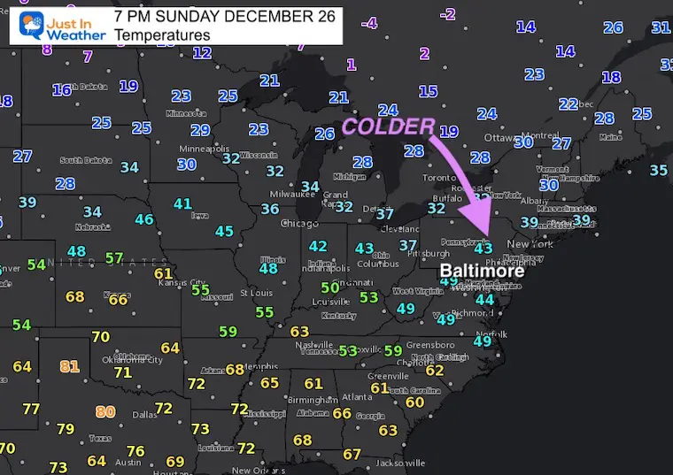
Saturday High at BWI was 68ºF
Sunday High at BWI was 60ºF
‘Normal’ should be 45ºF. So yes, the roads are warm. But there will be quick cooling with precipitation on Monday. Timing after 10 AM will help most regional roads stay wet.
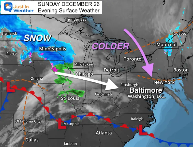
Sunday Evening Weather
A band of snow if moving through the Northern Plains. Ahead of it, some of the cold air will be dropping south. It now looks like it will arrive just in time Monday morning.
Sunday Evening Temperatures
Colder air will be dropping in tonight. We will NOT get the core of the arctic air, but it will be just cold enough when the precipitation arrives.
Monday Weather Notes:
- The models below show a variety of solutions for what may fall.
- There is a good chance most of the region sees snow and or sleet falling.
- Any stickage is more likely on grass and elevated surfaces.
- Traveling up I-95, there should be some slushy snow, but roads will stay wet. They had warm days this weekend as well.
- Parts of I-70 to I-68 may have some slick spots over the mountains.
- Traveling north on I-81, west on I-76 to Pittsburgh, or northeast on I-78 into the Poconos this may impact roads.
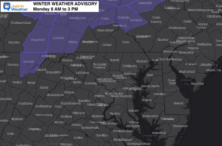
- Winter Weather Advisory in central PA. More on that below.
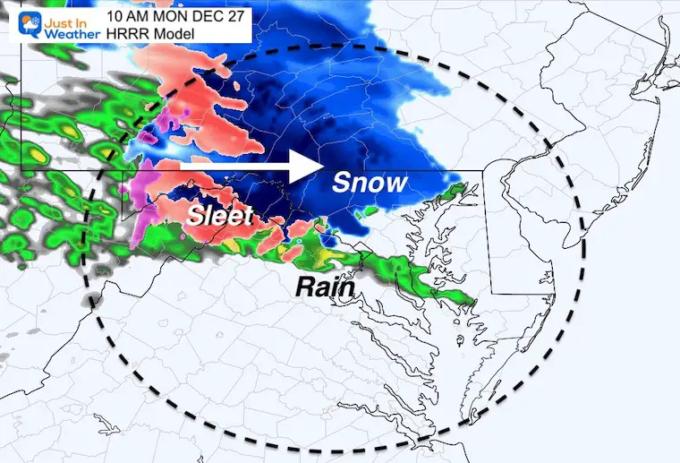
Monday Morning: Short Range Models
Arrival BY 10 AM
Both the HRRR and NAM are showing overrunning snow and sleet. This is when moisture rides up and over the cold air. The mid range temps support frozen precipitation, even with surface temps in the low to mid 30s.
The HRRR is a bit more robust, and I have reason to believe this. I will have a more detailed timeline from this model in my next update.
NAM Model Animation:
7 AM to 7 PM
This is also showing the arrival after 10 AM. However, this model has a tendency to run at least 1 to 2 hours slow.

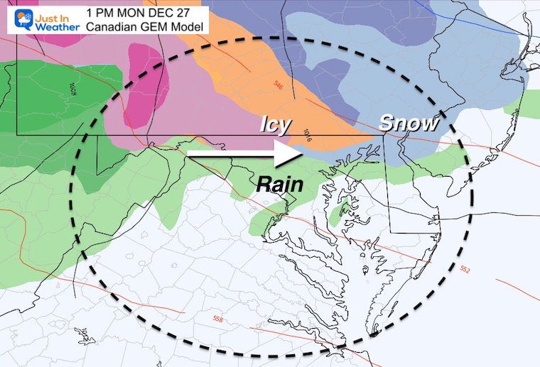
Mid Range Models:
Afternoon Snapshot at 1 PM
Canadian GEM
This is the warmest solution with the frozen ‘stuff; north of Frederick, but still falling on Westminster through the Hereford Zone and including Bel Air to Elkton.
Temps near freezing and some ice may impact some travel in southern PA.
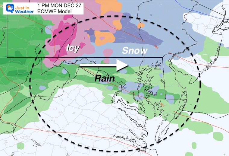
European ECMWF Model
This shows a slushy mix of snow and rain. However, this also includes temps mostly just above 32ºF, so any stickage would be on the grass.
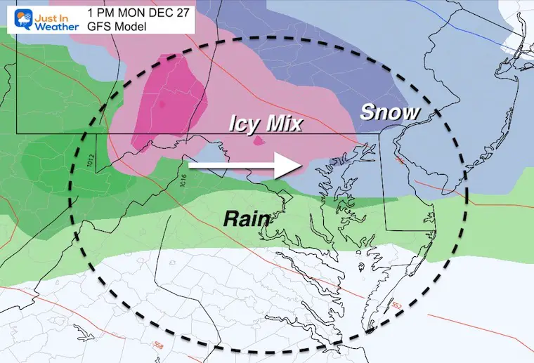
GFS Model
This is the most aggressive with holding the cold air and wintry mix all day, even in central Maryland.
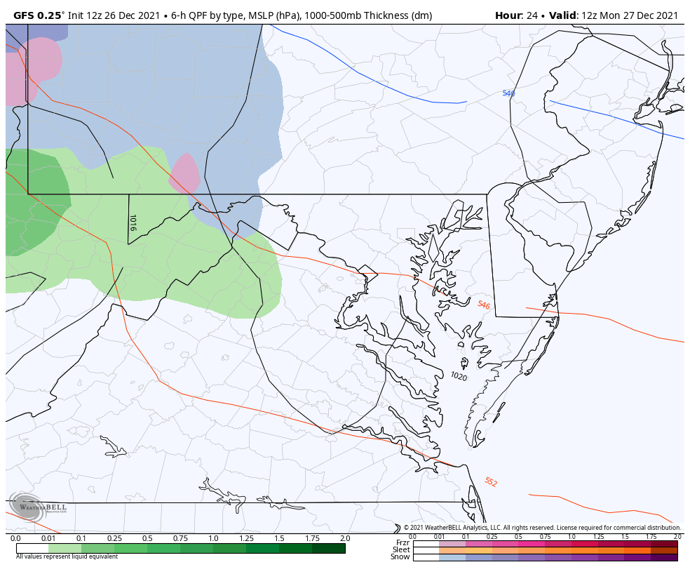
GFS Model Simulation
7 AM Monday to 7 AM Tuesday
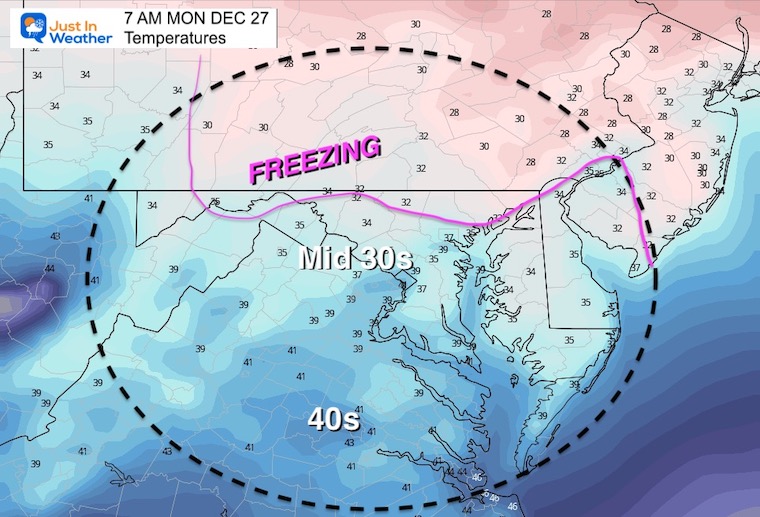
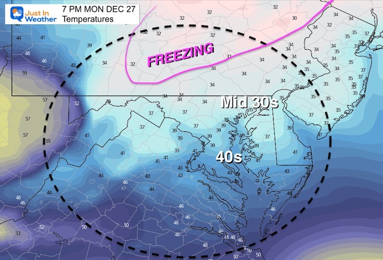
Temperature Forecast
The surface temps will barely be at freezing for the northern zones, but remain above 32ºF for Baltimore and south.
We can expect temps to dry after the snow and mix arrives, then hold nearly steady through the afternoon.
Morning
Afternoon
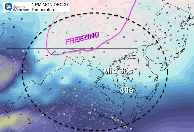
Evening
Winter Weather Advisory
Monday December 27
8 AM to 3 PM
Next Update around 10 PM will have the HRRR Model simulation timeline.
gravityform id=”1″ title=”true” description=”true” ]
ALSO SEE
Winter Outlook Series:
My Call For Snowfall

Last Winter Recap: My Old Outlook And Your Grades Of My Storm Forecasts


Please share your thoughts, best weather pics/video, or just keep in touch via social media


