


May 12 Mothers Day Showers And Another Aurora Viewing Tonight May Be Better
Sunday May 12 Mother's Day Morning Report Today, we focus on the all-important Mother’s Day weather and the ongoing impact of the latest Solar Storm. We have been stuck in…
Wednesday December 15
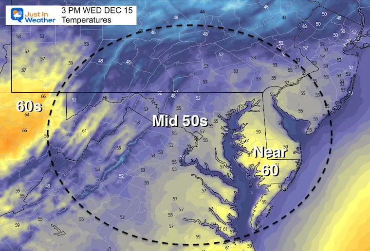
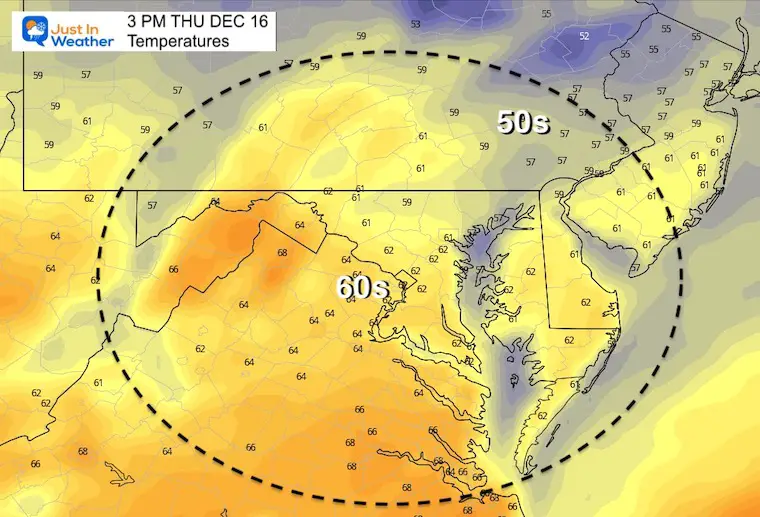
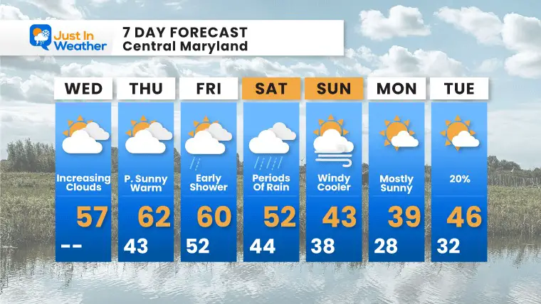
This is the time we get into the warm stretch we have talked about. It will be here for a few days, but tampered down a little. This may be hindered by variable clouds, then come to an end with rain on Saturday.
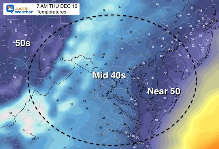
The colder air will return on Sunday, and be with us next week.
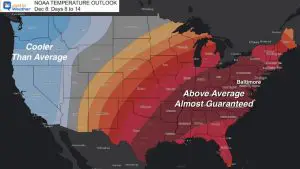
I have highlighted the flaw in computer modeling that dangled a phantom snow storm next week, but we will still get into the colder air Christmas week. In fact even the models that pushed in a mild holiday are now trending colder. That fits the pattern I had mentioned before we got into this.
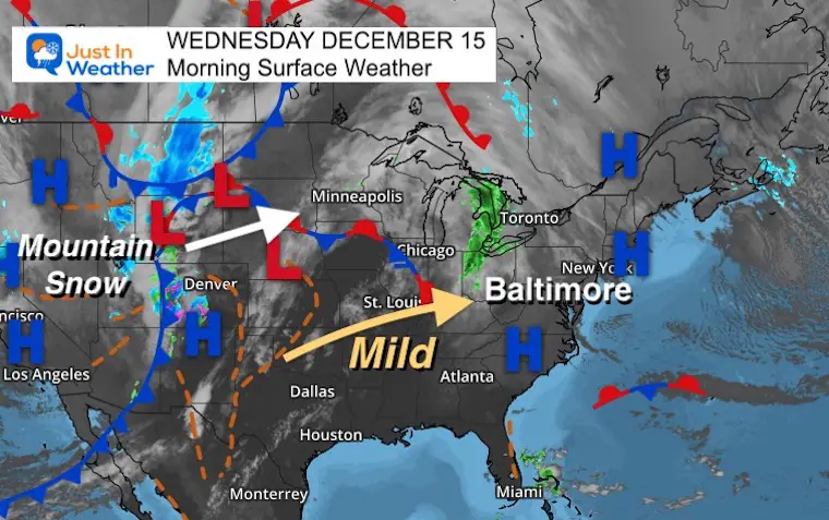
Morning Surface Weather
One system to our north will send in some additional clouds and a small chance of sprinkles late in the day. The theme is the mild air on the way in.
A major snow storm in the mountains will push into the north plains, but also could spark some more severe weather in the plains- not for us.
Morning Temperatures
A wide stretch of conditions with 20s to the north and western mountains.
30s and 40s in metro areas, and even the lower 50s by the beaches.
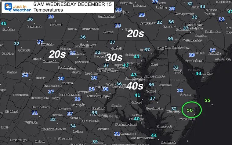
About 10 degrees above average.
Weather Almanac: Climate Data
TODAY December 14
Normal Low in Baltimore: 28ºF
Record 9ºF in 1962
Normal High in Baltimore: 45ºF
Record 70ºF 1971
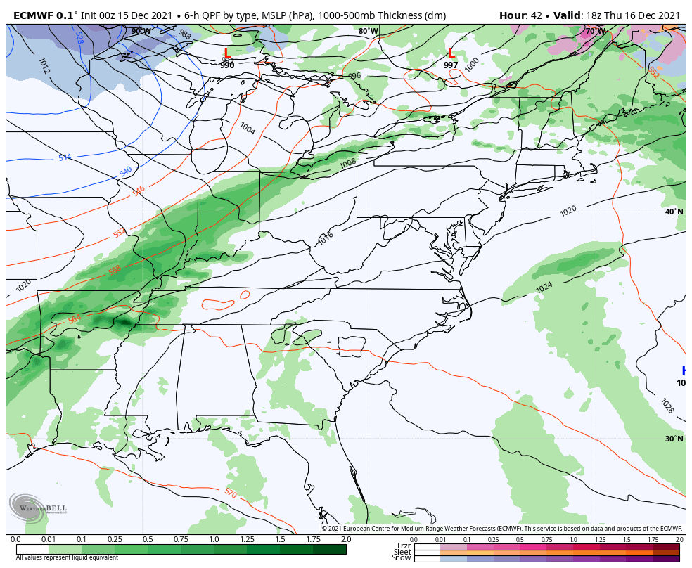
Here we see the next system that may send in showers overnight Thursday into early Friday.
Saturday will bring periods of rain. The main even will be later in the day (again), ushering in the colder air for Sunday.
Yesterday I wrote a report about
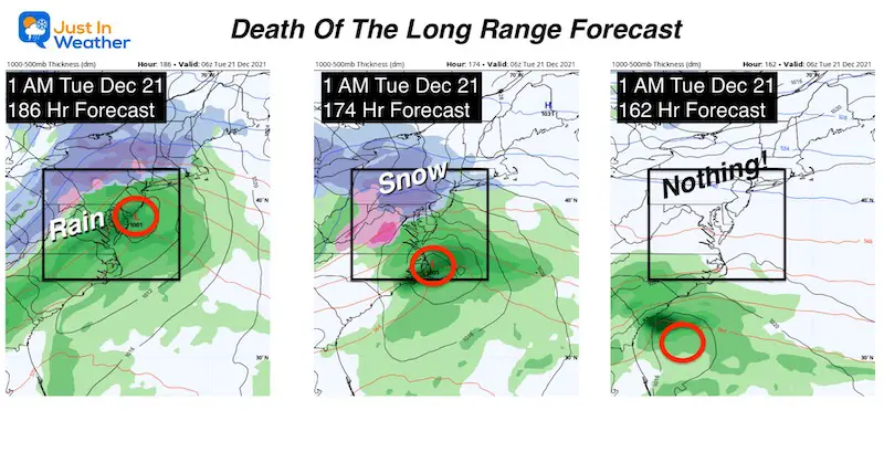
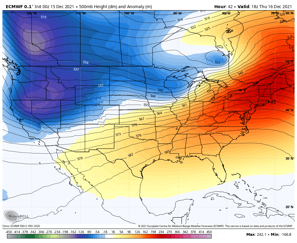
I do not have confidence in surface systems on display beyond 5 days.. but I do trust the trend in pattern changes. Here we see the jet stream showing the warm ridge the week, being related by a colder trough into Christmas Week. I still stand by colder weather into Christmas, and your wether apps may already be reflecting/flipping from their warmth to show that as well.
A few days are expected to reach the 60s. This should come to an end with rain on Saturday, then back to near or below normal temps into early next week.

Last Winter Recap: My Old Outlook And Your Grades Of My Storm Forecasts


