


April 27 Weather Chilly With Showers Then Turning Up The Summer Heat
Saturday, April 27 Morning Report One day to get through before the surge of summer heat. Today, we get clouds and rain showers as a warm front approaches. But on…
December 7 2021- Mid Day Update
I spoke with my buddy and former colleague Tony Pann this morning. He was driving in to WBAL and will be mentioning what I am about to tell you on his podcast today: He said, “If it doesn’t snow tomorrow, I am not going outside.” I understand!
We were not the only ones tracking this ‘light’ snow. Crews have put brine down on roads in parts of Carroll County, MD, possibly in other area. They get their info from NWS which has also been monitoring snow.
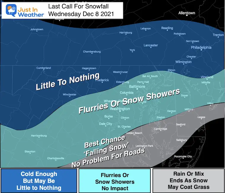
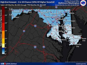
There will be some light snow in the region on Wednesday, but currently this ‘event’ is looking more wimpy than anything. At this juncture one day away, I am downgrading expectations (from a coating to 1 inch) to little if anything. There will be school as normal. I didn’t expect otherwise. But, I share in the disappointment which I’ll explain below.
I focused my messaging to address the warmer ground influencing roads in metro areas to downplay the impact. But with potential for stickage on the grass, anything less will look like missed call.
The excitement of the first snow still resonates with many of us. The potential of any impact is the reality. Aside from writing here and on social media, I have an obligation to my clients that range from school planning to snow removal.
I’ve kept them in the loop with trends, even this downgrade.
I spent the morning contacting all of them to call off any need for plans tomorrow. One client spends $250,000 in winter prep for materials and loading plows on trucks. So, there is pressure to get it right. They are ready when it hits, but it won’t be needed this time.
While downplaying this, I will still do an evening nowcasting update.
We have watched this early dance of models showing snow for many days. I had snow showers on my forecast since last Thursday, but only in the past two days did the anticipation build.
I admit my part in this play. I had to give some credit to the upgraded GFS Model. But while this was the most aggressive, I still remained on the cautious and much lower with my call of a dusting to 1 inch.
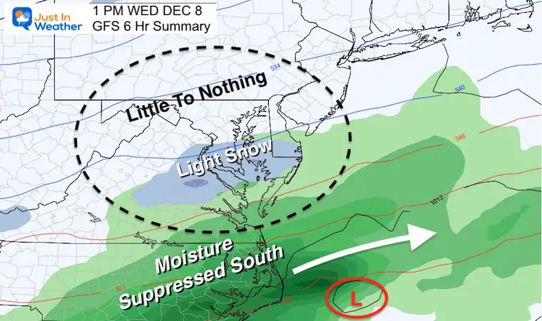
So when that model led the charge with steady snow, while the ECMWF was fading, it was hard to ignore. As recently as yesterday, the GFS showed 1 to 3 inches of snow in metro Baltimore.
I showed that in my report last night, but didn’t bite on it. I stayed with a coating to 1 inch. Even that now looks less likely.
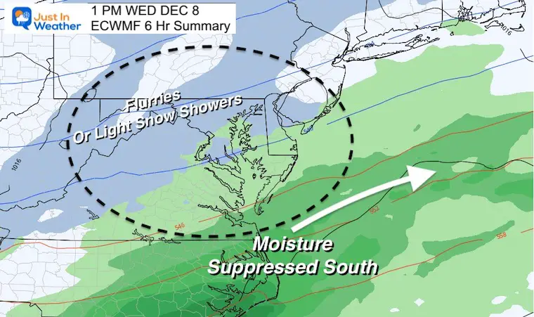
At first glance this afternoon it looks like a good set up. But the parts that need to come together to develop, may link up a little later and father east.
While both light events, there is too much difference just one day away. We would like a little more agreement at this time. The raises more questions.
The timing of the northern trough with the southern moisture is shown to team, however later. This allows the push south and east.
One glimmer of hope to watch flakes falling are shown on the European Model. The GFS has pushed this farther south and east, out of the central Maryland reach.
I still see there will be some middle ground when verified.
Each season I see a new set of conditions to factor and learn from. I look for patterns to apply in my forecasting. I have already had hesitation with recent computer guidance accuracy, which I’ve mentioned many times.
The issue a lot of us meteorologists have, relate to concerns with the American GFS Model. It is one of many model guidance solutions I view, but as I mentioned in my winter outlook: I have seen errors in all the model support.
This GFS has often played 2nd place to the leading European ECMWF model.
But, GFS got a $505M upgrade budget in 2020. One upgrade to the modeling came in March. Two supercomputers costing $105M will be operational in 2022. We could use it now!
Click the image for the resource page
Note: There are ‘official’, high and low snow maps to view.
Also, the Pennsylvania mapping only is for 24 hours and at last check did not include the event yet.
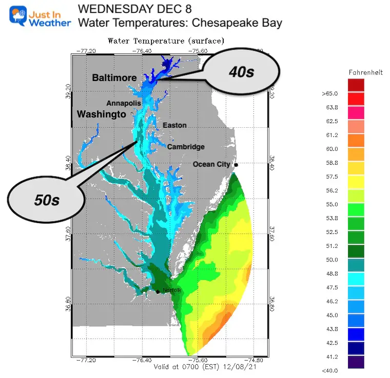
Click the image for all water forecast maps

Last Winter Recap: My Old Outlook And Your Grades Of My Storm Forecasts


