Conditions: Baltimore, Maryland, 04/23/2024 04:50:03 pm
Temperature

69°

Mostly Cloudy

35°

Dew Point
Relative Humidity

28%

Feels Like

69°

Wind (SE)

13mph

Air Pressure

29.99

Sun
Sun Rise

06:17 AM

Sun Set

07:52 PM

Day Length

13:35 Hours

Difference

2 min 20 sec gain

Moon
Moon Rise

07:52 PM

Moon Set

06:00 AM

Next: Full Moon

Apr 23,2024

Moon Phase

Waxing Gibbous

Climate
Average Low

45°

67°

Average High
Record Low

31°


(1982)

94°


(1960)
Record High
Conditions

November 30 Light Snow And Flurries Arrived Earlier This Morning

Winter Weather
Forecast

Tuesday November 30

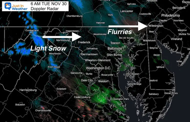
My first look at the radar this morning was at 5 AM, and it already showed light snow and flurries. This supports my theory of the model guidance bias. It arrived 3 to 4 hours earlier than suggested and covered more area into Virginia. 

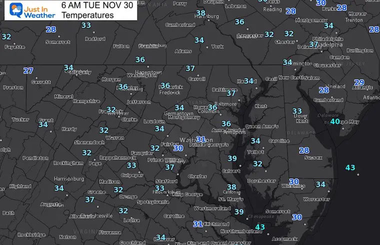
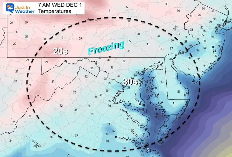
Reminder: This may be exciting for snow lovers, but will not be a travel concern.  Temps are near or above freeing for most of our region. 

However, if you are traveling north of I-76 (Penn Turnpike) there may be a little more on the mountains.


Morning Surface Weather

The Clipper will swing through our north today. There is support to keep light showers around through mid day locally. But farther north, closer to the Low Pressure, there will be more robust showers and some impact in the Poconos, and interior NY to New England. 


Morning Radar Snapshot

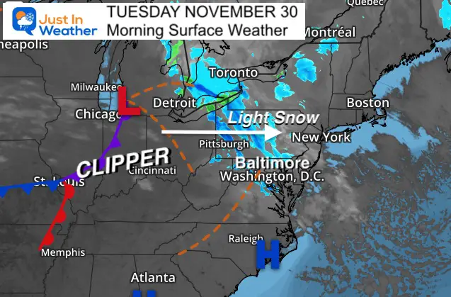
This coverage is about 2 to 3 hours early than mile guidance sh0wed yesterday. This is a theme I will be applying to storms in the winter ahead.


Radar Simulation —> Slider

This product has been the best performer, but still has been slow and a little limited with comparison to radar verification. 

Light showers may continue to around lunchtime.

november-30-weather-snow-radar-simulation-tuesday-am-6
november-30-weather-snow-radar-simulation-tuesday-am-7
november-30-weather-snow-radar-simulation-tuesday-am-8
november-30-weather-snow-radar-simulation-tuesday-am-9
november-30-weather-snow-radar-simulation-tuesday-am-10
november-30-weather-snow-radar-simulation-tuesday-am-11
november-30-weather-snow-radar-simulation-tuesday-pm-12
november-30-weather-snow-radar-simulation-tuesday-pm-1
november-30-weather-snow-radar-simulation-tuesday-pm-2
previous arrow
next arrow

Morning Temperatures

Not much freezing air to be found, so no worries about any snow flakes you see falling.


Afternoon Temperatures 

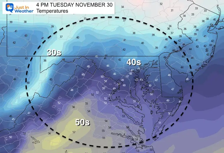
Still chilly later today.


Weather Almanac: Climate Data

TODAY November 30

Normal Low in Baltimore:  32ºF

Record 12ºF in 1929


Normal High in Baltimore: 51ºF

Record 74ºF 1933


Wednesday  Temperatures 

Morning

Freezing air will be farther inland.


Afternoon

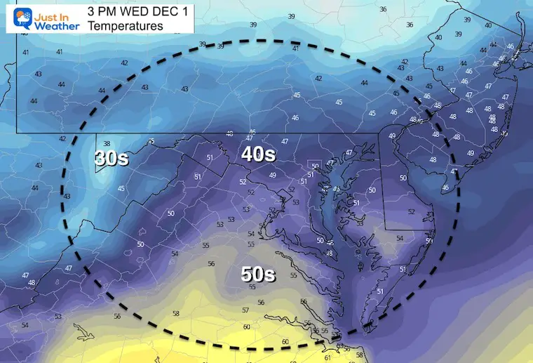
Starting to warm back up closer to ‘average’.


Looking Ahead:

Tuesday to Monday Animation 

The storm track remains to our north. 

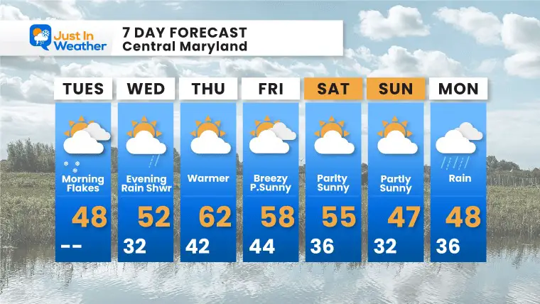
The next system may bring rain showers Wednesday evening and night. Then a brief warm up Thursday.

The next system looks like rain, at least at the start… on Monday. This will be followed by the next return to temps below average. 


November-30-weather-snow-rain-forecast


7 Day Forecast

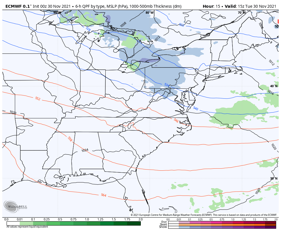
I sped up the next rain risk to Wednesday night. Then the warmest day of the week will be Thursday.

We remain mild most of the week, but after the storm on Monday, temps will drop below average again. 


Weather posts straight to your inbox

Sign up and be the first to know!


ALL FITF APPAREL


Also see:

What is Faith in the Flakes: History of December 5th Snow


Winter Outlook Series:

My Call For Snowfall


Last Winter Recap: My Old Outlook And Your Grades Of My Storm Forecasts

Winter Weather Page – Lots of resources


Solar Cycle Increasing Sunspots Suggests More Snow


Comparing 4 Different Farmer’s Almanacs: Majority colder winter outlook than NOAA


NOAA Winter Outlook- But Read The Fine Print


Signals For Early Start To Winter In November


Winter Outlook Series: La Nina Double Dip


Nor’easters May Give Hint For Winter La Nina Pattern


Winter Folklore Checklist


Please share your thoughts, best weather pics/video, or just keep in touch via social media

Facebook: Justin Berk, Meteorologist

Twitter: @JustinWeather

Instagram: justinweather