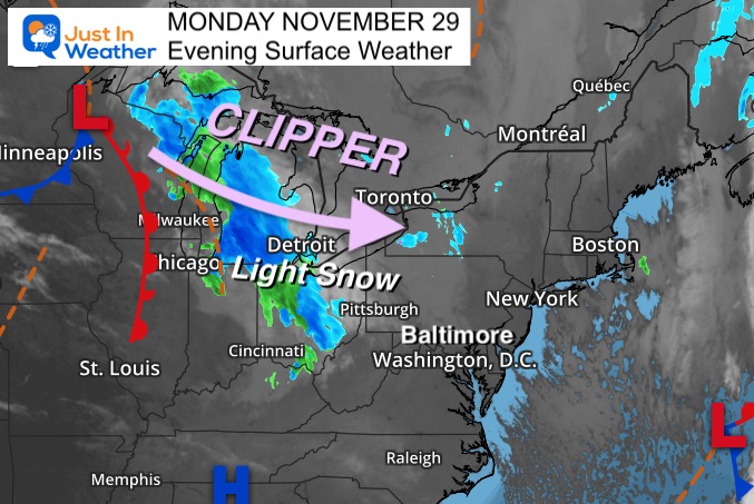
In my afternoon report I mentioned the phrase: The trend is your friend. Well, the trend for these little weather systems to expand more into Maryland is holding true. I believe the speed is a factor as well.
In short, light snow is more likely tomorrow morning, and it may arrive before sunrise. Faith in the Flakes! It’s trying to bring another show, and this will be similar to the weekend event.
While I write this to share in the excitement of those anxious to see a little snow, I am also writing for those who don’t want it to NOT FREAK OUT or be surprised.
My morning update will be earlier on Tuesday with the progress on the clipper.
Weather posts straight to your inbox
Sign up and be the first to know!
Monday Evening Weather
The snow breaking out ahead of the Clipper has been expanding quite a bit across Ohio this evening. This is really looking a lot more like the weekend event. It is also looking like once again this may be moving in faster than model guidance is suggesting.
Snow Simulation —> 5 AM to 2 PM
The NAM 3 Km has been most sensitive to the light snow.
There may be more than this verified on radar, with flurries expanding a bit farther south and east.
This update shows the cluster moving into metro Baltimore between 8 AM and 10 AM
If the bias holds, we could see flakes around the Beltway earlier… before sunrise (7 AM)
november-29-weather-snow-simulation-tuesday-AM-5
november-29-weather-snow-simulation-tuesday-AM-6
november-29-weather-snow-simulation-tuesday-AM-7
november-29-weather-snow-simulation-tuesday-AM-8
november-29-weather-snow-simulation-tuesday-AM-9
november-29-weather-snow-simulation-tuesday-AM-10
november-29-weather-snow-simulation-tuesday-AM-11
november-29-weather-snow-simulation-tuesday-PM-12
november-29-weather-snow-simulation-tuesday-PM-1
november-29-weather-snow-simulation-tuesday-PM-2
november-29-weather-snow-simulation-tuesday-PM-3
Note:
If you are traveling in PA along the Penn Turnpike or north, there may be some impact on roads during the morning commute.
For the snow near Philadelphia to The Poconos and metro NY, it may be late enough for some warming to not be an issue for travel.
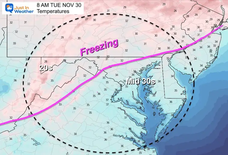
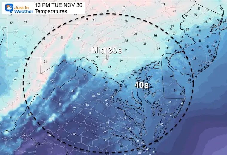
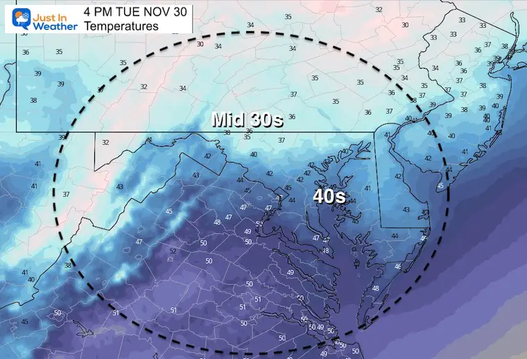
Temperatures
Tuesday Morning
The only concern I see is the big IF:
IF this arrives between 1 and 3 hours faster than suggested, it will have time to catch up to the cold air, especially west and north of I-95/Beltway.
At most that might support a coating on ‘some’ roads. But there is not a lot of moisture.
I would not be surprised to see a coating on grass, car tops, and elevated surfaces.
Noon
Most of the region will be above freezing by noon.
Afternoon
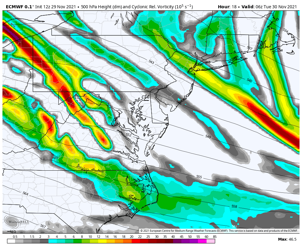
Jet Stream Vorticity:
Upper level energy will swing through in the morning. This is what will enhance the chance for snow showers or flurries to arrive
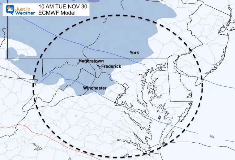
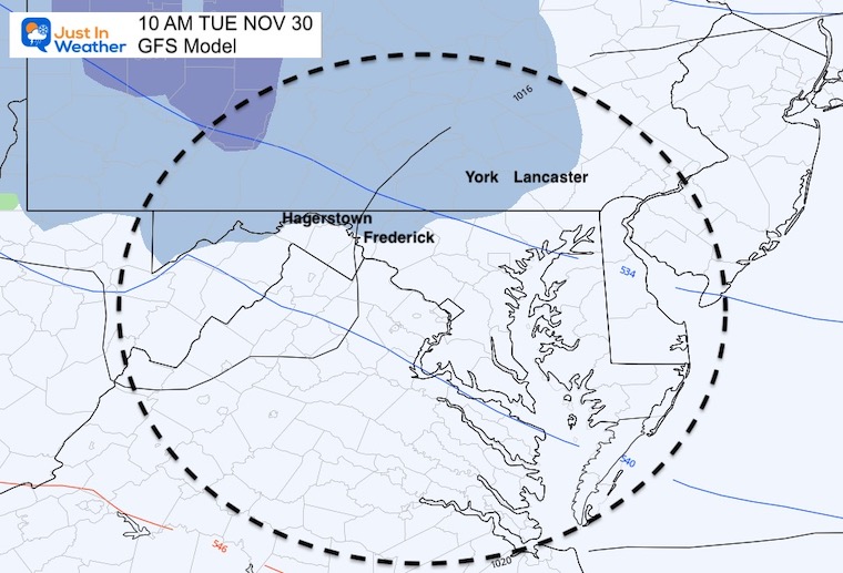
Snow Simulation On Other Models
European Model
GFS Model
This lowers the amounts and retreats the coverage father north.