


Soggy Saturday Update: Rain Timeline Through Preakness In Baltimore
Friday, May 17, 2024 As we approach another weekend, we have yet another weather system bringing us rain. This will make 16 of 20 weekends this year with some wet…
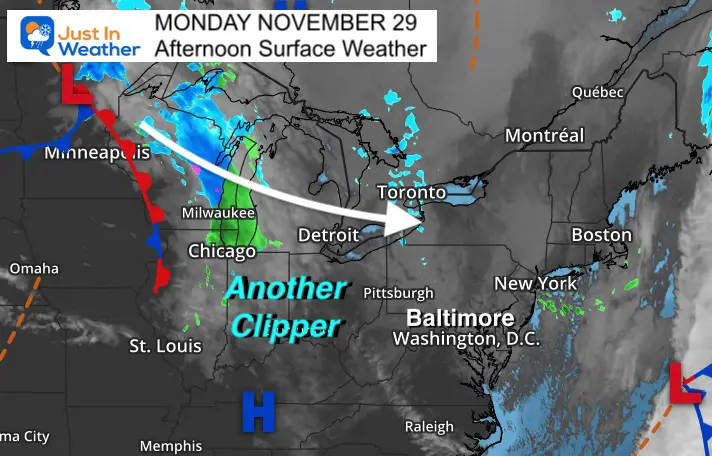
Monday November 29 2021
The trend is your friend. This is one of the most common sayings in the meteorological community and it applies in many ways.
While in this early winter weather pattern, it appears the sequence of Clippers keeps passing to our north. That was the case Saturday night, and will be the case again Tuesday morning.
Here is a look at a few computer models showing the likely coverage for light snow. However I must add in the themes I’ve noticed with many weather events over the past few months:
The main circulation with this clipper will pass through the Great Lakes into New York State. This north track is not optimal for us to get snow on the south end. but the upper level energy will also some moisture to develop and push through the mountains. However, the terrain will play play a classic role in how it tracks.
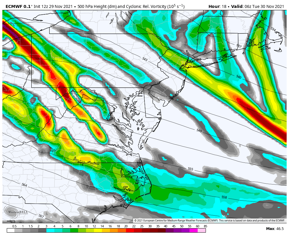
Upper level energy will swing through in the morning. This is what will enhance the chance for snow showers or flurries to arrive
The main enemy will pivot through central Maryland and southern PA between 4 AM and 1 PM.
The best chance for snow showers will be before and up to sunrise. Some flurries may linger into the early afternoon.
I’ve highlighted the areas most likely to get light snow falling.
There may be more coverage seen on radar with flurries expanded south into metro Baltimore (with no impact)
The best chance for snow showers will be before and up to sunrise. Some flurries may linger into the early afternoon.


We need 32ºF or colder for stickage. This looks so similar to the set up this weekend. Which also means that even with light snow, the stickage is more likely on grassy areas and elevated surfaces.
If you are traveling up to Harrisburg, along or north of the Penn Turnpike it may be worth paying attention to.

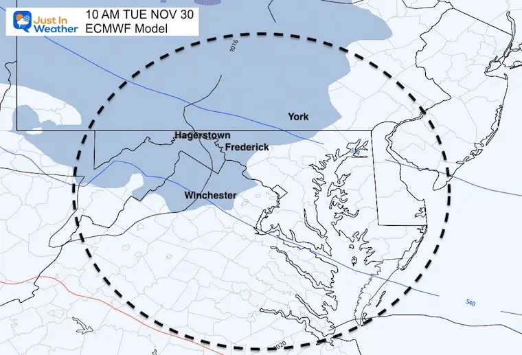
This high resolution model is hyper sensitive. The light snow may last one to three hours, with some coating on the grass. But more flakes may fall as flurries around and south of the beltway for a brief period. Some flurries could linger through lunchtime.

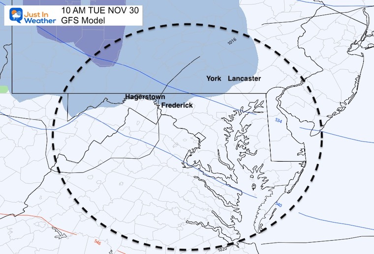
This lowers the amounts and retreats the coverage father north.
Also See:
Snow and Ice Forecasts From Area NWS Offices


Last Winter Recap: My Old Outlook And Your Grades Of My Storm Forecasts


