


July 18 Flood Watch In The Mountains Then Storms Expand Back This Weekend
Friday, July 18 2025 Morning Report There is some relief in sight, but I remain cautious. For the short term, today remains muggy, while the focus of strong storms and…
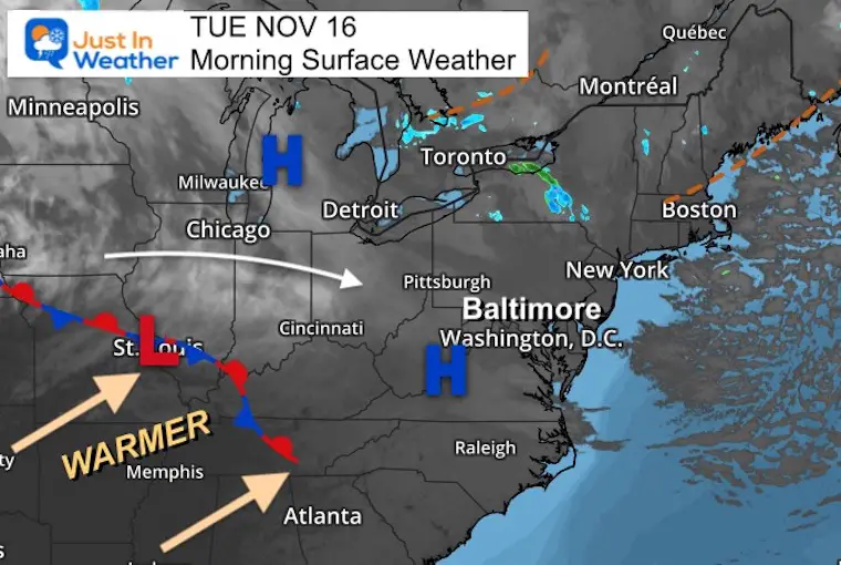
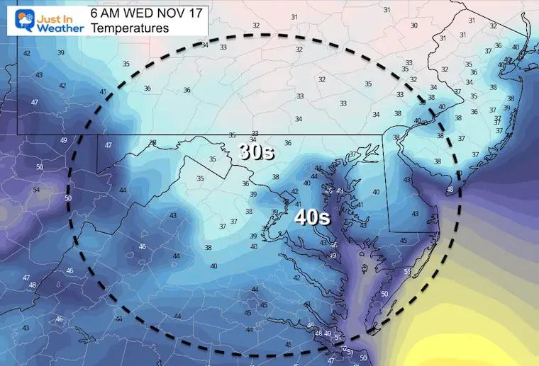
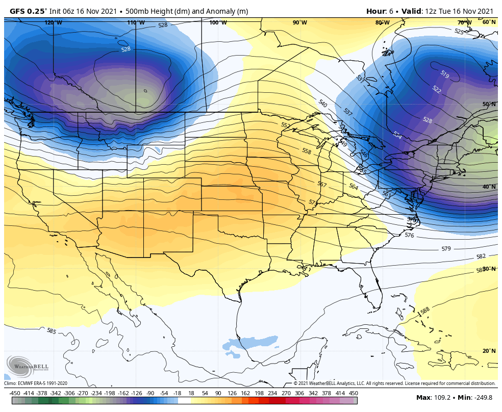
Tuesday November 16
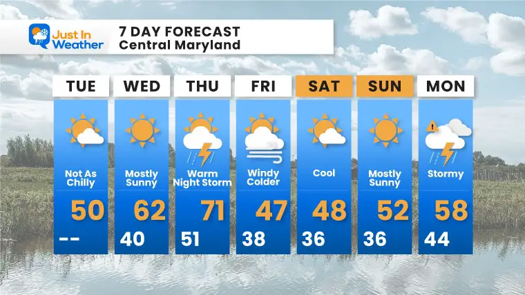
The core of the cold air in this segment is moving out. We will modify a little today and then aim for one day this week near 70ºF. This will be a wild ride, as a cold front will bring an abrupt change snd winter like pattern by the weekend into next week.
This is the active weather we expected, so there maybe some travel impact ahead of Thanksgiving. However, it is still too early to depict how rain and or snow may be spread between the Great Lakes to New England next week. Will we get in on any flakes? I will begin to track the models on that tomorrow.
High Pressure is in settling in, and as it gets closer to the winds get lighter. However, the upper level winds may still carry high clouds across our sky. The BIG WARM UP is just a day or two away.
What to wear?
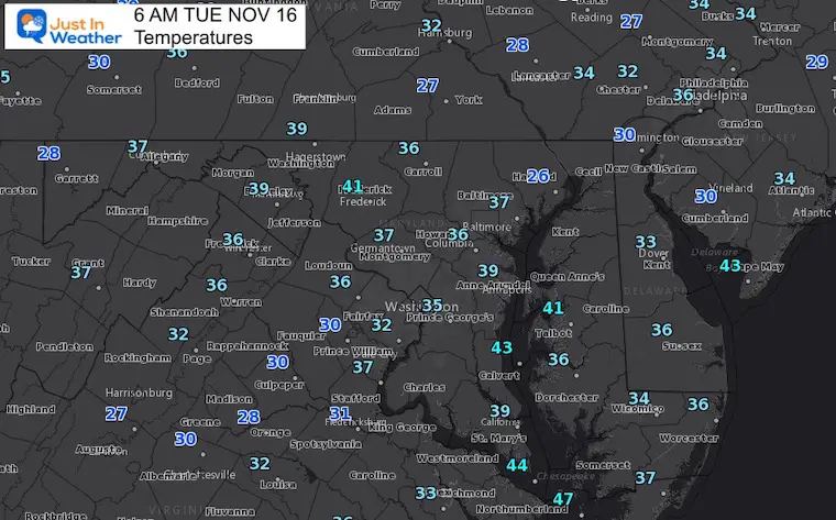
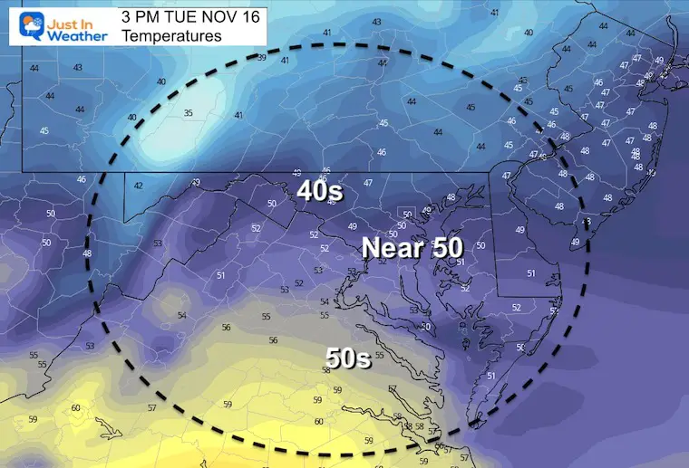
Gloves and hat this morning. Also time to warm up the car. But just s light jacket this afternoon.
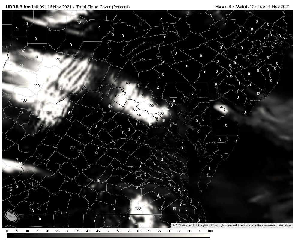
Clouds will mix in across the sky, and might dim out the sun at times.
Sign up and be the first to know!
Normal Low in Baltimore: 37ºF
Record 19ºF in 1996
Normal High in Baltimore: 56ºF
Record 79ºF 2005
Morning
Afternoon
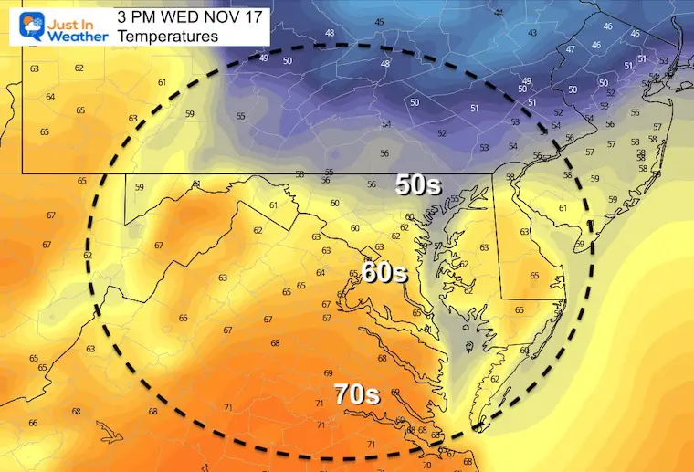
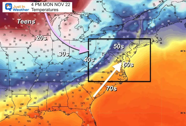
Temps jump to near 70ºF, then crash overnight. This will come with a cold front the will surge in strong storms, then strong winds for the Northwest.
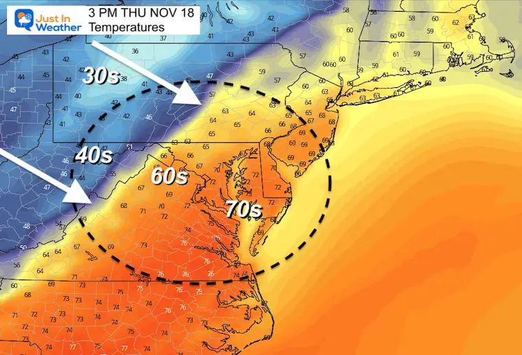
Big changes over the next week to 10 days. Big Warm up on Thursday, then the surge of cold air on Friday. There will be a surge of arctic air to establish a trough in the eastern US early next week.
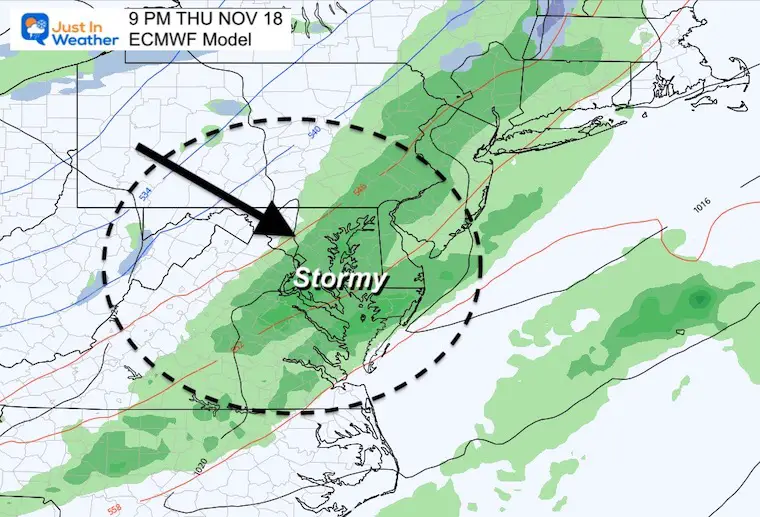
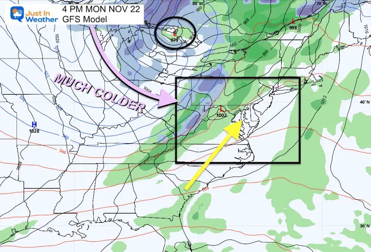
This screams ‘storm’ but it’s early to call the details. At this time, it looks like the storm timing will be Monday and Tuesday… which will be then the colder air moves in.
There will be Lake Effect Snow impacting Cleveland to upstate New York for a few days to follow.
There will be an abrupt change, but the timing and specifics are likely to be adjusted as we get closer.
Arctic air will be moving in, which will spawn the active weather.
A large cold front will be extended from the Core Low in the Great Lakes. There may be more snow to follow, but still too early to suggest where, etc.

Last Winter Recap: My Old Outlook And Your Grades Of My Storm Forecasts


