


January 6 Weather Some Fog And Clouds Followed By The Warm Up With Rain By The Weekend
Tuesday, January 6, 2026 The storm track has shifted to the north. We are still on the edge, which is why we have areas of fog, and most of the…
Tuesday January 4 2022
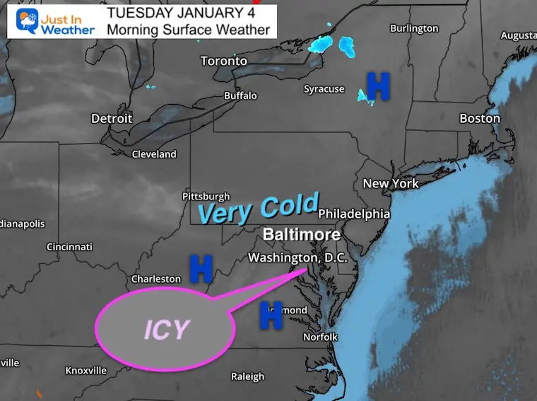
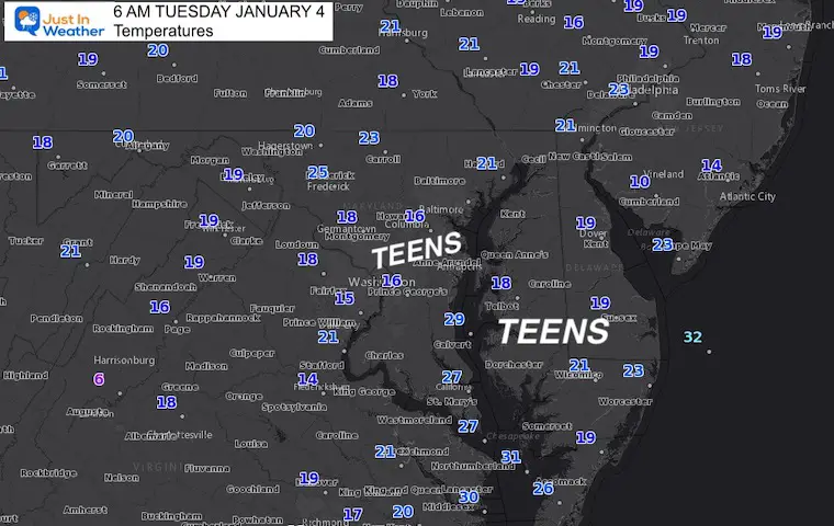
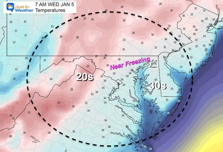
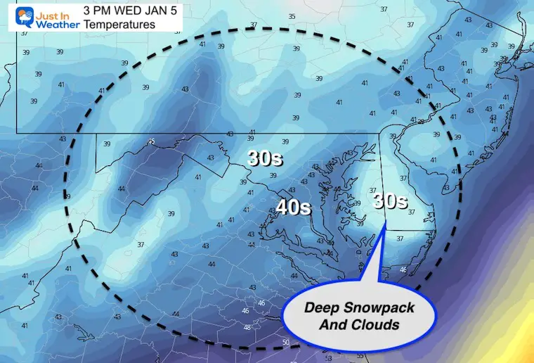
This morning we have some very cold air settling in to the region, with the lowest temperatures over the deepest snowpack. Many snow covered areas, away from the water, are in the teens with many icy spots.
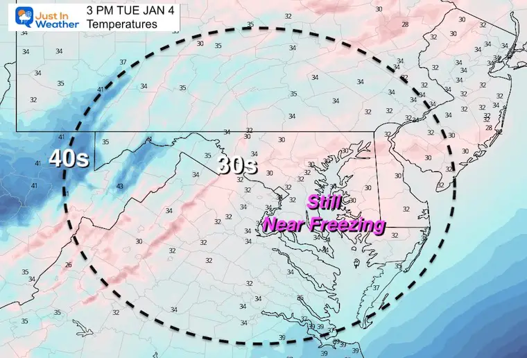
A little system will creep up the coast tomorrow morning. This should being rain on Delmarva, but the back edge may catch up to cold enough air for a little icing.
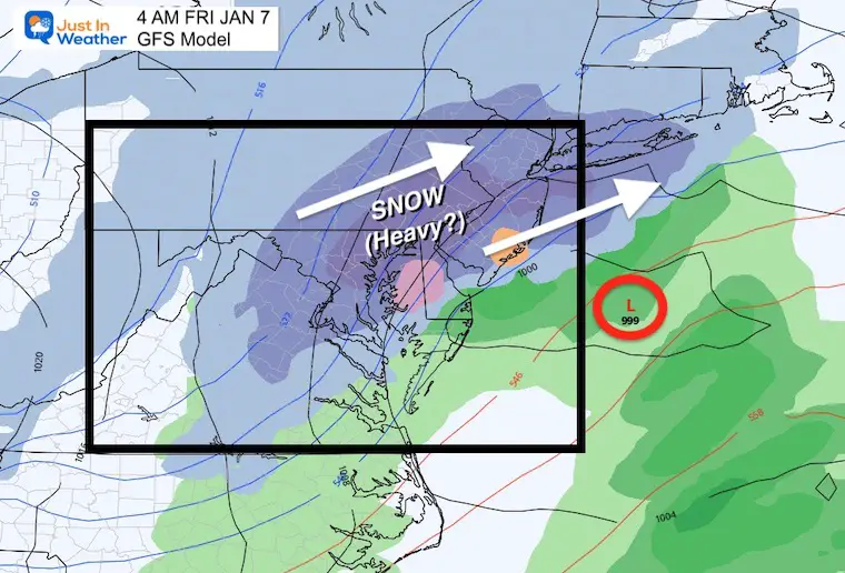
Then we shift our focus to the next ‘event’ with snow Thursday night into Friday morning.
It is important to note that the southern areas got hit with very heavy snow! Many areas have between 8 to 12 inches near Annapolis, Washington, southern Maryland, and central Delmarva. There is not enough equipment to clear it all, so travel might be impacted through the day.
Click to see the final snow report with record totals in the cities.
Please participate in the Poll
Normal Low in Baltimore: 26ºF
Record 4ºF in 1918
Normal High in Baltimore: 44ºF
Record 61ºF 1950
Tracking Rain and Maybe Ice West Of The Bay. Time concern will be 4 AM to 8 AM, and for a small area that was on the north edge of the snow yesterday.
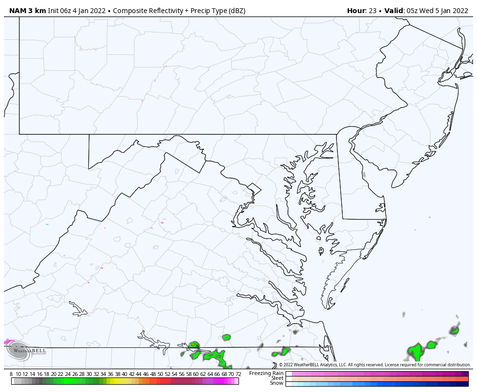
This needs to be washed closely for any light icing can become a concern.
Sign up and be the first to know!
I like that the models are picking up on the deep snowpack influencing temps on Delmarva. This is important to factor in to our next weather event as well.
GFS Model
This actually performed best with the last snow event, so it gets the spotlight now.
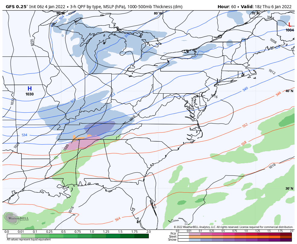
At this time it looks like a few hours of snow are mostly likely around midnight moving out around sunrise.
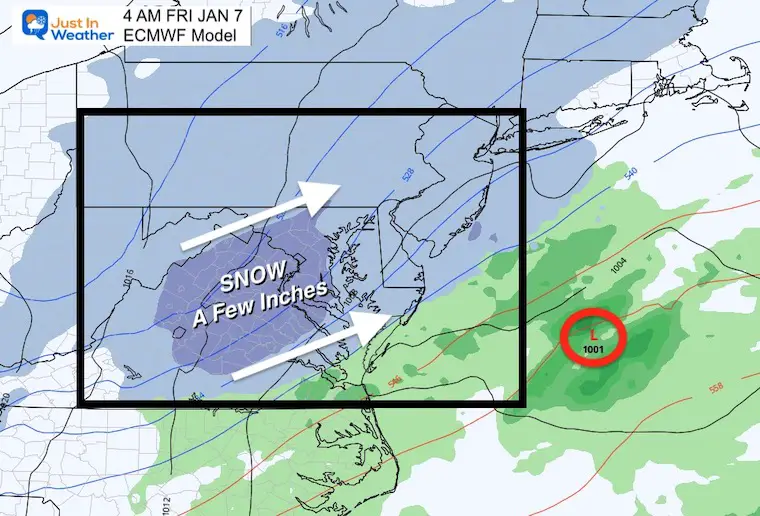
This is in line with the GFS, just a little farther east and less snow (about 2 inches for Baltimore).

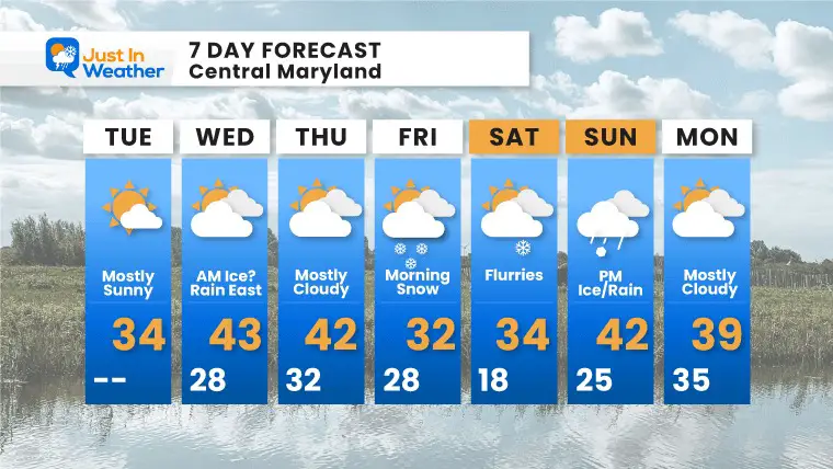
Most of this pattern is cold and more like winter.

Last Winter Recap: My Old Outlook And Your Grades Of My Storm Forecasts


