December 14 Warming Trend Then Big Changes Ahead
Tuesday December 14
It seems we had a really good showing for the Geminid Meteor Shower overnight. It has been nice to hear confirmation with Lots of reports confirming that.
This morning we have quiet weather and look to the national scale for all the action on the west coast. While we enter the warming trend we talked about last week, it does not look as warm as first thought.
We will have a few days in the 60s, but wind direction and clouds are likely to keep it in check. Then a fast moving pattern will bring in some rain this weekend and the return of colder air. This brings in the long range potential for wintry weather early Christmas week.
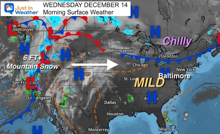
Morning Surface Weather
High Pressure dominates our weather, bit a cold front to our north will actually slide our way and help to shift the winds tomorrow, which will delay the warming trend.
On the west coast, that storm is so intense, over 6 Ft of snow is in the middle of falling for many ski resorts over 6,000 Ft. That will race across the nation on a fast moving jet stream.
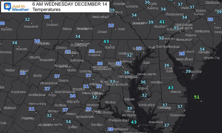
Morning Temperatures
Weather posts straight to your inbox
Sign up and be the first to know!
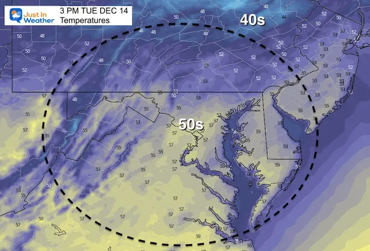
Afternoon Temperatures
Weather Almanac: Climate Data
TODAY December 14
Normal Low in Baltimore: 28ºF
Record 11ºF in 1960
Normal High in Baltimore: 46ºF
Record 71ºF 2015
*This was part of a 3-day ‘Heat Wave’ in 2015. Dec 12 to 14 had highs in the 70s.
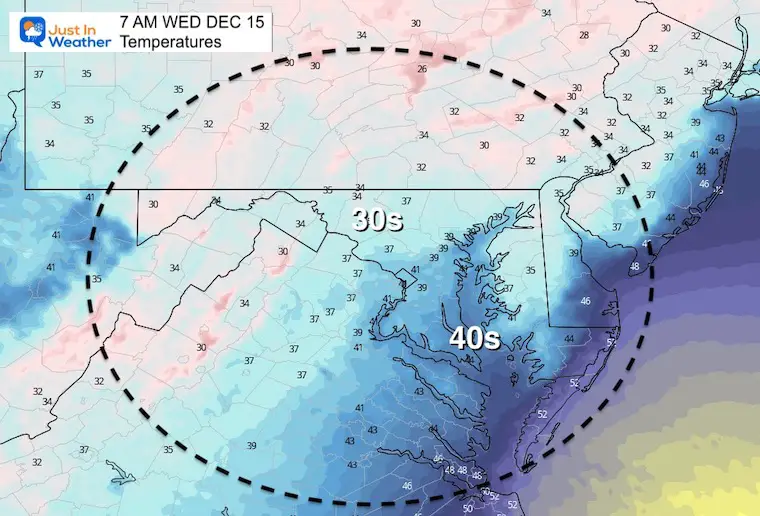
Wednesday Morning
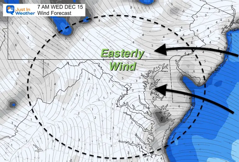
Wind Direction:
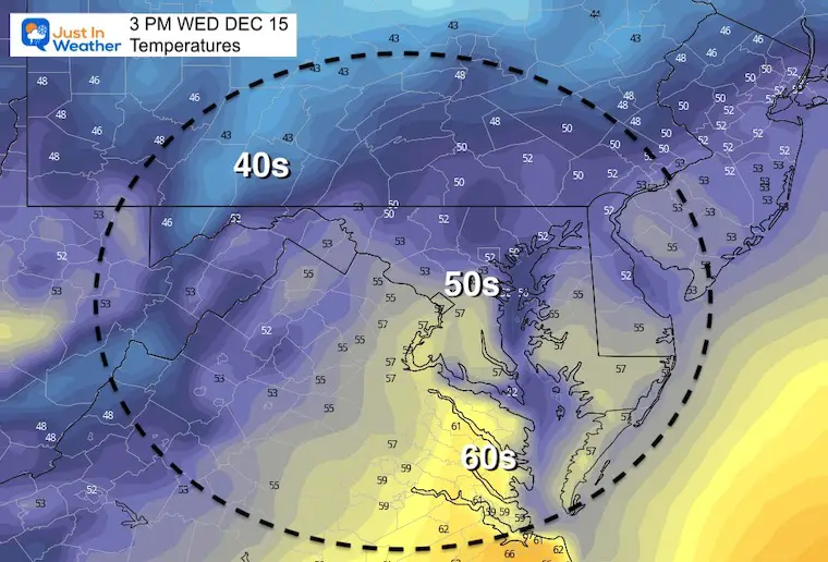
This will not be a strong wind, however it will be the direction that comes from a the ocean. This will slow down the impact of the warming trend.
Wednesday Afternoon
Looking Ahead
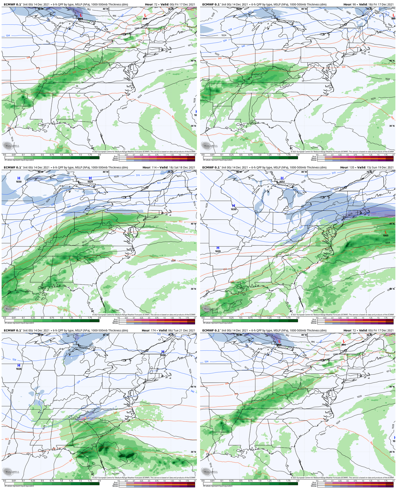
Thursday to Tuesday
Here is the ECMWF Model showing the next frontal boundary breaking up the rain Thursday, but returning on Saturday.
Farther out we see a new storm form along the southern boundary that will attempt to bring in snow by Tuesday of next week.
I DO NOT like to show models 7 days away based off of poor accuracy in recent months. But considering the potential for an abrupt return of winter during the Holiday Week, I think it’s a good idea to simply ‘watch’ this, but take it with a grain of salt for now.
7 Day Forecast
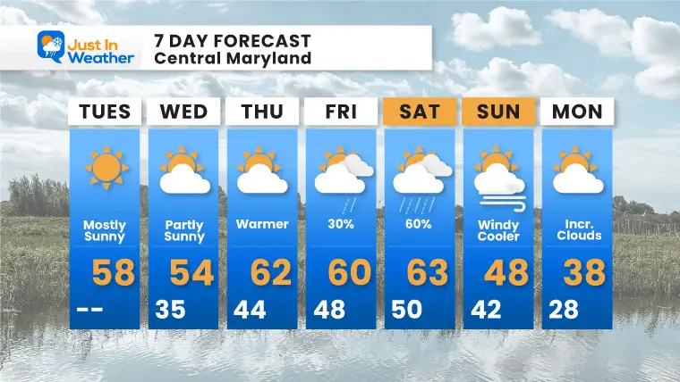
A few days are expected to reach the 60s. This should come to an end with rain on Saturday, then back to near or below normal temps into early next week.
Weather posts straight to your inbox
Sign up and be the first to know!
ALSO SEE
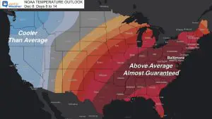
NOAA OUTLOOK: Warm Mid December, Please Let Me Explain
What is Faith in the Flakes: History of December 5th Snow
Winter Outlook Series:
Last Winter Recap: My Old Outlook And Your Grades Of My Storm Forecasts
Winter Weather Page – Lots of resources
Solar Cycle Increasing Sunspots Suggests More Snow
Comparing 4 Different Farmer’s Almanacs: Majority colder winter outlook than NOAA
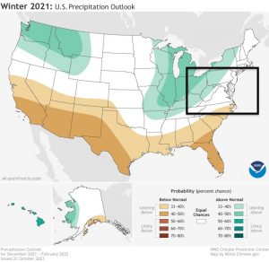
NOAA Winter Outlook- But Read The Fine Print
Signals For Early Start To Winter In November
Winter Outlook Series: La Nina Double Dip
Nor’easters May Give Hint For Winter La Nina Pattern
Winter Folklore Checklist
Please share your thoughts, best weather pics/video, or just keep in touch via social media
Facebook: Justin Berk, Meteorologist
Twitter: @JustinWeather
Instagram: justinweather


