November 5 Close Enough For Coastal Storm To Impact Our Weekend
Friday November 5
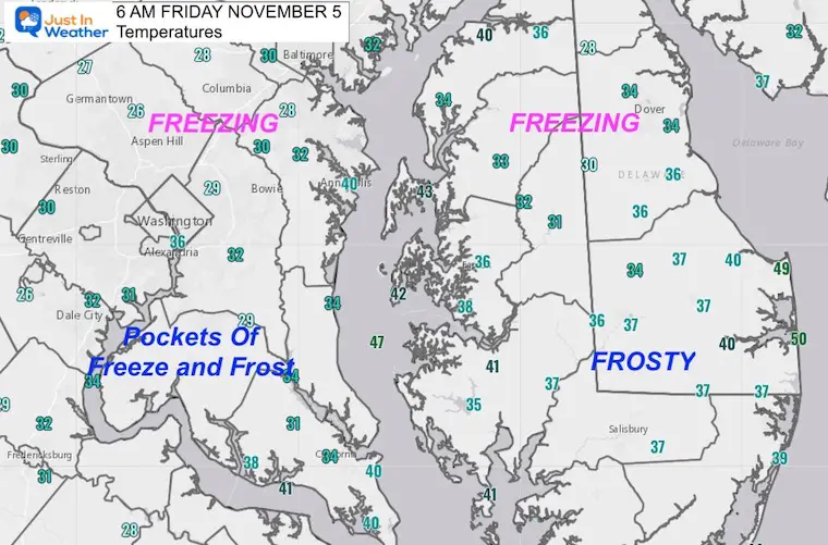
This morning starts with freezing temperatures in the warning area, but not everyone in southern Maryland got that cold. Next up will be a storm off of the Southeast US Coast that will be close enough to impact our region with clouds and coastal flooding.
This will NOT be like the last storm, but worth noting. Then we can look forward to a few quiet and warmer days next week.
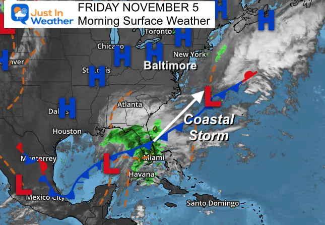
Morning Surface Weather
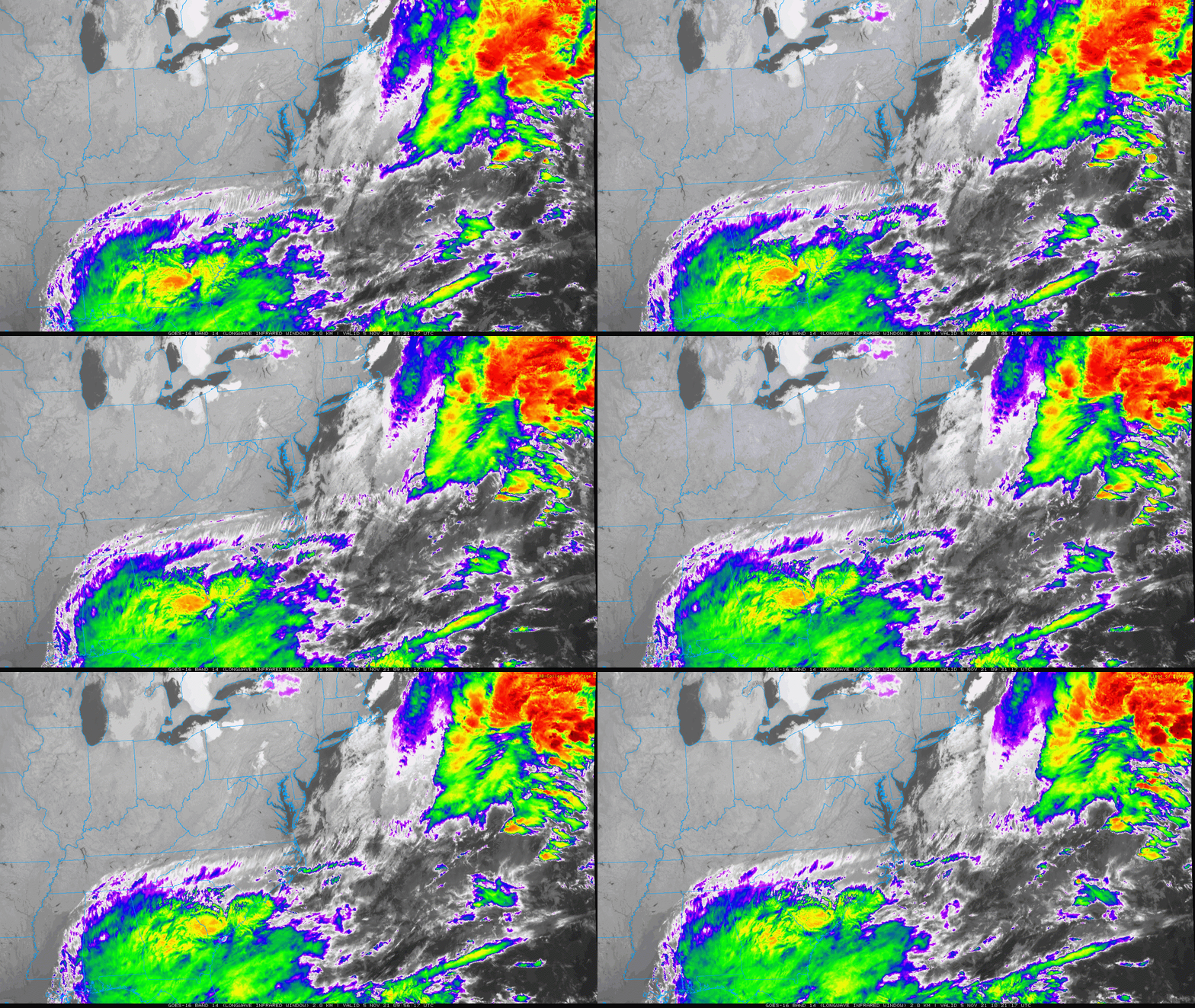
High Pressure is in control, helping with the freezing start. As one system exits of the coast, a new one forming in the Gulf will track off the Southeast Coast.
This will send high clouds our way, that may thicken up over the weekend. It will also increase the winds and high water on the coast.
Morning Temperatures
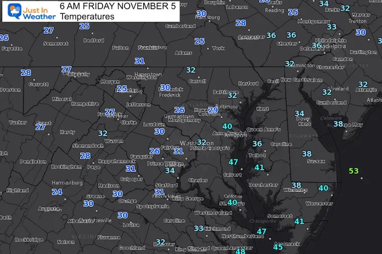
Closer Look At Southern Maryland
What to wear?
A few layers and a jacket!
Satellite Loop
2 Hours Ending at 6:20 AM
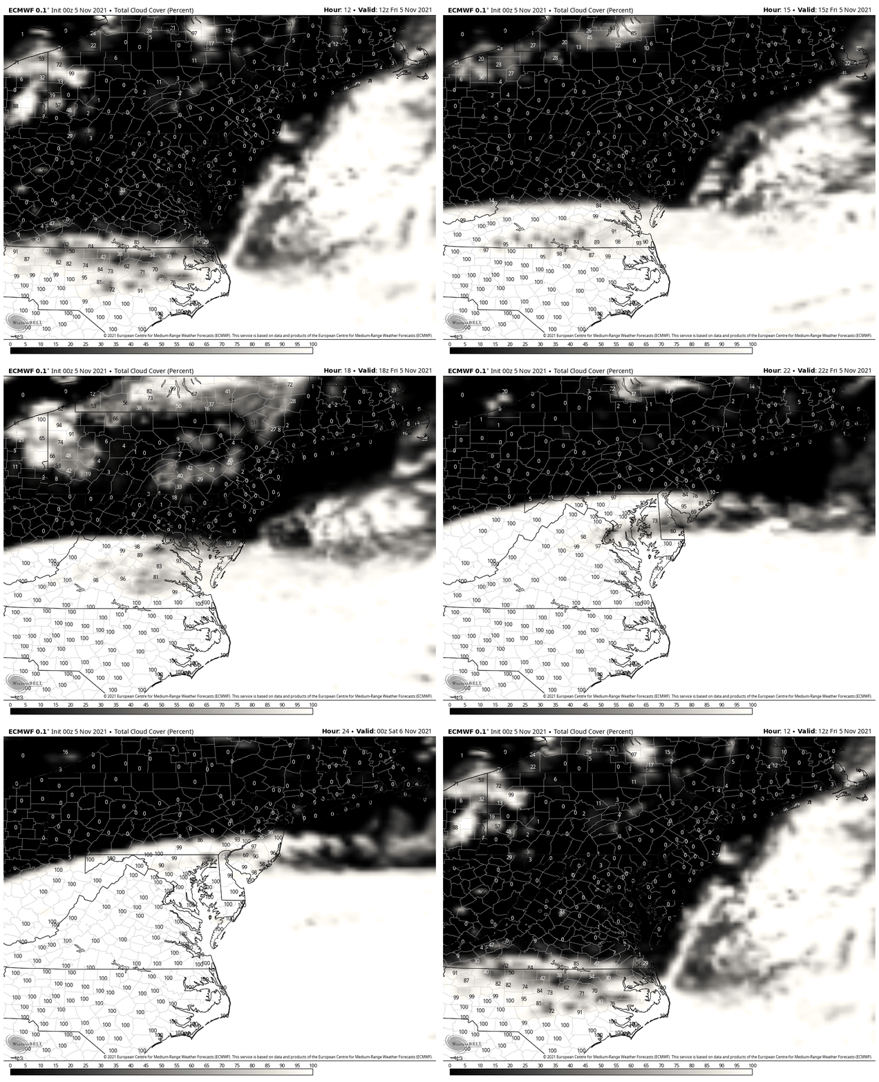
Cloud Forecast
8 AM to 8 PM Friday
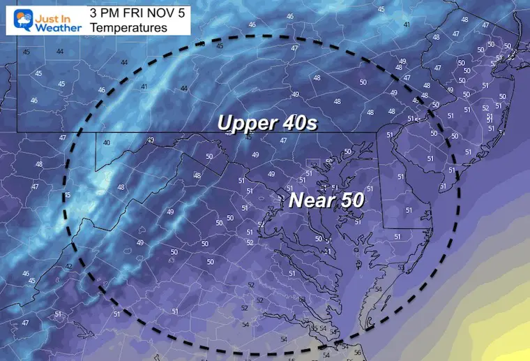
Afternoon Temperatures
In Case You Missed It
See:
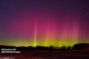
Northern Lights On Display In New England Thursday
Weather Almanac: Climate Data
TODAY November 5
Normal Low in Baltimore: 40ºF
Record 24ºF in 1998
Normal High in Baltimore: 60ºF
Record 83ºF 1961
Weekend Weather
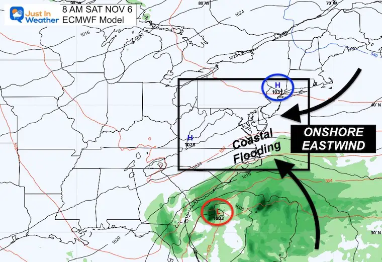
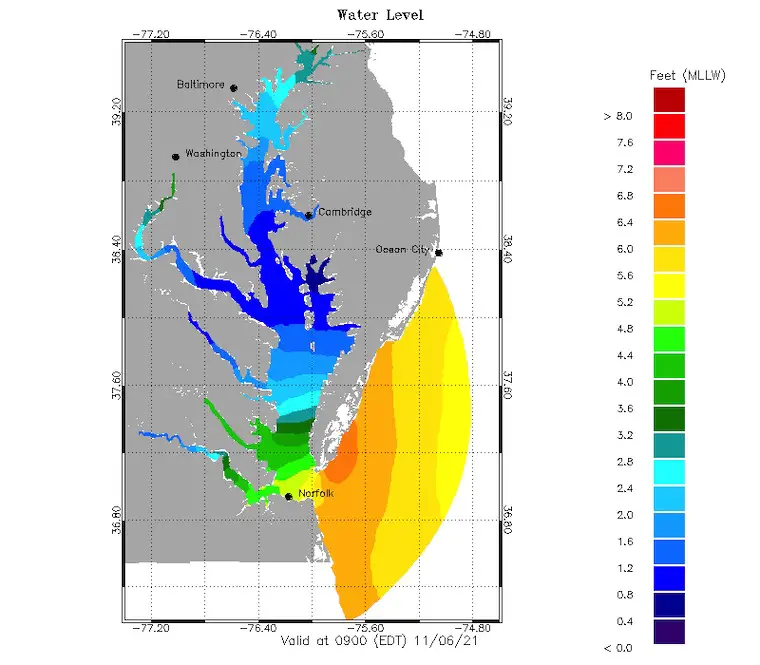
This storm off of the Southeast Coast will be met with High Pressure to our north. The combination will help to funnel stronger east winds. That Onshore Flow will enhance two things:
More Clouds
and
Coastal Flooding:
This should be more of an issue on the Atlantic Coast. See the water forecast maps here.
See all Bay/Coastal Water Forecast Maps
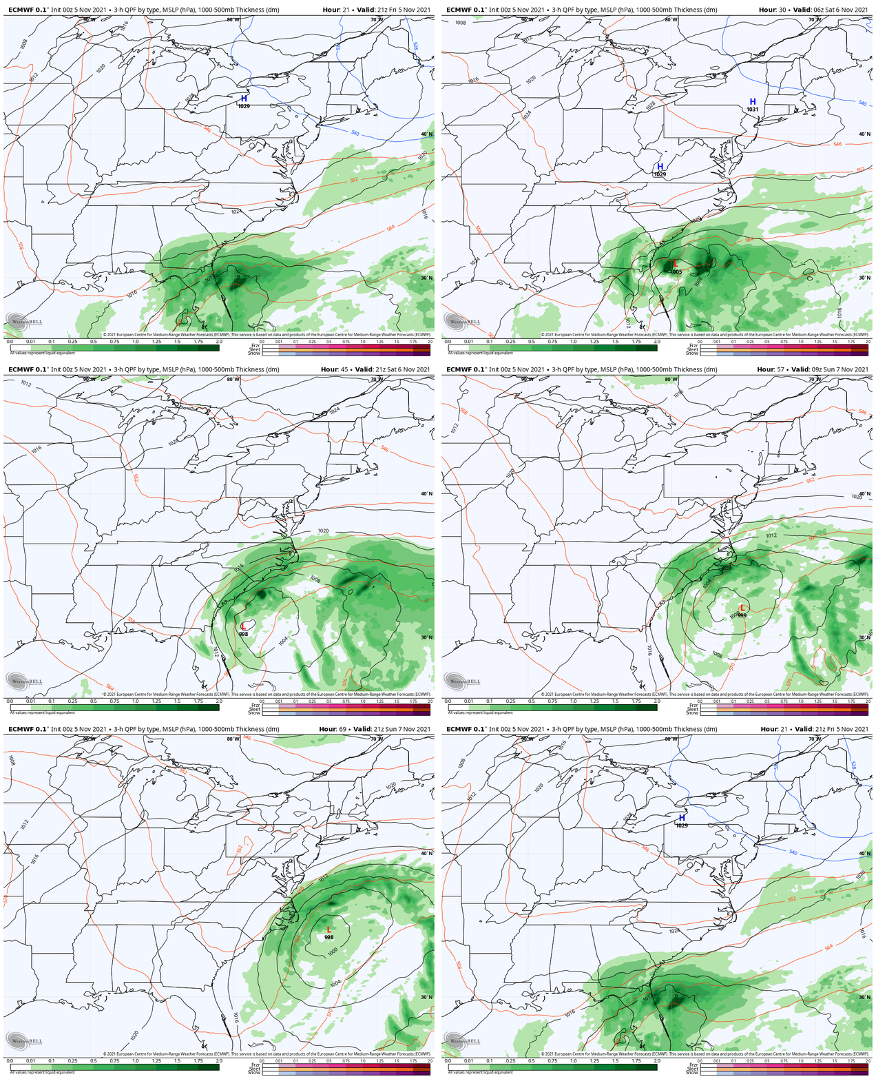
Storm Forecast:
European Model through Monday shows the rain staying just south of Delmarva. This is a close call, and close enough for clouds and winds to expand farther into Maryland.
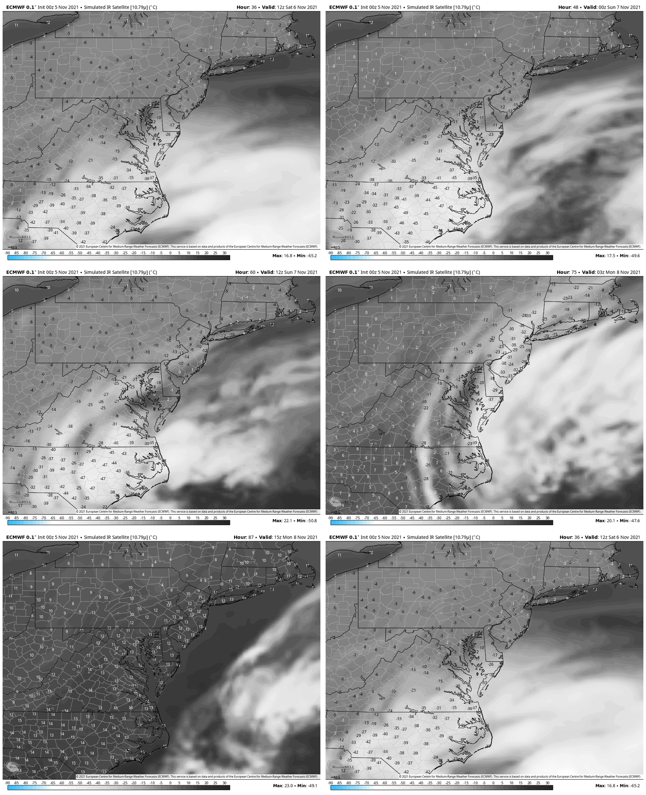
Cloud Forecast:
This shows more clouds this weekend, clearing out on Monday. The numbers are cloud temperatures in ºC.
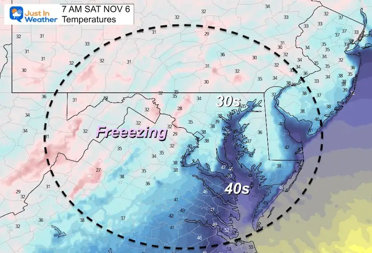
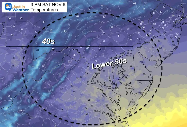
Saturday Temps
Morning
Still areas below freezing, but otherwise widespread frost.
Afternoon
Remaining cooler than average in the 50s.
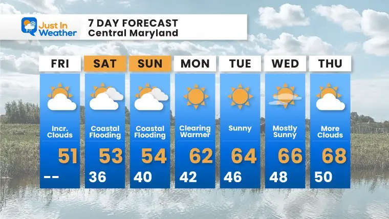
7 Day Forecast
This weekend we will watch that coastal storm for clouds. Farther west and north may get more sun mixed in.
Next week we clear out and warm up above average for the bulk of the week.
Explore More
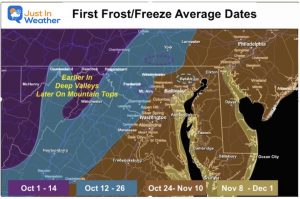
Average First Frost and Freeze Dates
Weather posts straight to your inbox
Sign up and be the first to know!
Winter Weather Page – Lots of resources
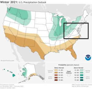
Also See The Winter Outlook Series:
Comparing 4 Different Farmer’s Almanacs: Majority colder winter outlook than NOAA
NOAA Winter Outlook- But Read The Fine Print
Signals For Early Start To Winter In November
Winter Outlook Series: La Nina Double Dip
Nor’easters May Give Hint For Winter La Nina Pattern
Winter Folklore Checklist
Faith in the Flakes Gear
SNOWSTIX – Available Now
Please share your thoughts, best weather pics/video, or just keep in touch via social media
Facebook: Justin Berk, Meteorologist
Twitter: @JustinWeather
Instagram: justinweather


