


Average Last Frost or Freeze Dates And Map For Maryland
There is a good reason why many gardeners suggest NOT to plan tomatoes until after Mother’s Day. Early surges of warm air in spring can be deceiving. Just because the…
December 4, 2022
Sunday Morning Update
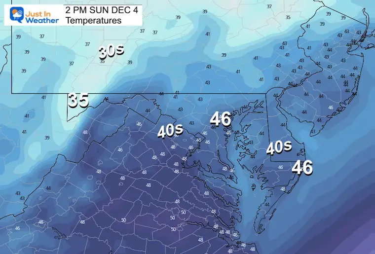
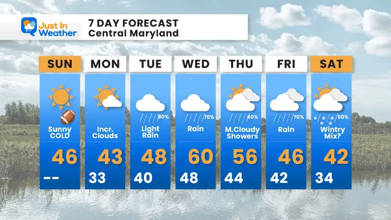
The colder air is back in place, but this is not the pattern change yet. It is seasonable to have cold shots and warm-ups ahead of a full pattern shift, which we are expecting over the next week or two. We will get a few days with rain and mild air during the week, then open the door to colder air. If your app is NOT showing colder air or wintry mix next weekend, there is a simple answer for that.
I do NOT lock in on a promise for any winter event a week away, but the signal is there trying for something. So please use your discretion with all the information you encounter. Here is a simplified look:
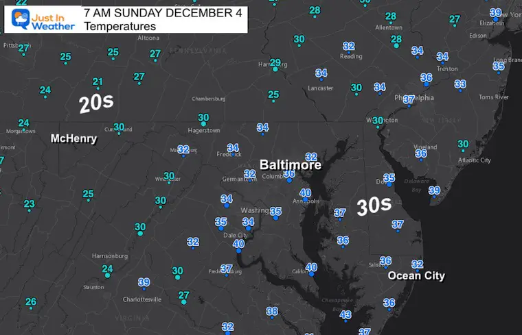
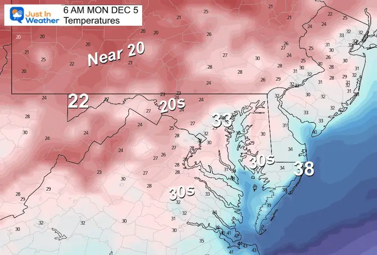
Seasonably cold morning, but the sun is shining.
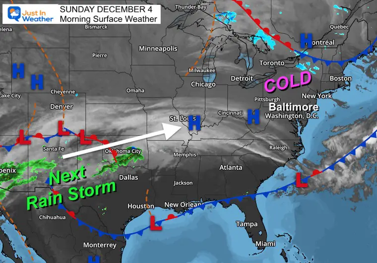
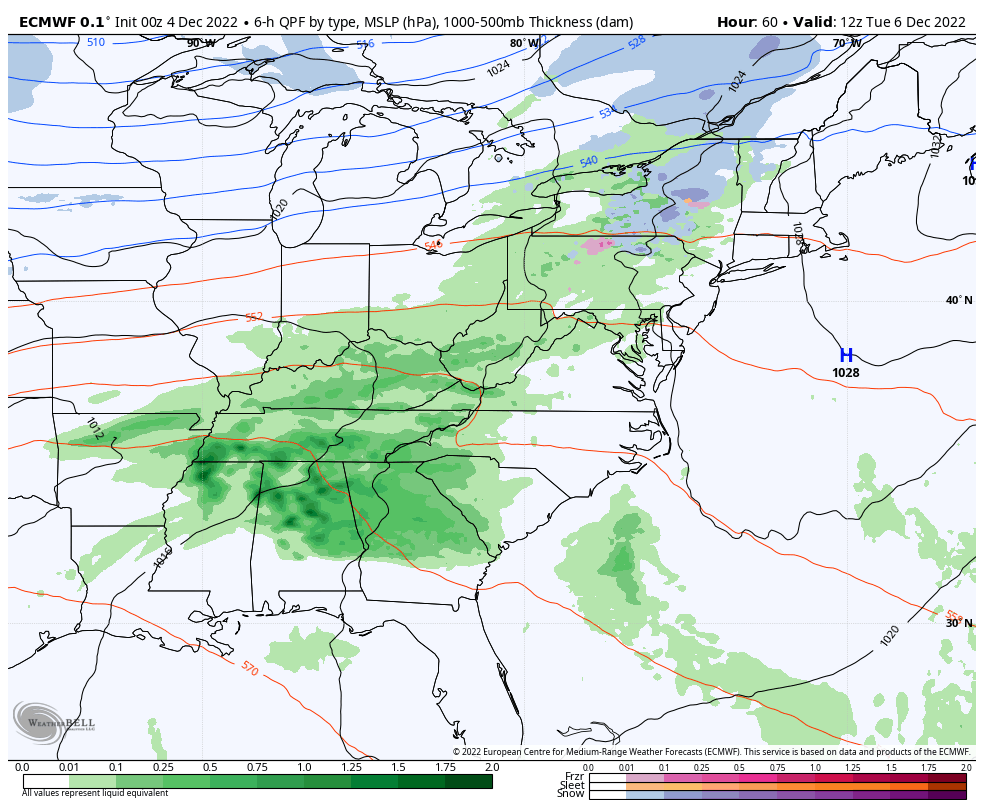
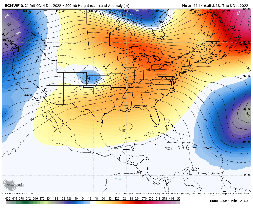
High Pressure has brought in this cold air mass. The next storm is forming in the Southwest US, which will be part of the pattern change. This is what we will watch bring us more clouds Monday and then a period of rain (on/off) Tuesday through Friday.
It will be cold, but the winds will settle down.
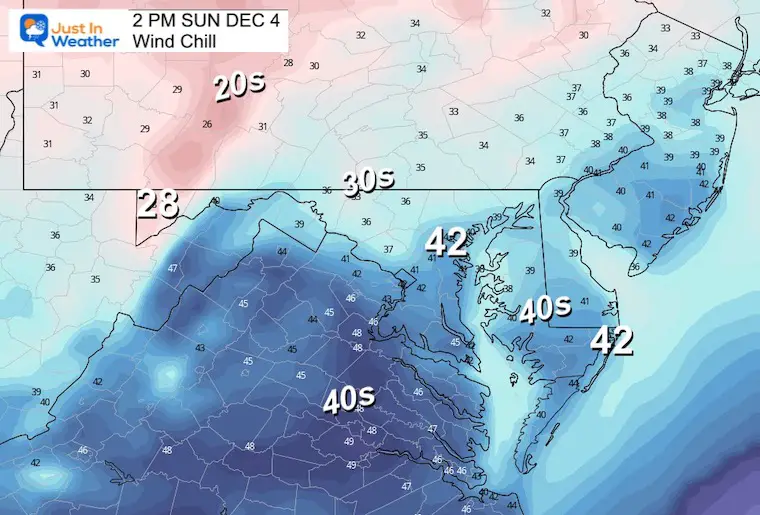
Any breeze will make it feel chillier.
Normal Low in Baltimore: 32ºF
Record 13ºF in 1966
SNOW: 7.8 inches in 1957
Normal High in Baltimore: 51ºF
Record 58ºF 1982
Comparing The Snow In Decembers With Similar Patterns
Comparing December Cold Pattern Forecast To Snow In Similar Analog Years
December Outlook Trending Colder For Start Of Meteorological Winter
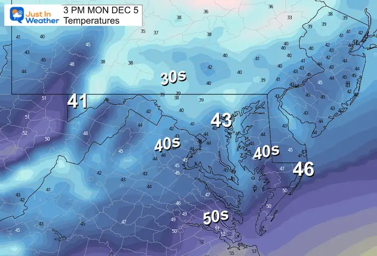
It will be breezy and colder!
It will be a colder morning to start the work week.
ECMWF Model: Tuesday to Saturday Morning.
Progressive waves of rain almost each day.
Friday Night/Saturday: Colder air may catch up and end with snow….
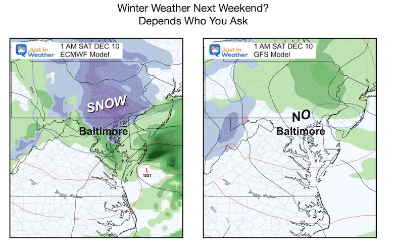
Here we see the storm track to the north and NOT bringing in the colder air.
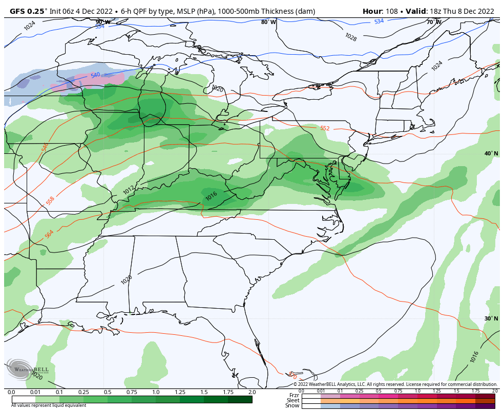
Mild temps will come with the initial rain mid week. However, this is the start of the change that shows a progressive opening of the arctic air to spill into the US next weekend and the week that follows.
After the rain, it will be chilly for the Ravens game. Then mild again next week with rain ahead of the pattern change.
There is rumbling about next weekend turning wintry. I will have a look at that in my next report.
RELATED REPORTS
Record Snow Cover Across The Northern Hemisphere
I see many factors to support colder influence with multiple systems. Early and later in winter. Check it out.
Winter Outlook 2023 For Snow Not Typical La Niña Plus Polar Vortex Disruption
Atmospheric Memory Suggests Active Winter Storm Pattern Outlook
Winter Outlook 2023 From NOAA Very Different Than Farmers Almanacs
Winter Outlook 2023 Early Look At Snow From Two Farmers Almanacs
If you want a snowy winter, this is what you might want to look for in the rest of the tropical season. (You might be seeing a lot of commercial snow removal people out this Winter).
Record August For No Named Tropical Storms: Closer Look At Snow Following
Winter Weather Folklore Top 20 And More Outlook Signals From Nature For Cold And Snow


Click to see more and ‘Book’ a visit to your school
