


May 2 One More Hot Day Then The Cool Down And Rain For The Weekend
Thursday May 2 Morning Report This is one of those days where we get a little surprise. The old air mass is holding strong and will allow one more hot…
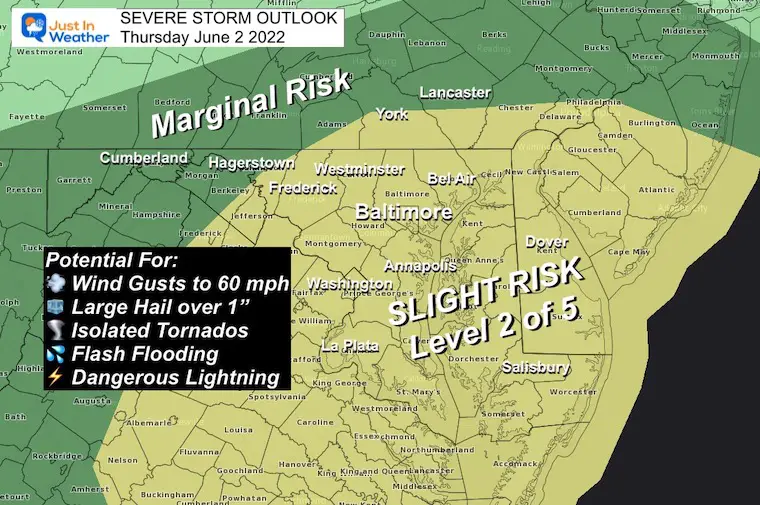
June 2 2022 Afternoon Update
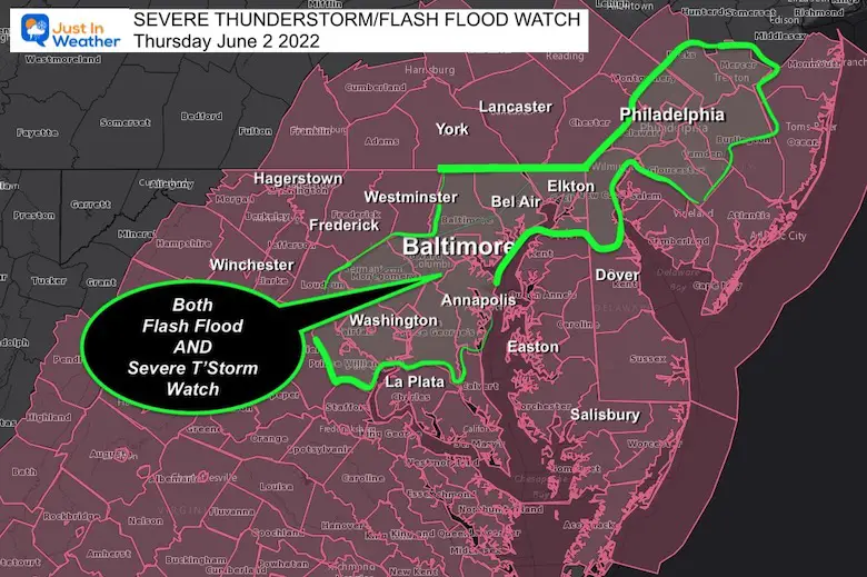
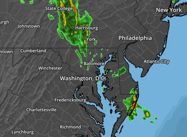
A Severe Thunderstorm Watch is in place until 9 PM, in addition to a Flash Flood Watch. That goes to 8 PM or 10 PM depending on your location. The overlap, meaning the heaviest total rainfall covers metro Washington, to Annapolis, Baltimore up to Philadelphia.
Severe Thunderstorm and Flash Flood Watch Overlay
A Watch means it ‘might’ happen.
A WARNING means it is ‘HAPPENING NOW’. This is more urgent and tracking an event across towns with more specific times.
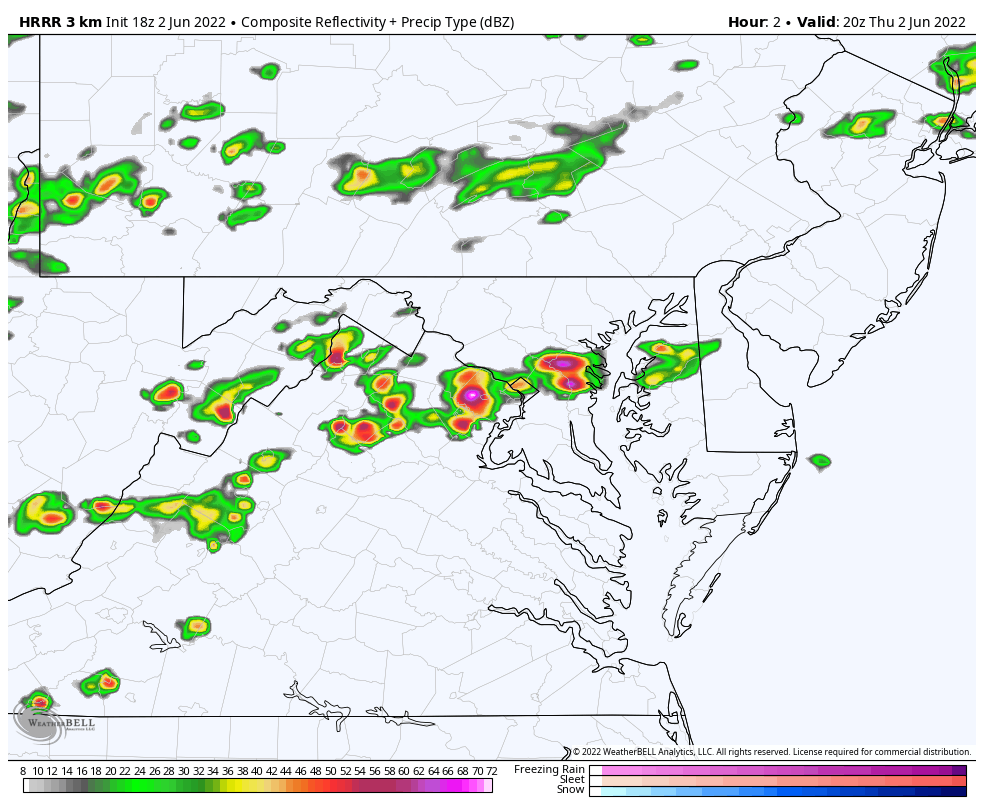
The storms that fired up this afternoon between Washington and Annapolis were caught late by short range modeling.
There is more to the west, and we have through evening.
1″ Hail was documented in Virginia – Sudley and Manassas.
In Maryland – Crofton.
That is enough to produce damage.
Local…
Watch this band develop and train – move over the same locations – along Rt 50. That helped with local flooding with rainfall rates over 1”/Hr.

There are more storms behind this initial cluster…

NEW RADAR SIMULATION: HRRR Model
Animation 4 PM Thursday to 6 AM Friday
I made this long loop to show the scattered activity overnight ending by morning.
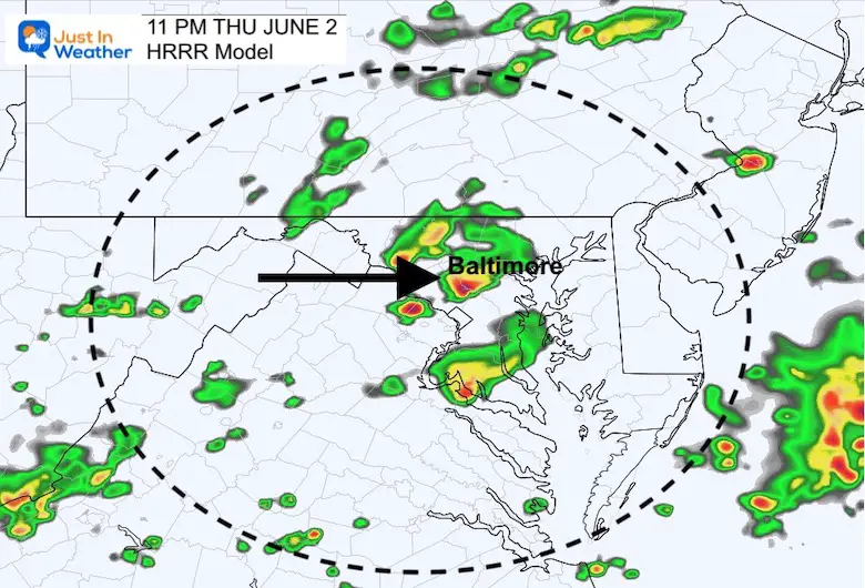
This is the last main push into metro areas… just before midnight.


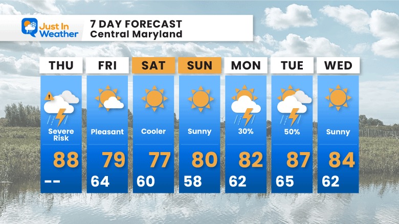
A pleasant cool down tomorrow into the weekend.
The tropical weather will miss us, but may impact the waves on the local beaches.
Much calmer on Bay Waters…

NOAA 2022 Hurricane Forecast- Above Normal Again


NOAA Study: Reducing Air Pollution INCREASED Tropical Storms

Atlantic Tropical History: Maps of Origin Regions Every 10 Days


May 16 Large Hail Videos And Storm Tracking Map


*Disclaimer due to frequent questions:
I am aware there are some spelling and grammar typos. I have made a few public statements over the years, but if you are new here you may have missed it:
I have dyslexia, and found out at my second year at Cornell. I didn’t stop me from getting my meteorology degree, and being first to get the AMS CBM in the Baltimore/Washington region.
I do miss my mistakes in my own proofreading. The autocorrect spell check on my computer sometimes does an injustice to make it worse.
All of the maps and information are accurate. The ‘wordy’ stuff can get sticky.
There is no editor that can check my work when I need it and have it ready to send out in a newsworthy timeline.
I accept this and perhaps proves what you read is really from me…
It’s part of my charm.