Warm winds have pushed in this morning, helping to set us in the zone for thunderstorms to turn severe. Winds have already been gusting over 30 mph, and could reach 50 mph at times.
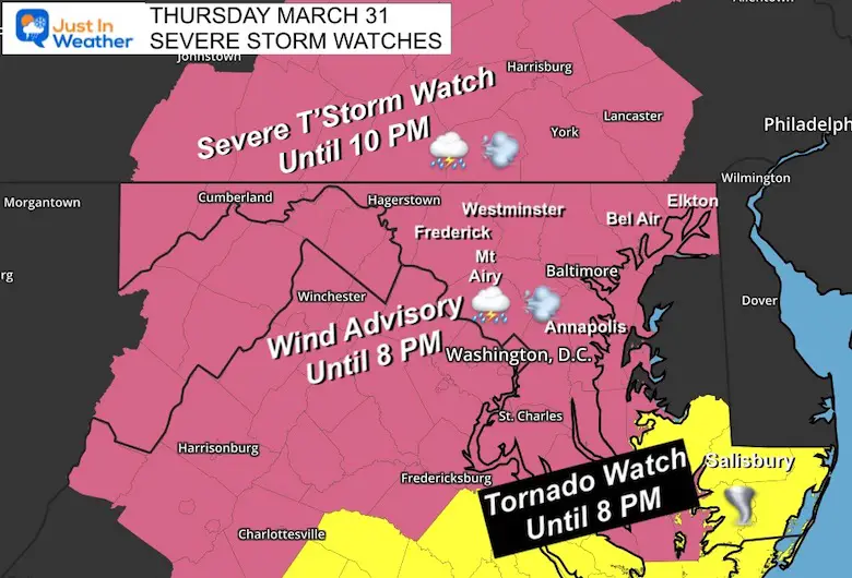
There has already been a very active system warmings with the lone of storms heading our way. In simple terms for your planning:
This afternoon: Windy with a few scattered showers.
This evening: Storms may turn severe between 7 PM and Midnight
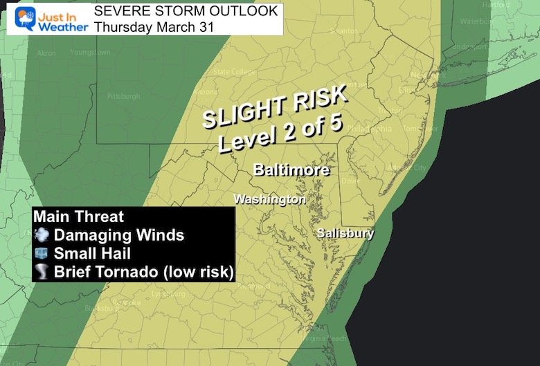
We are in the Slight Risk zone today.Please keep in mind the type of alerts you may see flash on your phone or TV screen:
Watch: It MIGHT HAPPEN. The would cover a large areas for ‘potential’ over a 4 to 6 hour period.
Warning: It is HAPPENING NOW.This would be a 30, 45, or 60 minute time frame with specific towns and a couple of counties listed.
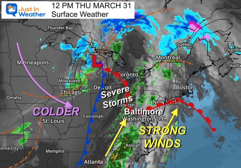
Mid Day Set Up
Surface Weather
This cold front is the main focus of the energy. That will cross our region tonight.
Surface Observations
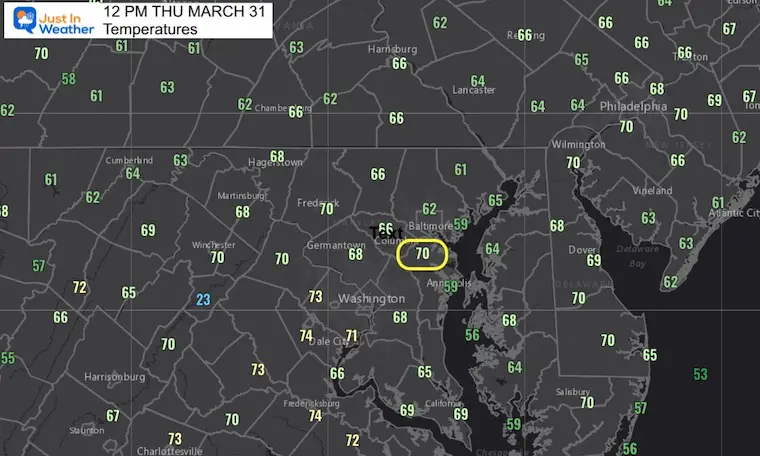
Baltimore’s BWI has reached 70ºF.
Most of the rest of our region ha reached the 60s to near 70ºF.
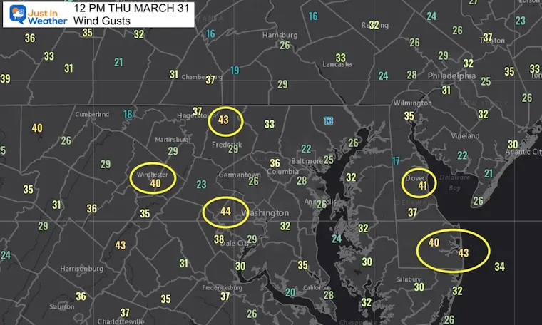
Wind Gusts
Most of the region has had winds between 20 and 35 mph.
A few spots have popped over 40 mph in the last hour.
This includes 43 mph at Camp David in northern Frederick County, also coastal Delaware.
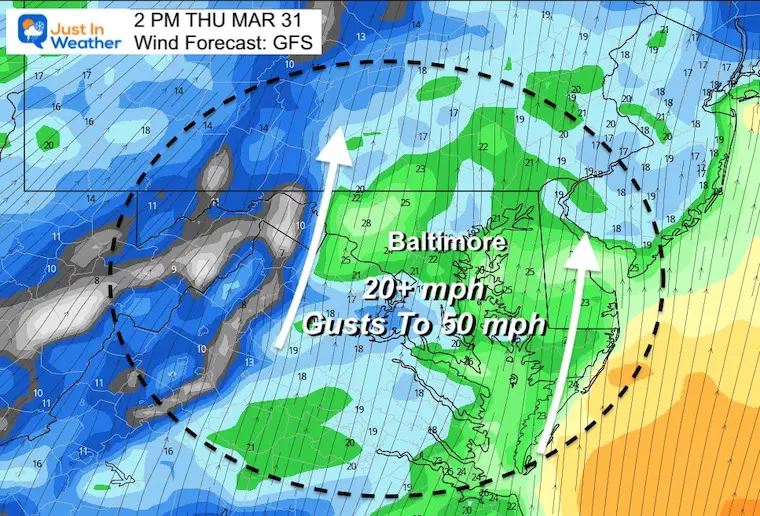
Wind Forecast
Strong winds may till reach 50 mph, regardless of rain and storms.
Inside some showers and storms they may push harder. Note that a Severe Thunderstorm has winds OVER 58 mph. That is enough for downing trees and power lines. If it was trash day in your neighborhood, I hope you find your bins later.
Radar Simulation Timeline —> slider
HRRR Model 3 PM to 11 AM
There will be some scattered showers during the afternoon that may not show up on this product. The main threat will be the timing of the strong storm line between 7 PM and Midnight.
march-31-weather-storm-radar-hrrr-pm-3
march-31-weather-storm-radar-hrrr-pm-4
march-31-weather-storm-radar-hrrr-pm-5
march-31-weather-storm-radar-hrrr-pm-6
march-31-weather-storm-radar-hrrr-pm-7
march-31-weather-storm-radar-hrrr-pm-8
march-31-weather-storm-radar-hrrr-pm-9
march-31-weather-storm-radar-hrrr-pm-10
march-31-weather-storm-radar-hrrr-pm-11
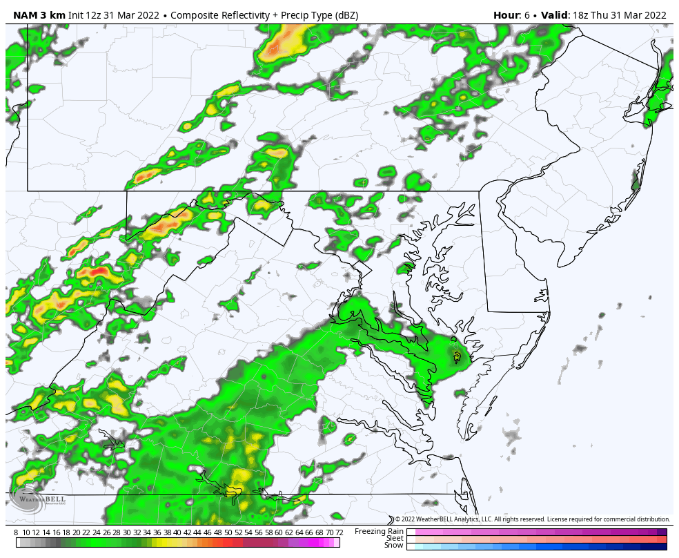
COMPARE TO THE NAM 3 Km Model
Radar Simulation Animation
NAM 3 Km Model
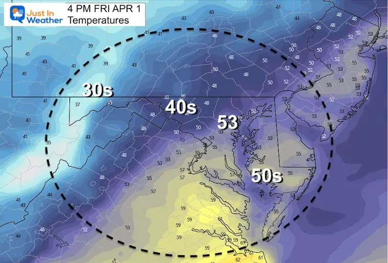
Friday
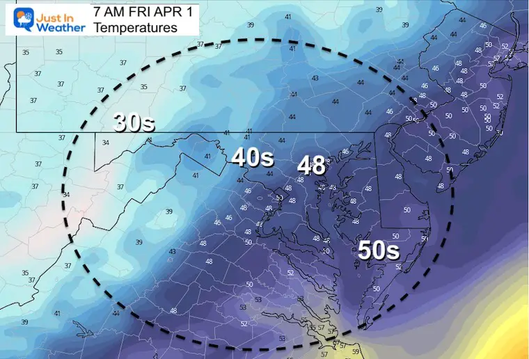
MorningTemperatures
Afternoon
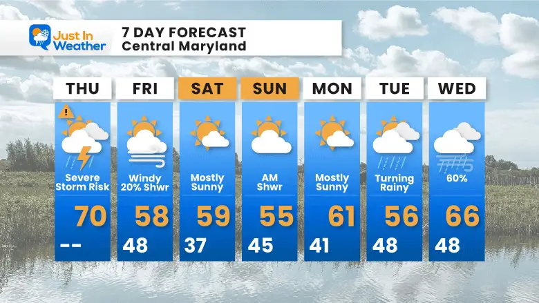
7 Day Forecast
Winds continue Friday…
Weekend back to bear normal…
Next week we watch another storm arrive Tuesday into Wednesday
I am aware there are some spelling and grammar typos. I have made a few public statements over the years, but if you are new here you may have missed it:
I have dyslexia, and found out at my second year at Cornell. I didn’t stop me from getting my meteorology degree, and being first to get the AMS CBM in the Baltimore/Washington region.
I do miss my mistakes in my own proofreading. The autocorrect spell check on my computer sometimes does an injustice to make it worse.
All of the maps and information are accurate. The ‘wordy’ stuff can get sticky.
There is no editor that can check my work when I need it and have it ready to send out in a newsworthy timeline.
I accept this and perhaps proves what you read is really from me…