


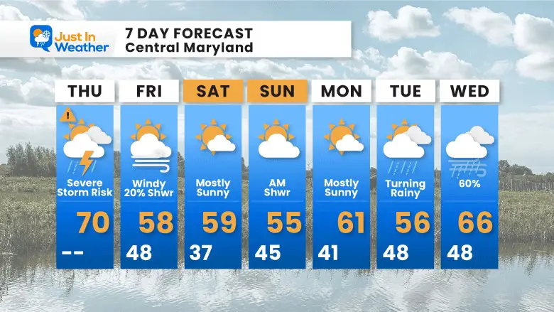
May 9 Cooler With Rain And Severe Storm Risk Tonight South
Thursday May 9 Morning Report Today is the first day of the year with sunrise before 6 AM in Baltimore, but we won’t see it. After a high temperature of…
Thursday Afternoon Update
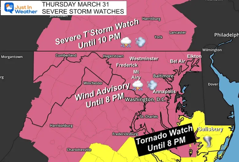
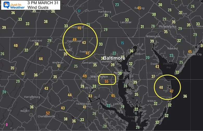
A lot of Advisories have been posted for this afternoon and evening in our region. Temperatures west of the Bay have reaches the 70s and winds have been gusting between 30 and 55 mph. The volatile weather will remain through midnight, but there are two separate areas we are focused on.
At this point, if outdoor actives/sports have not been cancelled, it might be a good idea to consider it for the pop up quick moving storm cells any time after 6 PM.
A Tornado Watch is for one cluster of storms crossing Virginia into Maryland’s Lower Eastern Shore.
A Severe Thunderstorm Watch is fro most of the area west of the Bay, mainly for the cold front that will bring a different line of storms from the west.
A Wind Advisory is also in place for gusts continued to push over 50 mph.
A Severe Thunderstorm can produce damaging winds over 58 mph, large hail over 1 inch dieter, and isolated tornados.
The Tornado Watch is for a higher chance to get a rotating thunderstorm to drop a funnel.
If any are issued for your area, please seek cover in a basement, or away from windows in an interior room or bathroom.
A bathtub with a tile wall has stronger reinforced walls to add protection.
Watch: It MIGHT HAPPEN. The would cover a large areas for ‘potential’ over a 4 to 6 hour period.
Warning: It is HAPPENING NOW. Should a storm actually produce these conditions: This would be a 30, 45, or 60 minute time frame with specific towns and a couple of counties listed.
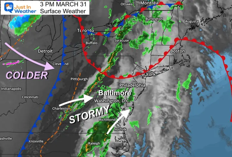
This cold front is the main focus of the energy. That will cross our region tonight.
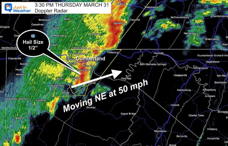
This cluster by Cumberland did have a history of including Tornado Warnings…
This Cell is RACING to the Northeast at 50 mph. It has been identified to have 1/2″ hail as well. This will end up in PA… With Chambersburg in the path b 5 to 6 PM.
This line is what Central Maryland and Southern PA will watch AFTER 7 PM
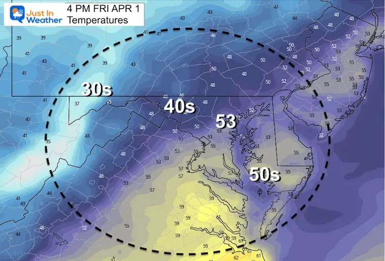
Baltimore’s BWI has reached 72ºF.
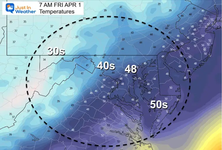
Cooler 60s dominate most of Delmarva, with 50s by the water.
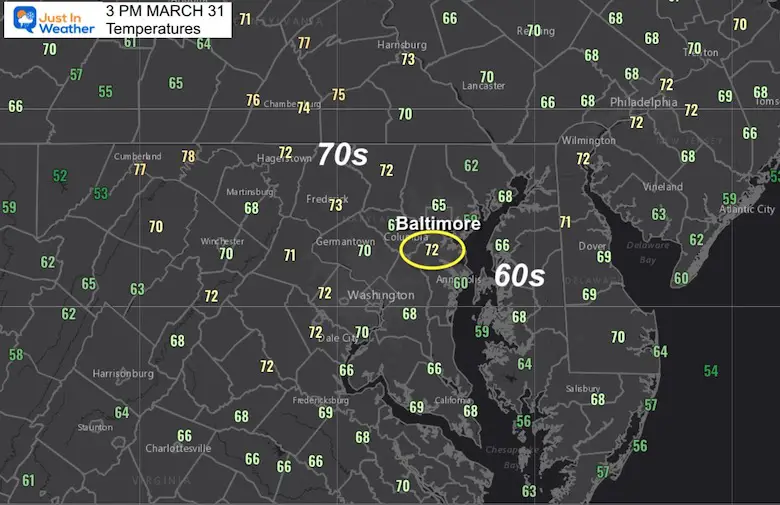
Most of the region has had winds between 25 and 50 mph.
A few spots have popped over 50 mph in the last hour.
This includes 55 mph in PG County just east of Washington.
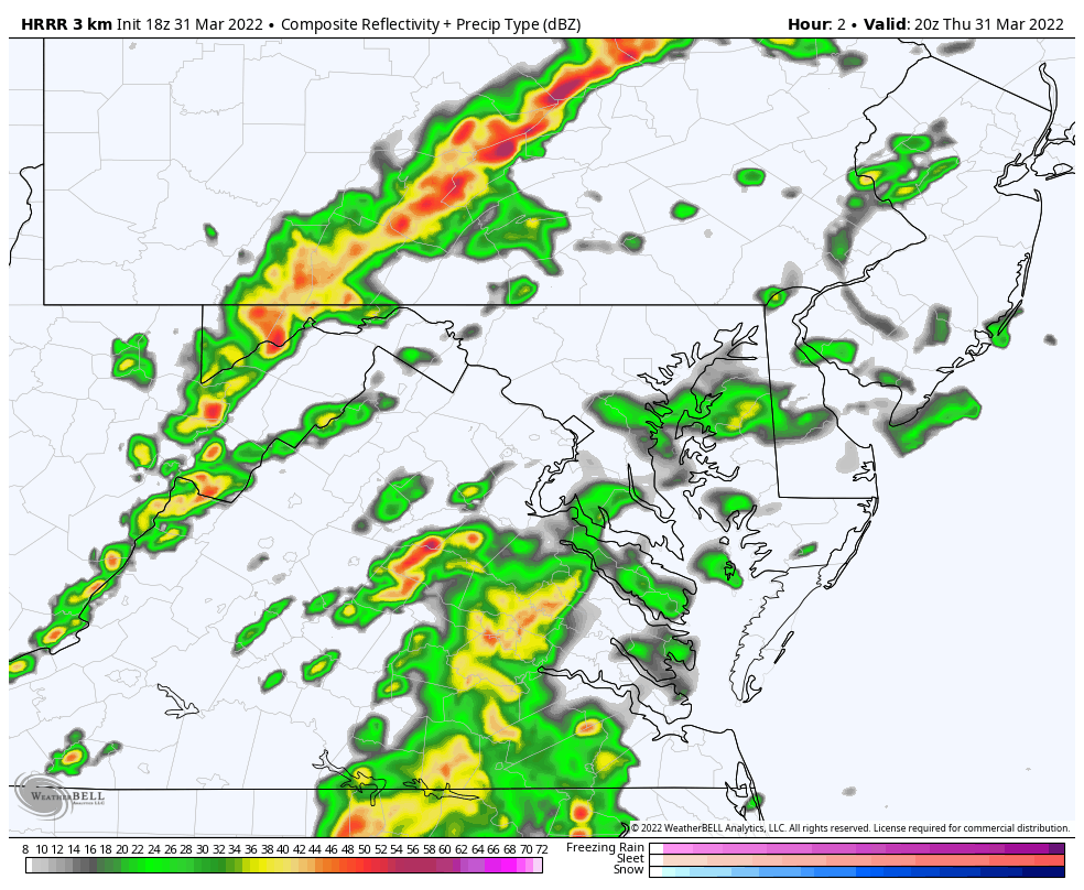
HRRR Model 3 PM to 11 AM
There will be some scattered showers during the afternoon that may not show up on this product. The main threat will be the timing of the strong storm line between 7 PM and Midnight.


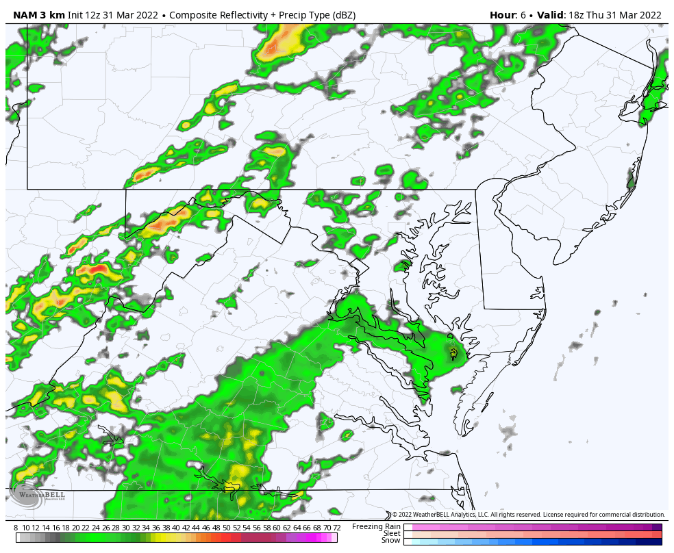
NAM 3 Km Model


Last Winter Recap: My Old Outlook And Your Grades Of My Storm Forecasts


*Disclaimer due to frequent questions:
I am aware there are some spelling and grammar typos. I have made a few public statements over the years, but if you are new here you may have missed it:
I have dyslexia, and found out at my second year at Cornell. I didn’t stop me from getting my meteorology degree, and being first to get the AMS CBM in the Baltimore/Washington region.
I do miss my mistakes in my own proofreading. The autocorrect spell check on my computer sometimes does an injustice to make it worse.
All of the maps and information are accurate. The ‘wordy’ stuff can get sticky.
There is no editor that can check my work when I need it and have it ready to send out in a newsworthy timeline.
I accept this and perhaps proves what you read is really from me…
It’s part of my charm.
#FITF