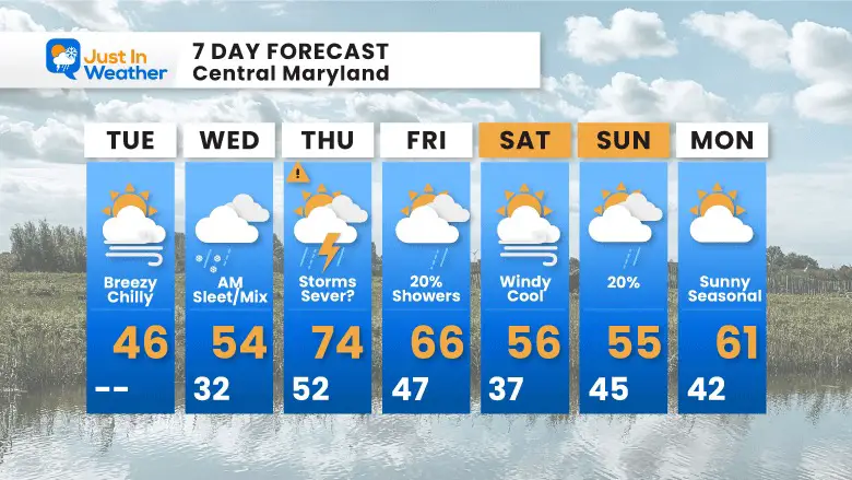
Tuesday March 29 2022
Evening Update
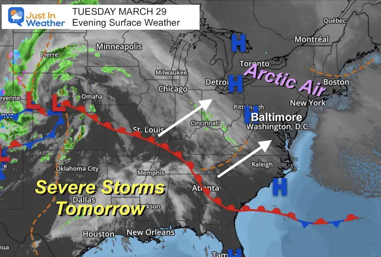
An abrupt change of seasons and extreme weather of sorts will cross our region spanning 36 hours.
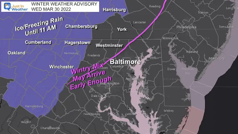
On Wednesday morning, the end of this arctic blast will come with a push of moisture and some freezing rain mainly in for the inland hills and mountain/valley areas.
On Thursday evening and night we have the potential for severe thunderstorms. The Outlook from NOAA has put Baltimore, central Maryland and Delmarva in the Slight Risk region.
Here is a brief look:
Evening Set Up
The arctic air has run its course and is about to get pushed out. This will happen from a larger storm in the central US. Moisture will arrive and push in early Wednesday, rising up and over the colder air. The result of warmer cloud and colder ground will be developing sleet and freeing rain.
The southern US is expecting a severe storm outbreak, and that will head our way on Thursday.
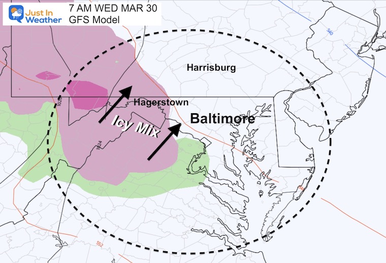
Winter Weather Advisory
This is primarily for sleet and freezing rain.
This includes the I-81 corridors which just experienced snow squalls and car pile ups yesterday. Even in Maryland. So be careful before sunrise through Hagerstown MD and up top Harrisburg in PA.
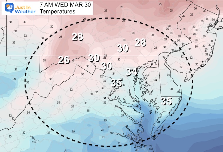
Morning Temperatures
The freezing line will be just west of Baltimore and the main cities. Yes, the nearby suburban counties will be below freezing if the moisture arrived sooner, so this is worth watching by sunrise in Frederik, western Howard, and Carroll Counties.
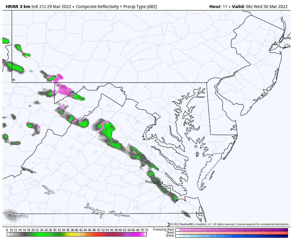
Radar Simulation Snapshots
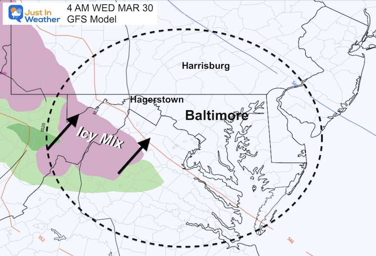
4 AM
7 AM
Timing is key, any earlier and we may need to pay attention to Frederick and Westminster.
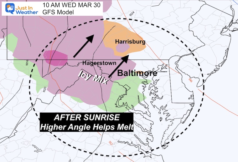
10 AM
Notice this is when it should reach the suburban areas… If this arrives before 8 AM, we need to pay closer attention for a minor ice glaze.
But the late March sun angle should help the pavement warm up enough .
Radar Simulation:
HRRR Model 4 AM to 10 AM
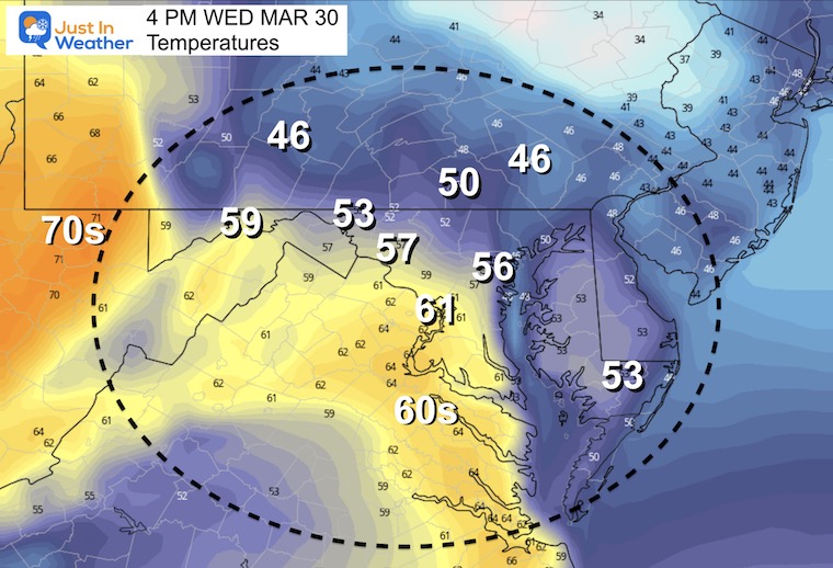
Afternoon Temperatures
Much warmer air will be flowing in. Notice how close the 60s, and even the 70s will be…
Next Up: Thursday
Severe Storm Outlook from NOAA
NOAA has put Baltimore, central Maryland and Delmarva in the Slight Risk region.
This means storms MAY contain damaging wind, large hail, and isolated tornadoes.
However the timing later in the evening and overnight could cut down on some energy.

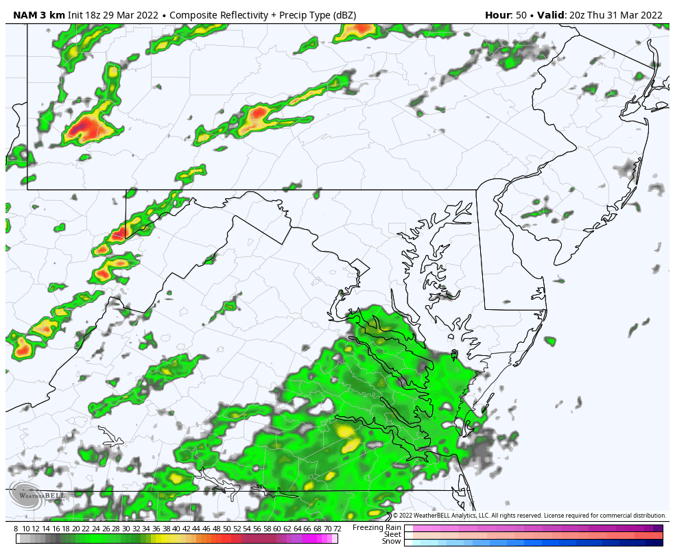
Radar Simulation: NAM 3 Km Model
4 PM Thursday to 2 AM Friday
I will be up early Thursday with any needed update on the timing of the freezing rain.
ALSO SEE
ALL FITF GEAR

FITF THUNDERSNOW


Winter Outlook Series:
My Call For Snowfall

Last Winter Recap: My Old Outlook And Your Grades Of My Storm Forecasts


Please share your thoughts, best weather pics/video, or just keep in touch via social media
*Disclaimer due to frequent questions:
I am aware there are some spelling and grammar typos. I have made a few public statements over the years, but if you are new here you may have missed it:
I have dyslexia, and found out at my second year at Cornell. I didn’t stop me from getting my meteorology degree, and being first to get the AMS CBM in the Baltimore/Washington region.
I do miss my mistakes in my own proofreading. The autocorrect spell check on my computer sometimes does an injustice to make it worse.
All of the maps and information are accurate. The ‘wordy’ stuff can get sticky.
There is no editor that can check my work when I need it and have it ready to send out in a newsworthy timeline.
I accept this and perhaps proves what you read is really from me…
It’s part of my charm.
#FITF


