Thursday March 10
Morning Report
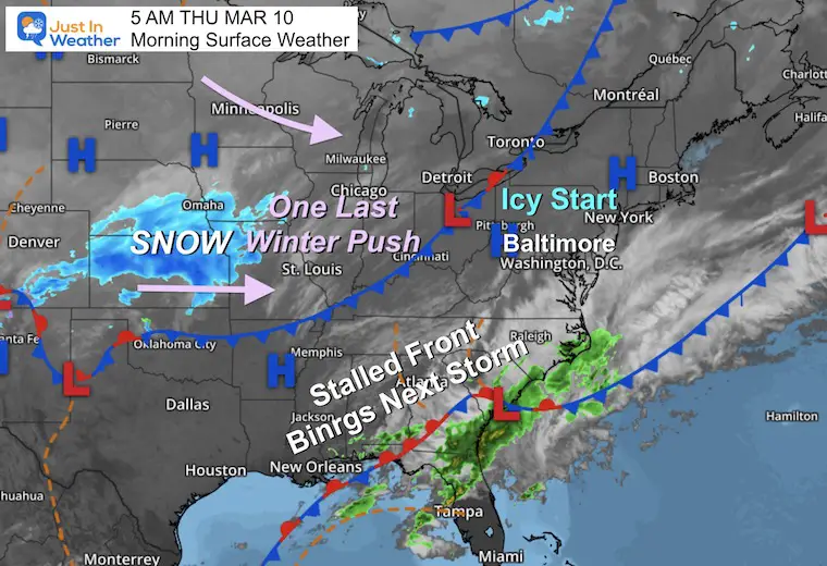
I believe things are winding down… for winter that is. There has been a lot of focus on the snow this week, which was by design to highlight the contrast to our record high temps. We have two quiet days ahead, then the main event on Saturday. This will bring on rain ending as snow and whip up strong winds. Temps will feel like mid winter again into Sunday.
Then…
Next week may very well be the spring pattern finally settling in with a firm grip. The ‘second’ polar vortex disruption might not be a ‘thing’ for us… There is some improvement AND something for everyone.
Headlines
- Today: Morning icy spots with freeing temps and patchy fog. Also thick frost on your car.
- Tomorrow: Mild
- Saturday: Stormy Rain To Snow. Strong Winds Gusting over 30 mph
- Sunday: Windy and Cold AND Clocks Forward
- Next Week: Spring Begins
Morning Surface Weather
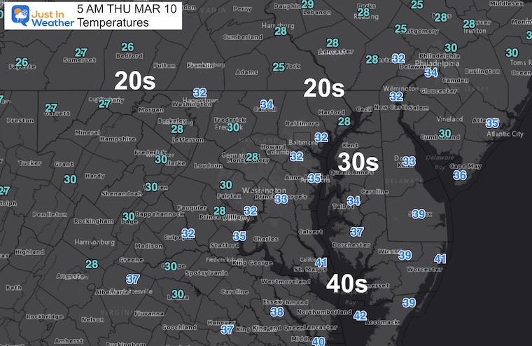
Morning Temperatures
Temps below freezing AND some patchy FOG.
There may be some icy spots AND thick frost on your car.
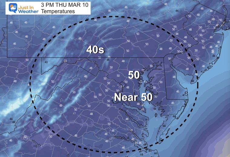
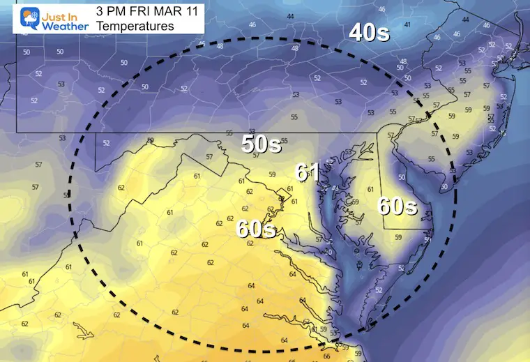
Afternoon Temperatures
Weather Almanac: Climate Data at BWI
TODAY March 10
Seasonal Snow: 14”
Normal Low in Baltimore: 31ºF
Record 11º F in 1996
Normal High in Baltimore: 51ºF
Record 80ºF 2016
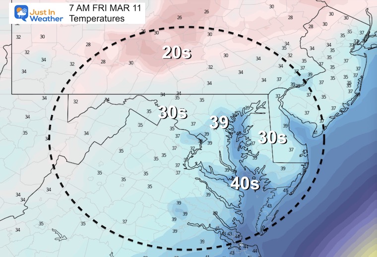
Friday Morning
Friday Afternoon
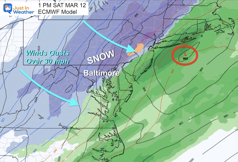
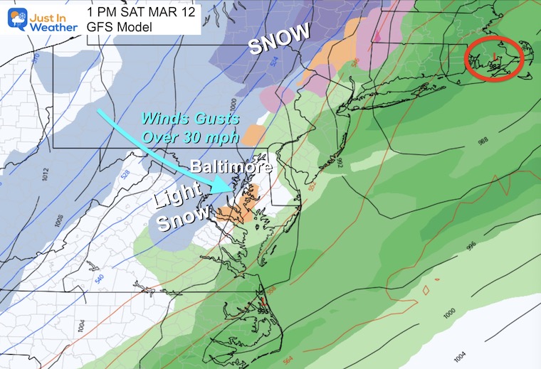
Looking Ahead: Saturday Snow?
I need to repeat myself: Your App showing 50s for high temps will be in the morning! Temps will be falling with strong cold winds over 30 mph.
Rain will begin, then change to snow.
This is the influence of the polar air… But with snow falling during the afternoon the warmer ground for most most of Central Maryland and then to Delmarva competes with the higher sun angle will likely mean pavement stays wet.
We will need to watch inland areas and higher elevations for some possible stickage earlier. Then for all of us what is wet could turn to ice at night.
European Model Animation
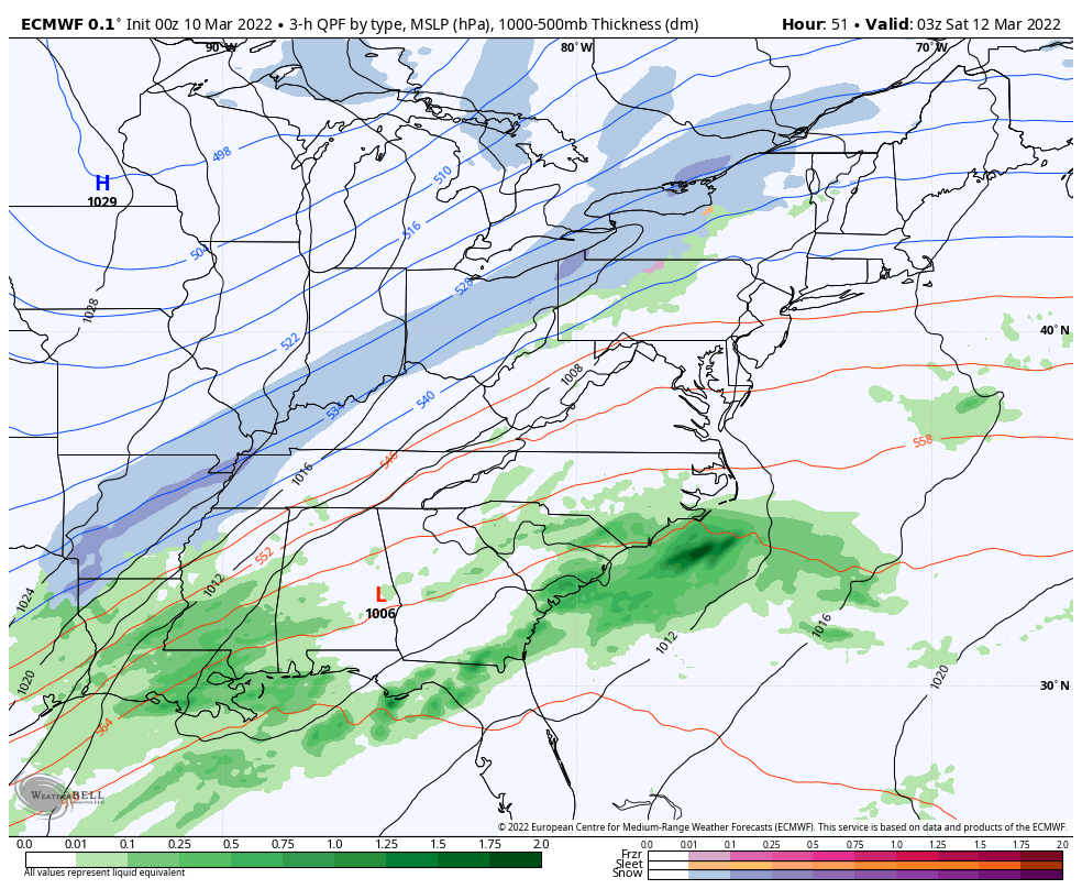
Snapshots
European Model – The snow will be expanding east to the coast during the afternoon. The question will be the intensity inland and if that can overtake the warm ground for any accumulation.
GFS Model – This continues to show a weak solution.
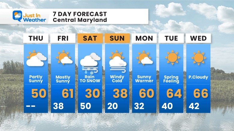
7 Day Forecast
The Saturday storms needs more explanation. I will spend more time on that in my next report.
Sunday morning: The ground may be icy. Note the clocks turn FORWARD 1 hour.
Next Week: I had said Beware the Ides of March and there would be a second Polar Vortex Disruption. For now it looks like that might not affect us, and we could turn the corner to remain in Spring….
ALSO SEE
ALL FITF GEAR

FITF THUNDERSNOW


Winter Outlook Series:
My Call For Snowfall

Last Winter Recap: My Old Outlook And Your Grades Of My Storm Forecasts


Please share your thoughts, best weather pics/video, or just keep in touch via social media
*Disclaimer due to frequent questions:
I am aware there are some spelling and grammar typos. I have made a few public statements over the years, but if you are new here you may have missed it:
I have dyslexia, and found out at my second year at Cornell. I didn’t stop me from getting my meteorology degree, and being first to get the AMS CBM in the Baltimore/Washington region.
I do miss my mistakes in my own proofreading. The autocorrect spell check on my computer sometimes does an injustice to make it worse.
All of the maps and information are accurate. The ‘wordy’ stuff can get sticky.
There is no editor that can check my work when I need it and have it ready to send out in a newsworthy timeline.
I accept this and perhaps proves what you read is really from me…
It’s part of my charm.
#FITF


