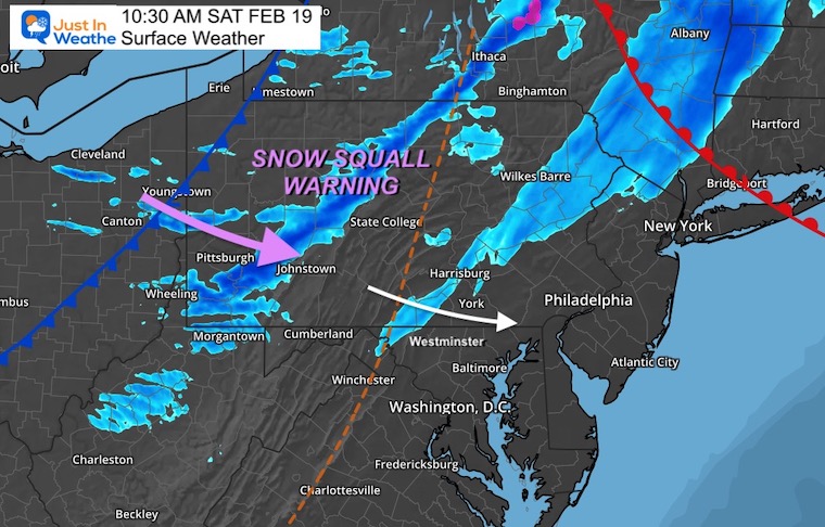
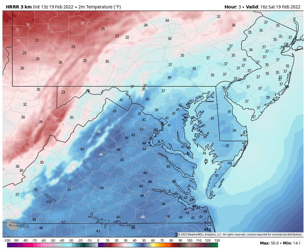
The arctic front on the way today has two lines of snow pushing out ahead of it.The first one will cross through northern Maryland and Southern Pennsylvania. The second line just ahead of the front has already prompted Snow Squall Warnings in central PA.The arrival is plotted in the timeline below as it should reach metro Baltimore.
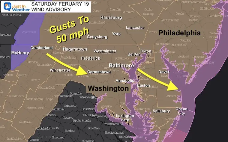
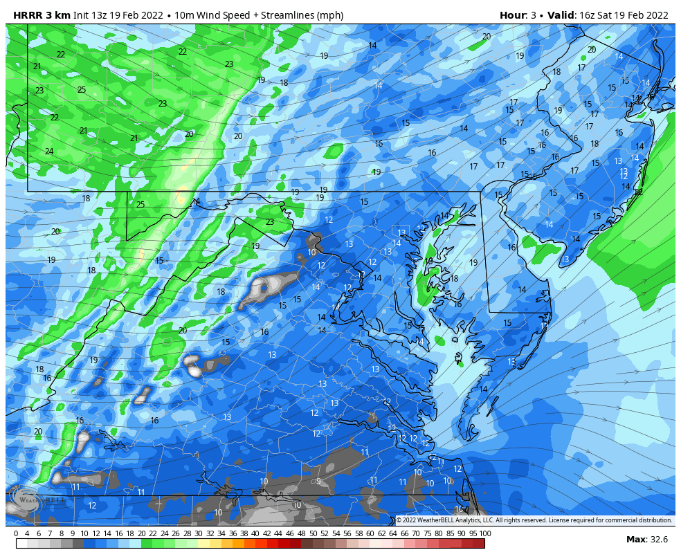
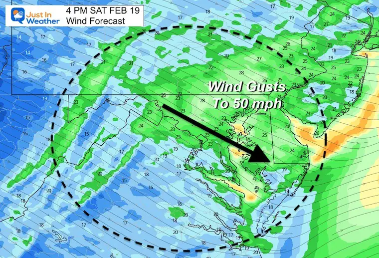
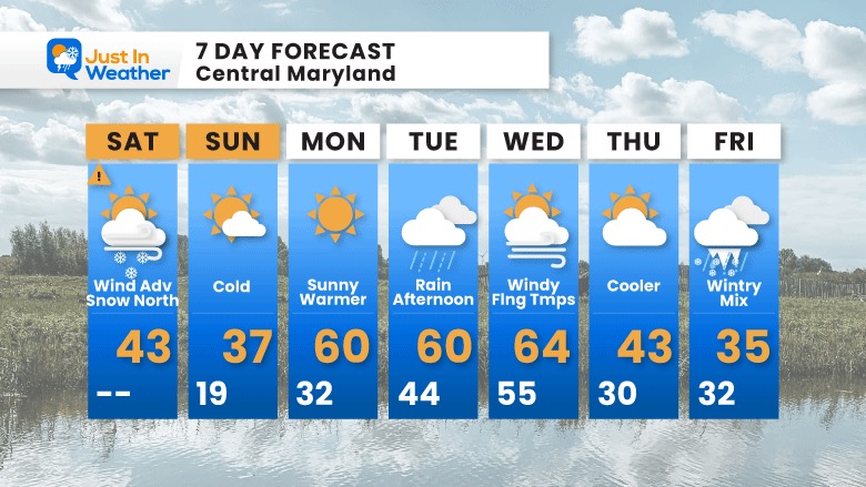
Winds will pick up as temperatures fall. So in addition to our Wind Advisory we will have an abrupt return to winter as the day progresses. This may impact your plans and hopefully you will dress accordingly for this evening.
Late Morning Set Up
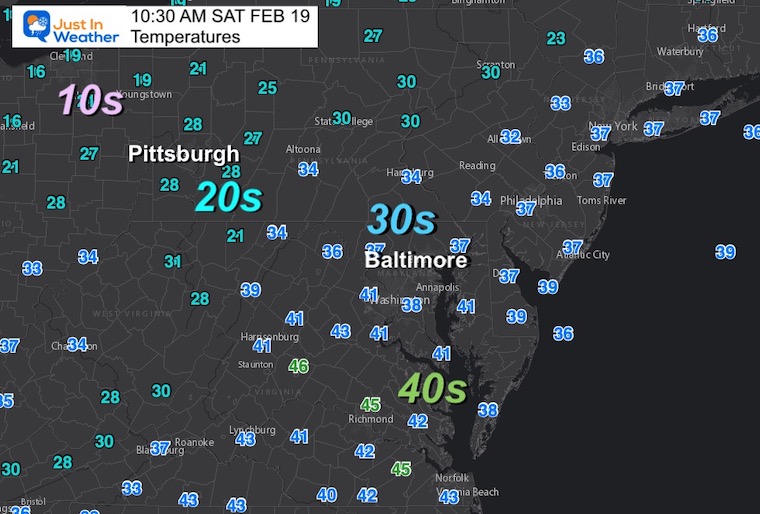
At 10:30 AM, the cold front was passing across the Ohio and Pennsylvania border. Two lines of snow have developed ahead of it.
A Snow Squall Warning has been issued in west/centra PA with the intense burst expected. Travel will be impacted with near White Out conditions of zero visibility an a quick 1 inch or so of snow.
The first one will be reaching Hagerstown, Westminster and York in the next hour.It may hold together for Bel Air and Elkton to Wilmington DE.But if you miss the first one, the second one will more likely reach these areas and expand into metro Baltimore early this afternoon.
I am aware there are some spelling and grammar typos. I have made a few public statements over the years, but if you are new here you may have missed it:
I have dyslexia, and found out at my second year at Cornell. I didn’t stop me from getting my meteorology degree, and being first to get the AMS CBM in the Baltimore/Washington region.
I do miss my mistakes in my own proofreading. The autocorrect spell check on my computer sometimes does an injustice to make it worse.
All of the maps and information are accurate. The ‘wordy’ stuff can get sticky.
There is no editor that can check my work when I need it and have it ready to send out in a newsworthy timeline.
I accept this and perhaps proves what you read is really from me…