Saturday February 19
Morning Report
Here we go again! Another Wind Advisory today as gusts this afternoon may once again push 50 mph. This is part of another arctic cold front on yet another weekend. There will be another line of snow squalls, near Baltimore and more likely west and north. Followed by yet another very cold Sunday morning.
It’s been a pattern all winter.
The other pattern emerging is a big warm up, which we will get to start the work week with a few days reaching the 60s.
Next week we are still following a possibly snow and icy mix on Friday.
Headlines:
- Wind Advisory – Falling Temps Afternoon
- Snow Squall – Mainly north and west of Baltimore
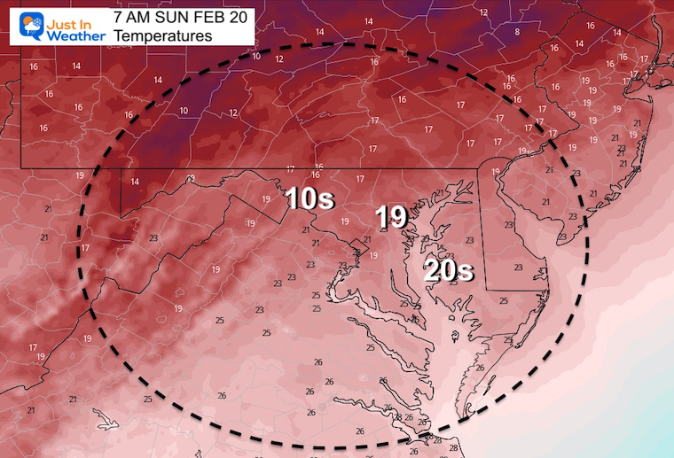
- Sunday: Colder
- Monday to Wednesday: Warmer with rain.
- Friday: Wintry Mix
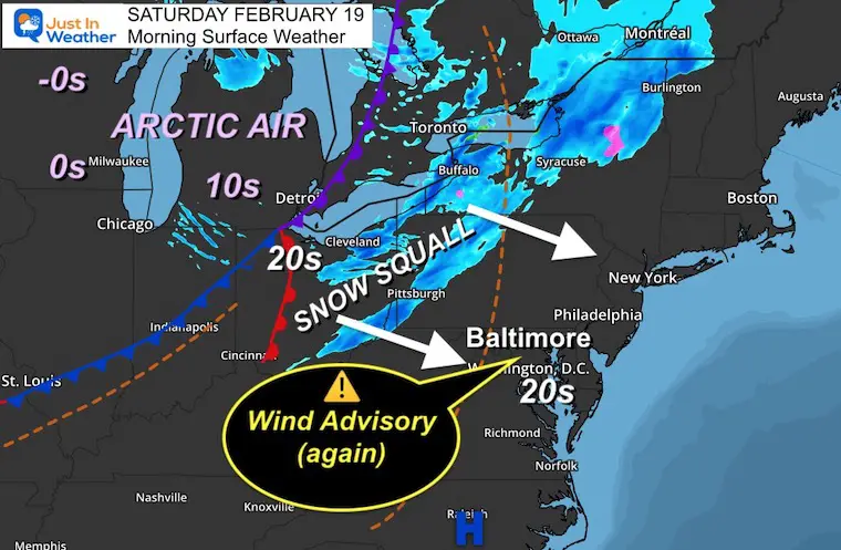
Morning Surface Weather
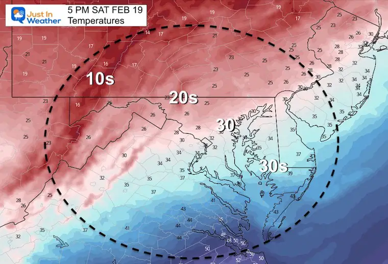
Locally temperatures start in the 20s, but we will get a brief boost before that arctic front arrives to bring temps crashing again!
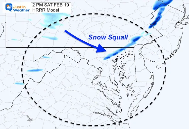
A squall line is moving through western PA ahead of the front. Plotting the snow is not easy for models. For now is it most likely to reach Frederick, Westminster, York, and Baltimore and possibly Bel Air to Elkton within an hour or two of noon. I will spend the morning analyzing if it can hold together or fall apart for areas south.
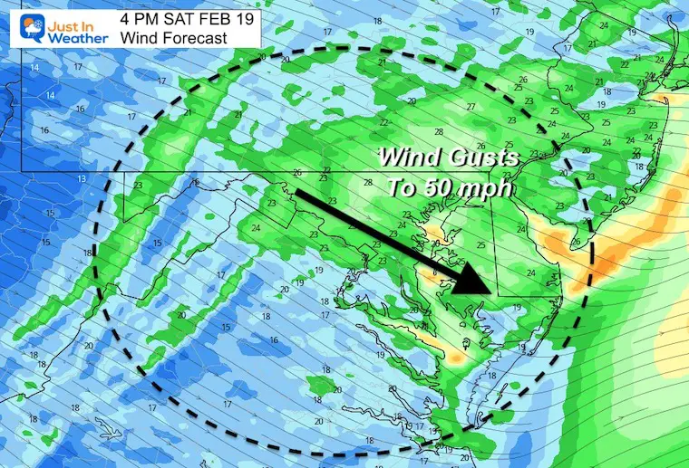
The Wind Advisory is for all of us! Gusts to 50 mph will follow this afternoon.
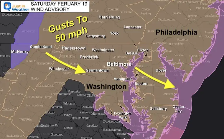
Wind Advisory
Late morning through the afternoon. Peak Wind Gusts Up To 50 mph.
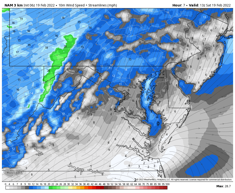
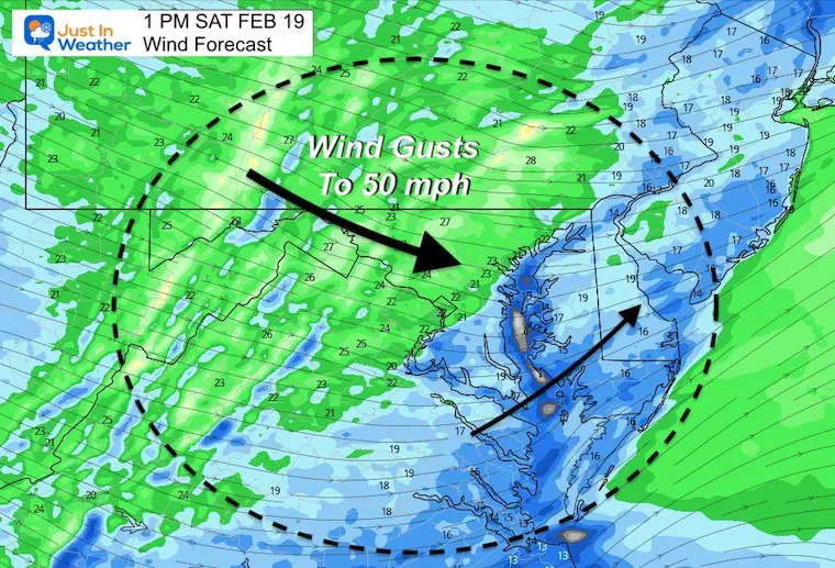
Wind Forecast
Animation 8 AM to 8 PM
We can see the wind shift to the Northwest mid day and increase during the afternoon. This will cause temperatures to fall during the day.
Wind Snapshots
1 PM
4 PM
Snow Squall
This is not easy to track on model forecast plots. There will be a push of briefly heavy snow mainly west and north of Baltimore.
12PM to 2 PM: Timing between Frederick, York, and Baltimore.
(I will post an hourly timeline in my next report)
Temperatures
1 PM

5 PM
Weather Almanac: Climate Data at BWI
TODAY February 18
Seasonal Snow: 14”
Normal Low in Baltimore: 27ºF
Record +3ºF in 1979
Normal High in Baltimore: 45ºF
Record 75ºF 1976
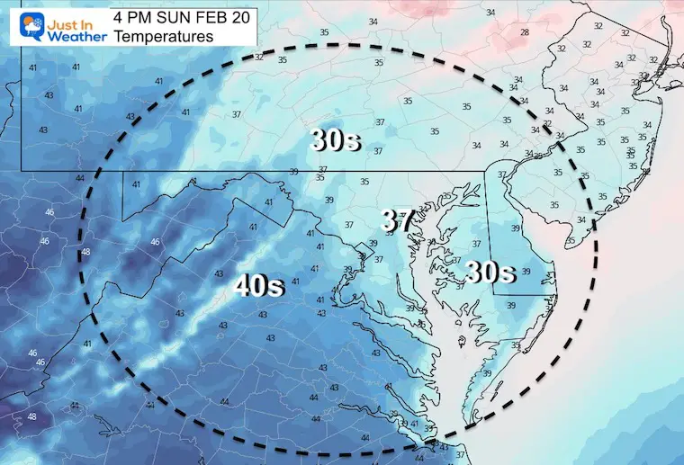
Sunday Temperatures
Morning
Afternoon
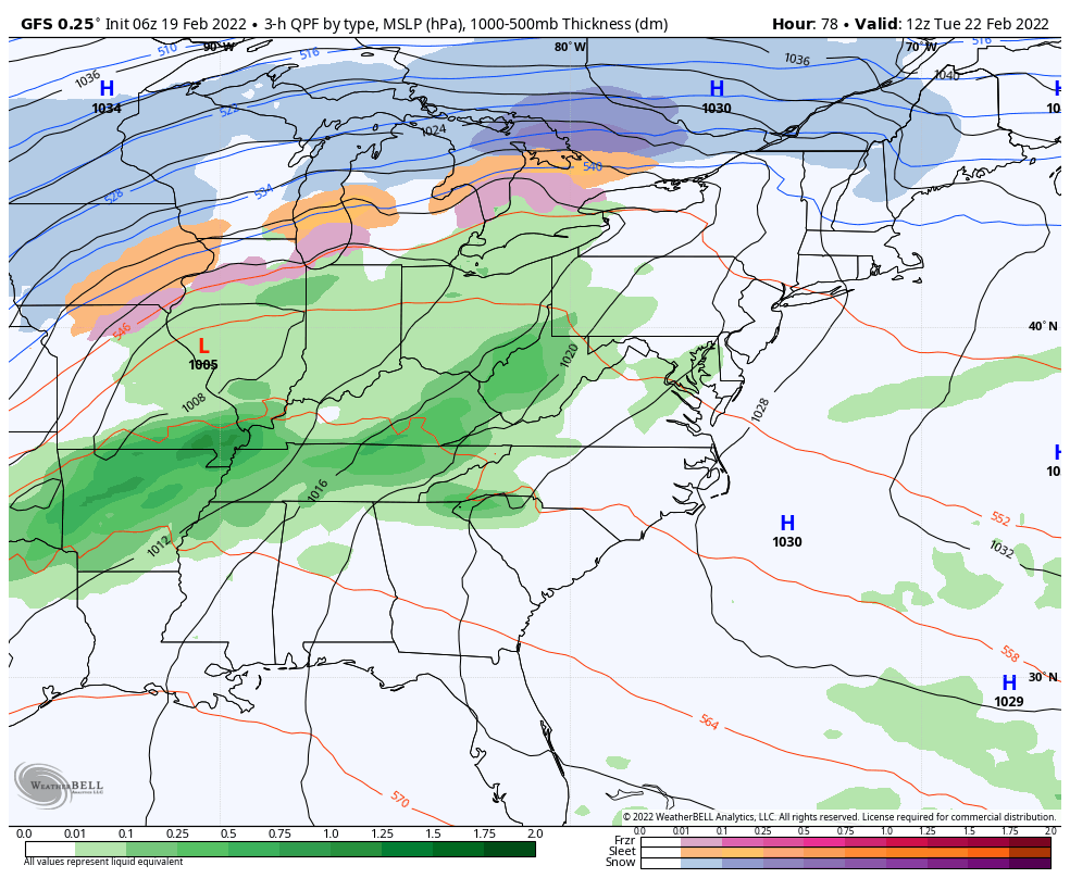
Looking Ahead!
7 AM Tuesday To 7 AM Friday
The next storm will surge us to the 60s with rain. The back end may bring in a windy mix by Friday. That wintry mix has been a consistent display for a few days.
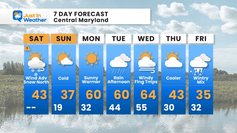
7 Day Forecast
Big changes- typical of late February.
From our cold weekend, to warm start next week, followed by winter trying to make a return at the end of next week.
ALSO SEE
ALL FITF GEAR

FITF THUNDERSNOW


Winter Outlook Series:
My Call For Snowfall

Last Winter Recap: My Old Outlook And Your Grades Of My Storm Forecasts


Please share your thoughts, best weather pics/video, or just keep in touch via social media
*Disclaimer due to frequent questions:
I am aware there are some spelling and grammar typos. I have made a few public statements over the years, but if you are new here you may have missed it:
I have dyslexia, and found out at my second year at Cornell. I didn’t stop me from getting my meteorology degree, and being first to get the AMS CBM in the Baltimore/Washington region.
I do miss my mistakes in my own proofreading. The autocorrect spell check on my computer sometimes does an injustice to make it worse.
All of the maps and information are accurate. The ‘wordy’ stuff can get sticky.
There is no editor that can check my work when I need it and have it ready to send out in a newsworthy timeline.
I accept this and perhaps proves what you read is really from me…
It’s part of my charm.
#FITF


