


May 1 Weather Gradual Cooling Trend Will Bring Rain Into The Weekend
Wednesday, May 1 Morning Report One of the marks of May Day is an ancient European holiday celebrating the start of summer. It feels like we have had our taste…
Friday February 18
Morning Report
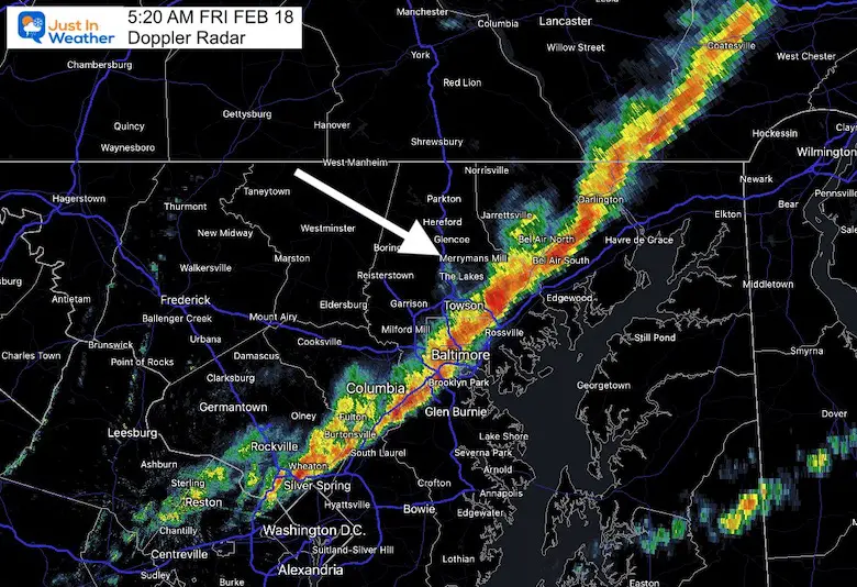
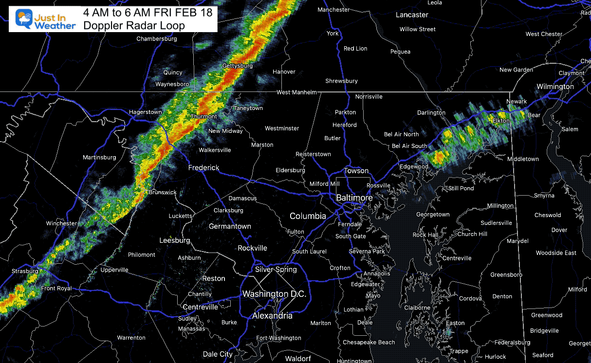
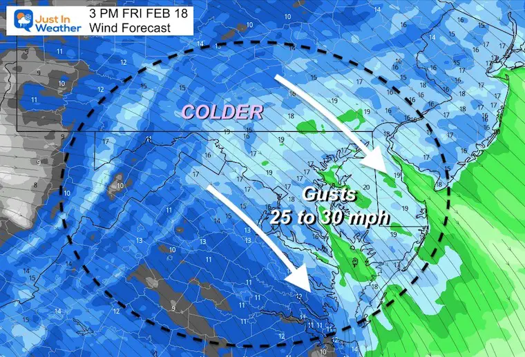
This front behaved as expected with the park wind gusts, timing, and intensity. I have already seen dozens of reports online from people that were up overnight due to the wind. Me too!
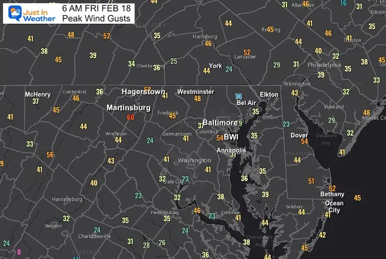
Let’s start with the strongest winds, as that forecast verified. Most areas saw gusts over 40 mph, but many 50s including Baltimore and Hagerstown. One report of 60 mph in Martinsburg.
There have been some large trees downed blocking roads. Also some scattered power outages. Please allow some extra time on your commute or check ahead for your route.
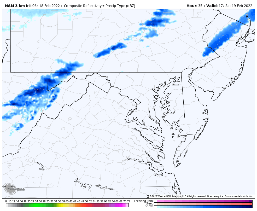
The forecast I showed last night had the squall line crossing Baltimore around 5 AM. This worked out pretty well.
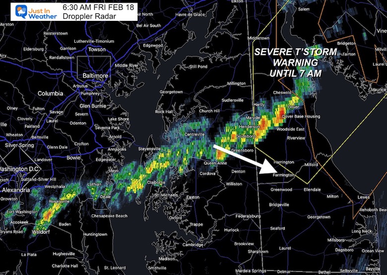
There are still 2 more hours until this clears the southern and eastern part of our region.
Northern Delaware: Until 7 AM
This squall line may produce winds up to 60 mph.
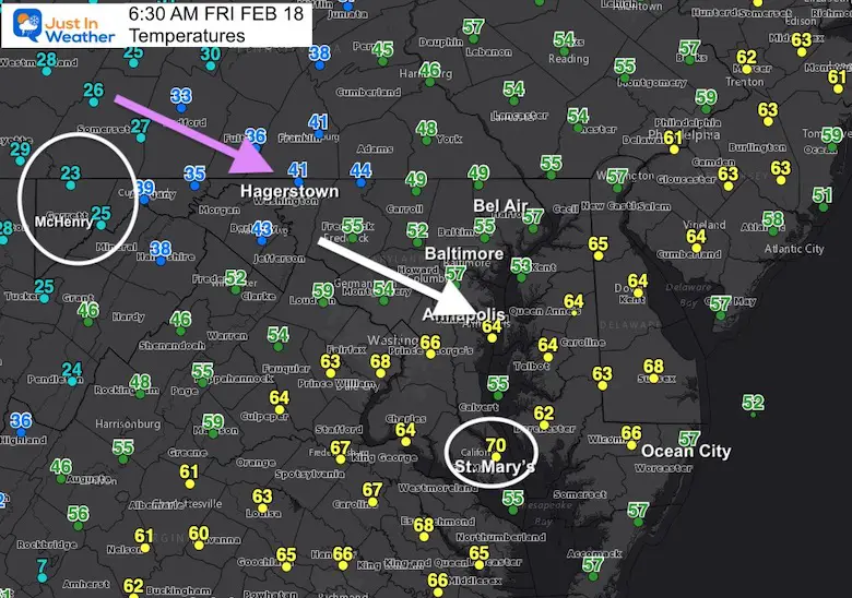
The spread across Maryland was incredible!
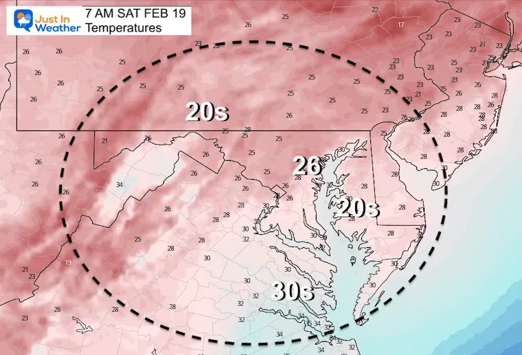
Mountains: Garrett County 24ºF
Southern MD: St. Mary’s County 70ºF
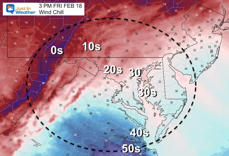
This cold front is the main story!

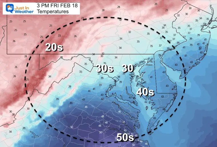
TODAY February 18
Seasonal Snow: 14”;
+0.2” ABOVE AVERAGE
Normal Low in Baltimore: 27ºF
Record +3ºF in 1979
Normal High in Baltimore: 45ºF
Record 75ºF 1976
Morning
Afternoon
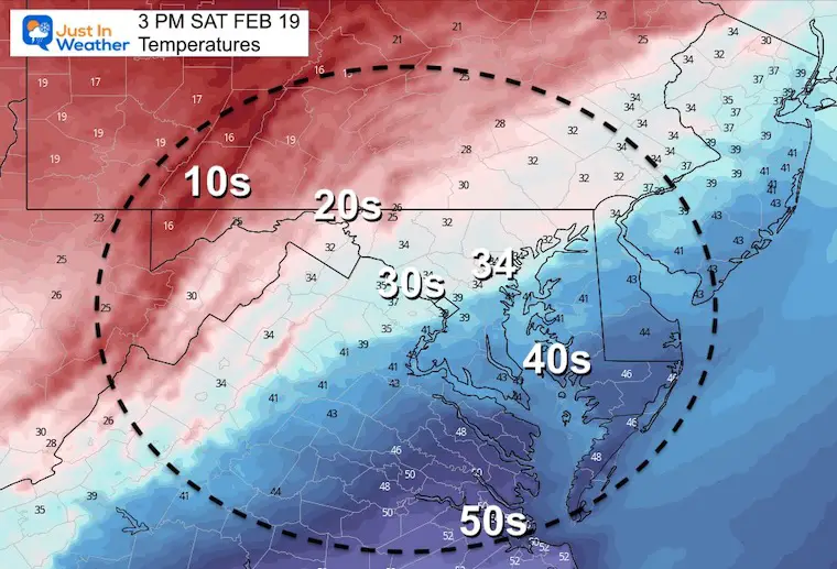
The next storm will surge us to the 60s with rain. The back end may bring in a windy mix on Thursday.


Last Winter Recap: My Old Outlook And Your Grades Of My Storm Forecasts


*Disclaimer due to frequent questions:
I am aware there are some spelling and grammar typos. I have made a few public statements over the years, but if you are new here you may have missed it:
I have dyslexia, and found out at my second year at Cornell. I didn’t stop me from getting my meteorology degree, and being first to get the AMS CBM in the Baltimore/Washington region.
I do miss my mistakes in my own proofreading. The autocorrect spell check on my computer sometimes does an injustice to make it worse.
All of the maps and information are accurate. The ‘wordy’ stuff can get sticky.
There is no editor that can check my work when I need it and have it ready to send out in a newsworthy timeline.
I accept this and perhaps proves what you read is really from me…
It’s part of my charm.
#FITF