Conditions: Baltimore, Maryland, 05/12/2024 09:10:02 am
Temperature

56°

Mostly Cloudy

51°

Dew Point
Relative Humidity

84%

Feels Like

56°

Wind (W)

6mph

Air Pressure

29.83

Sun
Sun Rise

05:55 AM

Sun Set

08:10 PM

Day Length

14:15 Hours

Difference

1 min 54 sec gain

Moon
Moon Rise

09:30 AM

Moon Set

12:29 AM

Next: First Quarter

May 15,2024

Moon Phase

Waxing Crescent

Climate
Average Low

51°

73°

Average High
Record Low

35°


(1963)

94°


(1881)
Record High
Conditions

Snow Squall Crossing Maryland PA Line Then We All Get Strong Winds

snow forecast
wind
Forecast
Warnings

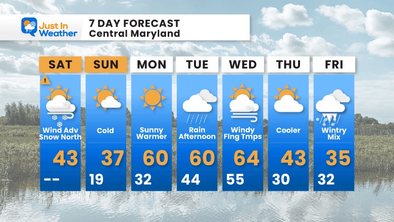
Saturday February 19 2022
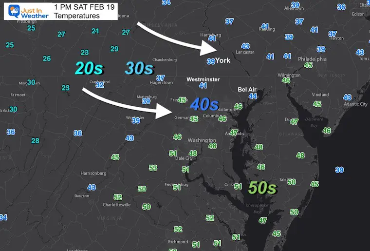
1 PM Update

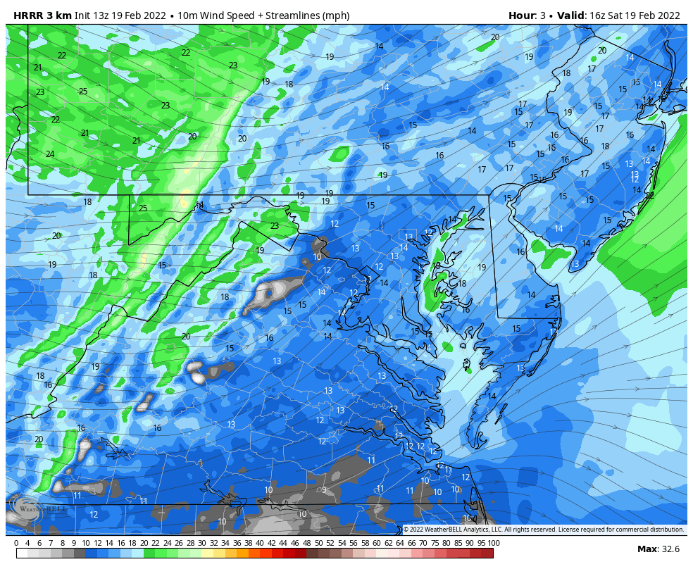
Tracking this line of snow across Pennsylvania included Snow Squall Warnings. It has produced white out conditions, which has been described a the feel of a blizzard for about 20 minutes. 

Traveling North? New Snow Squall Warning Issued in PA for:

  • Berks County
  • Lehigh County
  • Northwestern Montgomery County
  • West central Bucks County
  • South central Northampton County


Doppler Radar Loop

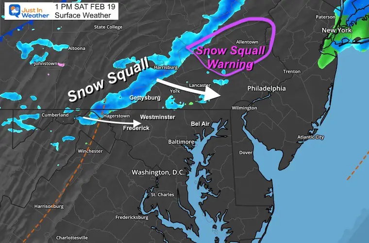
The most intense part for our region will remain across Southern PA, and northern Maryland.  A quick coating to 1/2″ of snow is possible.

This will include…

In Maryland: Thurmont, Taneytown, maybe Westminster to Manchester to Hereford in Baltimore County.

In southern PA: Gettysburg, York, Hanover, and Shrewsbury.


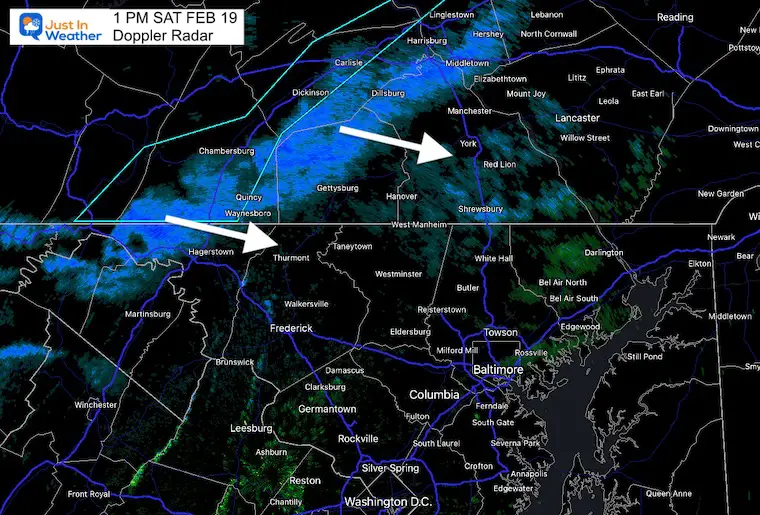
UPDATE:  There have been repots of VIRGA with the line… Meaning some of the moisture may be drying up before reaching the ground… SO the father east and south this moves, it will be less productive. 


Doppler Radar At 1 PM

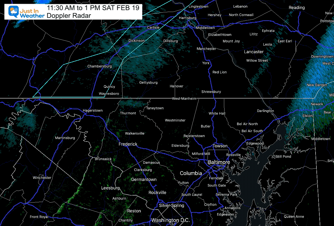
The southern edge of this includes Hagerstown, and it will clip northern Frederick,  Carroll, and Baltimore Counties. The line will break up a little but, but snow showers or a brief burst of ‘heavy flurries’ will try to cross metro Baltimore into Harford and Cecil C0unties between 2 PM and 3 PM.


From The Previous Update


Radar Simulation —> slider

11 AM to 7 PM

february-19-weather-radar-snow-squall-saturday-am-11
february-19-weather-radar-snow-squall-saturday-pm-12
february-19-weather-radar-snow-squall-saturday-pm-1
february-19-weather-radar-snow-squall-saturday-pm-2
february-19-weather-radar-snow-squall-saturday-pm-3
february-19-weather-radar-snow-squall-saturday-pm-4
previous arrow
next arrow


Wind Advisory

Model Guidance supports the potential for gusts with the front 50 to 60 mph.

Note: Strong wind will remain during the day as it ushers in colder air.


Wind Animation

12 PM to 7 PM


February-19-weather-wind-forecast-hrrr-Saturday


Afternoon Snapshot 


Early Afternoon Temperatures

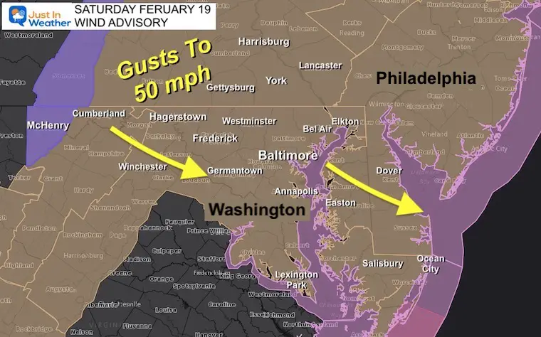
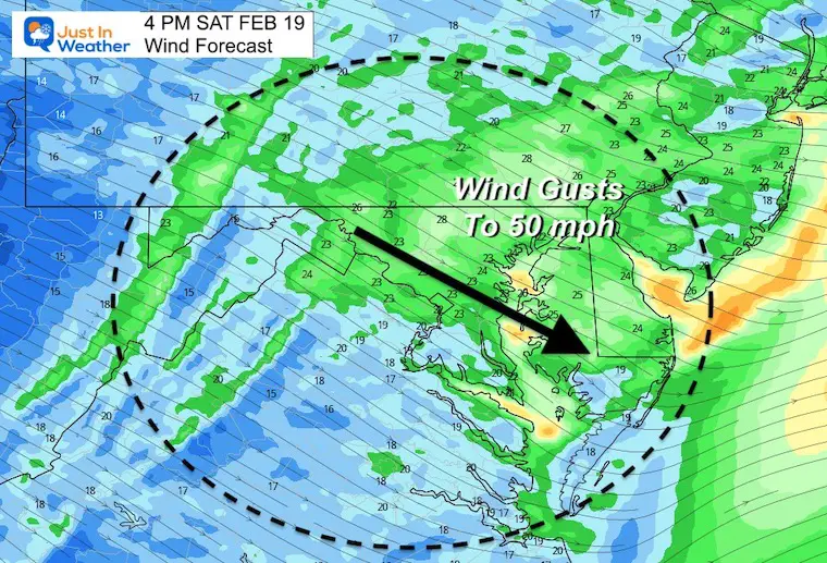
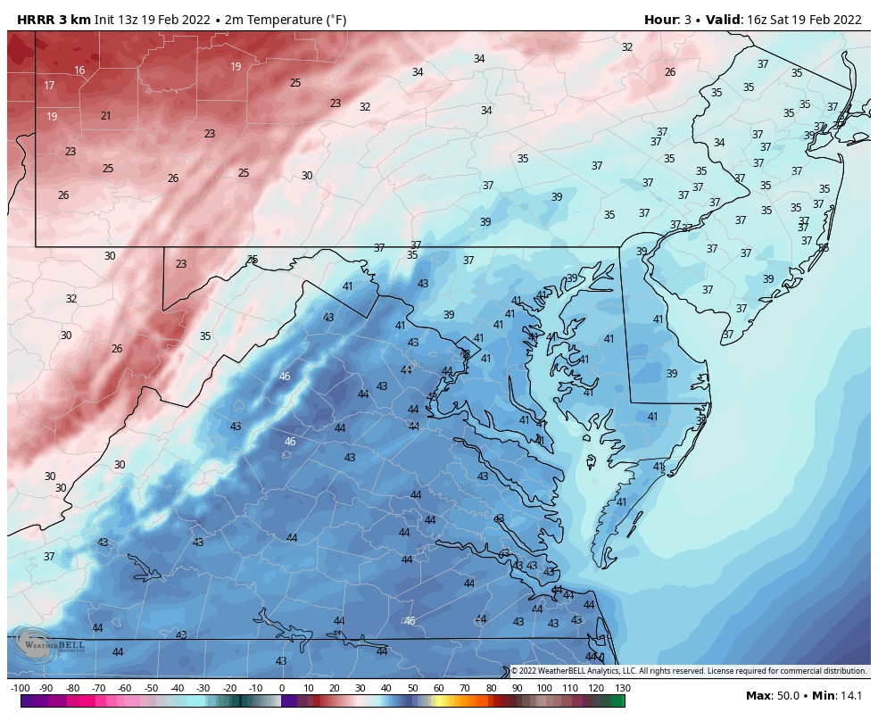
1 PM- Arctic air to the west of the cold front will arrive by mid afternoon and evening. 


Temperature Animation

12 PM to 7 PM

February-19-weather-temperature-forecast-hrrr-Saturday


Extended Forecast (initially issued this morning)


Weather posts straight to your inbox

Sign up and be the first to know!


ALSO SEE


What is Faith in the Flakes: History of December 5th Snow


ALL FITF GEAR


FITF THUNDERSNOW


Winter Outlook Series:

My Call For Snowfall


Last Winter Recap: My Old Outlook And Your Grades Of My Storm Forecasts

Winter Weather Page – Lots of resources


Solar Cycle Increasing Sunspots Suggests More Snow


Comparing 4 Different Farmer’s Almanacs: Majority colder winter outlook than NOAA


NOAA Winter Outlook- But Read The Fine Print


Signals For Early Start To Winter In November


Winter Outlook Series: La Nina Double Dip


Nor’easters May Give Hint For Winter La Nina Pattern


Winter Folklore Checklist


Please share your thoughts, best weather pics/video, or just keep in touch via social media

Facebook: Justin Berk, Meteorologist

Twitter: @JustinWeather

Instagram: justinweather


*Disclaimer due to frequent questions:

I am aware there are some spelling and grammar typos. I have made a few public statements over the years, but if you are new here you may have missed it:

I have dyslexia, and found out at my second year at Cornell.  I didn’t stop me from getting my meteorology degree, and being first to get the AMS CBM in the Baltimore/Washington region. 

I do miss my mistakes in my own proofreading. The autocorrect spell check on my computer sometimes does an injustice to make it worse. 

All of the maps and information are accurate. The ‘wordy’ stuff can get sticky. 

There is no editor that can check my work when I need it and have it ready to send out in a newsworthy timeline. 

I accept this and perhaps proves what you read is really from me…

It’s part of my charm.

#FITF