


May 5 Soggy And Chilly Start With More Rain During The Week Ahead
Sunday May 5 Morning Report We are stuck in this muck! The wet weather pattern continues with a soggy start this Sunday morning. The rain will try to break up…
Saturday February 5 – Morning Report
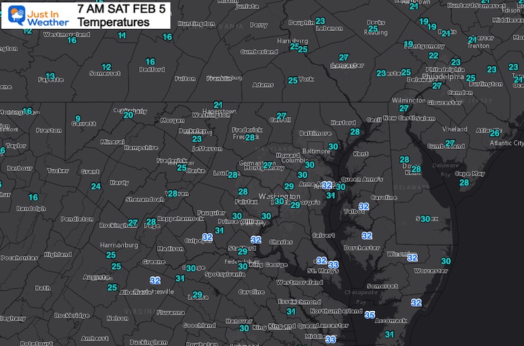
While you were sleeping the cold air filled in and was followed by snow showers. This shouldn’t be too much of a surprise. I mentioned the upper level energy following the storm, just that it arrived a little early.
This opens us up to the core of the cold air, which we can see in two radar loops below.
While next week will get back to near and above average temps, Mid February is expected to turn cold and wintry again.
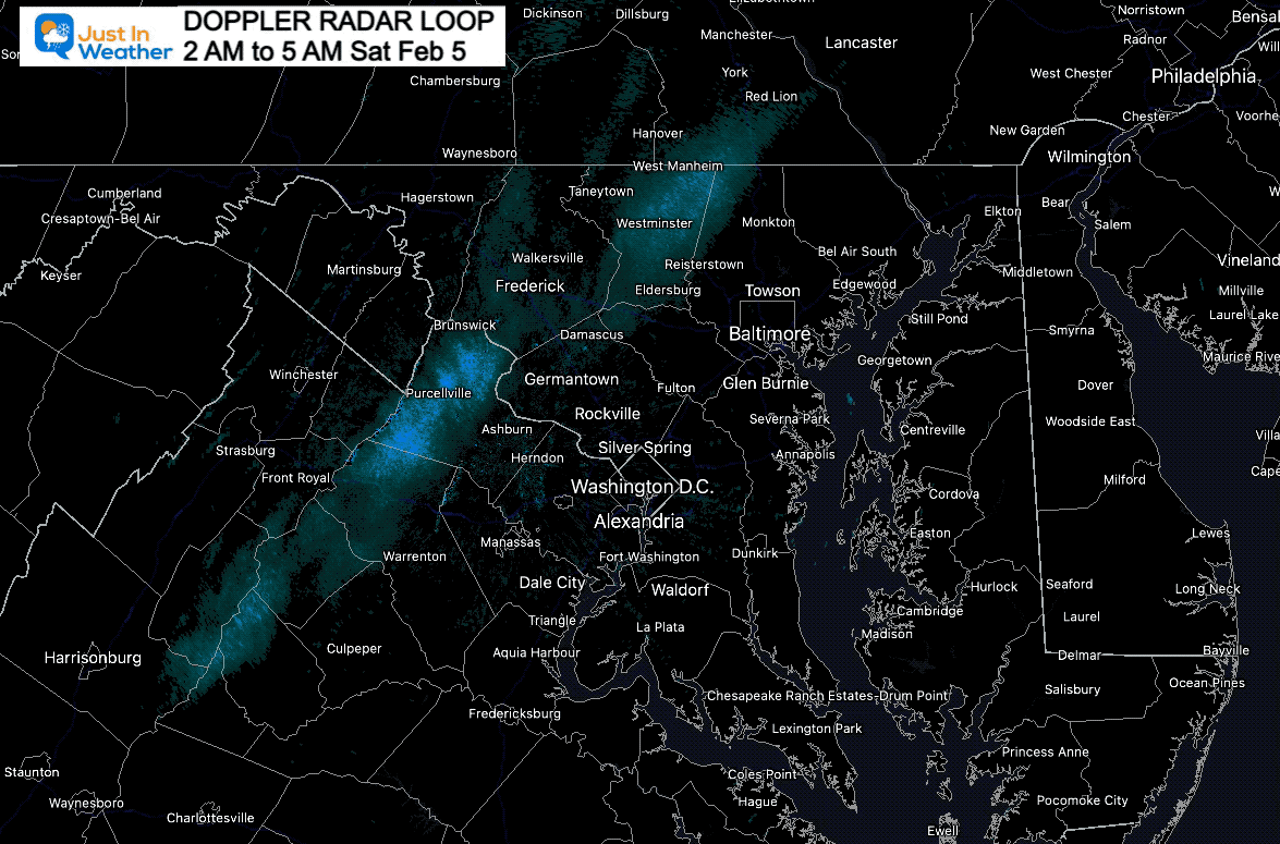
3 AM to 5 AM
Here we can see a line of enhancing snow as it crossed central Maryland. This was the leading trough, and may have dropped a dusting of snow on the ground.
5:45 M to 7:10 AM
The structure here is different, showing the banding of showers and possible squalls. These bands are more spread out, but also can drop a coating of snow on the ground and pavement. Temperatures are cold enough to support it now.
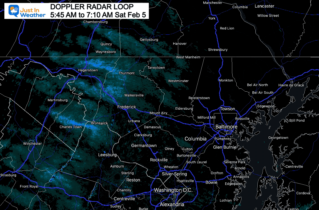
Snow showers have expanded into Central Maryland at sunrise. This may drop a coating of snow on the ground around the Baltimore Beltway, Howard County, and may reach BWI to Annapolis.

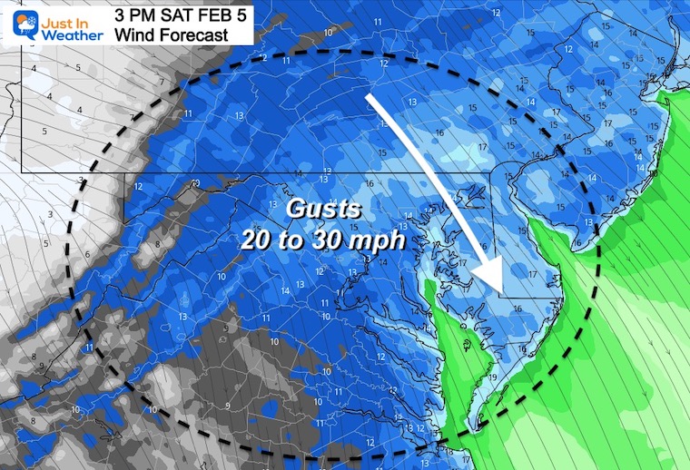
Off the East Coast goes the old front and storm that crossed the nation. We are now in a cold pattern, marked by the snow showers this morning. Winds will remain gusty, and we can’t rule out more flurries or a snow shower.

The freeze has reached the beaches.
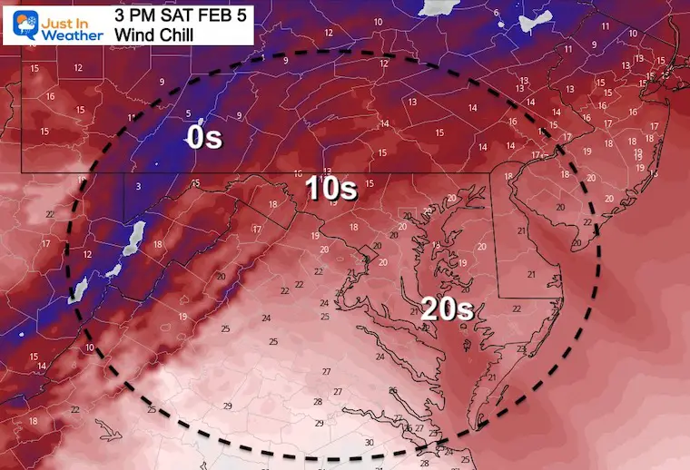
This is what it will ‘feel like’
Seasonal Snow: 13.3”;
+4.7″ ABOVE AVERAGE
Normal Low in Baltimore: 25ºF
Record -1ºF in 1996
Normal High in Baltimore: 43ºF
Record 73ºF 1991
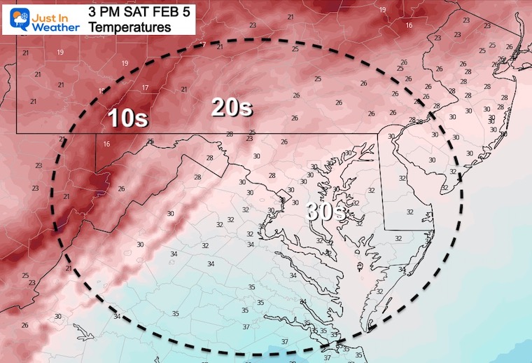
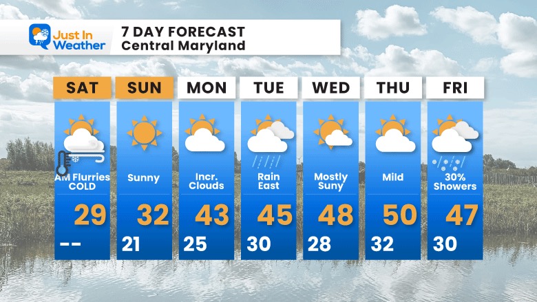
The weekend will end cold, but quiet.
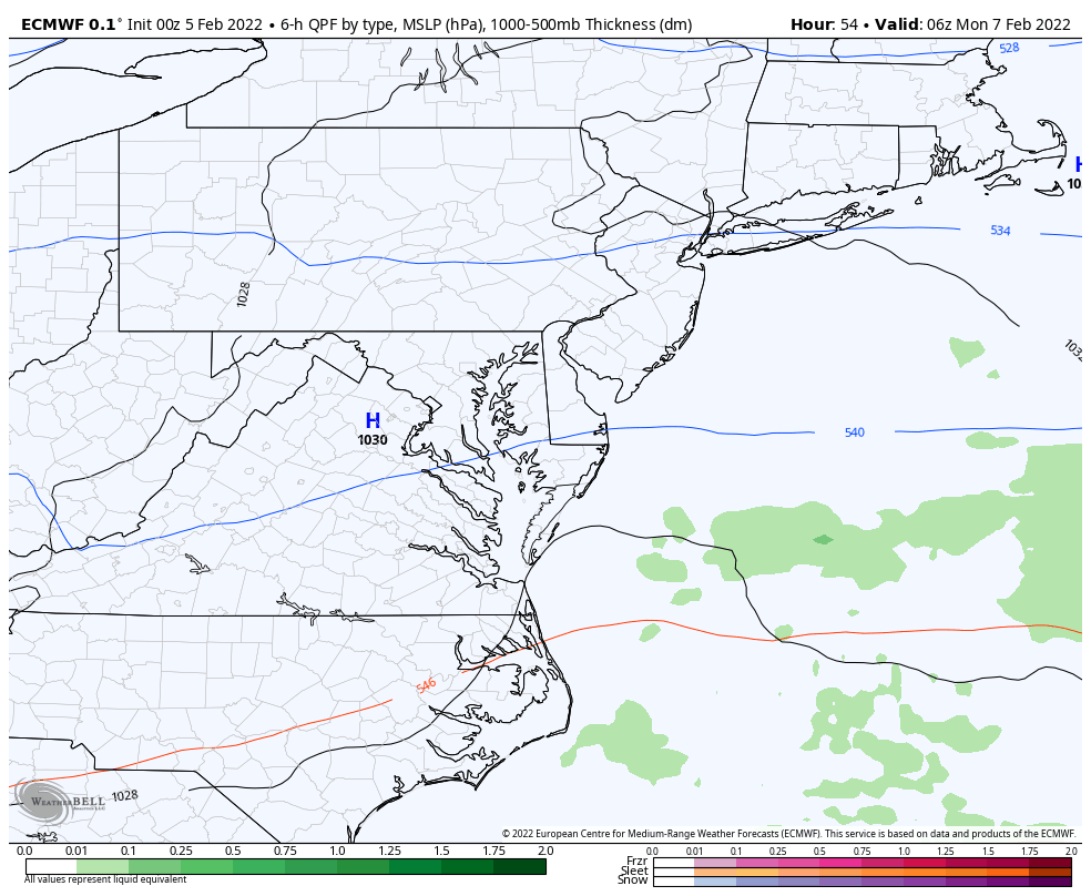
There is still a chance for some light showers nearby, more likely on Delmarva. The better chance of showers or steady light rain will be Monday night into Tuesday Morning.
Winter has more in store…
Mid Month we will see another push of arctic air in the jet stream, We may begin to see this develop at the end of net week, through Valentine’s Day.
No promise for Valentine’s Day specifically, but that is in the window for wintry weather to make a visit.
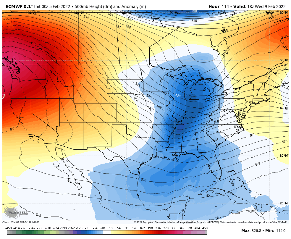
A ‘stretched’ Polar Vortex is the disruption we need to send arctic air our way
“My name is PV, stretched PV” (aka stratospheric #polarvortex). GFS forecasts coming around to predicting almost textbook looking stretched PV for second week of February with relatively #cold temperatures first in Central & East Asia & then east of the Rockies in Canada & the US pic.twitter.com/3HuOTsxdU8
— Judah Cohen (@judah47) February 3, 2022
7 Day Forecast
Next week will be slightly above seasonal norm. I will be watching Friday for any adjustment of cooler air arriving earlier and then the return of real winter cold into the following week.


Last Winter Recap: My Old Outlook And Your Grades Of My Storm Forecasts


*Disclaimer due to frequent questions:
I am aware there are some spelling and grammar typos. I have made a few public statements over the years, but if you are new here you may have missed it:
I have dyslexia, and found out at my second year at Cornell. I didn’t stop me from getting my meteorology degree, and being first to get the AMS CBM in the Baltimore/Washington region.
I do miss my mistakes in my own proofreading. The autocorrect spell check on my computer sometimes does an injustice to make it worse.
All of the maps and information are accurate. The ‘wordy’ stuff can get sticky.
There is no editor that can check my work when I need it and have it ready to send out in a newsworthy timeline.
I accept this and perhaps proves what you read is really from me…
It’s part of my charm.
#FITF