


May 5 Soggy And Chilly Start With More Rain During The Week Ahead
Sunday May 5 Morning Report We are stuck in this muck! The wet weather pattern continues with a soggy start this Sunday morning. The rain will try to break up…
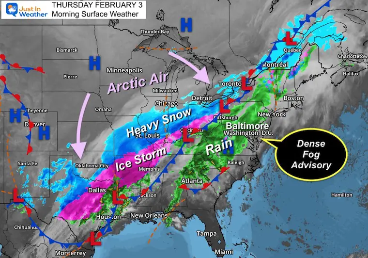
Thursday February 3 – Morning Report
To say the winter storm is big is an understatement. Snow or ice spans from the Mexican border on New Mexico and Texas to the Canadian border with Maine. A large region has impacted road and airline travel, with flight delays or cancellations impacted cities not in ‘it’.
Morning Set Up
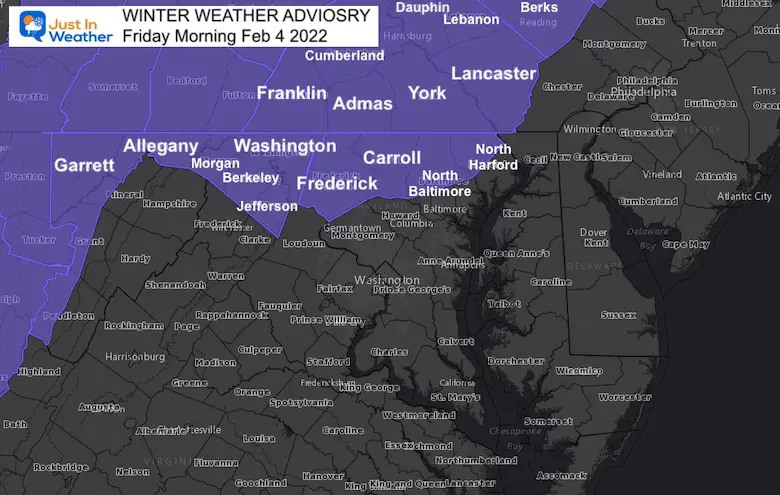
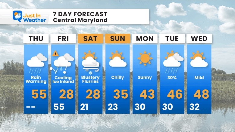
This morning we have a Dense Fog Advisory on Delmarva, with rain spreading in. The large winter storm will slowly move east as arctic air arrives for us early Friday on the back side.
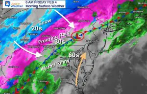
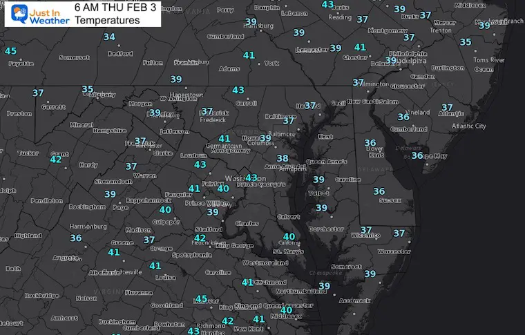
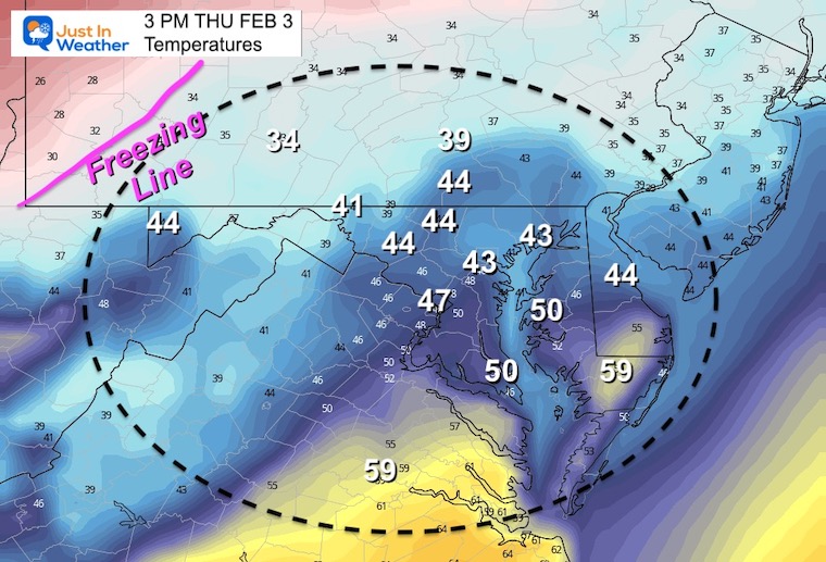
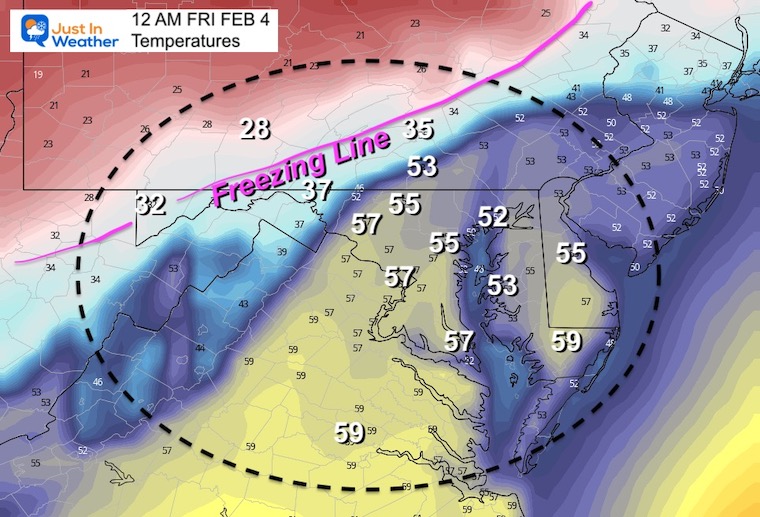
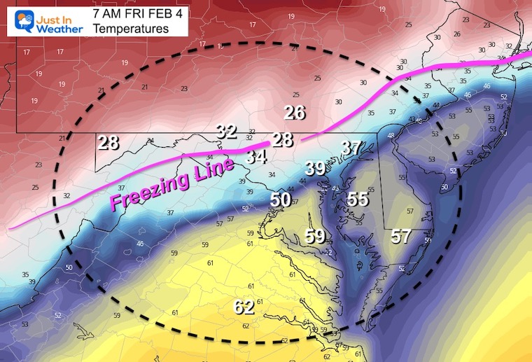
Temps will be warming all today, reaching the high at midnight. That same high temp is likely early Friday, then falling all day.
Freezing temps will arrive early enough for inland areas to turn icy. More details with our Winter Weather Advisory below.
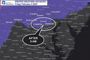
4 PM Thursday to 7 AM Sunday
Details for our region below.
Over 2000 miles spans the patch of Winter Storm Warnings from our southern to northern US borders.
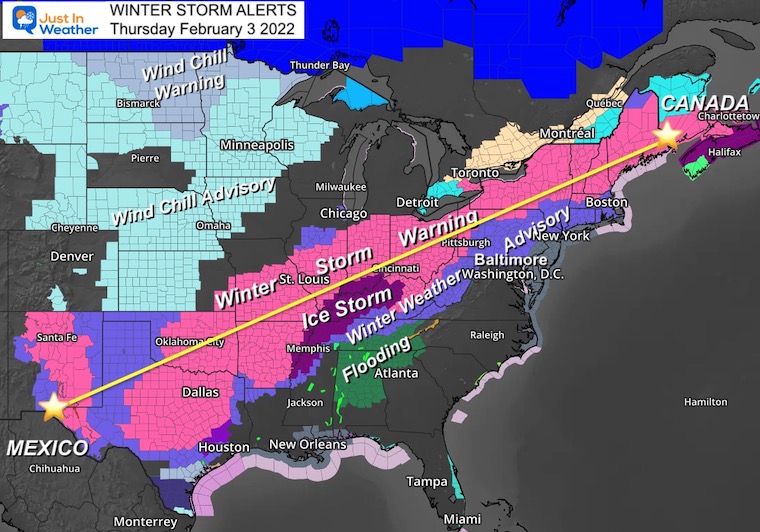
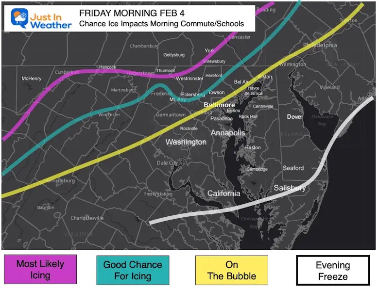
If you saw my report last night, this matches up with the regions I identified as Likely and Good Chance for icing to impact work and school travel.
More on our local impact below.
We are already on the warmer side of this storm system…
4:05 AM to 6:10 AM
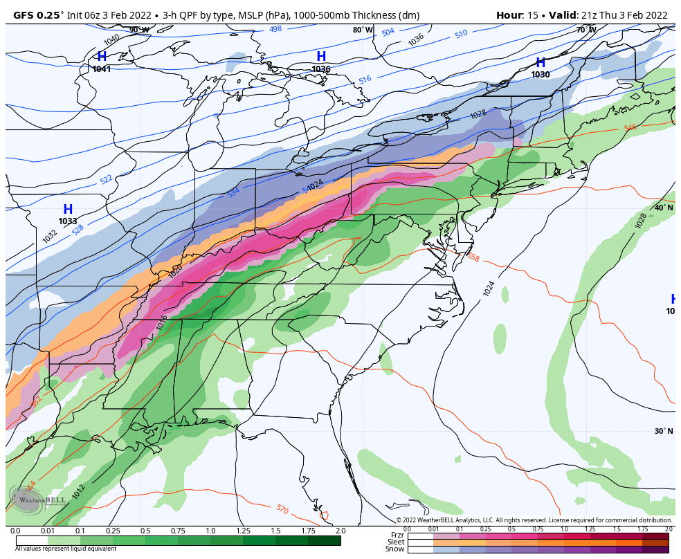
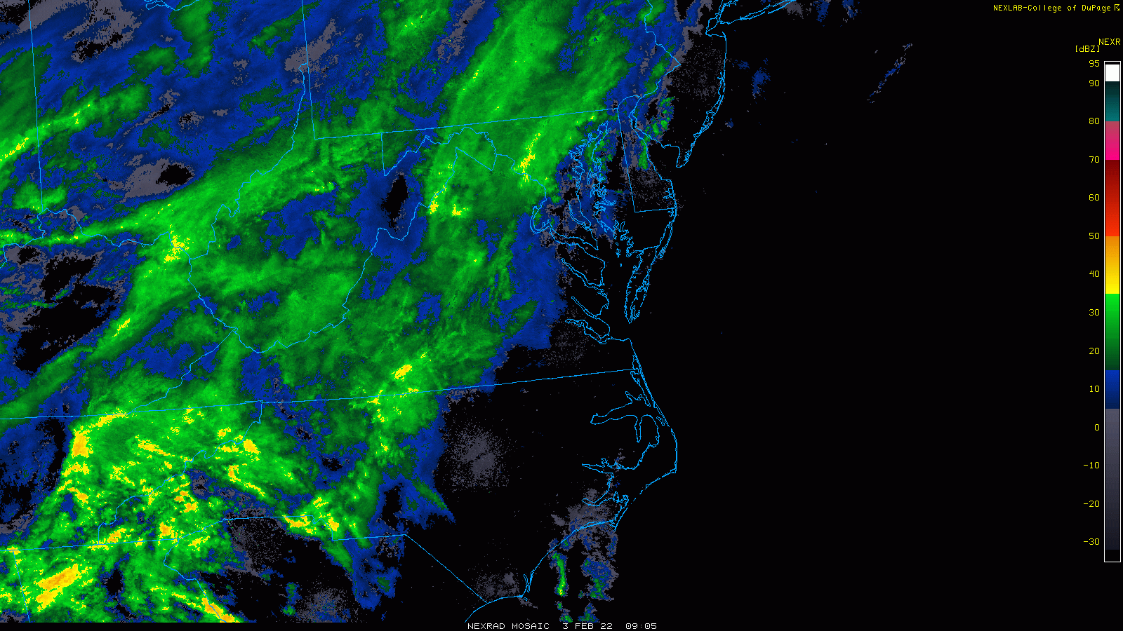
Bands of rain have spread in and will continue all day. There may be some breaks at times, but rain will be steadier and heavier later in the day.
I want to focus on this, since it has raised many question.
It is possible your weather app or local TV source is showing a high number for Friday’s high temperature. That will be CLOSE TO MIDNIGHT… Then falling all day.
3 PM Thursday to 11 PM Friday
This helps show the rise tonight and then quick fall Friday.
Places that stay wet during the day, may ice up late afternoon and evening.
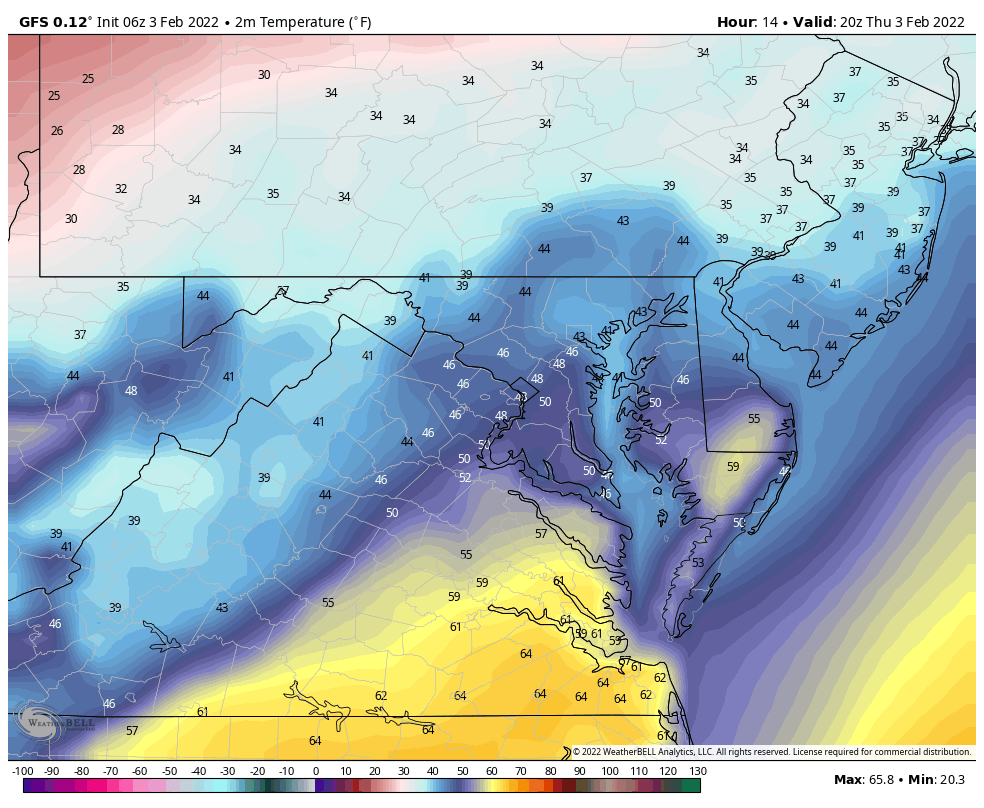
With rain, temps will be climbing through the 40s.
Local View
This is NOT A Promise, but where I believe the ice will establish on the roads to lead to travel concerns.
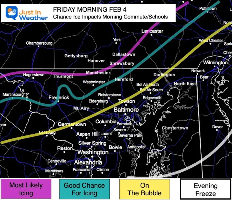
Most Likely Icing On Roads:
Good Chance For Icing:
On The Bubble:
Less Likely:
TODAY February 3
Seasonal Snow: 13.3”;
+4.7″ ABOVE AVERAGE
Normal Low in Baltimore: 25ºF
Record 4ºF in 1961
Normal High in Baltimore: 43ºF
Record 67ºF 2020


Last Winter Recap: My Old Outlook And Your Grades Of My Storm Forecasts


*Disclaimer due to frequent questions:
I am aware there are some spelling and grammar typos. I have made a few public statements over the years, but if you are new here you may have missed it:
I have dyslexia, and found out at my second year at Cornell. I didn’t stop me from getting my meteorology degree, and being first to get the AMS CBM in the Baltimore/Washington region.
I do miss my mistakes in my own proofreading. The autocorrect spell check on my computer sometimes does an injustice to make it worse.
All of the maps and information are accurate. The ‘wordy’ stuff can get sticky.
There is no editor that can check my work when I need it and have it ready to send out in a newsworthy timeline.
I accept this and perhaps proves what you read is really from me…
It’s part of my charm.
#FITF