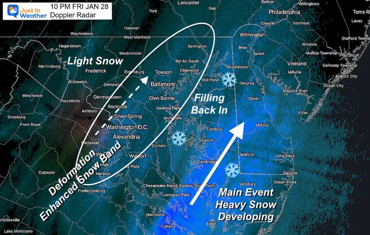
Here we are after a long week of trying to pin this storm down. Light snow has spread across much of the region today, but not sticking yet. That will change as it gets dark, and colder. The is ahead of the clipper part. The main event will develop off of the South Carolina Coast, as the upper level energy races in that direction. We will take a look.
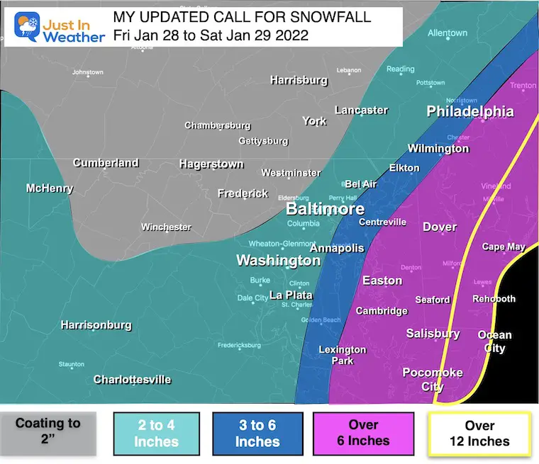
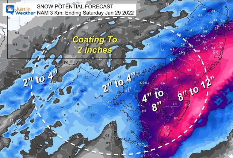
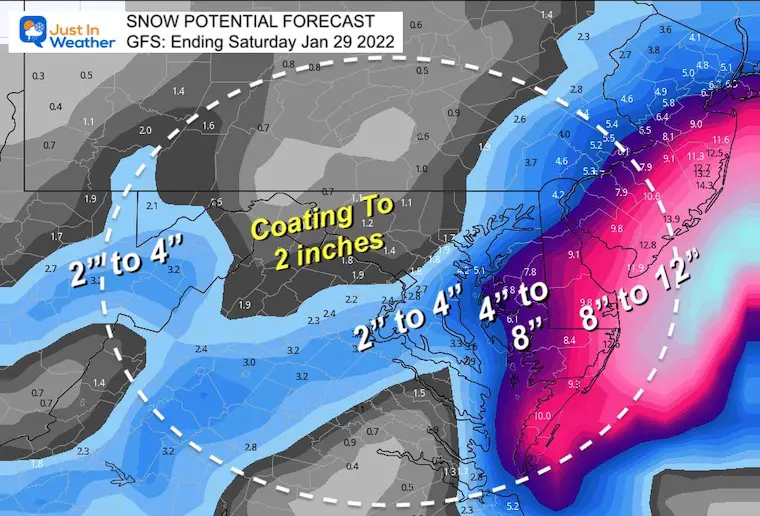
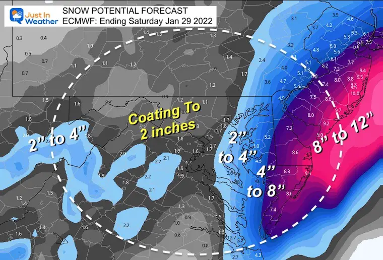
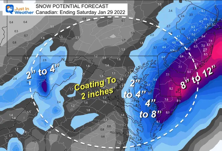
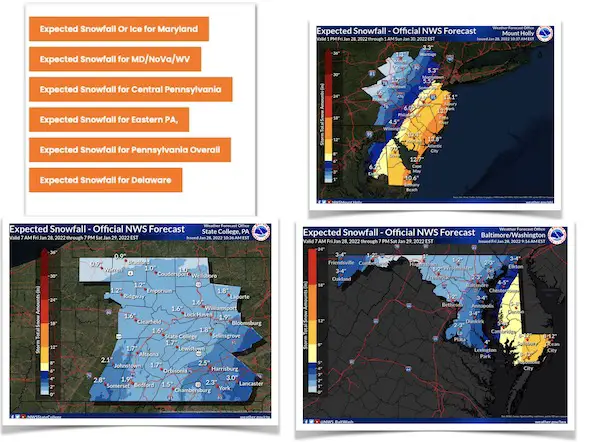
I also have new model snow maps to compare to my Updated Call For Snowfall and all the regional NWS Office snow forecasts.
Before we dive in, I wanted to highlight a few points based on messages I’ve gotten today:
Headlines
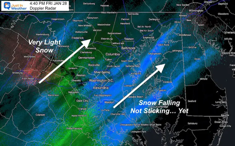
Snow has been falling and expanding across the region all day.
Stickage And Icy Roads: Since the ground is wet form snow and temps above freezing, when it gets dark and colder, roads will become slick tonight.
Temps have been to warm for stickage, but that will change this evening as it gets colder.
This will be a major storm. Even if you do not get in on the big snow, the storm itself is not a ‘bust’
Bomb Cyclone is a real meteorological term. It means the pressure drops at least 24 mb in 24 hours. I am sorry it may seem like ‘Catch Phrase’ that has been overused on TV. I did not use it much here for that reason.
Storm Name: I do not know or follow that. Naming winter storms is a Weather Channel marketing plan that is not endorsed by The National Weather Service or The American Meteorological Society. I do not work for TWC, so I don’t use it here. (learn more about marketing and branding)
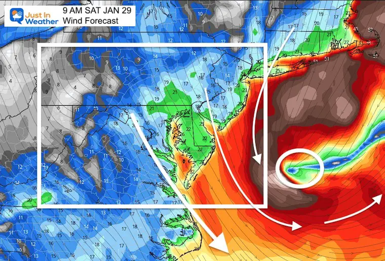
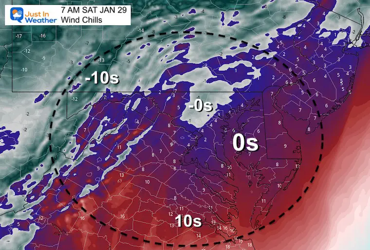
Planes: I do not know how airlines will respond. However, there will be very strong winds even outside of the snow zone. Plus major impact across Philadelphia, New York, and Boston. The cascading effect may lead to delays in other airports.
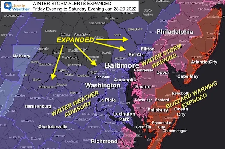
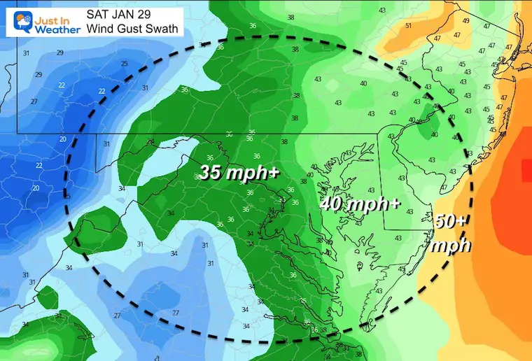
Blizzard: There is a legitimate warning for this rare event on Maryland’s Lower Eastern Shore, Sussex Co Delaware and up the coast to New England. The combination of high winds (over 35 mph) and heavy snow (over 1”/Hr) is the qualifier.
This same area may get over 12 inches of total snow, with drifts up to 2 to 3 Feet high.
Drifting will make it tough to measure snow. More accurate methods include finding at least 3 spots on your property to measure, then take the average. An easy math activity with the kids.
The storm will be moving away from metro areas in the morning.
The storm will be moving away from the beaches in the afternoon.
It’s been active with snow all day, but temps have not supported stickage yet.
Bands are moving to the northeast, and will be expanding this evening.
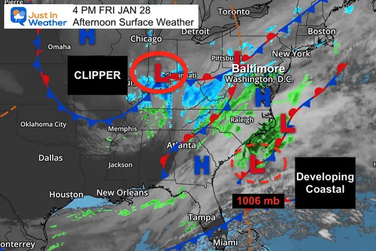
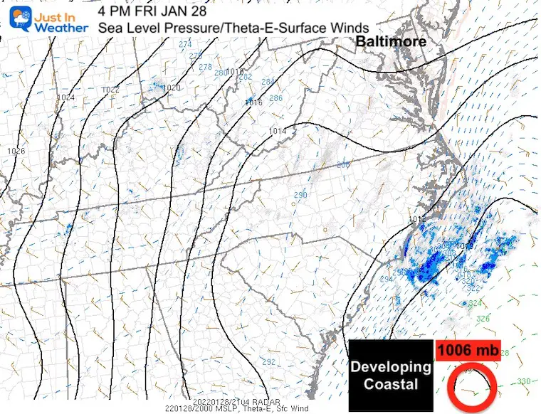
Afternoon Surface Weather
The Clipper is still near Cincinnati. This is one piece that will be enhancing the snow along our front…
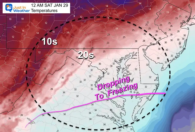
The freezing temps are located in Pennsylvania behind that front and will spread through the region this evening.
The Coastal Storm is just starting to form. Pressure measured at 1006 mb.
Mesoscale Analysis
The Main Low is located Southeast of South Carolina.
Note: Surface Pressure is 1006mb. It is forecast to be 975 mb east of Ocean City (a few hundred miles away) at 1 PM tomorrow afternoon. That’s a drop of 31 mb in less than 24 hours.
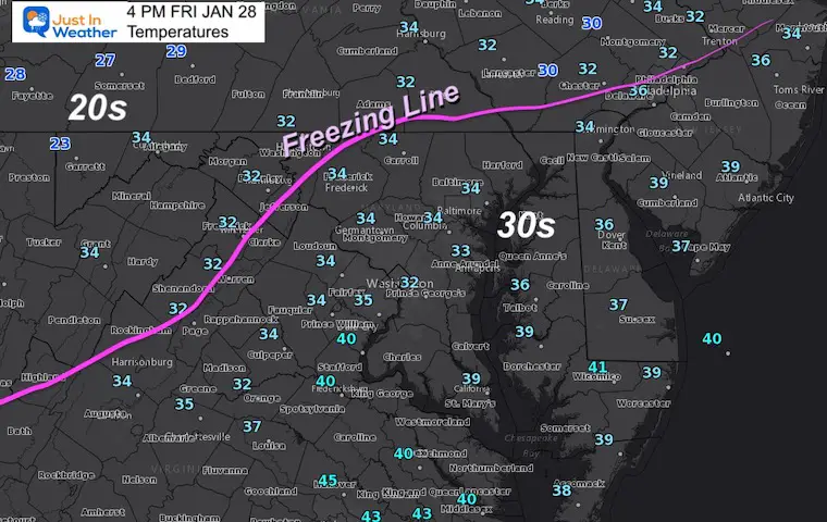
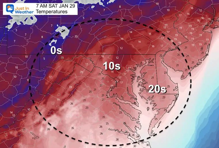
Temperatures At 4 PM
Temps have been just above freezing, which is why the snow that has fallen has not been sticking. That will change this evening.
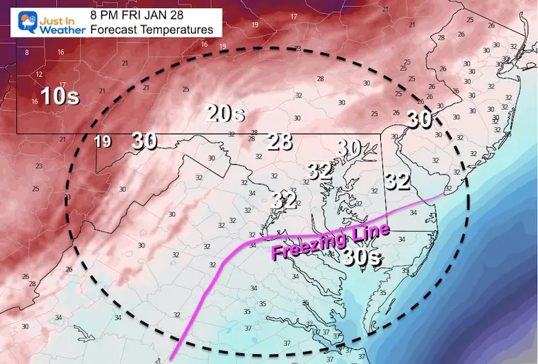
Forecast Temperatures at 8 PM
Snow should be sticking this evening as temps continue to drop… The freezing line will eventual reach southern Maryland and the Blizzard Zone before midnight.
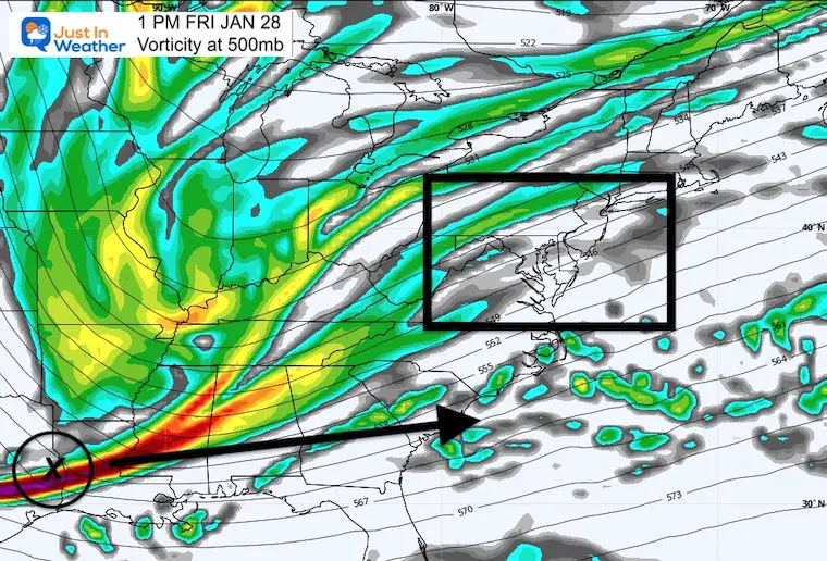
Upper Level Energy
Vorticity at 500mb
I showed this jet stream plot yesterday. This afternoon it was located in Texas and racing to the US coast.
Vorticity Animation
1 PM Friday to 7 PM Saturday
Even if you this looks like The Matrix, the enhanced circulation may jump out with this developing storm!
I am aware there are some spelling and grammar typos. I have made a few public statements over the years, but if you are new here you may have missed it:
I have dyslexia, and found out at my second year at Cornell. I didn’t stop me from getting my meteorology degree, and being first to get the AMS CBM in the Baltimore/Washington region.
I do miss my mistakes in my own proofreading. The autocorrect spell check on my computer sometimes does an injustice to make it worse.
All of the maps and information are accurate. The ‘wordy’ stuff can get sticky.
There is no editor that can check my work when I need it and have it ready to send out in a newsworthy timeline.
I accept this and perhaps proves what you read is really from me…