Tuesday January 26 – Morning Report
After reaching the 40s yesterday, the arctic air is back with us today. Temperatures will struggle to get back to near freezing in the cities, with 20s inland. There will be a slight wind chill as well.
The weather will be quite for two days, but the cold is setting the stage for the snow to arrive Friday and the coastal storm on Saturday.
Headlines:
- Today: Arctic Cold is Back
- Friday: Light Snow Develops After-noon
- Friday Night-Saturday: Coastal Storm!
- Close call for total snow along the local I-95 cities
- More Snow East (Delmarva and Beaches)
- We All Get Blustery Winds
- Blizzard In Boston?
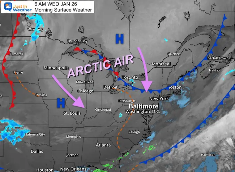
Morning Surface Weather
The next two days are all about the arctic cold. The core will remain north of our region, but most areas will remain near or below freezing during the afternoons.
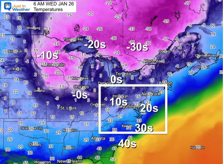
Morning Temperatures
The core of the cold has temps in the -10s to -20s across the western Great Lakes and even -30s across parts of Ontario and Quebec in Eastern Canada.
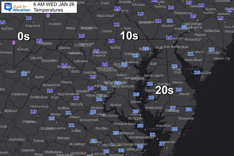
Local Temperatures
Thermometers have dropped into the teens and 20s. There will be a lot of focus on Delmarva (Delaware-Maryland-Virginia Peninsula), where cold air will establish support on the ground for stickage with the upcoming storm.
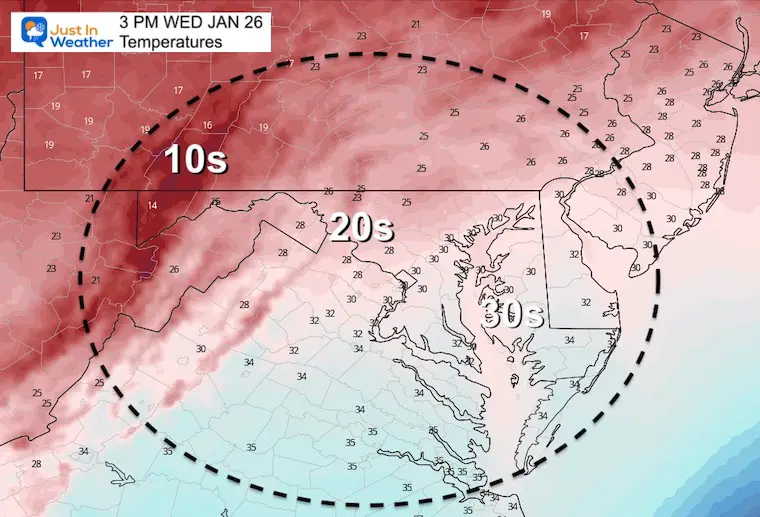
Afternoon Temperatures
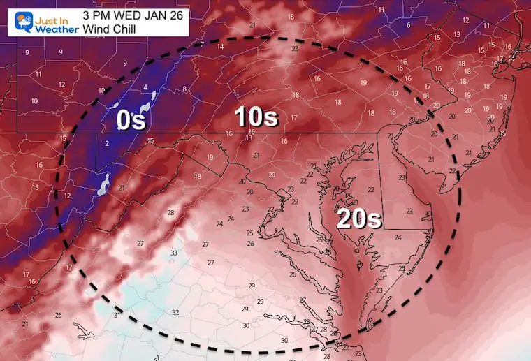
Afternoon Wind Chill
It will feel about 10 degrees colder than the thermometer shows.
Weather Almanac: Climate Data
TODAY January 26
Normal Low in Baltimore: 24ºF
Record 2ºF in 1961
Normal High in Baltimore: 42ºF
Record 79ºF 1950
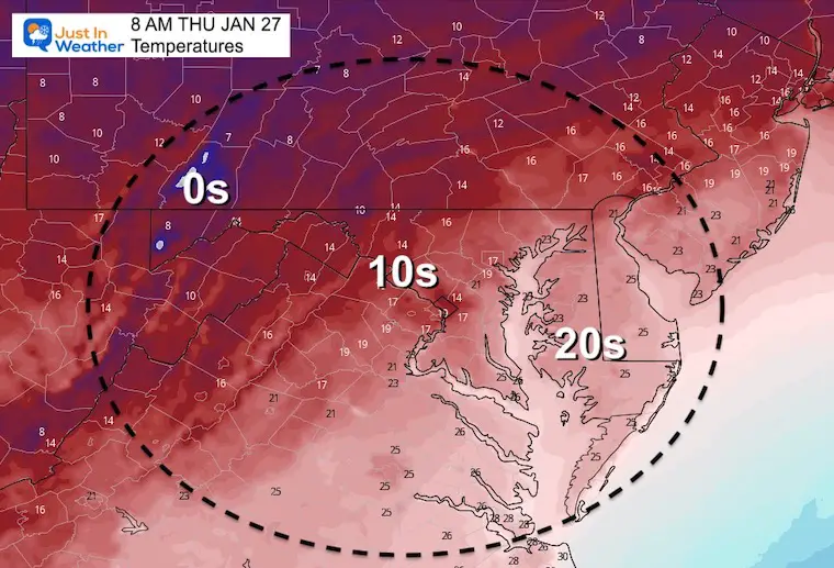
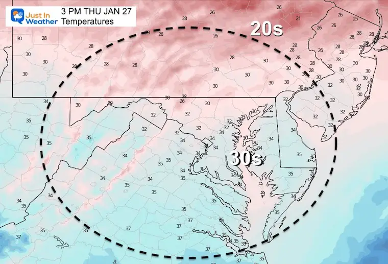
Thursday Temperatures
Morning
Afternoon
Looking Ahead:
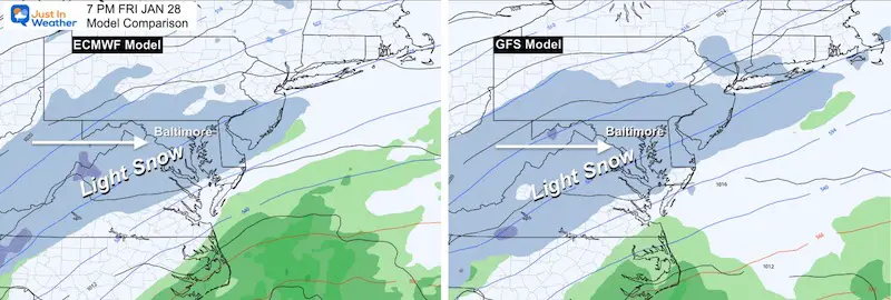
We continue to compare the European ECWMF (Euro) and American GFS Models. There are many more models, but these are the two big ones!
The Euro still has the edge of heavy snow close to I-95, while the GFS is farther east.
MAPS
Friday Evening
Agreement: Light snow spreads in during the afternoon. It is likes the region gets over 1 inch of snow with this part.
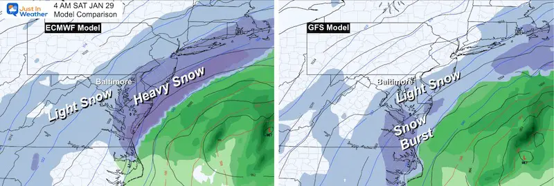
Saturday Morning
Coastal Storm Takes Form
Euro keeps back edge of heavy snow ‘near’ I-95/Bay. More snow on Delmarva and Beaches.
GFS is just farther enough east to end the snow for the cities and keep light snow on Delmarva.
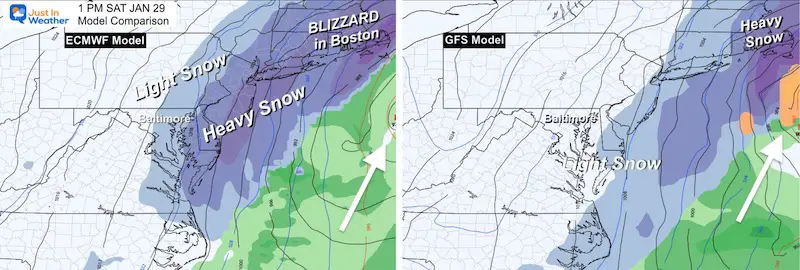
Saturday Afternoon
Euro has back edge of snow near I-95 cities and a Blizzard for Boston! Steady and heavy snow lingers on Delmarva
The GFS is just east, ending the snow for most of us, with lingering showers or flurries on Delmarva.
My Take:
Confident:
- Light Snow (for us) Friday Afternoon
- Most get over 1 inch though evening.
- Big Snowstorm/Blizzard Saturday for New England.
I Still Question:
- The TRACK along coast.
- Saturday Morning: Back Edge Of Steady snow between I-95 and coast. This is the make or break for totals.
- Snow Totals: Still too early! I DO NOT trust any model product this early. Often they overdo snow amounts beyond 60 hours (2.5 days)
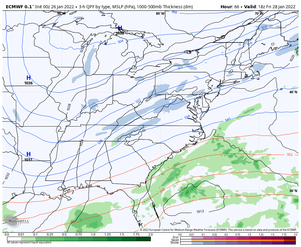
Model Animation:
Just for fun, here is how the Euro develops the storm. This is the model that is most robust with snow.
My first call for snowfall map will be issued on Thursday
Faith in the Flakes…
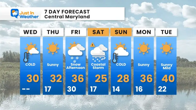
7 Day Forecast
Regardless of the full impact of the storm, blustery winds will reach all of us with more cold air Saturday. This will reinforce the arctic air Sunday.
Next week we expect a mild trend beyond Tuesday…
*Disclaimer due to frequent questions:
I am aware there are some spelling and grammar typos. I have made a few public statements over the years, but if you are new here you may have missed it:
I have dyslexia, and found out at my second year at Cornell. I didn’t stop me from getting my meteorology degree, and being first to get the AMS CBM in the Baltimore/Washington region.
I do miss my mistakes in my own proofreading. The autocorrect spell check on my computer sometimes does an injustice to make it worse.
All of the maps and information are accurate. The ‘wordy’ stuff can get sticky.
There is no editor that can check my work when I need it and have it ready to send out in a newsworthy timeline.
I accept this and perhaps proves what you read is really from me…
It’s part of my charm.
#FITF
ALSO SEE
ALL FITF GEAR

FITF THUNDERSNOW


Winter Outlook Series:
My Call For Snowfall

Last Winter Recap: My Old Outlook And Your Grades Of My Storm Forecasts


Please share your thoughts, best weather pics/video, or just keep in touch via social media


