Tuesday January 25 2022
Evening Update
If you want more snow, then the European ECMWF Model is leading the charge. Yes, it will snow, but how much? That all comes down to tracking a storm that has not yet formed. For now we can plan on some snow later on Friday. Then, if we get in on the main event, more snow will fall on Saturday.
We are still in the mode of tracking computer model guidance trends. Over the last two days, I have only ben looking for consistency. What I have seen in is encouraging for both the weekend storm and confidence in the computer support.
If you have been reading my reports, I have often highlighted the errors in modeling. But when justified, I will easily sing their praises. I hope we are on a trend for that.
The physics of the atmosphere supports a strong coastal storm Friday night into Saturday. The consistency over the past few days is encouraging for locking in on a track. But we are not fully there yet.
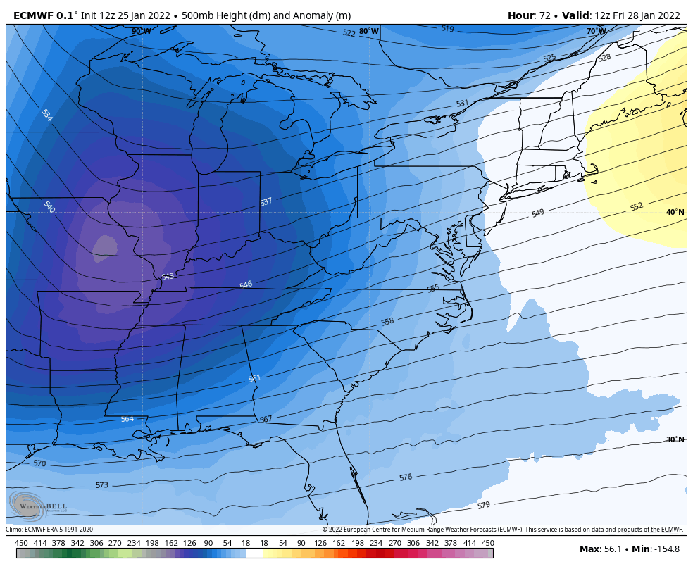
Jet Stream Saturday Morning
500mb level is around 18,000 Ft above the ground.
This Euro plot shows the essential ingredient for a Nor’easter to hug the coast: A Negatively Tilted Trough. The orientation of the Upper Level Low on the coast with a deformation to the northwest is the signal for storm to hug the coast and move more north, rather than head out to sea.

Jet Stream Animation:
7 AM Fri to 7 AM Sun
This helps show the progression of that deepening high amplitude trough, plus the movement around it.
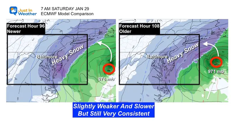
European Model Comparison
This Global Model has a new complete update every 12 hours. Here’s a look at the run from earlier today (Newer) compared to last night (Older). See the animation below.
What to like here:
- The heavy snow is plotted back to near I-95.
- While the Low varied a little with intensity and location, the snow plot is nearly identical! That is vitally important to increase confidence in snow amounts.
UPDATE
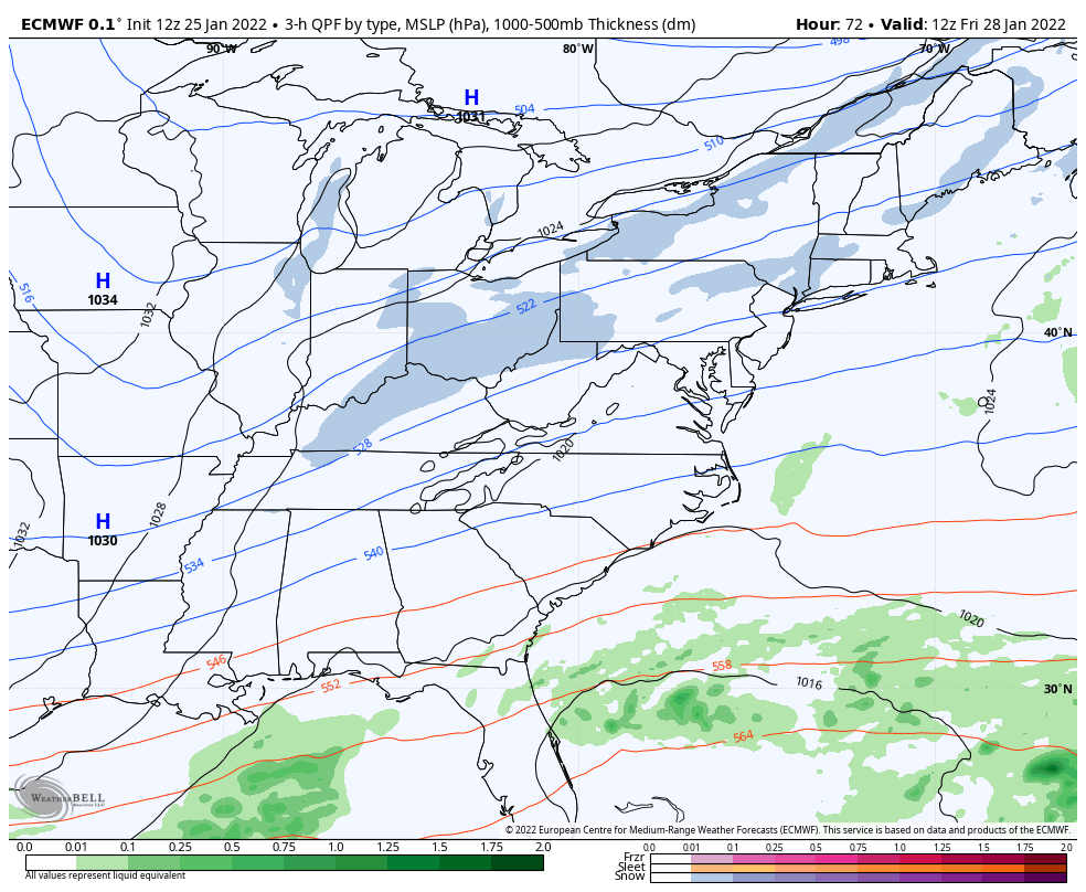
Storm Animation:
7 AM Friday to 7 PM Saturday
This model plot shows…
- Light snow arrives Friday afternoon. This will be approaching the coast, then will help fuel the Main Coastal Low forming well East of the South Carolina Coast.
- That Low rapidly develops and moves North towards New England.
- Our Mid Atlantic region remains in the cold zone, and gets in on the moderate snow overnight.
- This shows impact snow lasting for The Mid Atlantic through the day Saturday.
- IT IS STILL TOO EARLY TO TALK TOTALS
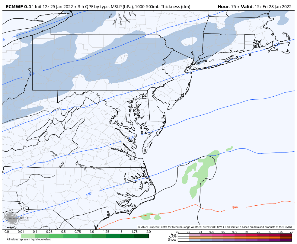
Closer Look
7 AM Friday to 7 PM Saturday
- I’ve slowed down the animation to highlight that the steady snow (dark blue) does reach metro Baltimore and I-95.
- This shows the heaviest snow between 4 AM to 4 PM Saturday.
- Retrograde: The strong Low is projected to pull back to the west across southern shores of Rhode Island. Should that happen, it would allow the wrap around snow to linger longer for us.
This is NOT PRECISE. As good as this may look to the snow-hound, there still will be some variation as the storm gets closer to actually forming.
This should be treated as a guide and possibly encourage discussing alternate plans. But specific will be elaborated more as we get closer.
GFS Model Comparison From Earlier
In my prior report, the main take away is that the GFS Model has pulled back a little westward. That trend increases the snow likelihood, but not as robust as the Euro.
The GFS has outperformed in two important events this month. So its credibility has been boosted. But this model upgrade is still on probation and needs to keep proving itself. So the test is on. For now, the Euro is leading the way, and this model is trying to fall in line and catch up.

Here’s how I view this:
Confident:
- Storm will form (Friday)
- Light Snow (for us) Friday Night
- Big Snowstorm for New England Saturday.
Still Question:
- How close to the coast?
- Saturday Morning: If storm is closer, then how much more snow may fall?
ALSO SEE
ALL FITF GEAR

FITF THUNDERSNOW


Winter Outlook Series:
My Call For Snowfall

Last Winter Recap: My Old Outlook And Your Grades Of My Storm Forecasts


Please share your thoughts, best weather pics/video, or just keep in touch via social media


