


May 17 Clouding Up Ahead Of A Soggy Preakness Saturday Then We Warm Up
Friday May 17 Morning Report Today may end up mild, but it will bring an increase in clouds ahead of our next storm. If you are heading to the mountains,…
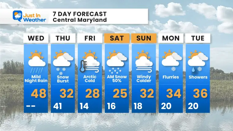
Wednesday January 19 2022
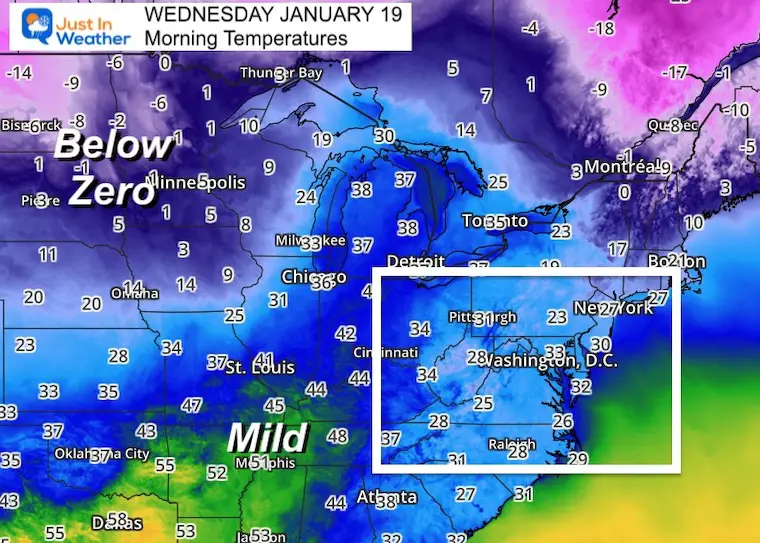
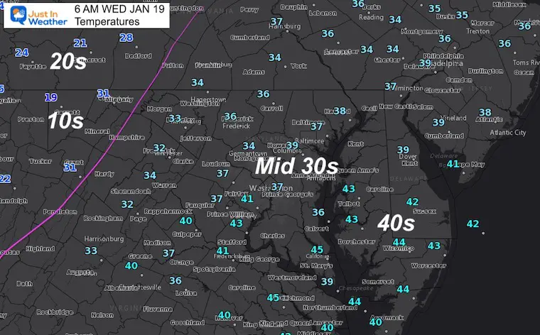
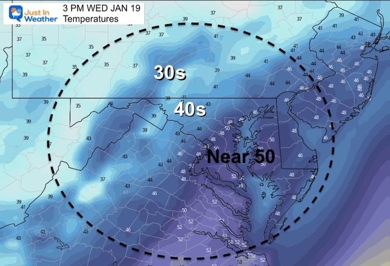
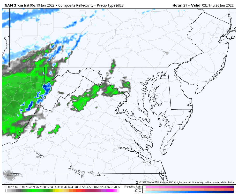
This morning starts seasonably cold, but the afternoon will be the warmest of the week. Make the most of it! A cold front will arrive tonight, along with developing Low Pressure that will time out just right. The result will turn rain to a burst of snow the should have an impact tomorrow morning.
I am trying something different in this report. Below is a timeline snapshot of key moments to compare the radar simulation and temperatures. It will snow before temps reach freezing, but the burst will allow slushy stickage and then a freeze.
Arctic air returns, then we watch that storm Friday night that will impact the coast, but still close enough if models do another kick back west.
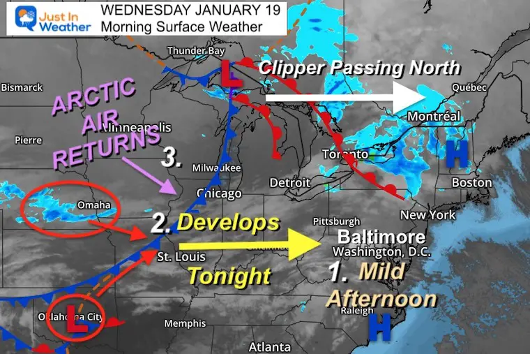
A large pool of below zero air in the northern plains is the source of what is heading our way. It will modify when we get it, but it will feed into the snow tomorrow and then our very cold Friday.
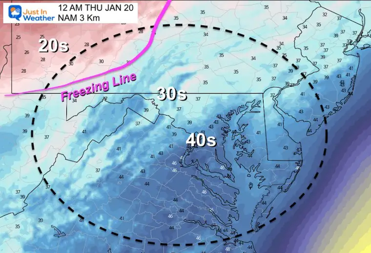
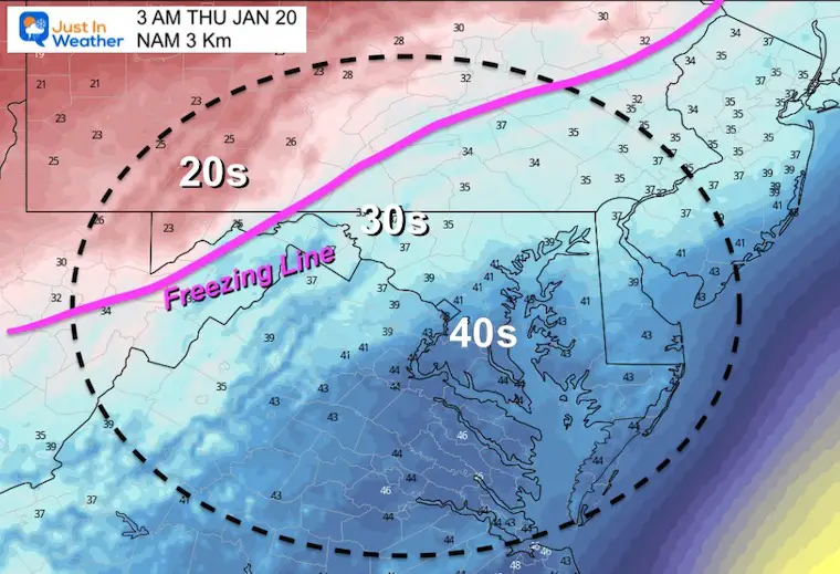
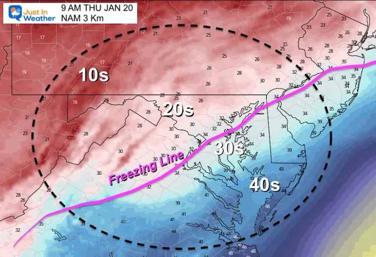
The freezing line has retreated west into the high mountains.
TODAY January 19
Normal Low in Baltimore: 24ºF
Record -5ºF in 1994
Normal High in Baltimore: 41ºF
Record 69ºF 1951
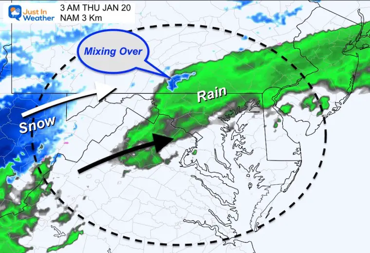
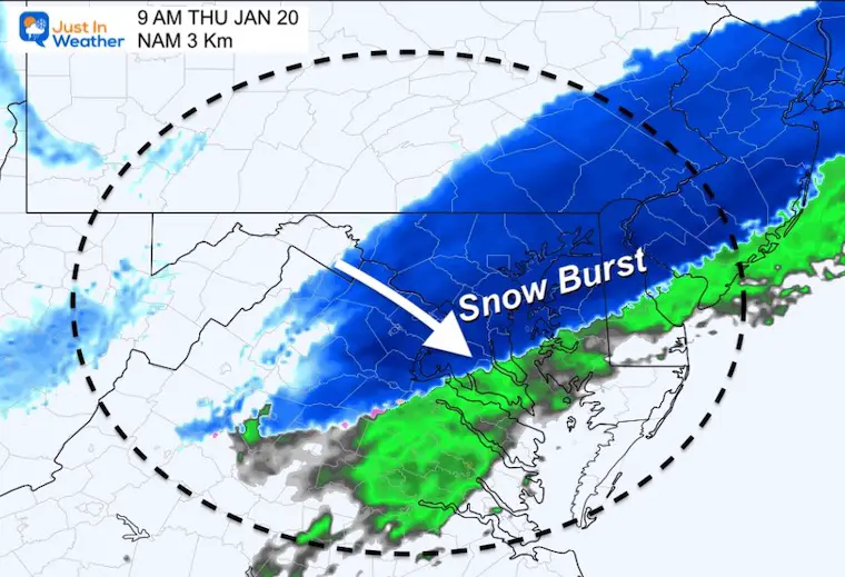
Closer look at this snow burst. Rain showers tonight, then turns to snow during Thursday morning. Snow will fall with slushy stickage on roads… THEN temps drop to freezing. This will be during the morning commute and could lead to an icy mess.
Please note the time stamps. Should this arrive an hour or two faster then even more impact on the metro commute is likely.
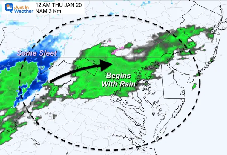
Snow will reach the northwest suburbs, but the surface freezing line will lag behind by an hour or two.
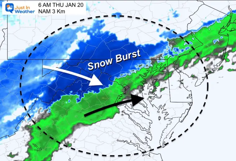
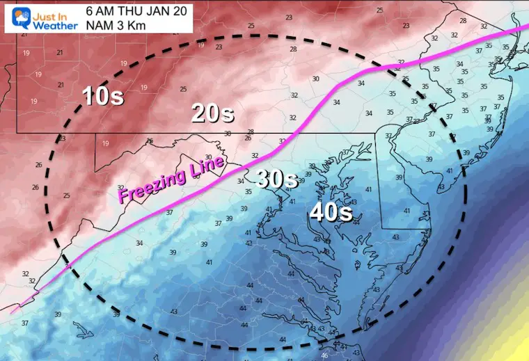
Snow will reach Metro Baltimore and Washington, but the surface freezing line will reach the northwest suburbs. This is when the slush may enhance the flash freeze.
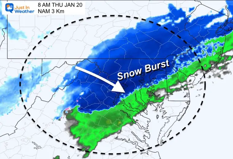
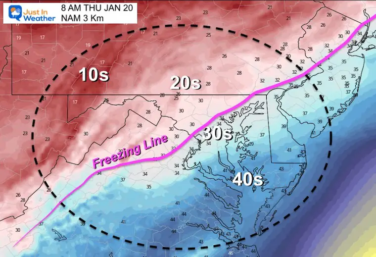
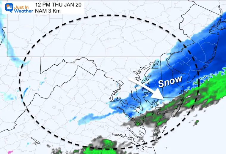
Snow will push through Annapolis and Southern Maryland/Northern Eastern Shore. Freezing temps reach Baltimore and Washington.
Snow through Delmarva and southern Maryland. The freezing line during the day may stall near Annapolis.
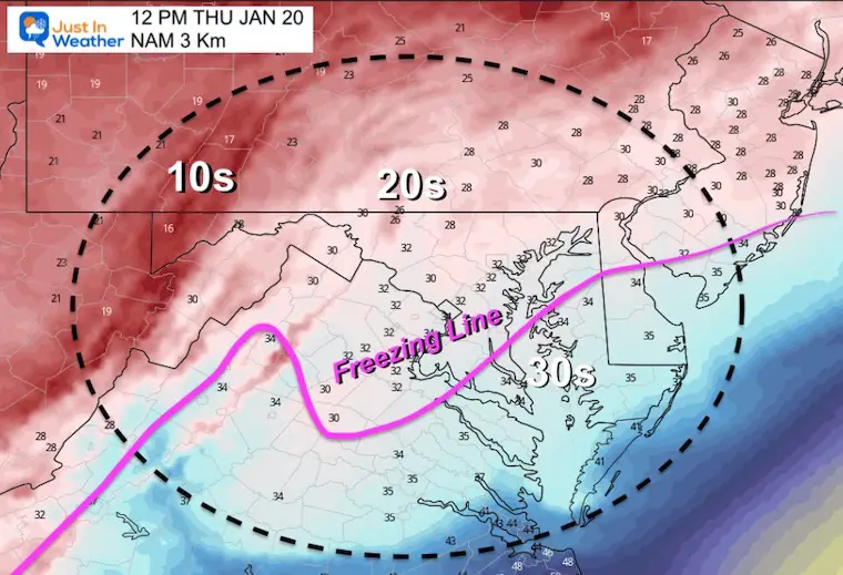
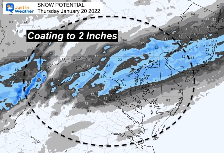
*There will be some melting during the transition. So not all that falls will stick.
I will make my map today, which will likely cover a broad coating to 2 inches of snow.
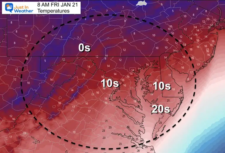
Arctic Air Back In Place
Note: Afternoon temps will struggle to reach the mid 20s for the cities.
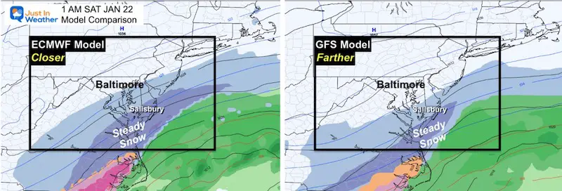
Coastal Storm Early Saturday Morning?
I have not put too much emphasis on this event for two reasons:
What had looked that a big snow event a few days ago, yesterday then pushed off the coast (for us).
In the overnight model package, it has come back west a little. Considering the last event kept shifting back west, I see a good possibility this may still do that at well.
This is still an event for Maryland’s Lower Eastern Shore and south…
For now we see the Euro with more impact, and I will pay attention to any shift. In this case, a pill back west of 100 miles would bring the impact snow back to the cities.


Last Winter Recap: My Old Outlook And Your Grades Of My Storm Forecasts


