The latest information this evening from the NAM 3 Km Model seems to support the trend noticed during the day. The storm appears to be tracking a little farther west, which would allow warmer air to pull in Sunday night.
This is not the best news for snow lovers looking for the opposite boost. But then again, this is not set in stone. IF you want this to shift east with colder air and more snow, then here is what to watch for. It includes how this turns the corner tomorrow and the upper level energy.
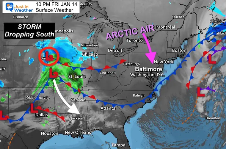
Friday Evening Set Up
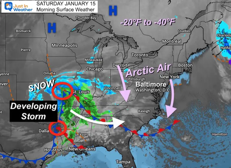
Low Pressure is dropping southward from Iowa.I know this plot shows a few ‘L’s on the map, but the core circulation is where the snow/rain line is wrapping around. However, this may symbolize the initial focus of where the primary Low will take form and grade along the southern states.
Arctic Air is moving in from Canada into New York and Pennsylvania heading our way.
By Saturday the temps locally will stay in the 20s during the day.
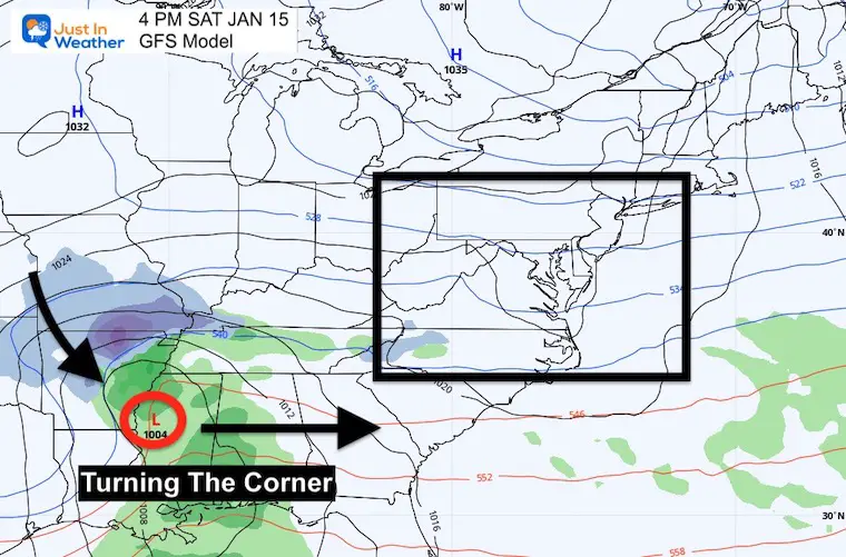
Saturday Afternoon
The Surface Low should be located in Northern Mississippi. This will be as it ‘turns the corner’ and swings to the east.Where this happens will help determine our eventual snow and rain line.
IF you want more snow, you want this to end up a little farther south than this location.
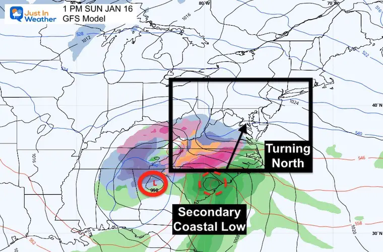
Sunday Afternoon
The primary Low should be near Atlanta, GA as a secondary Low will be forming along the South Carolina coast. This will be as the system will be moving north in our direction.
IF you want more snow, you will want this to verify farther east than shown here.
This will be the final opportunity to shift the track.
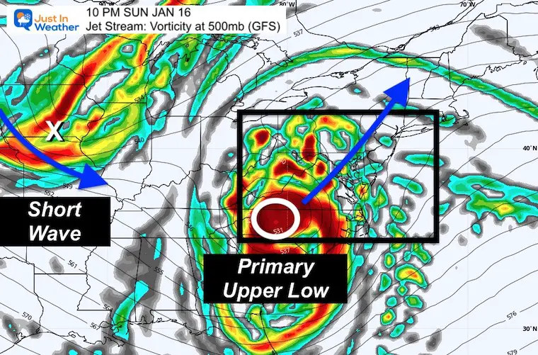
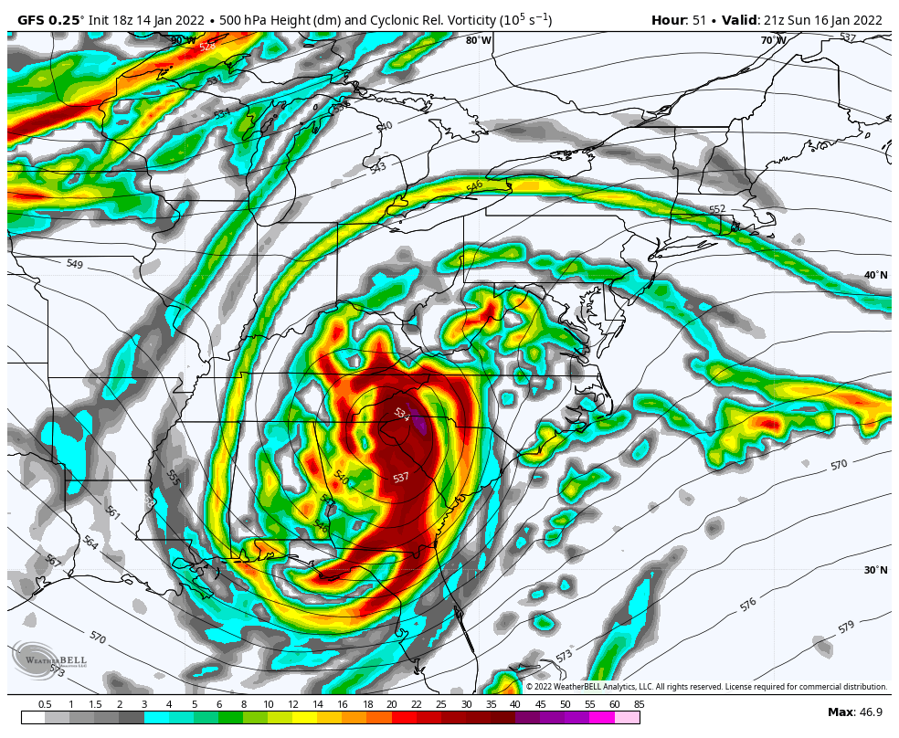
Jet Stream: Looking Aloft
The location of the Upper Level Low (white circle) is where the core of the cold air will be direct by.
At 10 PM, this location has been shown to be pulled WEST thanks to the influence of the Short Wave upstream. This is the next piece of energy that will swing in and kick the entire system out on Monday.
IF you want snow, that Short Wave needs to speed up and shift the entire system east.
Jet Stream Animation
4 PM Sunday to 7 AM Tuesday
Latest Timeline For Snow-Mix-Rain
Notes: As of now, this looks like snow will move in quickly between 2 PM and 6 PM
It will be heavy in a hurry.
Change to sleet, freezing rain, and rain during the evening.
Latest guidance has the ice into Hagerstown- which may lower totals there.
Rain pushes into southern PA by midnight.
Ice may accumulate 0.10 to 0.20 inches
Winds will gust to 45 mph
NAM 3 Km Sunday 2 PM to Midnight
*If you want snow as shown above, we need the system to shift 50 to 100 miles farther east.
Begins at 1 PM Sunday, but the arrival will expand snow from south to north all afternoon. Then transition to ice fro sleet and freezing rain during the evening.
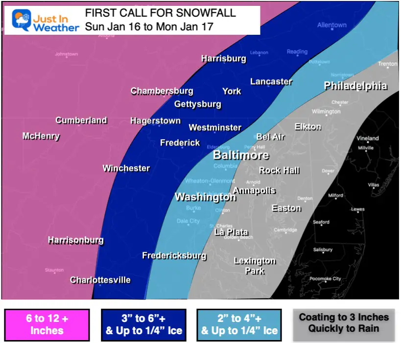
My Call For Snowfall
*This is subject to be changed. I may issue a new map on Saturday based on how the ‘turn’ behaves.
There will be a tight gradient of snow totals based on when the warm air comes in with the easterly winds.
The transition will be from the south and east…
Given the arctic air in place ahead of the storm, there may be extensive icing in the areas in blue, especially in dark blue. Up to 1/4″ of ice on top of the snow is possible. Ice can linger longer than model suggest, so the timing will be refined as we get closer.