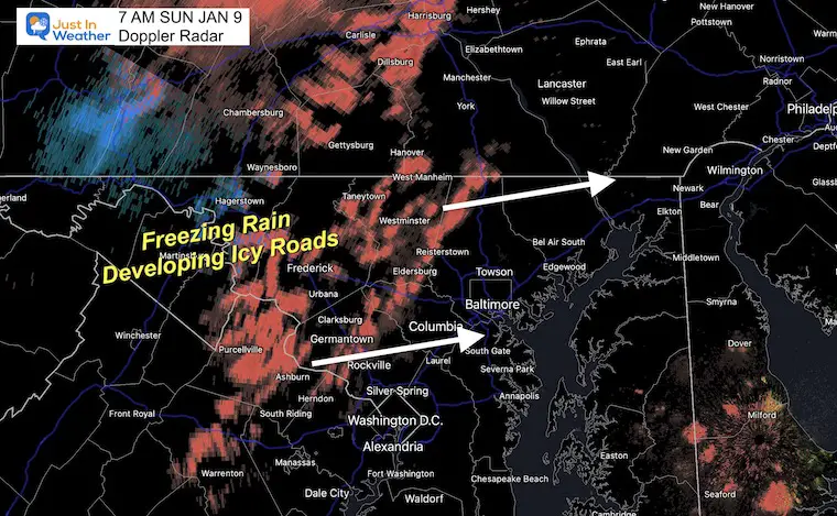
A band of freezing rain has developed in the western suburbs beyond the short range modeling. Basically there is more icing expected in metro areas this morning and the computer guidance underplayed it. This will be an issue until 11 AM to noon.
The timing and temps make this a potentially dangerous ice situation for a few hours.
Most roads have been treated, but you may still encounter some icy spot. It’s more like you have to contend with glaze of ice on your steps, walkway, or car.
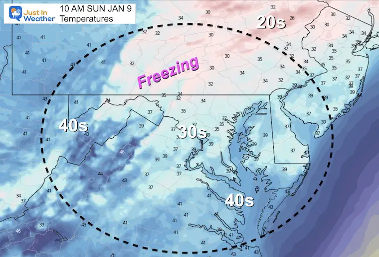
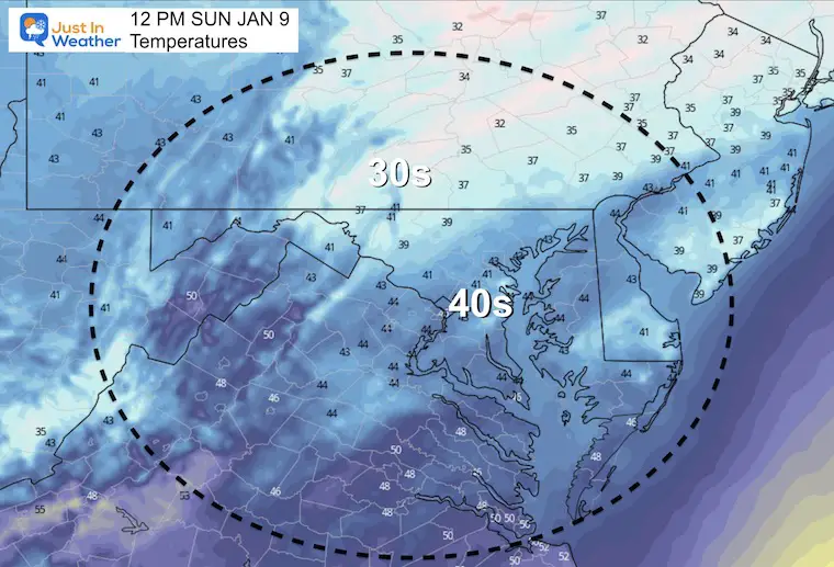
The timing brings in warmer air by noon, but as temps rise, there still could be some icing as rain falls on frozen pavement.
Here’s the early timeline, with the full weather report below.
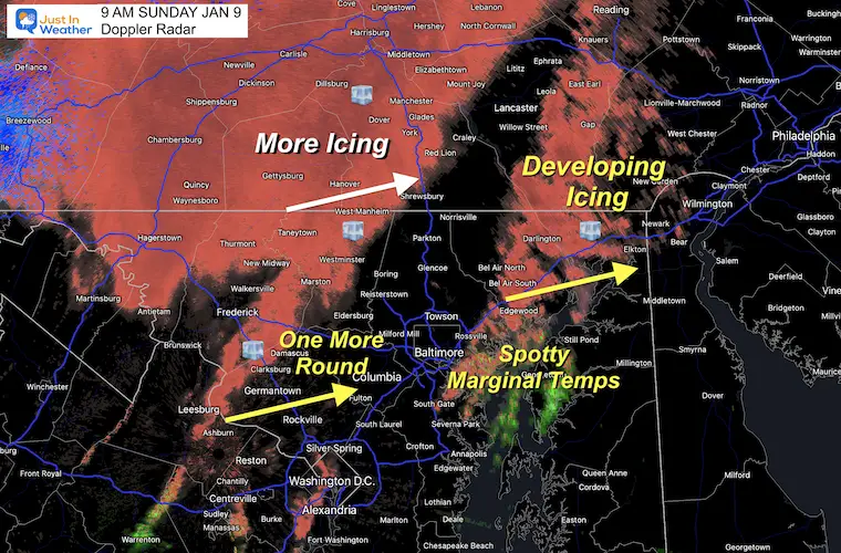
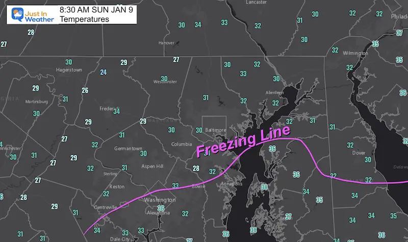
A large field of freezing rain has reached the western side of Baltimore and Washington.
This icing may expand to both Baltimore and perhaps northern Anne Arundel County that is not in the Advisory. Just a heads up. Please use caution walking or driving north of Annapolis this morning.
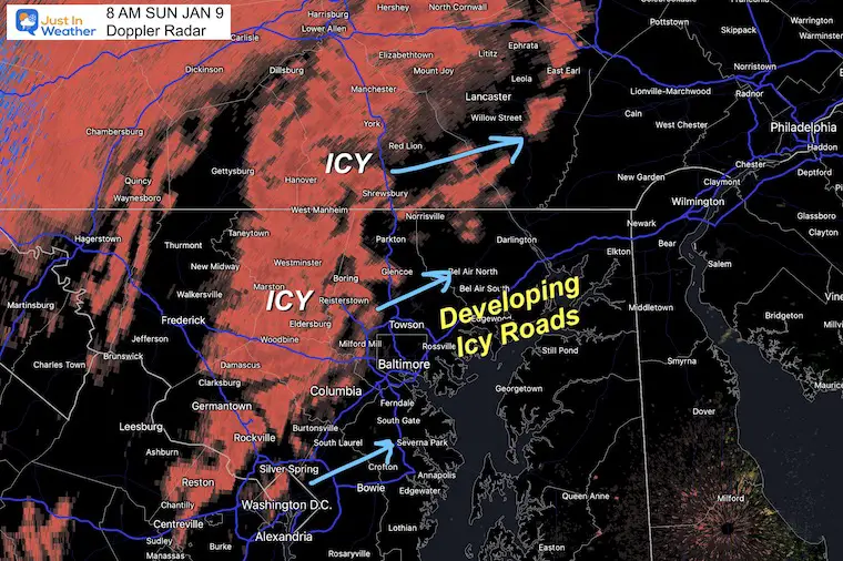
8 AM – More Ice in Central Maryland
This expanded much farther south than model guidance showed.
Be Careful Driving and Walking. This includes Anne Arundel County.
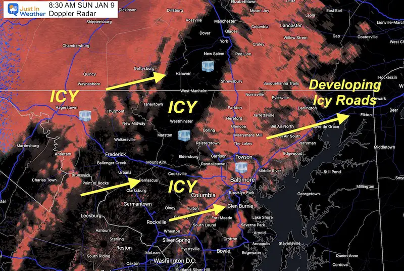
8:30 AM Radar
This has expanded to include Anne Arundel County that was not in the NWS Advisory. PLEASE BE CAREFUL!!!
Temperatures: UPDATED at 8:30 AM
Still plenty of readings below freezing!
Radar Simulaiton —-> sldier
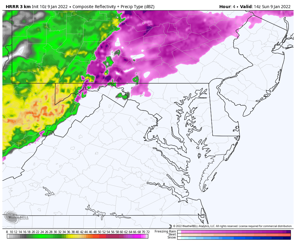
This is MISSING the freezing rain in central Maryland! Please use caution.
I am showing this for the transition timing to rain mid day.
january-9-weather-ice-rain-sunday-am-8
january-9-weather-ice-rain-sunday-am-9
january-9-weather-ice-rain-sunday-am-10
january-9-weather-ice-rain-sunday-am-11
january-9-weather-ice-rain-sunday-pm-12
10 AM Temperatures
Noon Temperatures
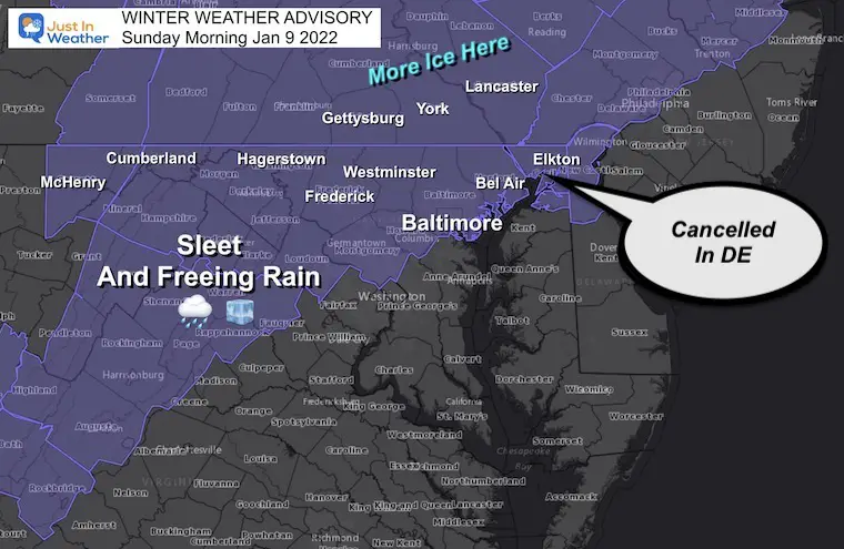
Winter Weather Advisory
Freezing Rain
This was cancelled in DE, but more ice expected in central PA.
HRRR Full Animation
This is MISSING the freezing rain in central Maryland! Please use caution.
I am showing this for the transition timing to rain mid day.
10 AM to 7 PM
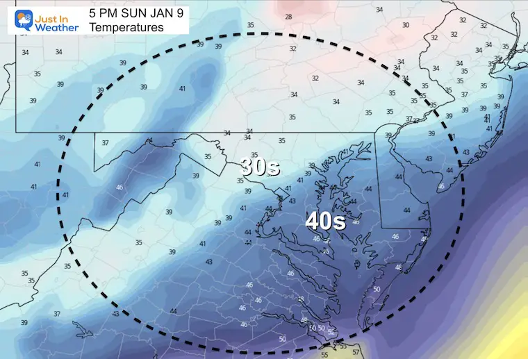
Here we can see the transition north of Baltimore between 10 AM and noon. Then a chilly rain, which could be heavy at times over Baltimore and Ravens game through the afternoon.
Afternoon Temp
This will be just a chilly rain (above 32ºF) this afternoon.
NOTE:
We will clear tonight and turn windy. Then the race will be on for the wind to dry the pavement or ice things up by morning.
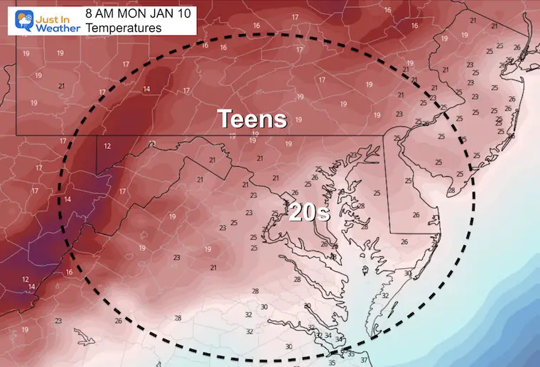
Monday Morning Temperatures
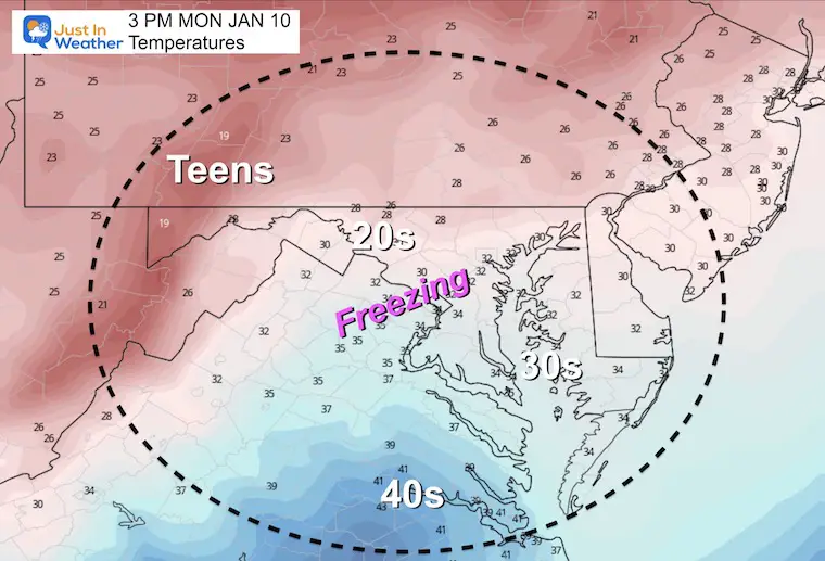
Monday Afternoon Temperatures
Weather Almanac: Climate Data
TODAY January 9
Normal Low in Baltimore:24ºF
Record 2ºF in 1970
Normal High in Baltimore: 41ºF
Record 75ºF 1937
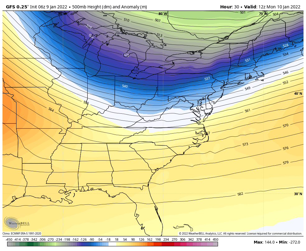
Jet Stream Next Week
We will get clipped by this Polar air mass Monday night into Tuesday.
Milder air arrives mid week, but we watch a storm off the coast likely miss us. However, that will help to pull back in colder air next weekend.
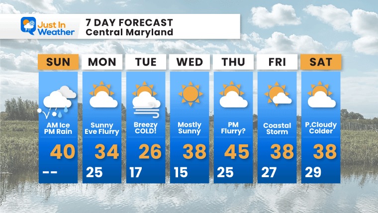
7 Day Forecast
Monday: Windy and colder. Evening flurries possible with arctic air.
Tuesday: Arctic air arrives: Bitter Cold!
Milder End Of Week, but update not as warm for long.