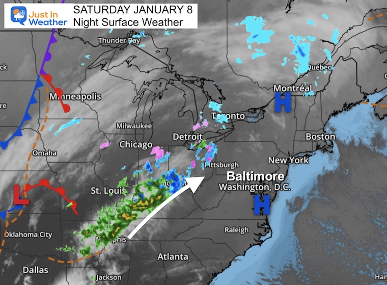
January 8 Saturday Night Update
After a week with two respectable snow storms, this weekend ice potential seems a little anticlimactic. But with a Winter Weather Advisory in effect, we must pay attention to the chance for freezing rain and sleet the may impact some travel.
Evening Set Up
A ribbon of moisture is pushing north into the Ohio Valley. This will continue to stream north and get a push our way in the morning.
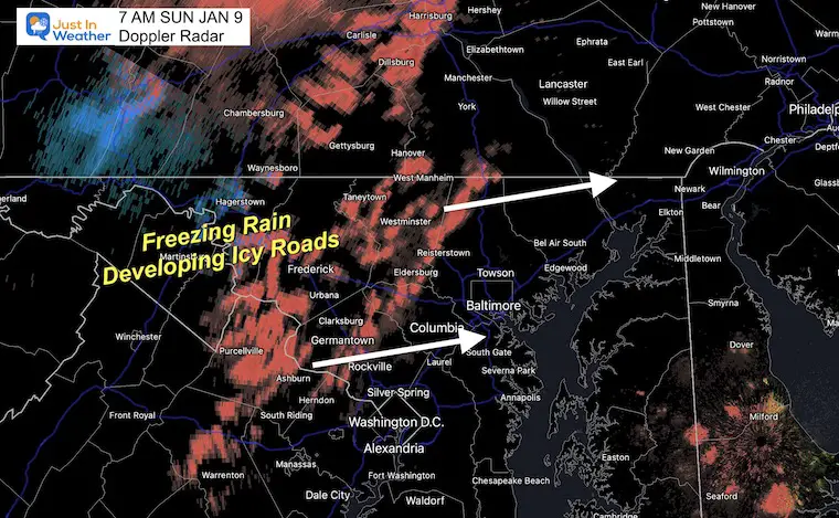
UPDATE SUNDAY MORNING
Click to see: Developing Icy Roads – More Freezing Rain Than Models Suggested
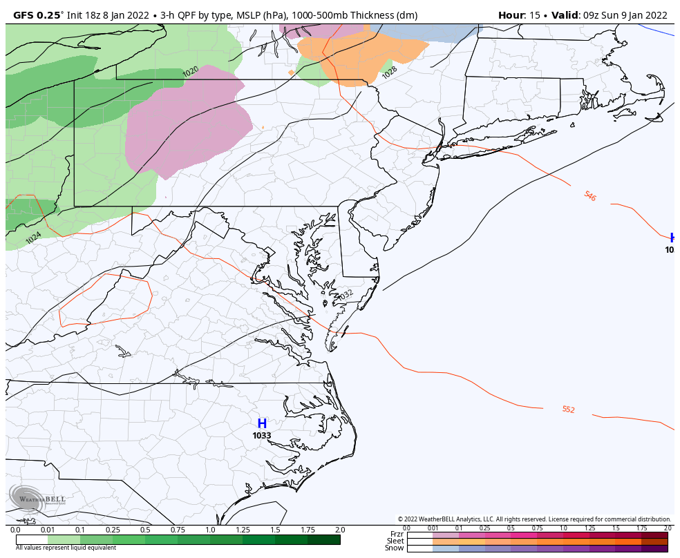
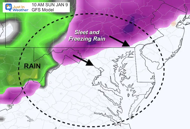
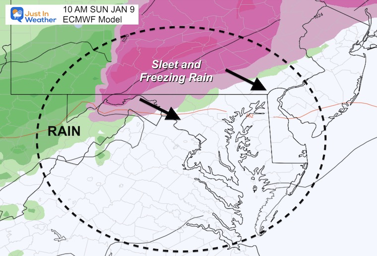
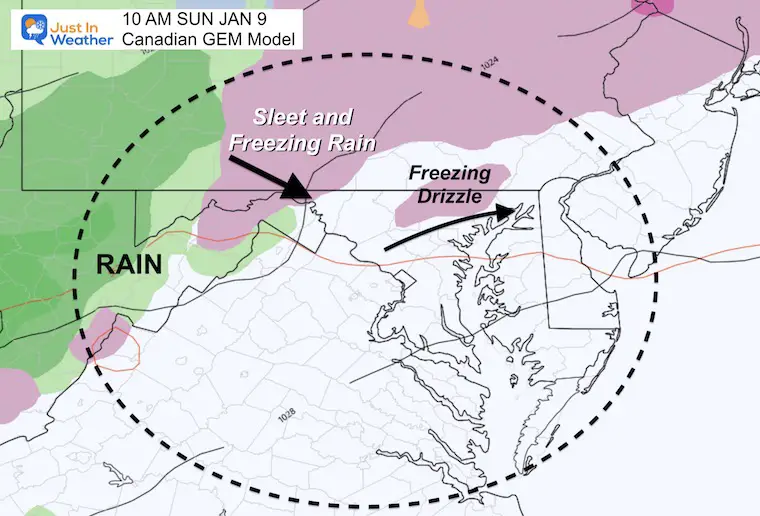
Sunday Animation: GFS
This will mainly be a chilly rain event. Especially in the afternoon. But where this arrives early enough, it will begin as sleet and freezing rain. That risk is mainly west and north of Baltimore. The locations vary on the computer guidance.
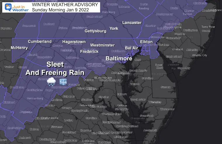
Winter Weather Advisory:
Expanded south along the I-81 mountains.
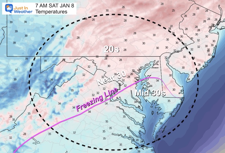
Temperatures At Daybreak
With increasing clouds and a wind shift, temps will modify a little by morning. However it will still be cold enough for icing.
The big question will be: Where will the precipitation be then?
My main thoughts are based on timing.
- Temps will still be below freezing at daybreak, but the main line of precipitation will be well west of the cities. This will track north of Baltimore into southern PA as well, similar to what happened with the snow onset Thursday night. It reached there many hours before reaching Baltimore.
- Freezing drizzle or light sleet may arrive during the morning and not show well on radar.
- It is the light stuff that can be the most tricky.
Metro Baltimore/Beltway:
If anything reaches you, it would likely be after 9 AM; spotty and light.
If it arrives after noon, temps should warm above freezing, then a chilly rain.
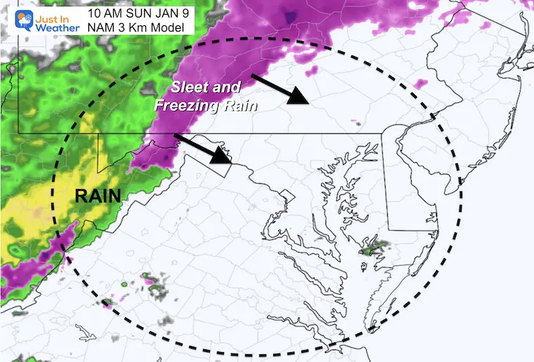
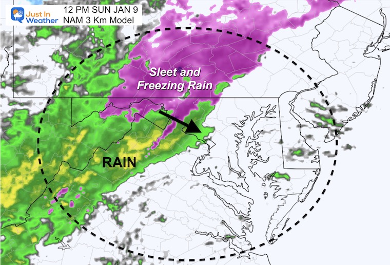
Model Comparison at 10 AM
GFS
European
Canadian GEM
NAM 3 KM
10 AM
Noon
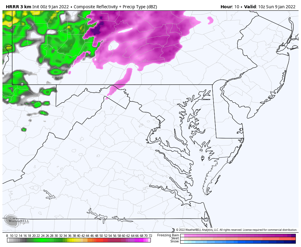
HRRR Animation
- This takes most of the icing west and north of Frederick to Westminster between 7 AM and noon.
- More impact in the western mountains and along/north of the PA line.
- Anything in metro Baltimore would be spotty or drizzle after 9 AM.
- The afternoon will be a steady but chilly rain.
I will be up in the morning with the latest on the location and an update on the expected timing.
FINAL CALL TO GRAD MY FORECAST
Click Here To: Grade My Forecast and Final Jan 7 Snow Reports
ALSO SEE
ALL FITF GEAR

FITF THUNDERSNOW


Winter Outlook Series:
My Call For Snowfall

Last Winter Recap: My Old Outlook And Your Grades Of My Storm Forecasts


Please share your thoughts, best weather pics/video, or just keep in touch via social media


