


May 3 Cooler Today Then More Rain Expected This Weekend
Friday May 3 Morning Report Another record high of 90ºF was reached yesterday at BWI. This tied the mark set in 2018. Today, a cooler wind will bring us closer…
Thursday December 30
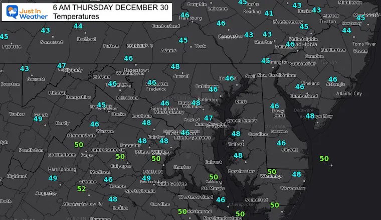
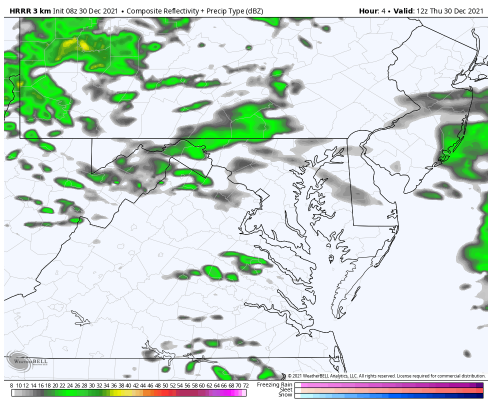
We have another morning starting with rain showers and fog. The showers will linger through mid day, then we enter a warming trend for a few days.
There is plenty of arctic air, and plenty of moisture. We we get warm rain over the New Year weekend, but a last wave may pull in the cold air in time to end it as snow Monday morning. I will show the two possible results below.
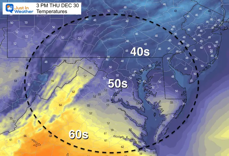
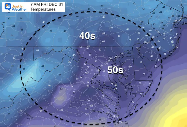
Morning Fog is thanks to overnight rain. The showers will move out of the region mid day. The really warm air will move in tomorrow, but there is plenty of arctic cold that will try to head our way.
With our warming, we will rain as the storm pattern will dominate the weekend. Then we need to watch how it will depart Monday…
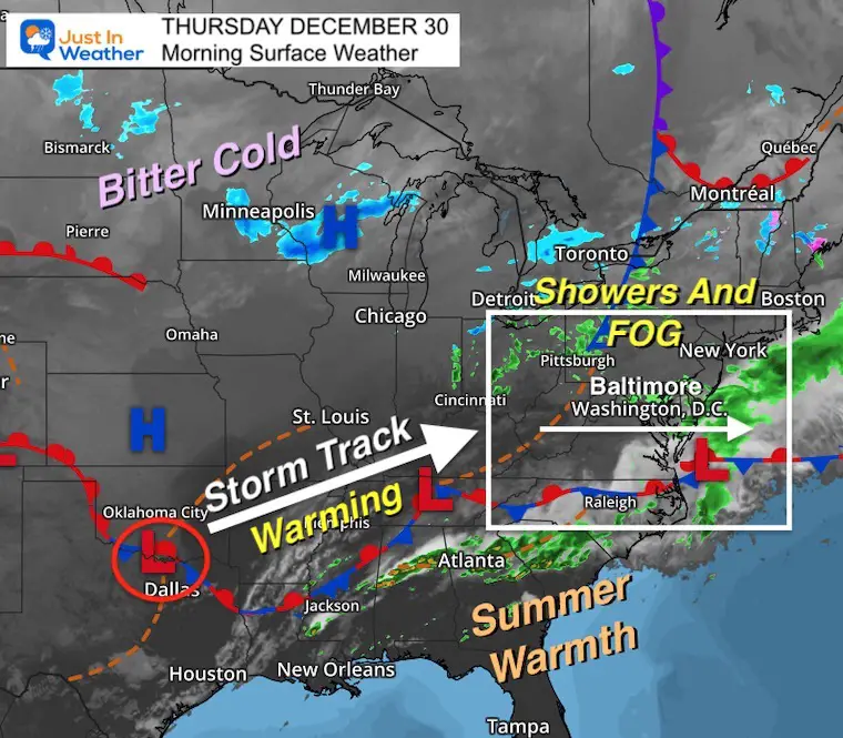
Very similar to yesterday…
Locally we are again mild in the 40s…
Northern Plains: Below Zero!
Southern US/ Gulf Coast: Mornings temps into the 70s, feeling like summer!

Under 2 miles is widespread. These are at reporting stations. There are many areas in between that are lower under 1 mile, so travel will be slowed.

Normal Low in Baltimore: 25ºF
Record -3ºF in 1880
Normal High in Baltimore: 42ºF
Record 68ºF 1990
This is the aggressive GFS Model. I am showing this to highlight the waves of Low Pressure, but the end is in question.
Our steadiest and heaviest rain will be Saturday afternoon into Sunday.
Should a second Low Pressure form on the coast, it will pull in colder air and end with snow.
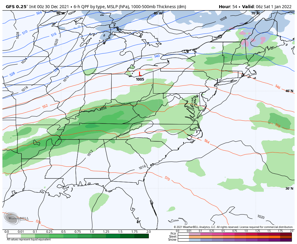
This GFS Model is trying to push steady accumulating snow Monday morning. I can not buy this solution yet.

I must follow the conservative route with a faster and farther Low Pressure. That would take more moisture away by the time the cold air arrive. The result would still end this with some snow, but it will be light or flurries.

Because this is the American Model that most of your apps and local weather forecasters use. I will always provide contrast and my suggestion which I support. But here can see why you may see different forecasts elsewhere.
Note: The modeling has been poor, but the Euro has been continued to be more consistent. That is the one I will continue to watch for any trends. I will highlight those trends with each report.
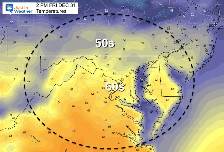
Warming weather begins Friday… The rain on Saturday will develop more in the afternoon and evening.
That snow chance on Monday morning is still a wild card. I will not hype this, but follow it closely.


Last Winter Recap: My Old Outlook And Your Grades Of My Storm Forecasts


