Thursday December 16
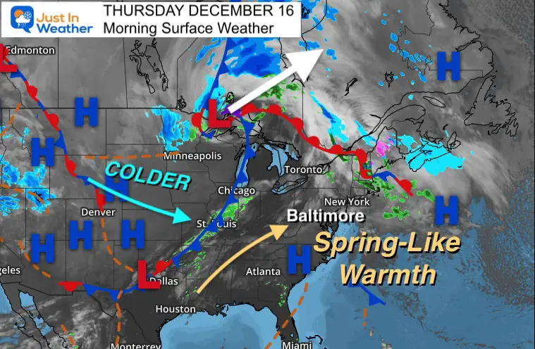
Today is going to be a spring-like day with temperatures pushing into the 60s. The rain chances will be scattered into Saturday, and colder means a return to ‘near normal’ Christmas week.
But first we must account for the Derecho that crossed the plains states yesterday.
Morning Surface Weather
The storm that caused more than a 1000 mile path of storm damage is now exiting Minnesota and heading into Canada.
*This was in Colorado yesterday morning.
Storm Reports Yesterday
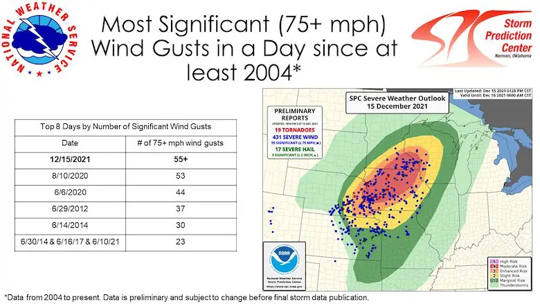
The most extensive impact can be seen with over 500 reports of wind damage.

Satellite Loop
The speed and coverage of this system is simply amazing!!
Wind Speed Record:
The NOAA Storm Prediction Center has over 55 reports with winds OVER 75 mph.
Derecho
This line of storms will fit the criteria across many states. Over 250 mile path with winds over 58 mph. This map only covered to 6:30 PM CST

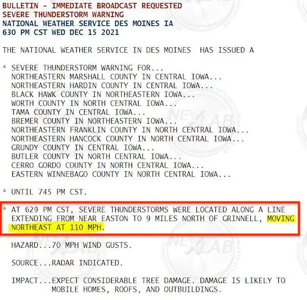
Most Impressive Storm Report
This listed the FORWARD SPEED of the storm at 110 mph. WOW!
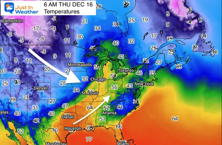
Morning Temperatures
A wide stretch of conditions with 20s to the north and western mountains.
30s and 40s in metro areas, and even the lower 50s by the beaches.
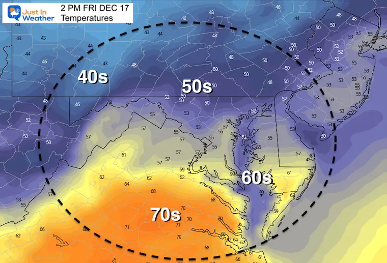
Afternoon Temperatures
Spring Like 60s

Weather Almanac: Climate Data
TODAY December 16
Normal Low in Baltimore: 28ºF
Record 10ºF in 1951
Normal High in Baltimore: 45ºF
Record 71ºF 1971
Friday Temperatures
Morning

Afternoon
Rain Animation: Thursday Evening To Sunday
When that cold from reaches us, it will lose some punch.
Scattered showers will be the result for us, but it will still bring in colder air and a return to ‘normal’ Christmas week.
Closer Look At The Rain Chances
Saturday may begin with early rain, then showers in the evening with the actual cold front.
7 Day Forecast
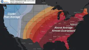
The return to ‘near normal’ chill Christmas week. For now it looks quiet, but our trust in long range storm tracking has been lost. We could still have something develop within a few days of Christmas in the cold air. Stay tuned…

ALSO SEE
Winter Outlook Series:
My Call For Snowfall

Last Winter Recap: My Old Outlook And Your Grades Of My Storm Forecasts


Please share your thoughts, best weather pics/video, or just keep in touch via social media


