December 15 2021
Less than one week from the deadly tornado that hit western Kentucky and many other states, we have another rare December storm system. This may produce more nighttime tornadoes, even over some areas with snow on the ground.
A very active jet stream is working on spring like temps and winter air to produce a massive storm system pushing into the Northern Plains. This is a different region than last week.
Here is a summary of the broad impacts of this event, with maps and videos below.
This storm includes:
- Hurricane Force Winds (75 to 100 mph)
- Tornadoes (Moderate Risk)
- Dust Storm (videos from Colorado and Oklahoma )
- Severe Thunderstorms moving at hurricane forward speed!
- Snow (north)
- Record Heat (south)
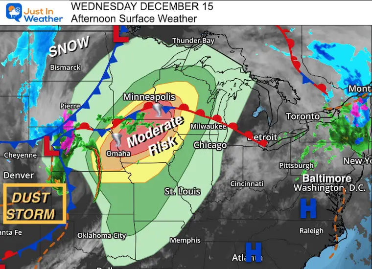
Afternoon Surface Weather Map
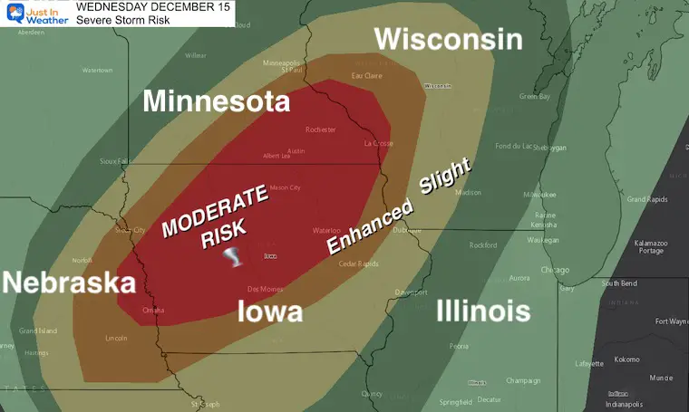
Severe Storm Risk
This large areas of Moderate Risk includes much of mental Iowa, parts of Nebraska, Southeast Minnesota, and western Wisconsin.
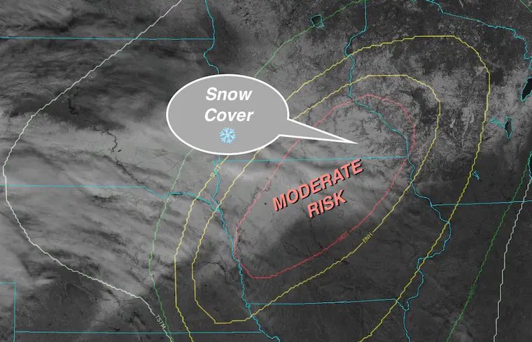
Tornado Risk Where There Is Snow Cover
The visible satellite earlier showed the snow on the ground in northern Iowa and southern Wisconsin
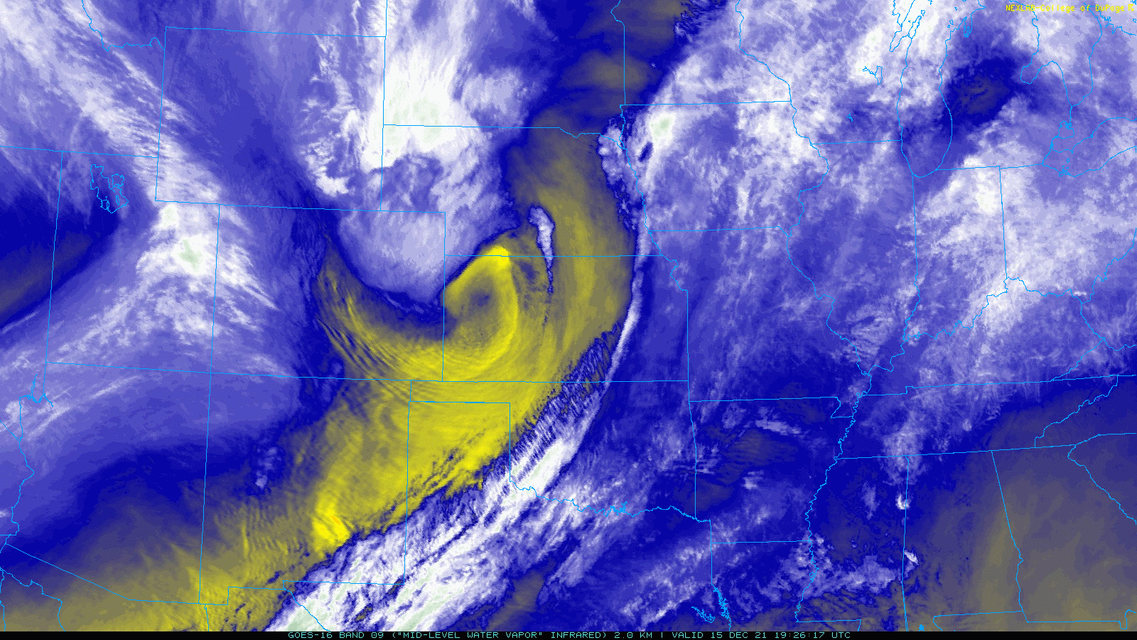
Afternoon (Water Vapor) Satellite)
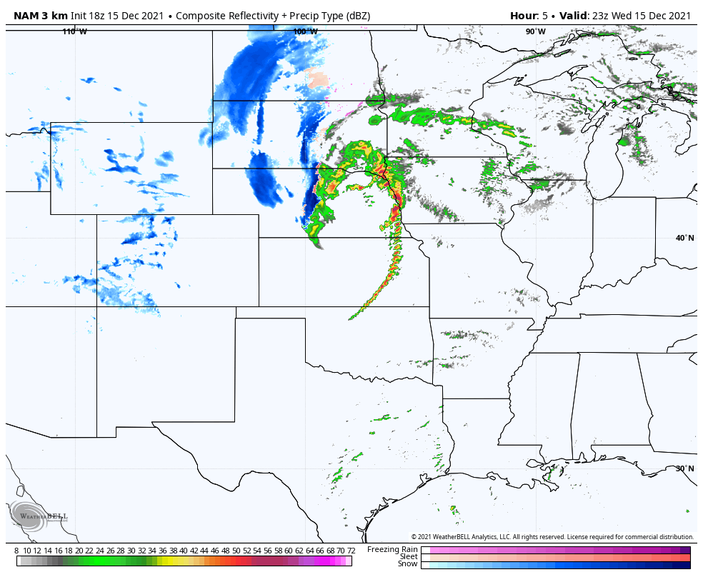
The circulation is charging through Kansas and Nebraska. We can see the line of severe storms erupt ahead of that vortex and push into Iowa. This is expected to increase in intensity through midnight… So once again severe weather will after dark for many areas.
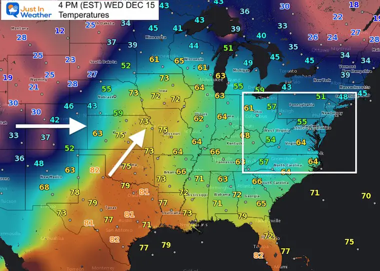
Temperatures
This contrast of air masses is the driving force for this severe weather event.
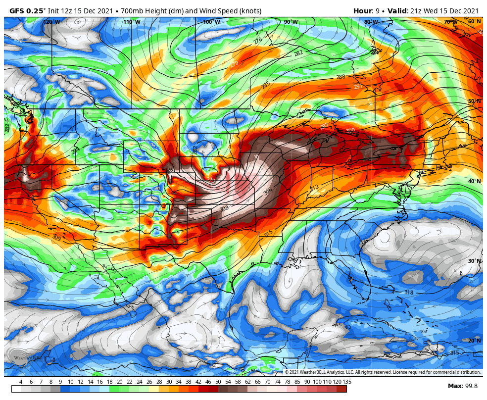
Upper Level Winds
The wind at 700 mb are pushing 135 knots…
This is crazy! This can direct the speed of individual storms as well as mix down to the surface!
This looks to be peaking over Iowa and Wisconsin around midnight!
Storm Report: MOVING AT 95 mph!!!!
This is the forward speed of the storm…
This is being treated with utmost seriousness. I want to highlight that last week’s storm was advertised well in advance as well.
NWS Tweet
Radar Simulation Through Midnight
Dust Storm Videos
Boulder Colorado: Wind gusts reached 80 to 100 mph
Turpin Oklahoma
ALSO SEE
Winter Outlook Series:
My Call For Snowfall

Last Winter Recap: My Old Outlook And Your Grades Of My Storm Forecasts


Please share your thoughts, best weather pics/video, or just keep in touch via social media


