


May 19 Weather Sunday Starts Foggy The Warming With Sun And Summer Heat On The Way
Sunday May 19 Morning Report The aftermath of the rainy Saturday is plenty of leftover moisture. This has left us with a bit of humidity and areas of thick fog…
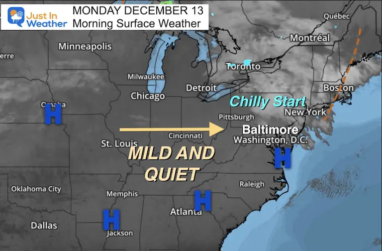
Monday December 13
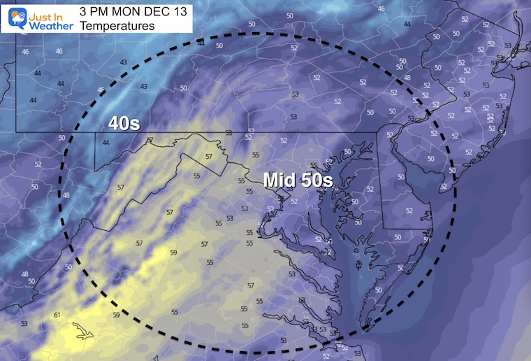
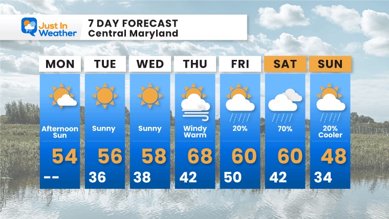
A chilly start today may include some clouds, but the overall pattern will be warming during the week.
For the eastern US , this may be a blessing in disguise for the rescue and recovery effort in the tornado zone.
The warmest days will be at the end of the week, which could break with a period of rain over the weekend.
High Pressure will dominate the eastern US this week. After a chilly morning, the next few afternoons will be warming.
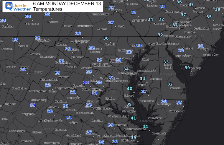
Normal Low in Baltimore: 29ºF
Record 8ºF in 1960
Normal High in Baltimore: 46ºF
Record 72ºF 2015
The warm week will peak Thursday and Friday, but more clouds and scattered showers may pass overnight. Then, Saturday will bring in more widespread rain, and being to knock temps back down Sunday.
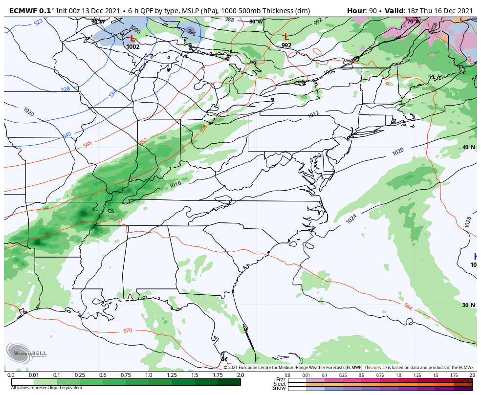
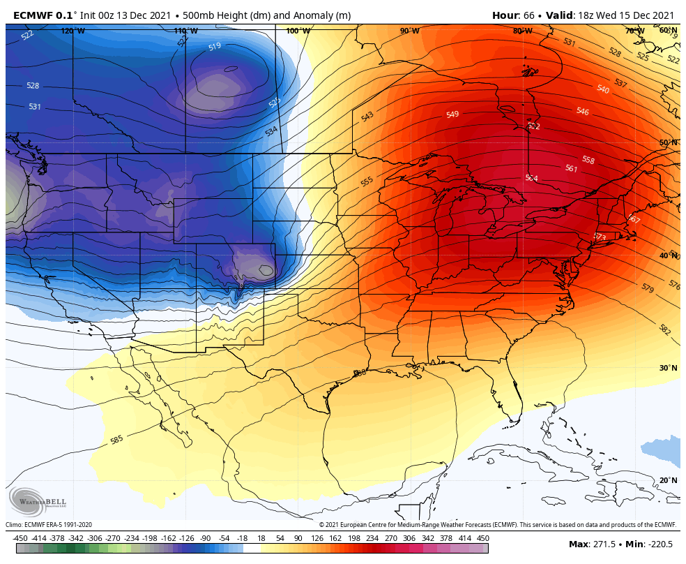
Based on the European ECMWF, we see the ridge of warm air (orange) for much of this week begins to break down next week.
I am seeing some inconsistent plots later in the period.
It is starting to look like the start of Christmas Week will be cooler, but getting a tru winter pattern in place will not be abrupt. Little confidence in specifics for Christmas, so don’t buy into long range forecasts other than trends. For now I would suggest the trend will bring in a gradually transition downward on temps. Here we see a brief warming on the 22nd, but colder air may arrive around Christmas.
Temps should peak on Thursday. I am basing these temps on computer guidance, and bumping them up a little. But often we end up warmer than projected. So another day near 70ºF is possible Thursday.
Signs of a return to near or colder than normal are still expected Christmas week, but it may still feature some mild days during the gradual downward trend.

Last Winter Recap: My Old Outlook And Your Grades Of My Storm Forecasts


