Saturday December 11
So much is happening with this storm system, and it is somewhat relevant to our expectations, as that system will be crossing our region later today.
After morning fog, we have a Wind Advisory in place with temps pushing near 70ºF. Then rain and possible severe storms late. More on that below.
Let’s begin with a horrible tornado outbreak late Friday and overnight. Historic may be an understatement.
There have been 36 tornado reports across the south. On the other side, a snowstorm that dropped 21 inches on St. Paul, Minnesota.
Tornado Reports
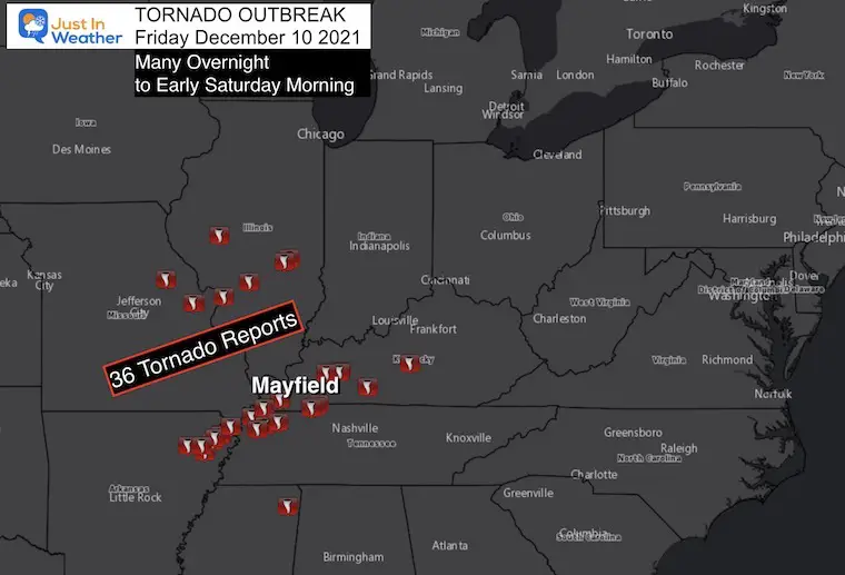
Tornado Haedlines:
Possible long track (on ground for 100 miles – 4 states… AR, MO, TN, KY)
Kentucky (Mayfield) Hardest Hit
Gov. Andy Beshear said at least 50, but up to 70-100 people possibly killed.
With People Inside:
- Candle Factory leveled
- Nursing Home Roof Collapsed
- Amazon warehouse partially collapsed near St. Louis in Edwardsville, IL
Eyewitness Reports online
Lots of area of Kentucky hit with Tornados . They caught this picture from a lake house down at Ky / Barkley Lake as it passed over the lakes . Said it was a F4 , Mayfield Ky Destroyed. Prayers sent 🙏 pic.twitter.com/BAsLzhXyWJ
— Kaoru OBryan Fishing (@kyprobassangler) December 11, 2021
The Graves County Emergency Management Office says if you live in Mayfield and can walk safely, you should head to Fire Station House 1 at 211 E Broadway street. There will be buses to help transport people. @JackKaneWPSD shared these photos of some of the damage there. pic.twitter.com/YJUQv5HnoD
— WPSD Local 6 (@WPSDLocal6) December 11, 2021
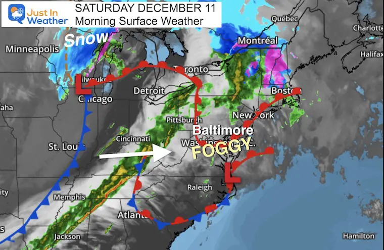
Morning Surface Weather
The line of storms is still active this morning, producing more severe weather. We may get in on some of that later today.
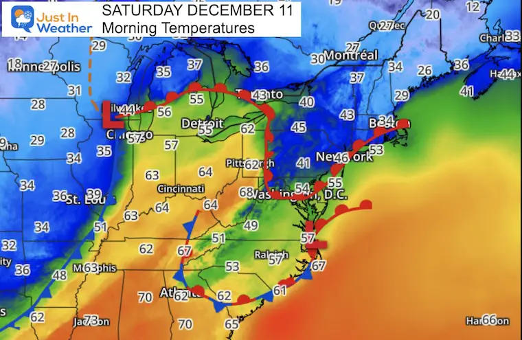
Morning Temperatures
The storm is driven by this contrast of temperatures.
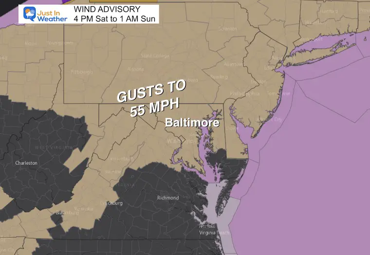
Wind Advisory
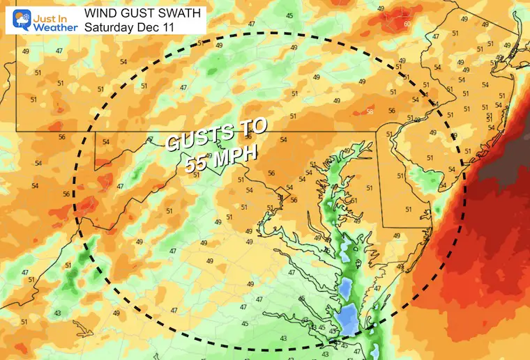
The first thing we will notice will be wind gusts up top 50 mph after 4PM
Wind Forecast: Peak Gusts
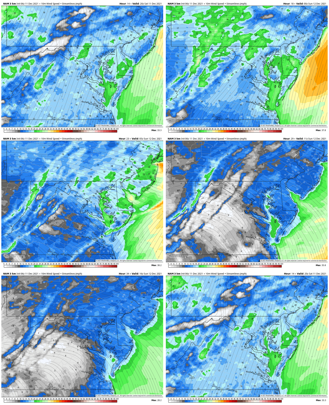
Wind Forecast Animation
First the winds from the southwest, then switching to the NW with the cold front this evening.
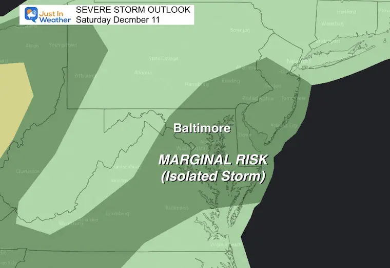
Severe Storm Outlook
Reminder: There is a small chance for storms to turn severe, but if they do:
- A Watch means they might happen
- A Warning Means it is happening now and being tracked.
Radar Simulation —-> slider
This is the best guidance, but the timing may be slow. It is possible the arrival may be an hour or two earlier than shown here.
Temperature Forecast
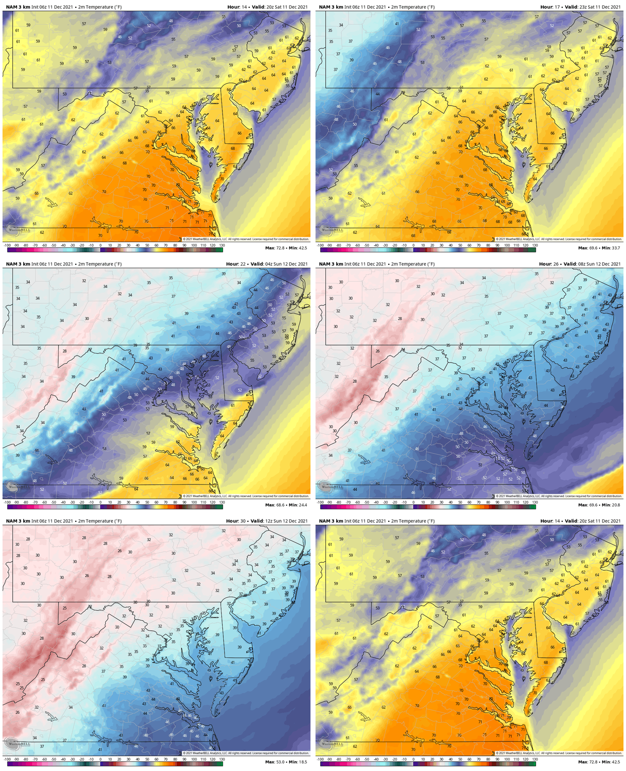
Animation: Saturday Afternoon to Sunday Morning
With that cold front, temps go from 65ºF to 70ºF, then to the 30s.
Note: The record high at BWI was 69ºF in 1979. Today may be challenge that- despite the number shown on this plot.
Weather Almanac: Climate Data
TODAY December 11
Normal Low in Baltimore: 29ºF
Record 9ºF in 1968
Normal High in Baltimore: 46ºF
Record 69ºF 1979
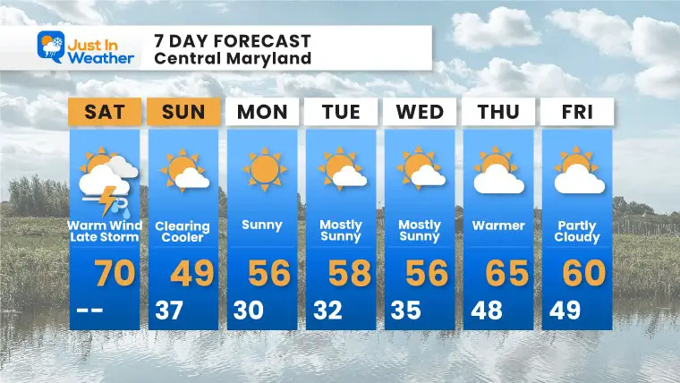
7 Day Forecast
Briefly back to the color air Sunday. Then we get into that long stretch mil pattern next week. Temps will reach the 60s later in the week.
*Still expecting a cool back down Christmas week.
ALSO SEE
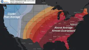
NOAA OUTLOOK: Warm Mid December, Please Let Me Explain
What is Faith in the Flakes: History of December 5th Snow
Winter Outlook Series:
Last Winter Recap: My Old Outlook And Your Grades Of My Storm Forecasts
Winter Weather Page – Lots of resources
Solar Cycle Increasing Sunspots Suggests More Snow
Comparing 4 Different Farmer’s Almanacs: Majority colder winter outlook than NOAA
NOAA Winter Outlook- But Read The Fine Print
Signals For Early Start To Winter In November
Winter Outlook Series: La Nina Double Dip
Nor’easters May Give Hint For Winter La Nina Pattern
Winter Folklore Checklist
Please share your thoughts, best weather pics/video, or just keep in touch via social media
Facebook: Justin Berk, Meteorologist
Twitter: @JustinWeather
Instagram: justinweather


