


July 18 Flood Watch In The Mountains Then Storms Expand Back This Weekend
Friday, July 18 2025 Morning Report There is some relief in sight, but I remain cautious. For the short term, today remains muggy, while the focus of strong storms and…
Thursday October 28
I realize there is a lot of anxiety about the storm on the way. As of Thursday evening, we have Wind Advisories, Coastal Flood Advisories, and the potential for a period of heavy rain that may lead to inland aerial flooding mid to late afternoon.
I have some weather updates here, including new forecast maps. Plus, more details about our NEW Boating and Bay page that can give you a lot more real time updates on numerous conditions.
Note: Harford County MD has already closed schools for Friday
This is going to be a bad storm, simply because of the wind direction from the Southeast piling water up the Chesapeake Bay. There already has been flooding on the Bay today, and it will be worse Friday.
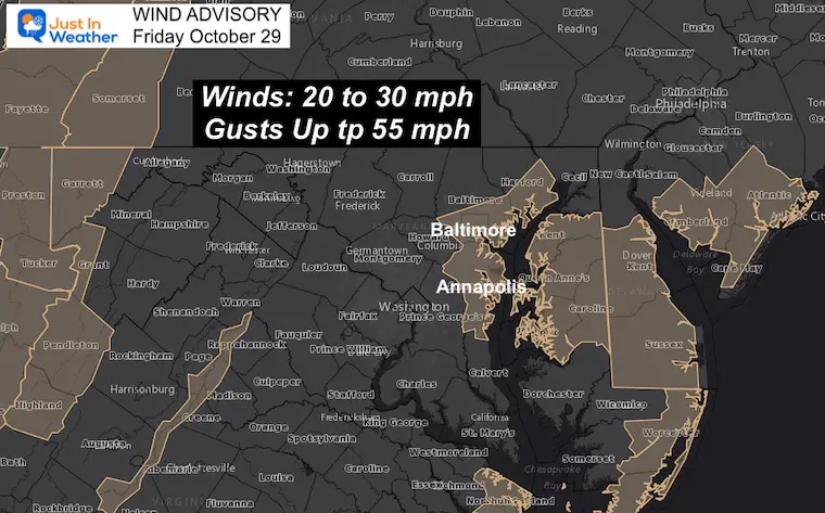
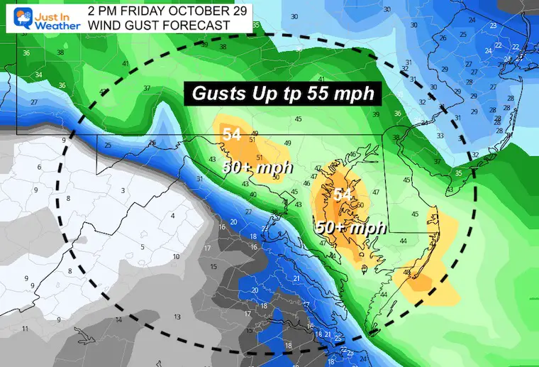
The winds will be strongest in the afternoon and early evening. Gusts to 55 mph may knock down some trees and power lines. Area bridges are most likely to have some form of wind restrictions to add to traffic problems.
The loose foliage may also get stripped and may add wet leaves to slicken up roads.
I do not know who compared this to Hurricane Isabel, but a lot have asked about that. For what it is worth, that was a Hurricane with the wave memory of a once Category 5 storm that came in off the ocean. This storm is circulating inland, however it is pulling wind and water in from the Atlantic.
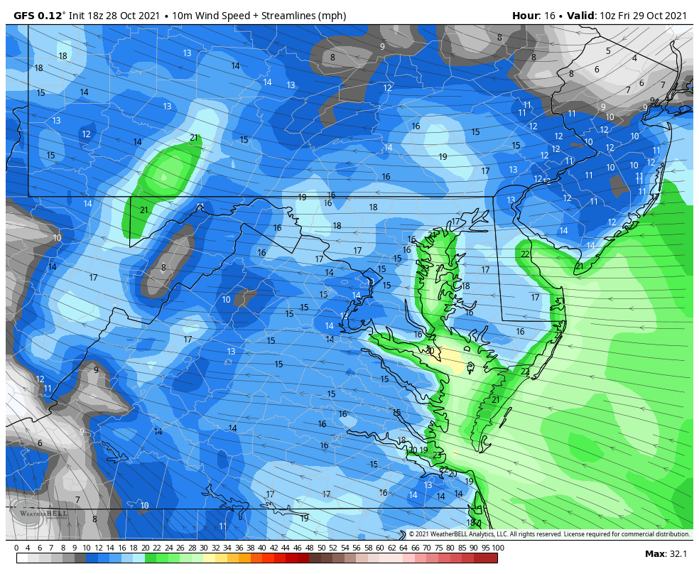
2 Hours Ending 8:46 PM
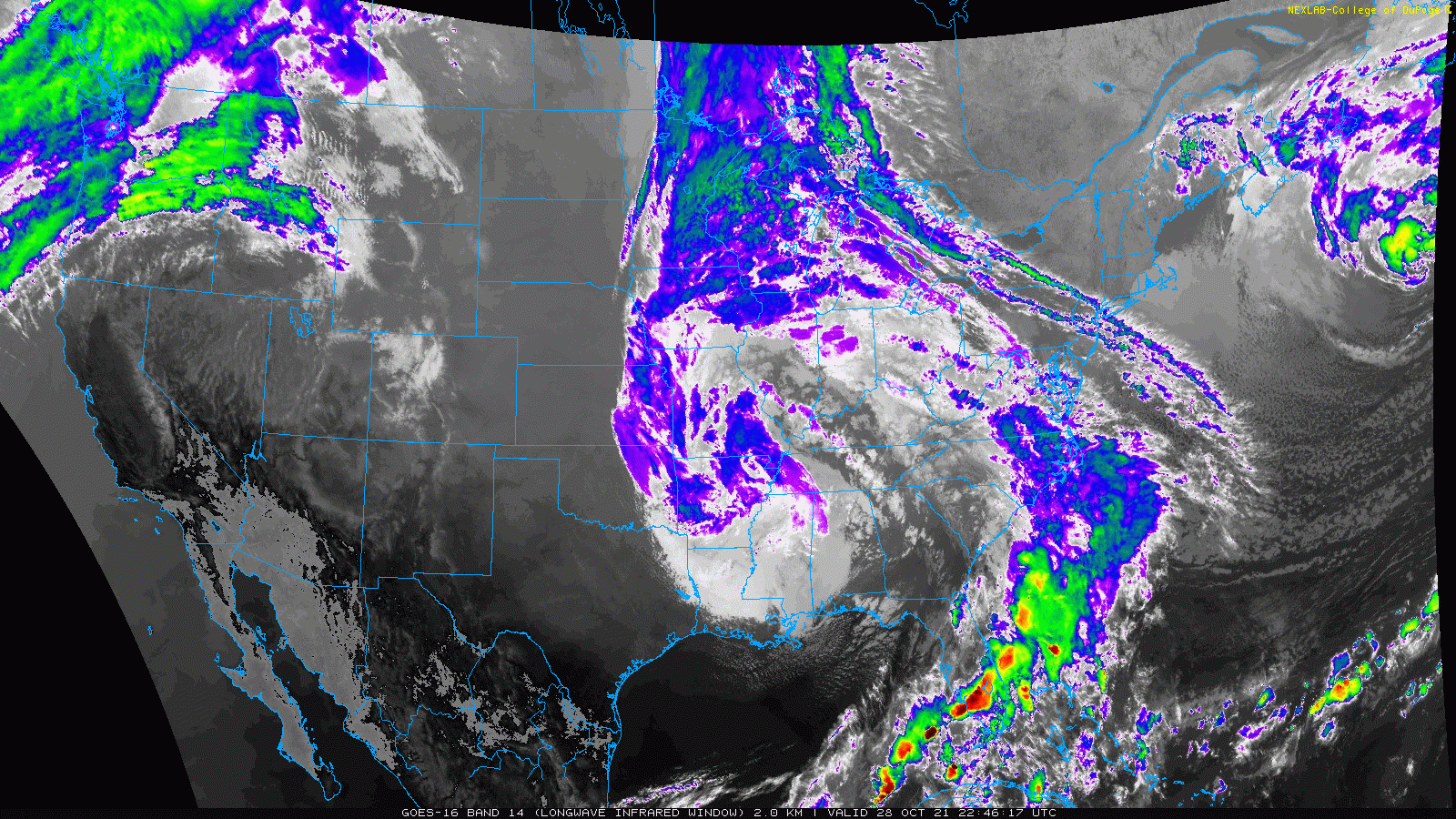
See details below the image…
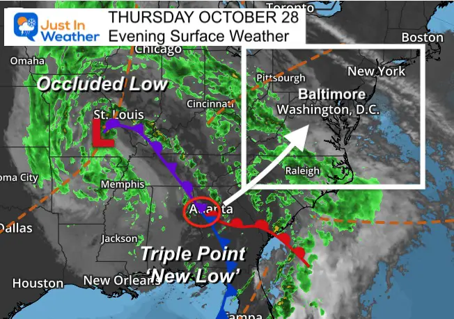
The Occluded Low is the primary system that as had the cold air wrap completely around the center. This cuts it off, and often shifts the energy to the southeast. That is identified by the ‘Triple Point’ where a new Low Pressure will form. That is what will reach us on Friday.
This will be responsible for pulling in the wind and water from the Atlantic. While it will bring flooding, it is hard to compare this to hurricanes that move in from the Ocean.
This storm originated from the Pacific Ocean, and brought severe storms to the southern states. But it is not tropical and has been one land for a few days.
Water will run up to 4 Feet or higher over normal. This is most critical at times of High Tides.
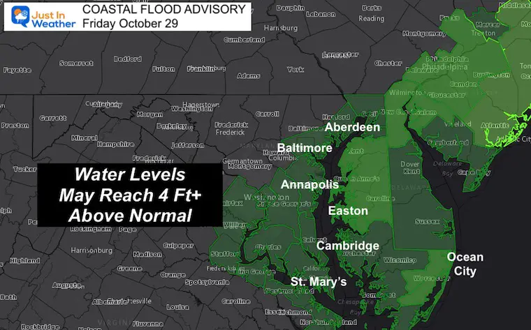
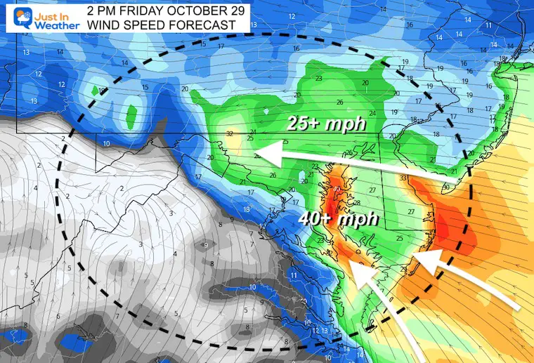
This is the concern on the Bay: Wind Direction from the East and Southeast!
Let’s take a snapshot at 2 PM when the worst conditions may be felt locally.
This flow from the East and Southeast prevents low tide from flowing out and increases the High Tides.
These are 1 minute sustained winds…
It also helps tp Slosh the water to the WEST SIDE of the Chesapeake Bay. That is what places like Annapolis to coastal Baltimore County get hit hardest with flooding.
These are peak winds lasting 3 to 10 seconds. This is when we may see gusts 50 to 60 mph.
See the additional Bay Resources, and the Rain Maps below.
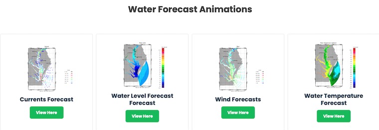
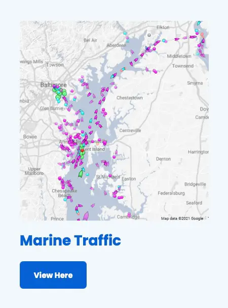
Boating and Bay page you will see
This includes currents, water levels, wind, water temps, and salinity. Click this image to control the maps.
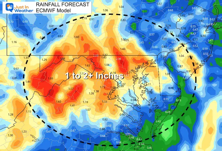
Timing the rain:
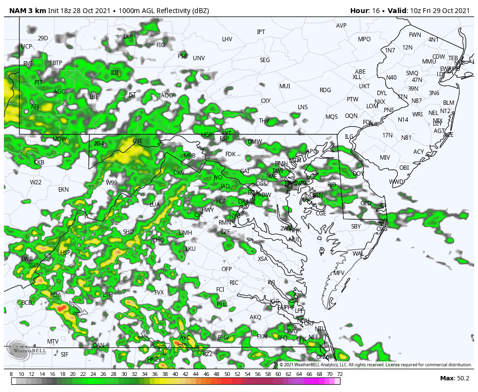
Most of this will fall during a few hours in the mid afternoon to early evening. That is when we may have some inland areal flooding from the rainfall.
Sign up and be the first to know!
NOAA Winter Outlook- But Read The Fine Print
Signals For Early Start To Winter In November
Winter Outlook Series: La Nina Double Dip
Nor’easters May Give Hint For Winter La Nina Pattern

