


July 18 Flood Watch In The Mountains Then Storms Expand Back This Weekend
Friday, July 18 2025 Morning Report There is some relief in sight, but I remain cautious. For the short term, today remains muggy, while the focus of strong storms and…
Sunday October 24
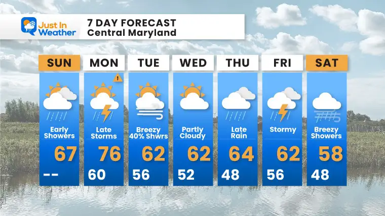
Big changes are on the way with the weather, and perhaps with the leaves around you. If you recall last week I expected frost this morning. That is not the case, as we have clouds and some rain showers with a disturbance. That will pass through with a few showers, but improving this afternoon.
We are in the track of those Pacific Storms reaching us ever couple of days…
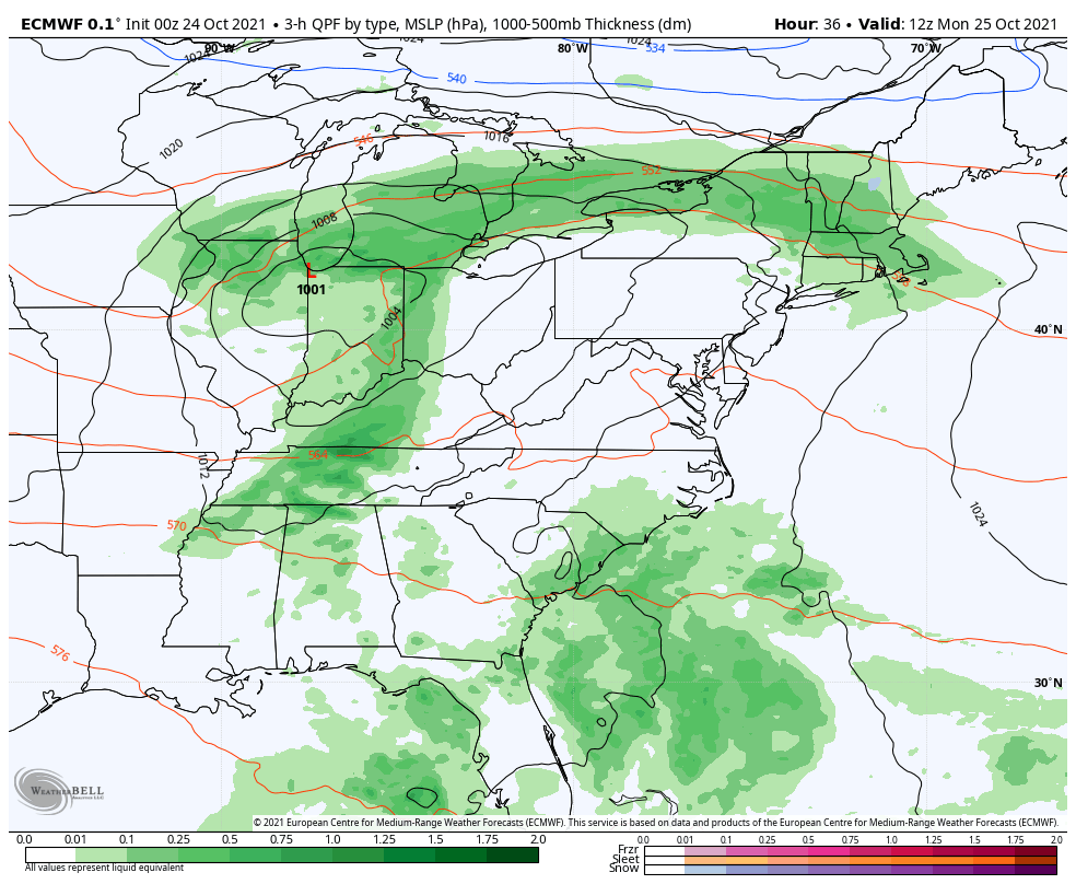
Morning Surface Weather
A disturbance this morning will swing through, then we get a break before storms arrive late Monday.
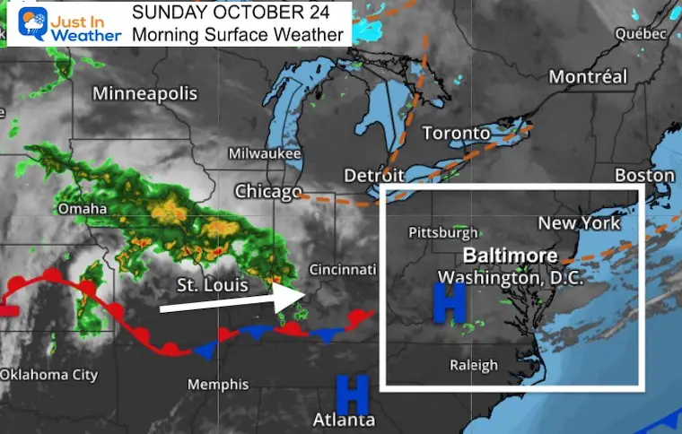
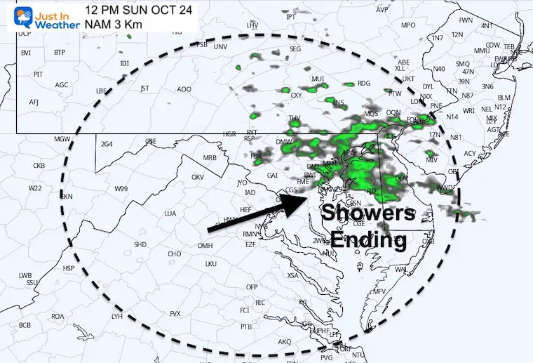
A cluster of rain showers is expected to pass through mid day, then improve this afternoon.
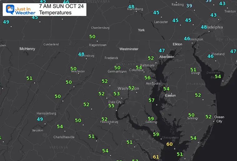
These numbers will be close to seasonal averages for this date.

Normal Low in Baltimore: 43ºF
Record 25ºF in 1969 *Coldest on record for month
Normal High in Baltimore: 64ºF
Record 82º F 2001
NOAA Winter Outlook- But Read The Fine Print
Signals For Early Start To Winter In November
Winter Outlook Series: La Nina Double Dip
Full Hunter’s Moon May Appear Full For 3 Nights
Waterspout Among Top 10 Storm Photos Saturday
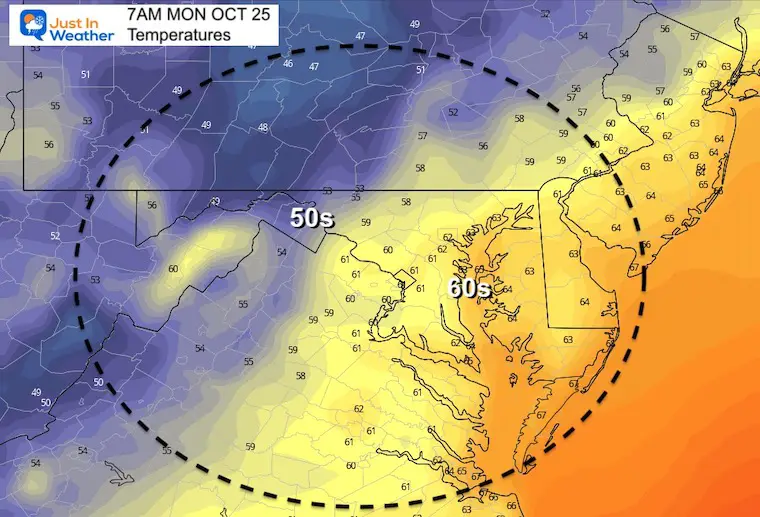
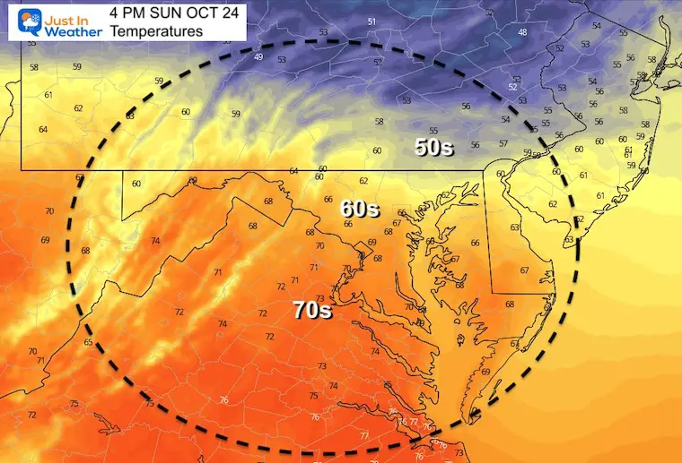
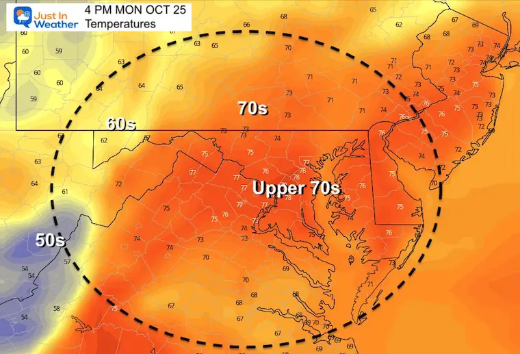
This will be the only warm day during the work week.
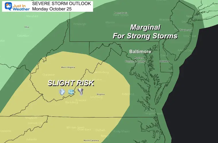
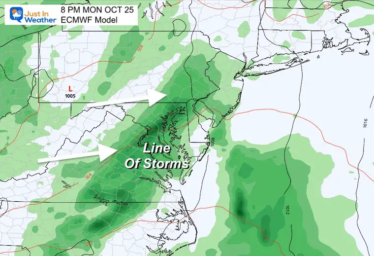
Trying to time this line in our region. Timing may play a role in the potential for severe storms, or losing some punch if it is too late after sunset.
Sign up and be the first to know!
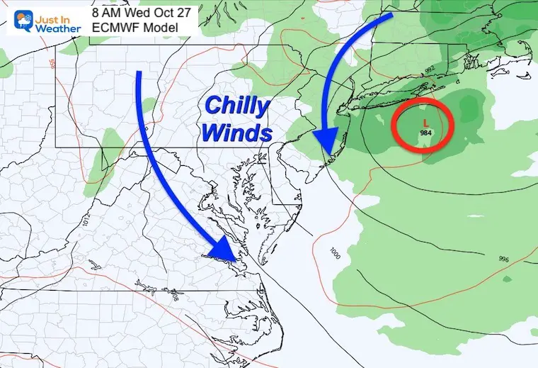
Tracking this system for a few days will swing a band of rain/storms our way after dark Monday, then switch the winds into Wednesday turning us much cooler.
If this Low Pressure develops and stalls over New England, it will enhance the cool winds and lingering showers for us.
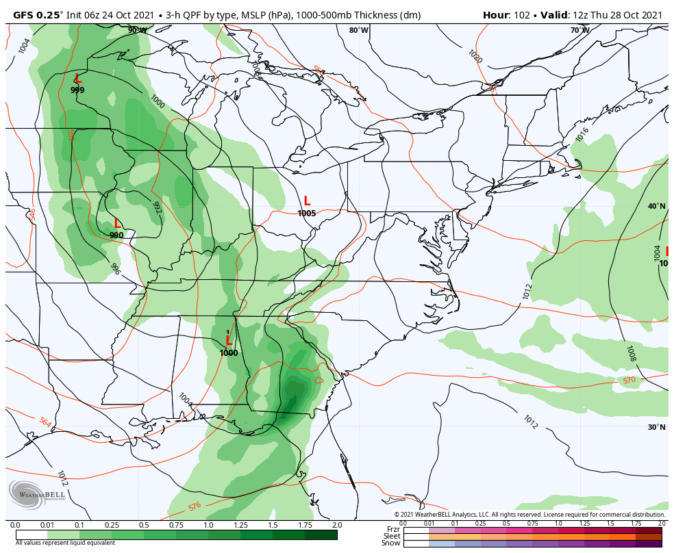
The next storm will be stronger hitting the west coast, and for us as well. The timing is the hard part as it will be racing across the US. Here it looks like arrival Thursday evening/night… Lasting into the start of the weekend.
The main ‘rain day’ for us will be Friday.
Look closely and you might see a spot of blue in West Virginia. There may be the first snow observed at Snowshoe, and elevations over 4,000 Ft.
Monday will be a brief warm up, then the week will be dominated by a few storms and progressively cooler air.


Sign up and be the first to know!