


July 18 Flood Watch In The Mountains Then Storms Expand Back This Weekend
Friday, July 18 2025 Morning Report There is some relief in sight, but I remain cautious. For the short term, today remains muggy, while the focus of strong storms and…
October 16 2021
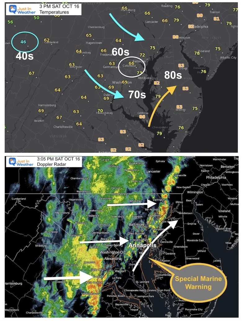
A strong cold front was expected to bring us from the 80s to the 40s. With that transition, a line of strong to severe storms was forecast to cross central Maryland between 2 and 4 PM. That was my call on timing in my morning report. It turns out, that was almost exactly on target with a spectacular cloud display in the Annapolis area around 3 PM. Here is a look at my Top 10 pick of photos including a few close ups of the waterspout from today’s weather event in that part o our region.
At the bottom of this post, a look at what passed by.
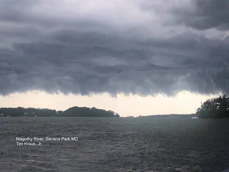
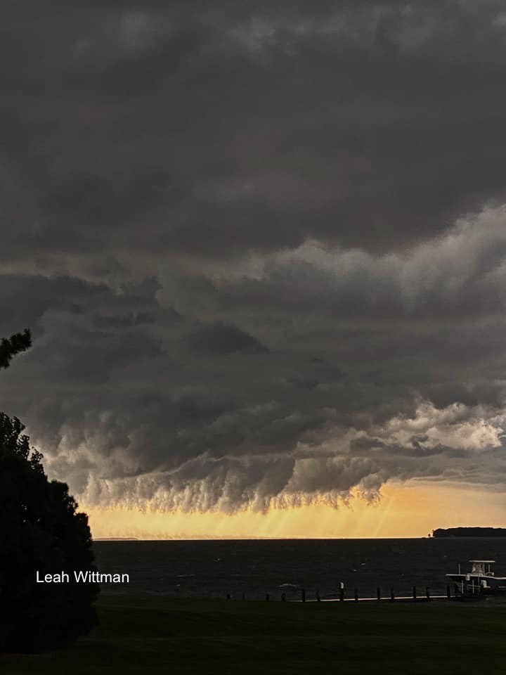
We will work backwards from the Eastern Shore
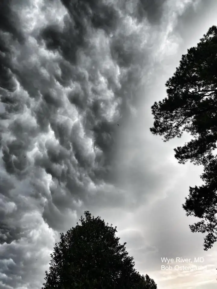
Shelf Cloud

Shelf Cloud
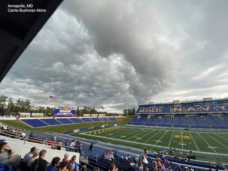
At The US Bands Invitational- Shelf Cloud
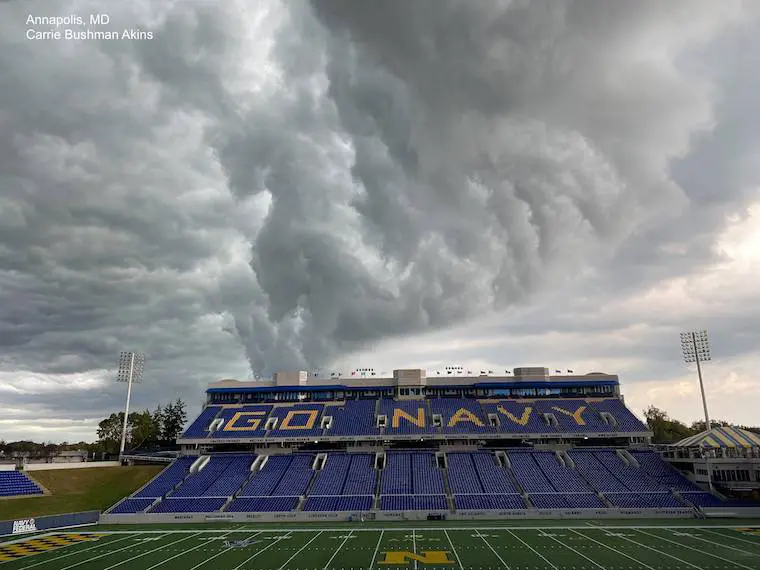
Looking underneath the shelf cloud.
All dedicated to Karen and Tessa Gunnell who captured a close up view of two vortices kicking up spray as they crossed the Bay Bride.
Close up view, a large circulation of spray getting kicked up.
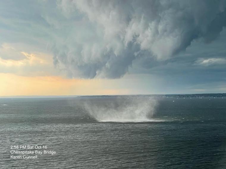
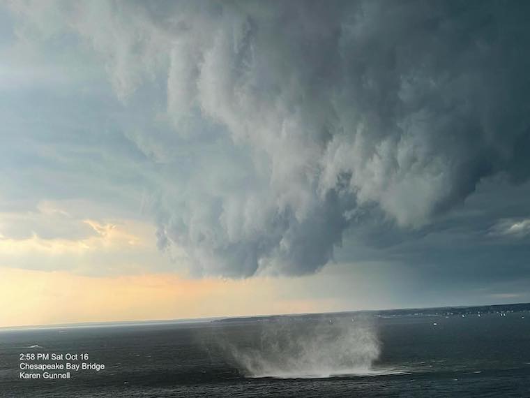
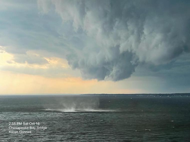
Two distinct separate vortex spray fields
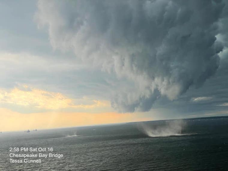
Captured by Tessa Gunnell while a passenger in a car crossing The Chesapeake Bay Bridge.
Time, just before 3 PM.
Temperatures has just dropped at Baltimore’s BWI in one hour from 80ºF to 66ºF.
Doppler Radar: The front line of rain was passing Annapolis, as there was a Special Marine Warning on the Chesapeake Bay.
There did not appear to be much circulation at cloud level.
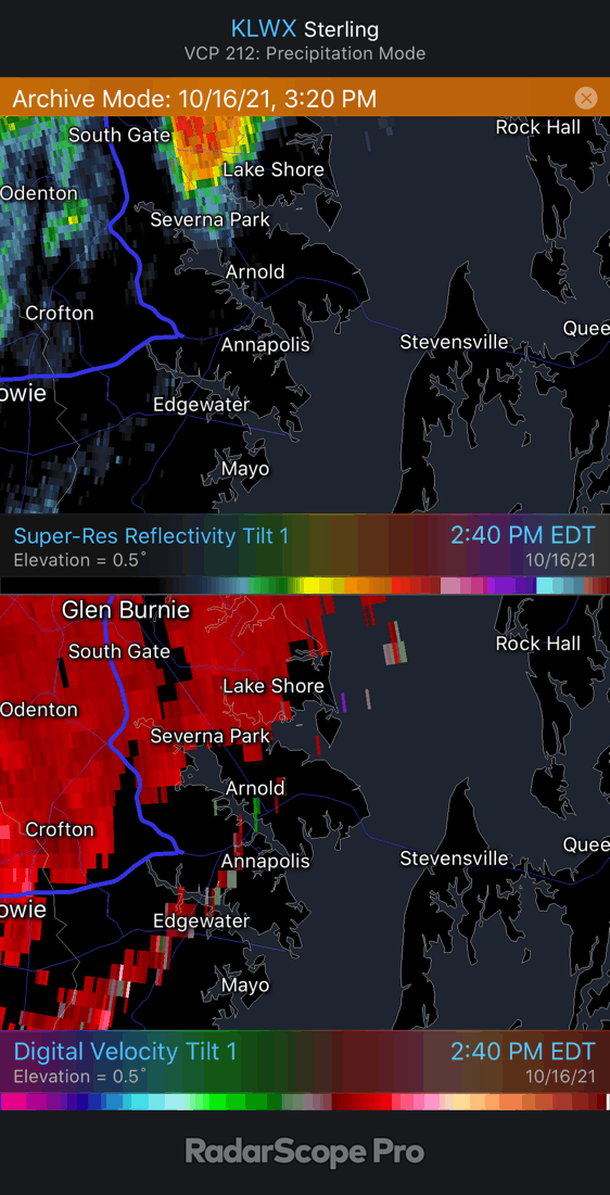
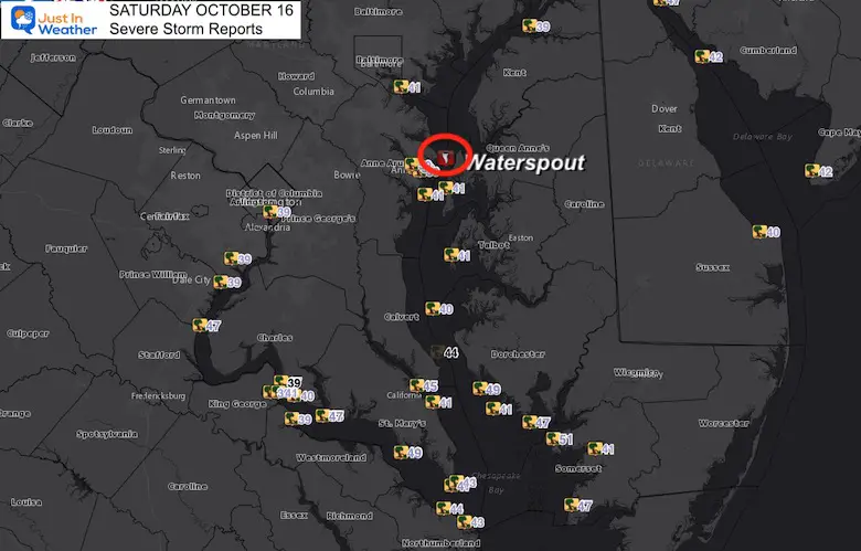
The NOAA outlook has a better chance for severe storms Northeast of Baltimore, but most of the action was across the southern half of the Chesapeake Bay. This included the waterspout.


Please make sure you sign up for my newsletter.
See the SUBSCRIBE button at the bottom of the page.
This way you will get an email to make sure you are notified with each new post.