


Average Last Frost or Freeze Dates And Map For Maryland
There is a good reason why many gardeners suggest NOT to plan tomatoes until after Mother’s Day. Early surges of warm air in spring can be deceiving. Just because the…
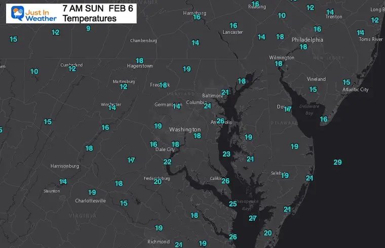
Sunday February 6- Morning Report
Have you noticed a trend with these Sundays? Talk about a pattern, this is 4th Sunday in a row with much of our region starting off in the teens or colder.
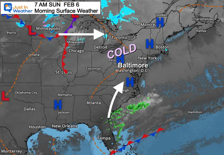
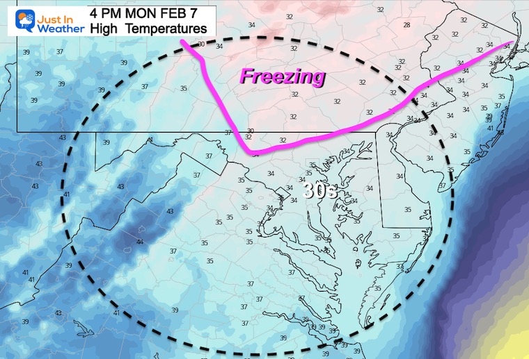
Today’s weather will be quiet, but the cold established s much different set up for possible freezing rain Monday morning. It is very different than what we missed out on last Friday and worth the mention.
Here are the past few Sunday morning low temps at Baltimore’s BWI
A slight push up on the thermometers. BWI has warmed to 21ºF at sunrise.
High Pressure is in control, and will keep our sky sunny today.
This will also allow a little system along the coast to ride north tonight.
Just cold enough ‘after midnight’ to allow for icing. (See below)
I get it! To some this may seem like crying wolf. But this is different.
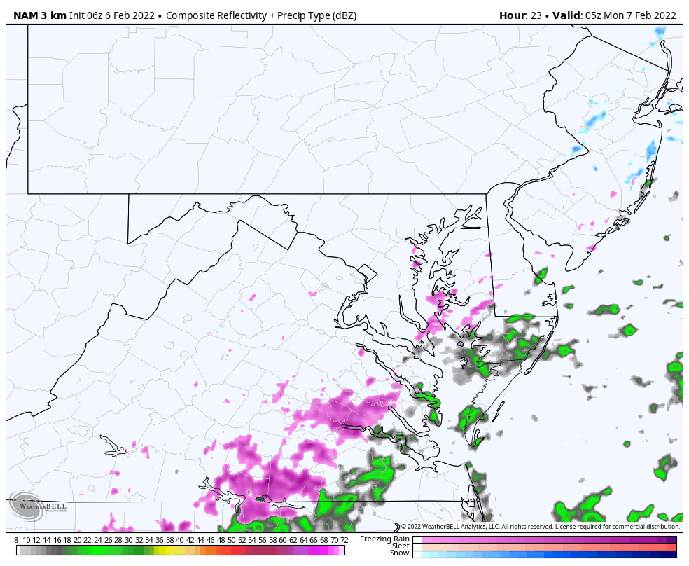
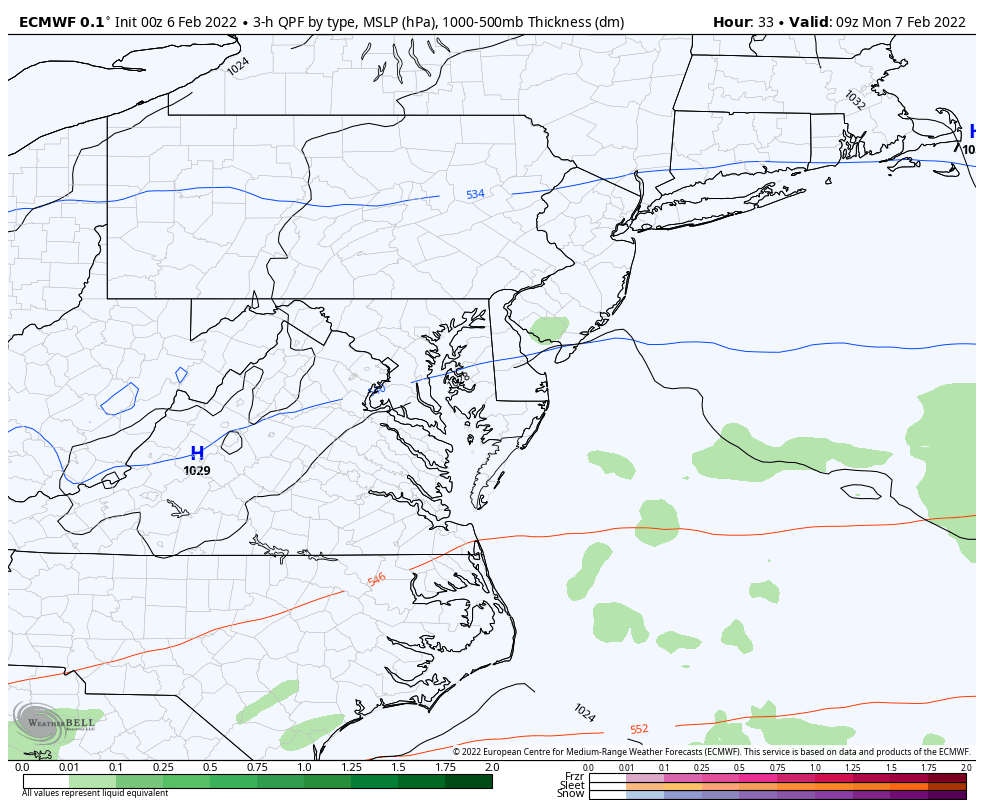
This is the NAM 3 Km Model. It is the one that accurately called the delay of cold air and held off the icing last Friday.
This is a different set up. It is not Rain turning to Ice. It is starting off that way, overnight on cold and dry ground. That is more optimal for ice to develop on the roads.
Also: Do you recall last Friday and two weeks ago had a delay of the freeze? That was due to a last moment ‘shift west’. Do you recall the coastal Blizzard? That expanded the heavy snow across Delmarva due to a late ‘shift west’. It just wasn’t enough for metro areas.
This event is ALSO based on the ‘farther west’ track….
12 AM Monday to 3 PM Monday
*This is the system that had looked like snow last week, then was supposed… Now is it back in a weakened and warmer form…
Here we see just enough moisture and cold air to produce a glaze on the roads afternoon midnight into the morning.
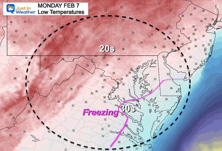
Here is the point of concern at daybreak.
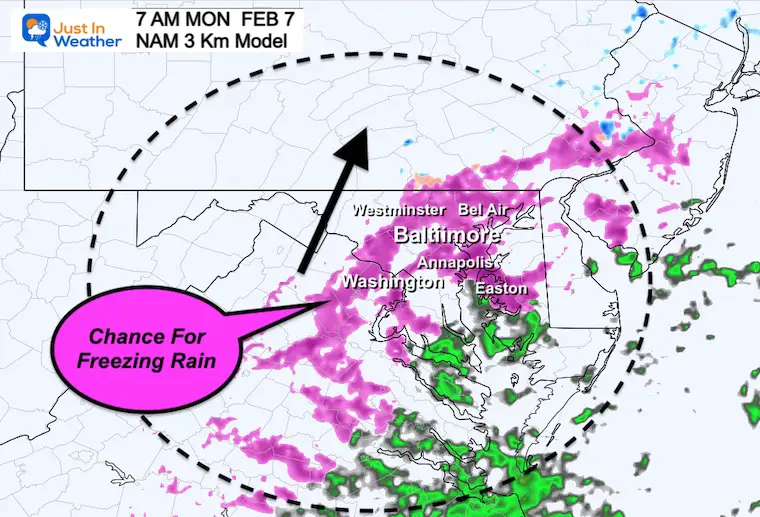
This is NOT showing a widespread icing event. The GFS is quiet as well, which is why your weather app may not be showing it.
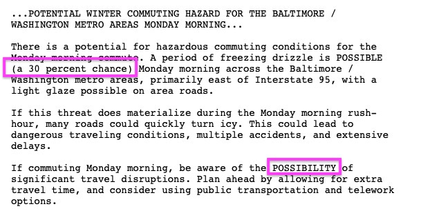
National Weather Service: Statement
I am not alone in this. Here is the NWS Statement trying to show their caution while getting the message out.
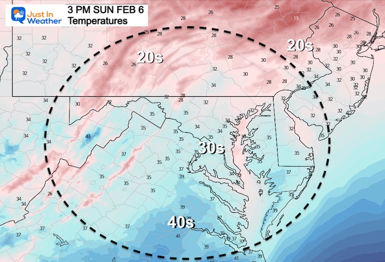
Slow push to thaw during the afternoon
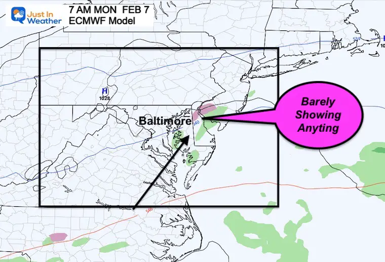
Here is how the European Model is treating this event with rain Monday night into Tuesday morning.
Normal Low in Baltimore: 25ºF
Record +1ºF in 1895
Normal High in Baltimore: 43ºF
Record 72ºF 2008
Winter has more in store…
Mid Month we will see another push of arctic air in the jet stream, We may begin to see this develop at the end of net week, through Valentine’s Day.
Here’s The European Jet Stream Loop
No promise for Valentine’s Day specifically, but that is in the window for wintry weather to make a visit.
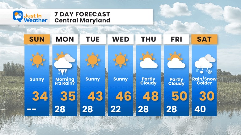
This will be a quiet week, with temps pushing the 40s to near 50ºF.
The next push of cold air will arrive next weekend. It may arrive with a rain/snow mix on Saturday, then arctic air returns Sunday into next week.


Last Winter Recap: My Old Outlook And Your Grades Of My Storm Forecasts


*Disclaimer due to frequent questions:
I am aware there are some spelling and grammar typos. I have made a few public statements over the years, but if you are new here you may have missed it:
I have dyslexia, and found out at my second year at Cornell. I didn’t stop me from getting my meteorology degree, and being first to get the AMS CBM in the Baltimore/Washington region.
I do miss my mistakes in my own proofreading. The autocorrect spell check on my computer sometimes does an injustice to make it worse.
All of the maps and information are accurate. The ‘wordy’ stuff can get sticky.
There is no editor that can check my work when I need it and have it ready to send out in a newsworthy timeline.
I accept this and perhaps proves what you read is really from me…
It’s part of my charm.
#FITF