Saturday March 26 Rain And Snow Showers Then Polar Vortex Disruption
Saturday March 26
Morning Report
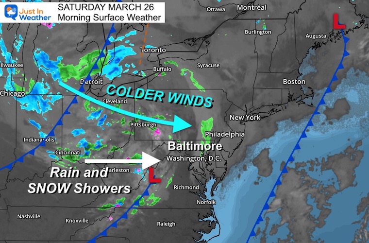
This is the weekend we get the reboot of winter. I have been mentioning the Polar Vortex ‘Disruption’ because that core circulation will be dislodged and pushed south. It will NOT be on top of us, but it will be tracking through northern New England. After seeing snow mixed in with showers and then a few morning deep freezes, it will be hard to doubt.
Today we have a disturbance that will bring in the initial colder air. Rain showers will develop on gusty winds. While the high temp will be near 50ºF, that will be early afternoon, then drop along with some snow or graupel mixed showers.
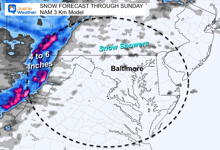
The mountains will be getting accumulating snow with as much as 6 inches in parts of western Maryland.
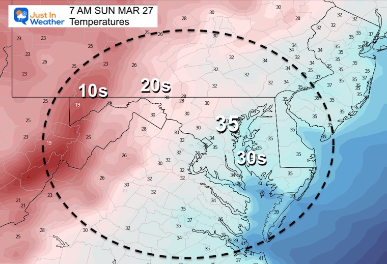
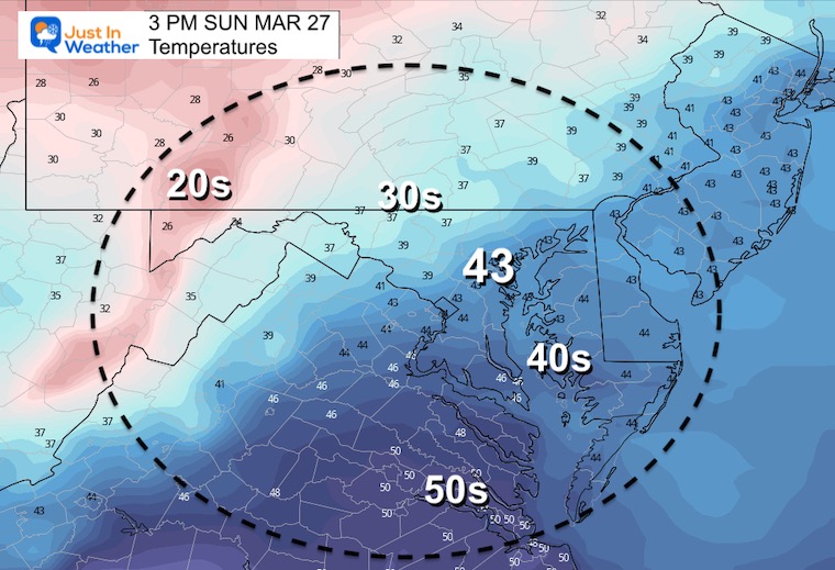
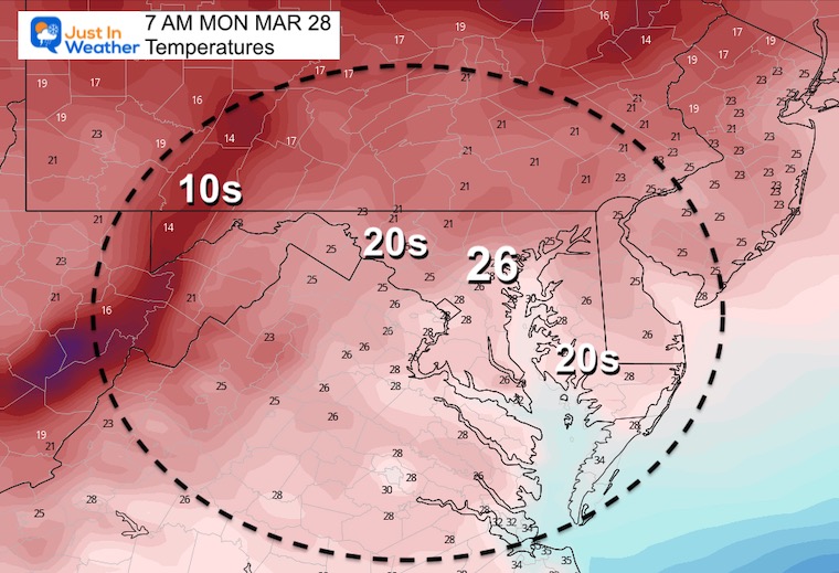
The core of the cold air for metro and coastal areas will be late Sunday into Monday. Most of next week will be chilly, but a brief warm up will come with rain by Thursday. Let’s take a look.
Monday Morning Set Up
Surface Weather
Temperatures

Jet Stream Energy
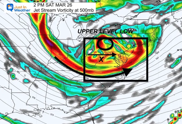
Vorticity (spin aloft) will be pivoting through this afternoon. This encourages cold formation and development of showers
Animation Saturday Morning To Sunday Afternoon

2 PM Snapshot
The main disturbance will move in during the afternoon.
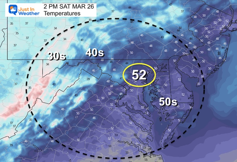
Afternoon Temperatures
Quick Drop From Early Highs
2 PM Temperatures
Your weather app may show a high in the 50s, but that will be early…
Winds
Strong winds may gust to 30 mph and usher in the colder air.

4 PM
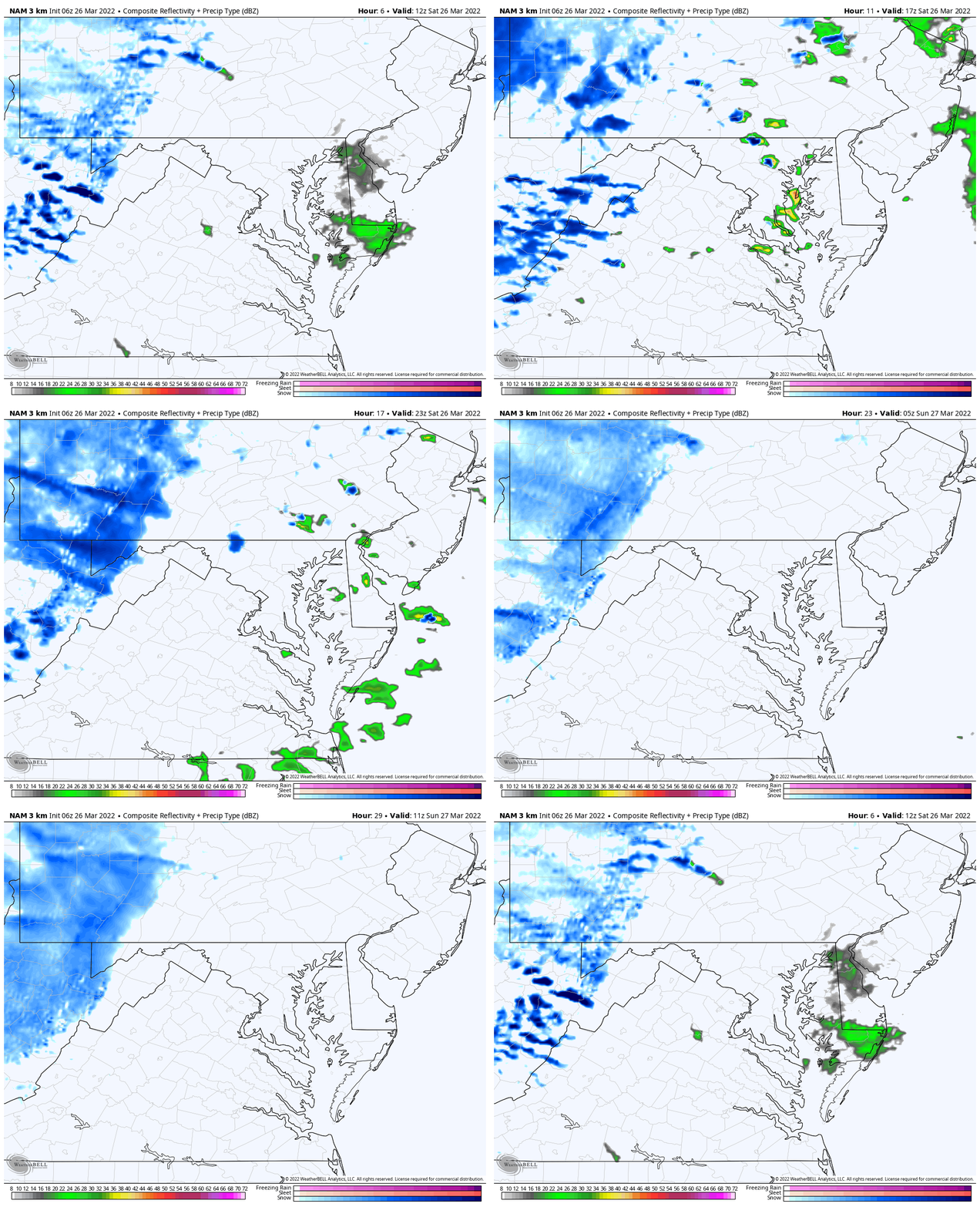
Radar Simulation Timeline —-> slider
Radar Animation To Sunday Morning
NAM 3 Km Model
Snowfall Forecast
Many ski areas have closed for the season, but could see as much as 6 inches of new accumulation this weekend.
CLIMATE DATA
TODAY March 26
Seasonal Snow: 14.4”
Normal Low in Baltimore: 37ºF
Record 21º F in 1878
Normal High in Baltimore: 57ºF
Record 84ºF 1921
Polar Vortex Disruption
Here is a comparison of the Jet Stream Plots From Saturday To Sunday. Here we can see the transition of the Polar Vortex into Northern New York and New England
Saturday Afternoon
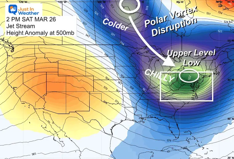
Sunday Afternoon

Sunday Temperatures
Morning
Afternoon
Monday Morning…
Here comes the Deep Freeze
7 Day Forecast

Weather posts straight to your inbox
Sign up and be the first to know!
ALSO SEE
What is Faith in the Flakes: History of December 5th Snow
ALL FITF GEAR
FITF THUNDERSNOW
Winter Outlook Series:
Last Winter Recap: My Old Outlook And Your Grades Of My Storm Forecasts
Winter Weather Page – Lots of resources
Solar Cycle Increasing Sunspots Suggests More Snow
Comparing 4 Different Farmer’s Almanacs: Majority colder winter outlook than NOAA
NOAA Winter Outlook- But Read The Fine Print
Signals For Early Start To Winter In November
Winter Outlook Series: La Nina Double Dip
Nor’easters May Give Hint For Winter La Nina Pattern
Winter Folklore Checklist
Please share your thoughts, best weather pics/video, or just keep in touch via social media
Facebook: Justin Berk, Meteorologist
Twitter: @JustinWeather
Instagram: justinweather
*Disclaimer due to frequent questions:
I am aware there are some spelling and grammar typos. I have made a few public statements over the years, but if you are new here you may have missed it:
I have dyslexia, and found out at my second year at Cornell. I didn’t stop me from getting my meteorology degree, and being first to get the AMS CBM in the Baltimore/Washington region.
I do miss my mistakes in my own proofreading. The autocorrect spell check on my computer sometimes does an injustice to make it worse.
All of the maps and information are accurate. The ‘wordy’ stuff can get sticky.
There is no editor that can check my work when I need it and have it ready to send out in a newsworthy timeline.
I accept this and perhaps proves what you read is really from me…
It’s part of my charm.
#FITF


