Sunday March 27
Morning Report
It definitely feels like winter and is about to get even colder! We had quite a day yesterday in the transition. I am still going through the pics and videos of the snow showers. I have some here, even the 10 inches of snow on the ground in Western Maryland this mornin.g.
The cold winds continue and we still have the core of cold air on the way tomorrow. Then we may have a mid week wintry mix followed by one warm day with thunderstorms.
Saturday Highlights
Grauple (gr-AW-pple)- The type of snow that fell often described as dipping’ dots. Flakes partially melt as the tips curl in, then re-freezes on the way down. Many had temperatures in the mid to upper 40s! Yes, I had one reading as high as 48ºF while it was falling.
Here’s a look at a few video clips shared via Twitter:
This shows it well
This close up shows the grauple texture
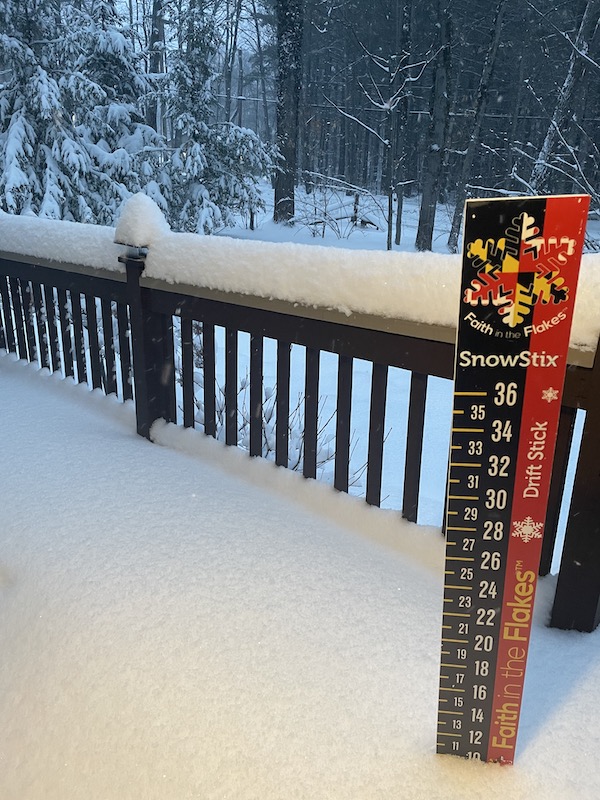
Western Maryland Snow
My friend Kristin Skeweris texted me this:
10” of snow ‘on the ground’ at Deep Creek Lake!
She said likely OVER A FOOT total but a lot compacted user heavy weight. Now it is fluffy. That is a signal of the colder air moving it.
A shame Wisp just closed for the season…
If you are traveling through on I-68, it will be difficult at times again today.
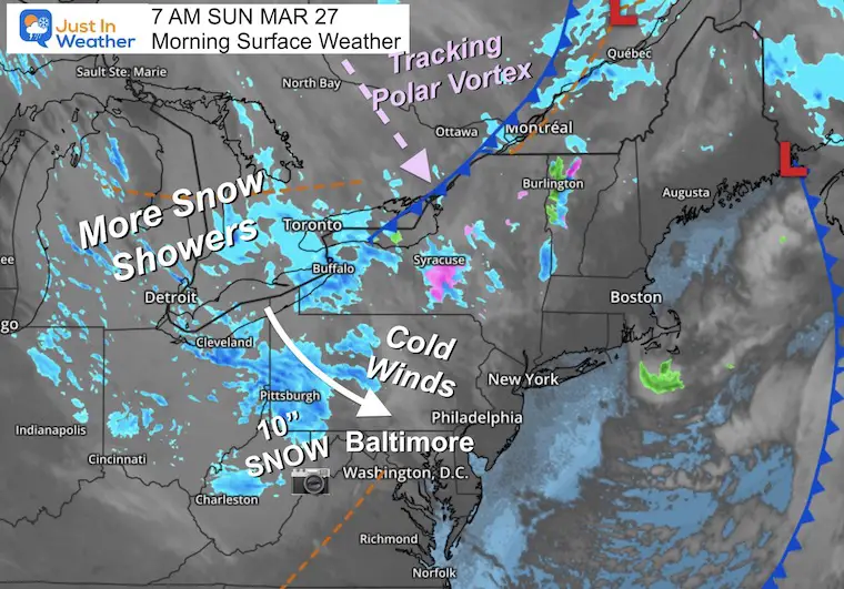
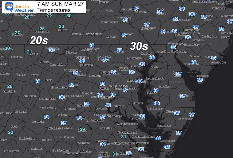
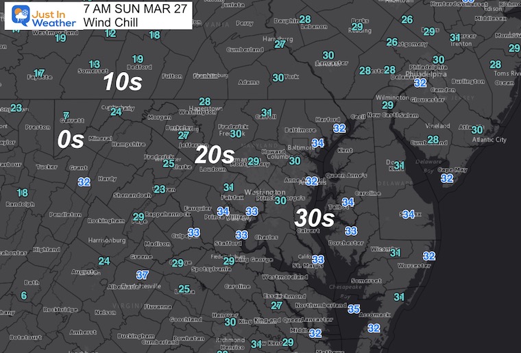
Monday Morning Set Up
Surface Weather
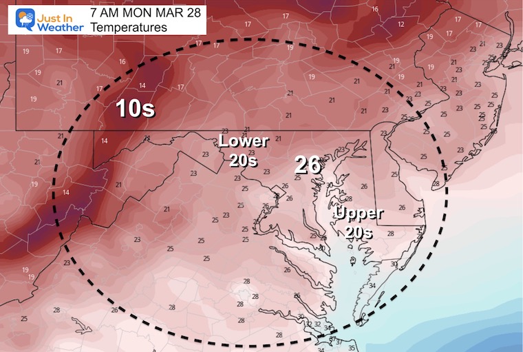
Temperatures
Wind Chill
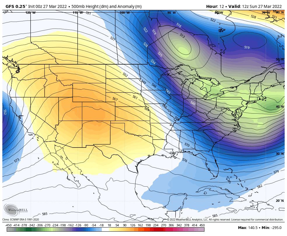
Polar Vortex Disruption
Here we can see the transition of the Polar Vortex into Southern New England. If this was mid winter, we would have an epic arctic outbreak. Now in late March, it is modified a bit, but will still be undeniable. There will be a warm up Wednesday into Thursday. This may start with ice and end with thunderstorms.
SNAPSHOTS
Sunday Morning
It did not arrive yet, but that core circulation in central Canada is what will be diving into the US.
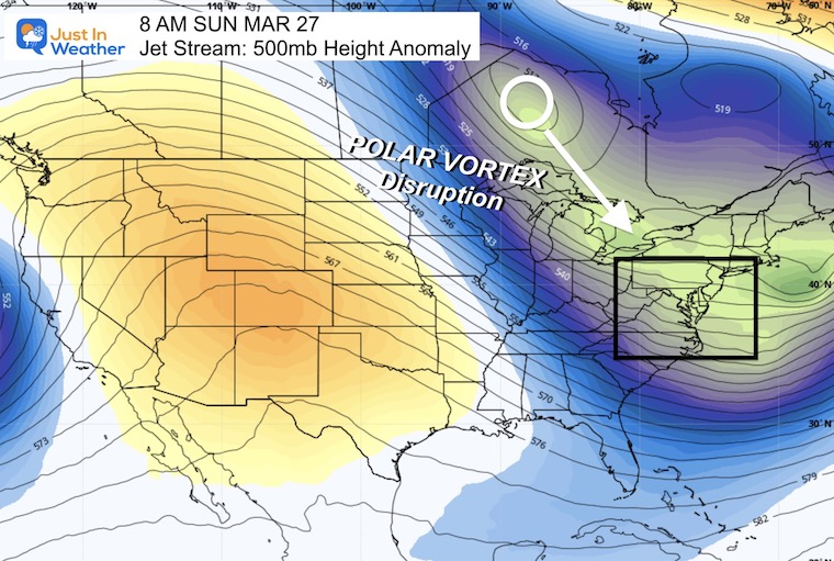
Monday Afternoon
This core circulation has been plotted to track into southern New England, farther south and colder!
Animation Sunday Through Wednesday
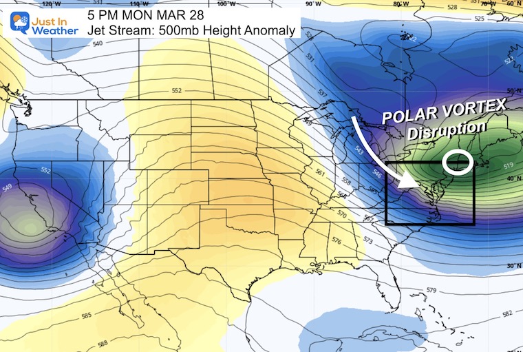
More Snow Showers Today
Radar Simulation 8 AM to 6 PM
The instability will ignite a few more passing flurries or snow showers similar to yesterday.
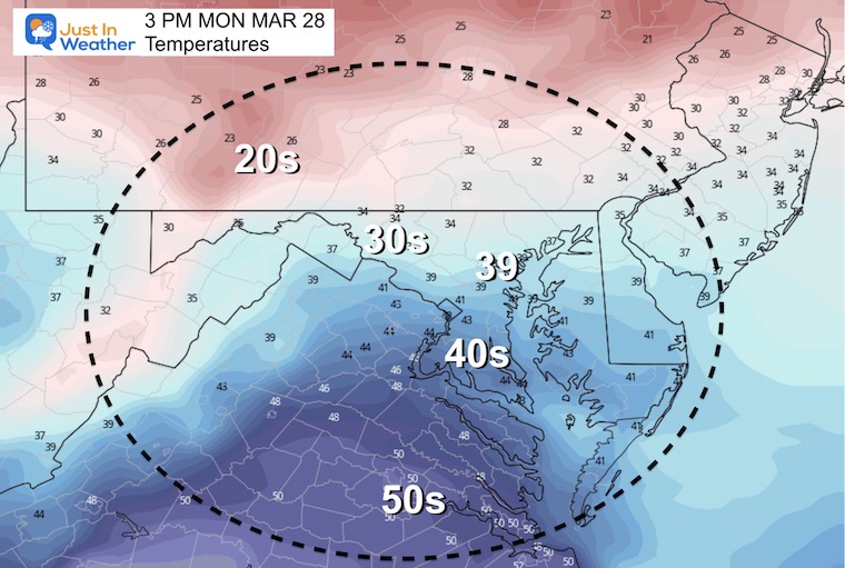
Afternoon Temperatures
CLIMATE DATA
TODAY March 27
Seasonal Snow: 14.4”
Normal Low in Baltimore: 37ºF
Record 20º F in 2014
Normal High in Baltimore: 58ºF
Record 86ºF 1921
Monday Temperatures
Morning
Record for Baltimore = 21ºF in 1982
Afternoon
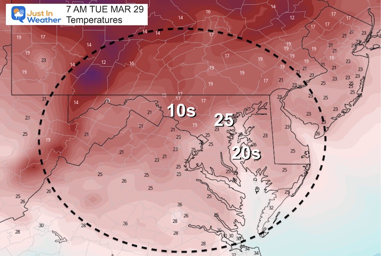
Tuesday Morning…
Record for Baltimore = 18ºF in 1923
Looking Ahead
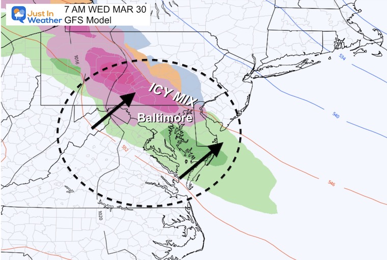
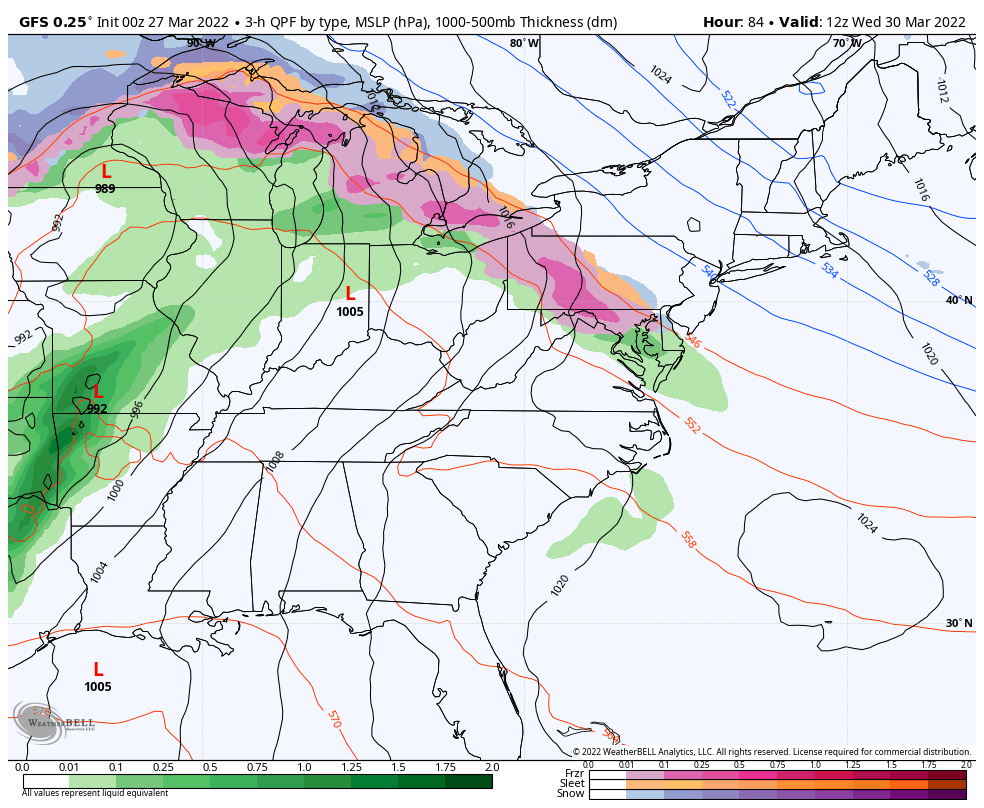
Mid Week Ice?
Still watching the transition to warmer air that may bring in a snow/sleeet mix on Wednesday morning. I doubt there will be much of a problem, but we may need to watch inland areas that tend to be colder given the timing of the day.
Wednesday Morning Snapshot
Forecast Animation Wednesday Morning To Friday Morning
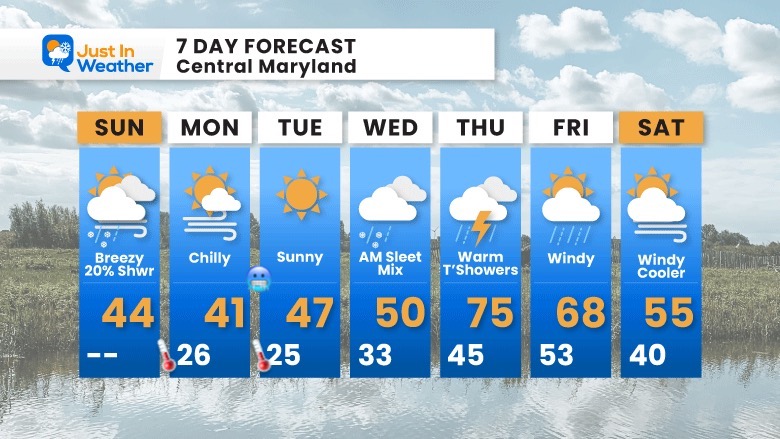
7 Day Forecast
Transition from COLD to some icy mix, then the WARM DAY brings a chance for thunderstorms. Colder air next weekend, but not as cold as what we currently have.
ALSO SEE
ALL FITF GEAR

FITF THUNDERSNOW


Winter Outlook Series:
My Call For Snowfall

Last Winter Recap: My Old Outlook And Your Grades Of My Storm Forecasts


Please share your thoughts, best weather pics/video, or just keep in touch via social media
*Disclaimer due to frequent questions:
I am aware there are some spelling and grammar typos. I have made a few public statements over the years, but if you are new here you may have missed it:
I have dyslexia, and found out at my second year at Cornell. I didn’t stop me from getting my meteorology degree, and being first to get the AMS CBM in the Baltimore/Washington region.
I do miss my mistakes in my own proofreading. The autocorrect spell check on my computer sometimes does an injustice to make it worse.
All of the maps and information are accurate. The ‘wordy’ stuff can get sticky.
There is no editor that can check my work when I need it and have it ready to send out in a newsworthy timeline.
I accept this and perhaps proves what you read is really from me…
It’s part of my charm.
#FITF


