


January 13 Mild Ahead Of Arctic Front That Will Bring Rain To Snow Later Wednesday
Tuesday January 13 We are once again back to mild afternoons with sunshine, but that is about to change. The next cold front will usher in a series of arctic…
Saturday January 22 – Morning Report
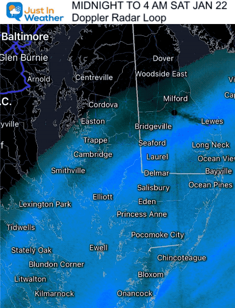
The core of this arctic cold air is in place this morning, following the overnight snow that fell over the beaches. The snow expanded a little farther north as evident by the Winter Weather Advisory issued for southern Delaware.
Reports range from a coating to 3 inches in Ocean City. See the radar and some photos below.
We remain cold this weekend, and shift our focus to a Clipper that will arrive with snow showers Sunday that could bring a fresh coating.
What’s next? Perhaps you heard about a big storm next weekend. I have some news maps that help reinforce why I do not like to discuss far out winter storms for our region.
Radar Loop Midnight to 4 AM
The light snow got close to Easton and Rehoboth.
More snow fell south and east.
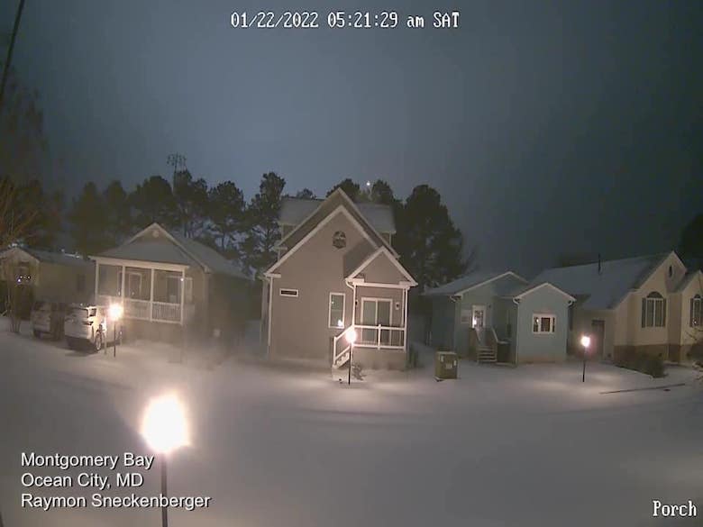
Photos Shared On My Facebook Page
More reports will fill in the numbers as people wake up and measure.
Ocean City snow reports up to 3 inches.
Snow Hill, MD pushing the 2 inch mark.

Snow in Salisbury appears to have dropped at least 1 inch on the ground.

The coastal storm is moving offshore. It produced heavy snow (over 5 inches) from Virginia Beach to central North Carolina. An impactful ice storm occurred over coastal South Carolina!
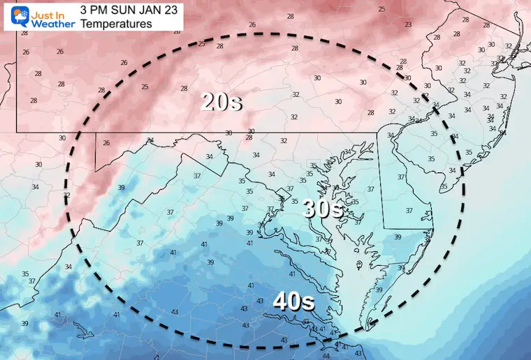
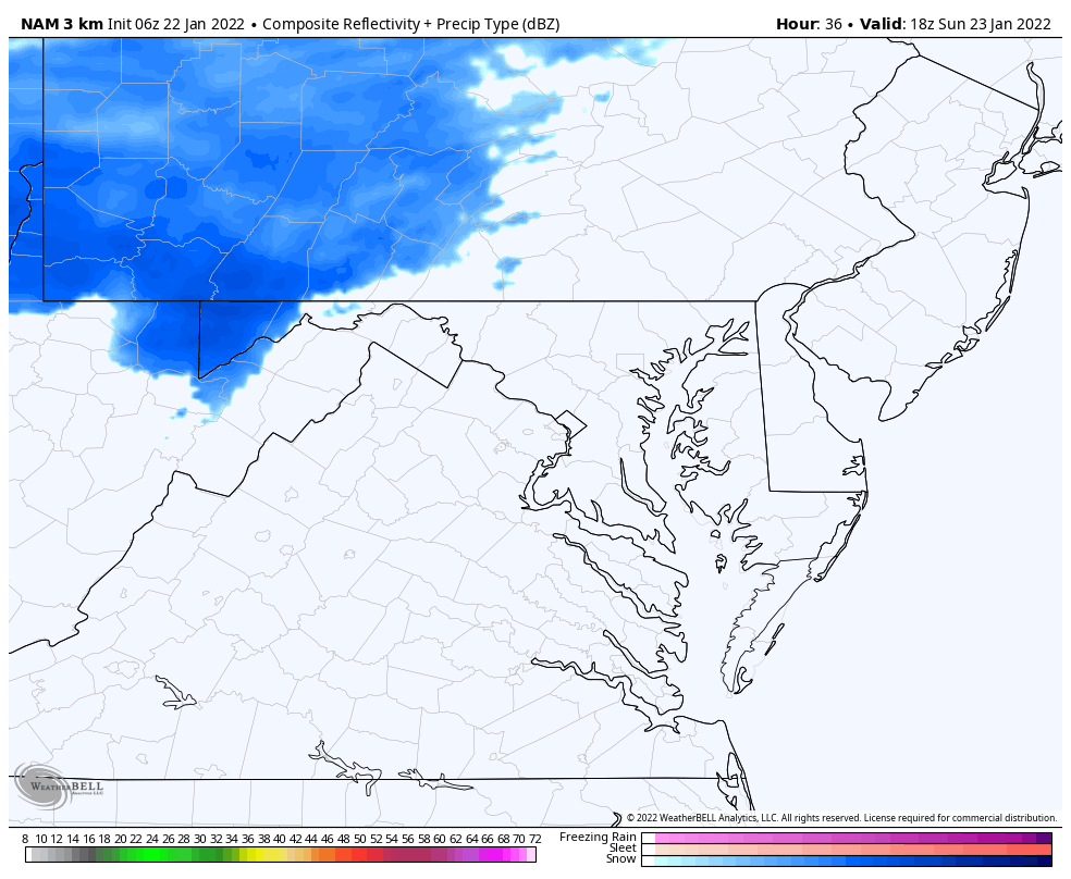
Clipper: The next system will race from the Great Lakes to reach us Sunday afternoon.

Arctic Air has brought temps to the -20s to northern New England and around Montreal Canada.

Single Digits just north and west of Baltimore.
BWI may have missed the elusive 14ºF mark, but there my be another chance next week.
Teens in metro areas, and 20s to the coast.


If you missed it:
Click to participate in Grade My Forecast For Thu Jan 20 Snow (or no snow)
TODAY January 22
Normal Low in Baltimore: 24ºF
Record -7ºF in 1984
Normal High in Baltimore: 41ºF
Record 69ºF 1927
Morning

Afternoon
1 PM to Midnight
There may be some bursts of snow that can coat the ground during the afternoon and evening.
This comparison is why I DO NOT trust model outlooks for winter storms one week away. I have skipped the social media buzz many times and many ties it worked out. Case in point, the storm today was shown last week to be ‘a big one’ for us. I didn’t bite and will not bite here.
The model runs Friday evening showed a push east (again), with the ECMWF Model a little closer. But there is still a lot of uncertainty.
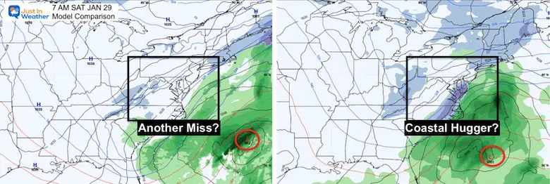
Once again the American Model came back with an impactful snow event for the cities next weekend.
The pattern looks very good! The specific details are less confirming and the computer guidance has not been supportive beyond 5 days.
I will watch it, but too early to get excited or change any plans.

At first glance following Atmospheric Memory or ‘the trend is your friend’ makes me want to downplay the potential next weekend to follow something similar to what we just saw… But I do have Faith in the Flakes. The pattern is robust and subtle changes in the amplitude of the jet stream can make a big difference in storm track… So we will watch with cautious optimism.
Sign up and be the first to know!


Last Winter Recap: My Old Outlook And Your Grades Of My Storm Forecasts


