


January 13 Mild Ahead Of Arctic Front That Will Bring Rain To Snow Later Wednesday
Tuesday January 13 We are once again back to mild afternoons with sunshine, but that is about to change. The next cold front will usher in a series of arctic…
Thursday January 20 2022
8 PM
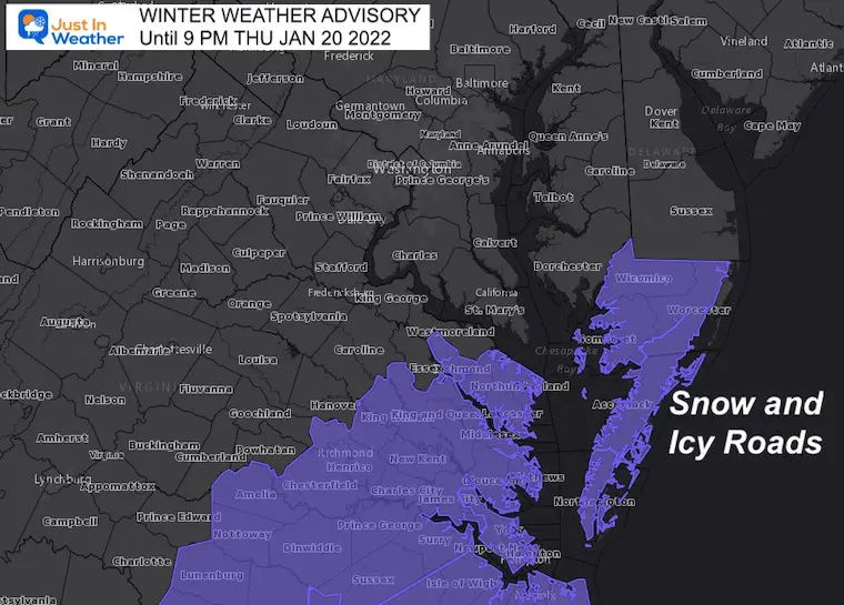
The snow attention has shifted to the Lower Eastern Shore of Maryland. Perhaps I could have titled this The White Sands Of Ocean City?
I intend to wrap up this event an ask you to grade my forecast, but it is not done yet. While we missed out on the snow and ice in metro areas, it is raging across lower Delmarva. At least this part of my forecast worked out.
This is an area not accustomed to dealing with a lot of wintry weather, so limited equipment may make for the travel problems to extend through Friday.
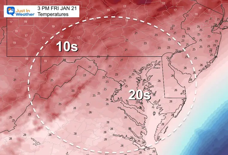
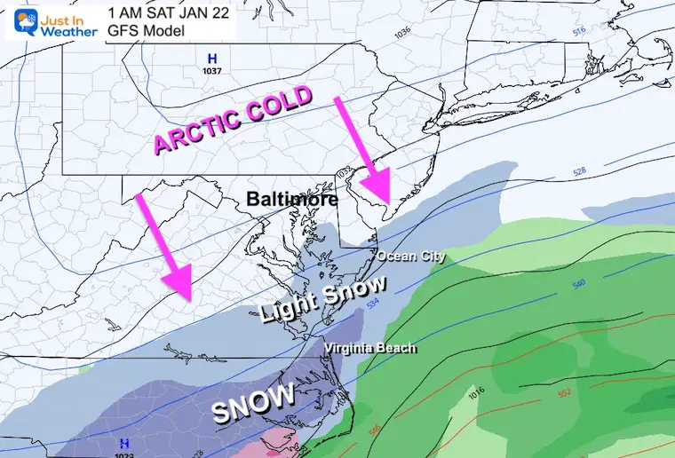
A deep freeze will follow the snow, and temps remain in the 20s all day Friday. Then a little snow will clip this same region Friday night.
The main issue here is for snow falling that will stick along with falling temps. So wet roads that are not treated have already been icing over.
While this includes Salisbury and Snow Hill. I would expect any place that had recent snow and the ground is still wet, will have icy unless it is treated.
Snow has continued all day in Southern Maryland. It has become more of an issue with stickage since the sun got low enough in the sky after 4 PM.
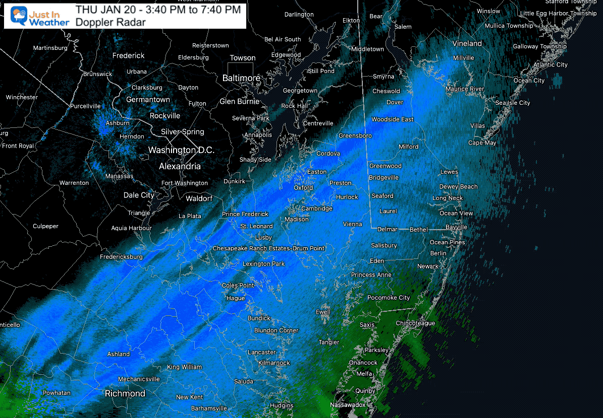
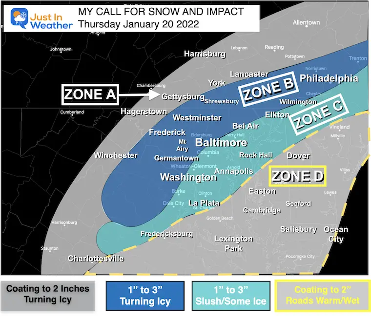
Zones A, Part of B, and D worked out! Well, that was during the day. The same force that delayed the cold air for central Maryland this morning, also slowed down this system this evening. That is why their wet roads are now icing up.
Most of my Zone B and C was where I busted. I will have a a wrap up of this on Friday.
Here’s a look at the arctic air that will follow. This snow region will be in the 20s, while teens and even some isolated 0s will be in the cities, central Maryland, and farther west/north.
Reminder: A low of Southern Maryland may have had wet roads from the earlier snow, plus in the evening’s snow zone. There will be lots of icing where roads, sidewalks, and steps are not fully treated. Be careful int the morning.
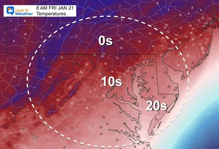
Not much warming as temps remaining in the 20s.
The coastal storm will barely clip this same region as it moves farther off shore. This is the storm I did not spend much time talking about, and it was for the best.
The beaches may get a fresh coating up to 2 inches, ending by Saturday morning.
Sign up and be the first to know!


Last Winter Recap: My Old Outlook And Your Grades Of My Storm Forecasts


