Wednesday January 19 2022
Afternoon Update
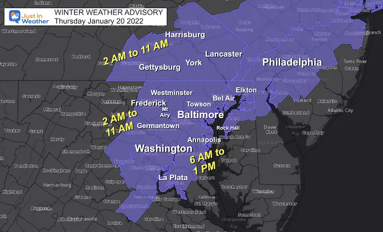
Finally! The National Weather Service has issued a Winter Weather Advisory for Thursday morning to include central Maryland. I mention this because I have been sharing my forecast with my clients for two days, and they are prepared. But for some road clearing contractors, there is more validation of the forecast for their clients.
As for the schools, there is a narrow window Thursday morning when rain will change to slushy snow, then that may ice up all during the commute. I see at least a delay potential for region wide schools.
Winter Weather Advisory
From National Weather Service- Baltimore/Washington
Split into 2 zones for timing- based on the arrival of snow, then near freezing temps.
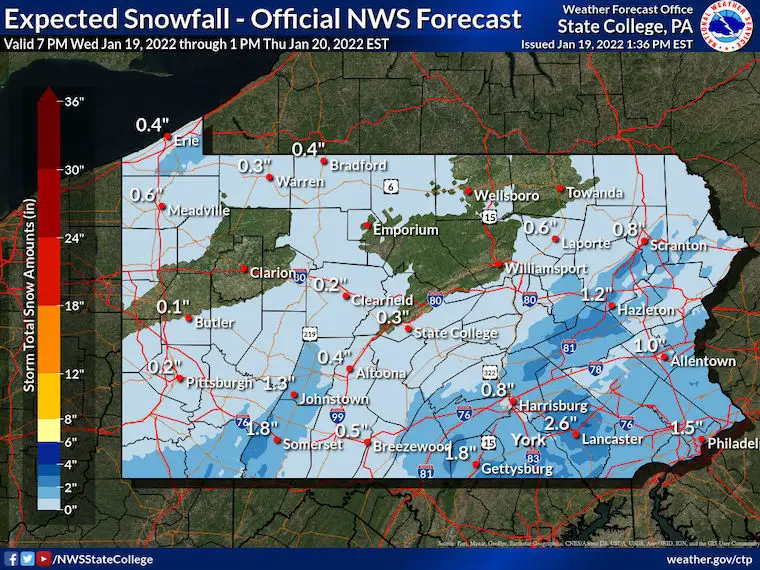
*Southern PA county may still be added. That is up to NWS State College.
North Zone:
- Before sunrise: Rain to snow. Slushy then icy roads.
- Up to 2 inches of snow. Isolated spots to 3 inches
South Zone:
- Includes Baltimore Beltway, Annapolis, and metro Washington.
- A little later, and marginal temps.
- Slushy roads ‘may’ got icy. But temps will be slightly above or below freezing.
See the latest timeline breakdown for radar and temps below.
UPDATE:
ADVISORY EXPANDED TO INCLUDE SOUTHERN PA
HEADLINES:
- Thursday morning: Transition to snow between 6 AM and 9 AM in central Maryland. Temps falling below freezing west/north of Baltimore 1 to 2 hours after snow begins. Slushy stickage will lead to icing on roads.
- Thursday Mid Day/Afternoon: Snow ends for Baltimore, expands to Southern Maryland and Delmarva.
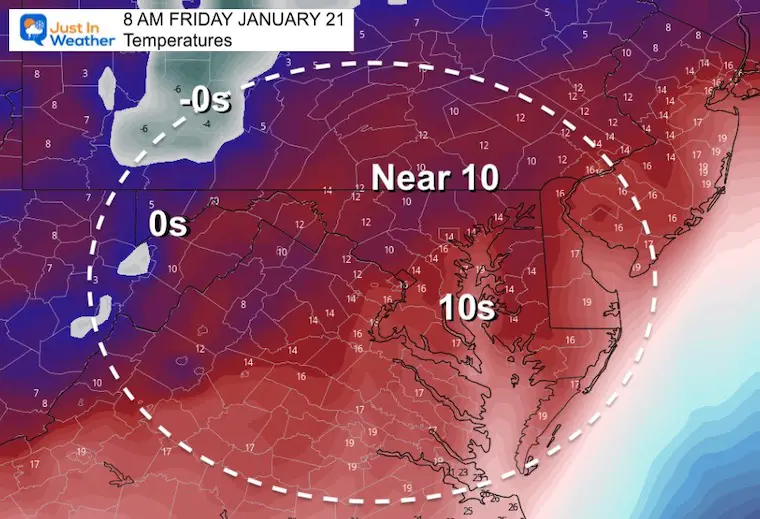
- Friday: Arctic Air returns. Lows in the Teens, Highs in the 20s.
NWS Forecast Maps
Click Here For: Full package of NWS snow maps
*My call is very similar to this. I will work on my personalized map in a bit.
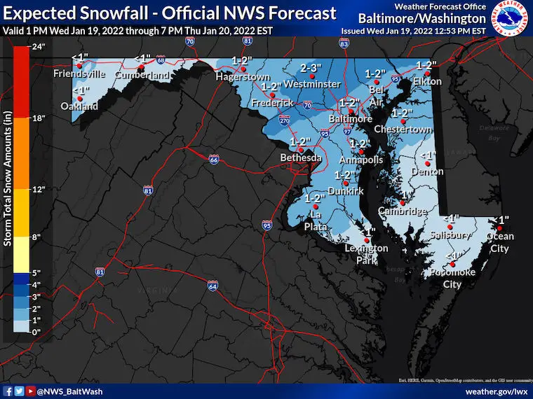
Notice the NWS forecast has Southern PA with up to 2 inches of snow. They should be added to the Advisory.
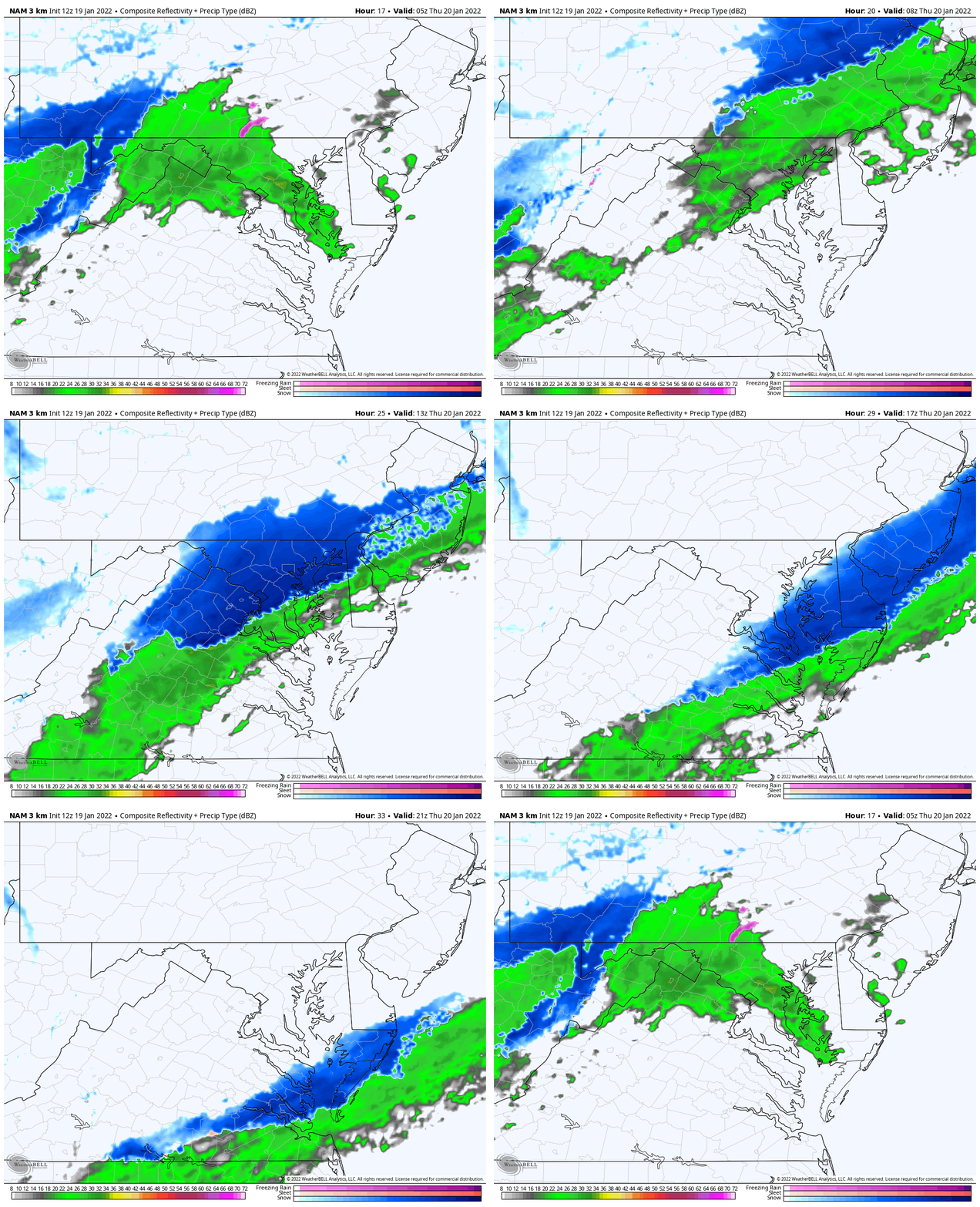
Radar Simulation Animation
12 AM to 4 PM
Rain will transition to snow in central Maryland between 6 AM and 10 AM. The wave of Low Pressure may sent the northern edge of snow back north into Pennsylvania for additional snow coating there for a couple of hours.
Snow will linger in southern Maryland and The Lower Eastern Shore during the afternoon.
Tonight/Thursday Morning
Closer look at this snow development.
Rain showers tonight, then turns to snow during Thursday morning. Snow will fall with slushy stickage on roads… THEN temps drop to freezing west and north 1 to 2 hours after the change to snow. This will be during the morning commute and could lead to an icy mess.
Please note the time stamps. Should this arrive an hour or two faster then even more impact on the metro commute is likely.
Radar Simulation and Temperatures
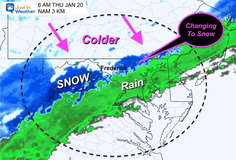
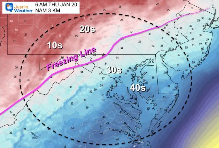
6 AM
Watching the snow develop near Frederick and the PA line in Baltimore County.
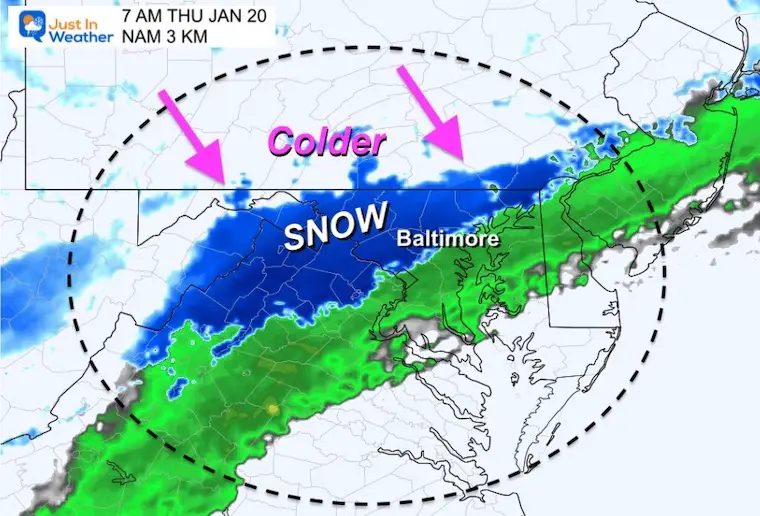
7 AM
Snow should expand to Baltimore. Steady snow expected between Frederick, Westminster, and perhaps Bel Air.
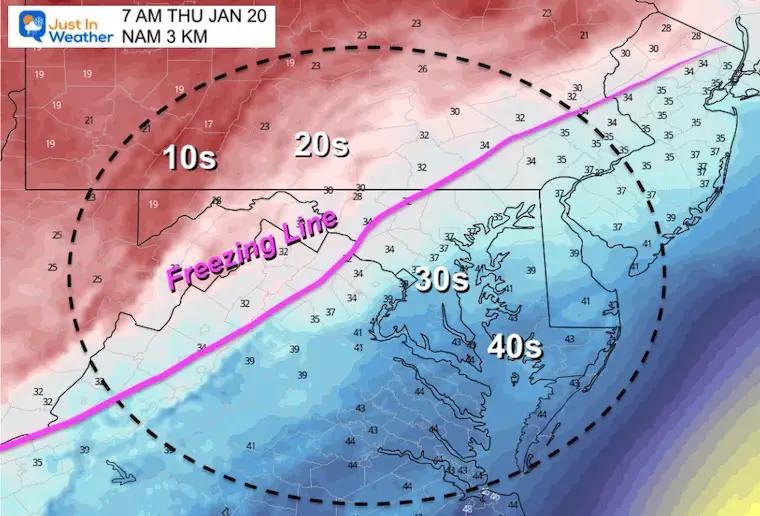
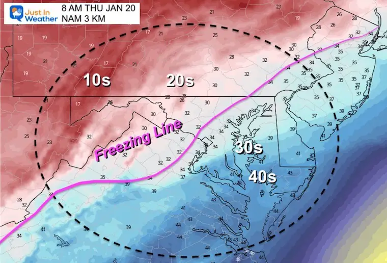
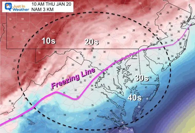
The Freezing Line will reach 1 to 2 hours after the snow begins.
This should reach Frederick to Westminster and York PA at this time.
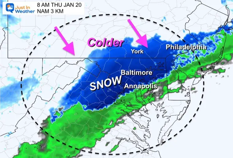
8 AM
Snow will expand south to near Annapolis.
The freezing line should reach Germantown, Westminster, and northeast to Forest Hill.
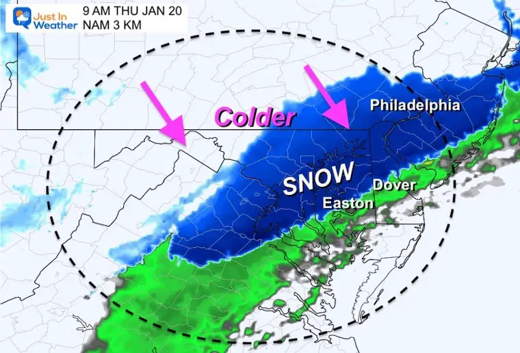
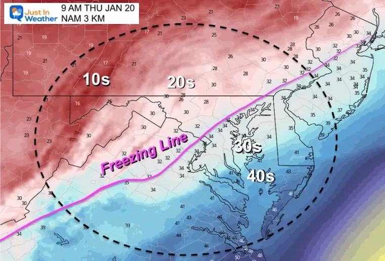
9 AM
Snow should arrive in Kent Inland and Easton. Also close to Dover.
A brief north push into southern PA may expand the coating on the roads.
Temps down to the 20s in Carroll County will accelerate the chance for icing on the roads.
The freezing line will be close to the Baltimore AND Washington Beltways.
10 AM
Snow should be ending in metro Baltimore, but expanding to southern Maryland.
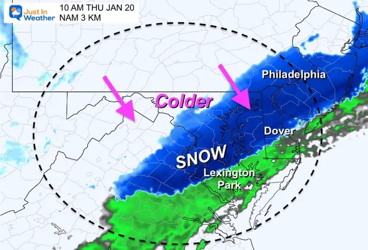
The freezing line will be close to I-95 and remain nearly stationary during the day.
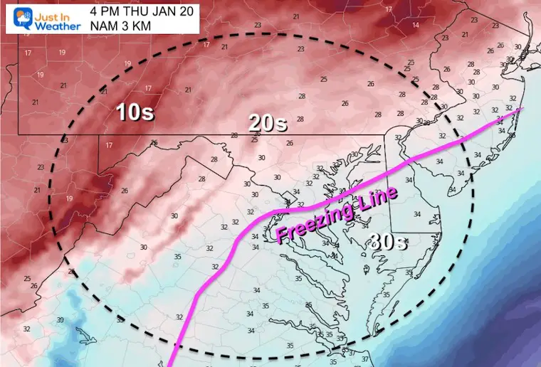
Late Afternoon
The freezing line will still be draped across Rt 50/Bay Bridge areas. So the snow in Southern Maryland may be melting on the pavement.
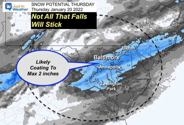
How much Snow?
Please note this is the NAM forecast, not mine. I am showing you because I think the general expectation of 1 to 3 inches is a good starting point.
COMPARE TO
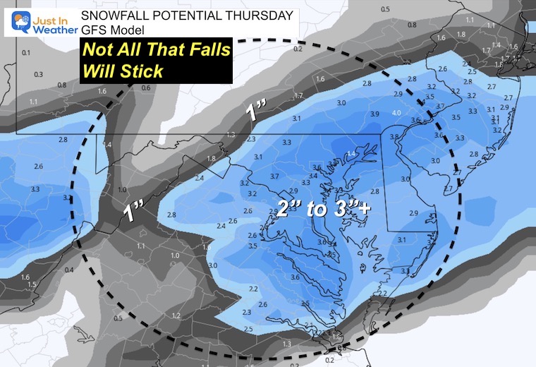
GFS Model
This is very aggressive with snow totals. However I still think not all that falls with stick due to some initial melting.
Friday Morning Temperatures
Here’s a look at the arctic air that will follow.
Weather posts straight to your inbox
Sign up and be the first to know!
ALSO SEE
What is Faith in the Flakes: History of December 5th Snow
ALL FITF GEAR
FITF THUNDERSNOW
Winter Outlook Series:
Last Winter Recap: My Old Outlook And Your Grades Of My Storm Forecasts
Winter Weather Page – Lots of resources
Solar Cycle Increasing Sunspots Suggests More Snow
Comparing 4 Different Farmer’s Almanacs: Majority colder winter outlook than NOAA
NOAA Winter Outlook- But Read The Fine Print
Signals For Early Start To Winter In November
Winter Outlook Series: La Nina Double Dip
Nor’easters May Give Hint For Winter La Nina Pattern
Winter Folklore Checklist


