Sunday January 9 2020 at 8 PM
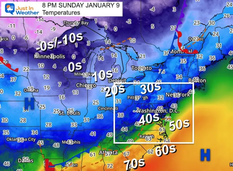
The rain with this front is still slowly pushing across our region. There is no ice nearby at the moment, but it is chilly with mid 30s to mid 40s Sunday evening. It will not take much to refreeze.
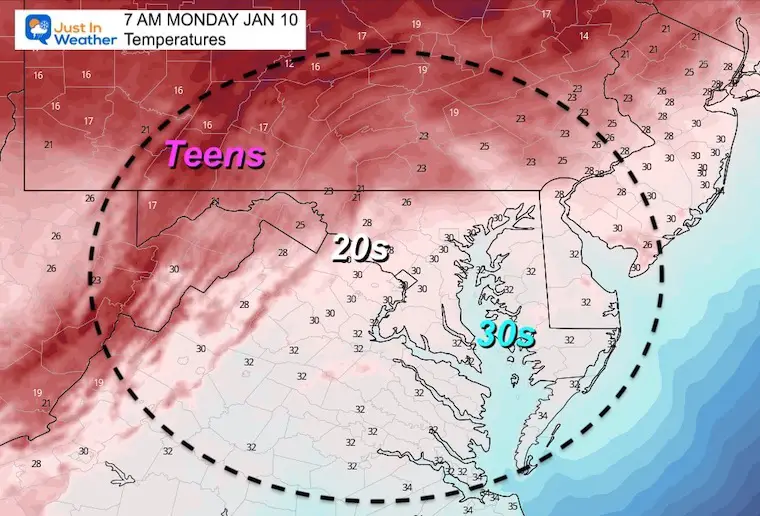
Temperatures are expected to fall into the 20s by daybreak, with near freezing in Southern Maryland and Delmarva. However, that will come with gusty winds. So the race is on for the wet roads. Will the winds dry them out before the temps can ice them over?
Below is the set up this evening and forecast for morning weather.
I have learned to not make a guess for road conditions and school calls. What I can do is show you the information and chance to plan and check in the morning.
Why? I do not know how your local main and side roads will be treated. I also do not assume to know the comfort level of your decision makers. I can only speak for the school I work with personally. I can also suggest you throw down salt on your walkways and driveways before going to sleep.
Sunday Evening Set Up
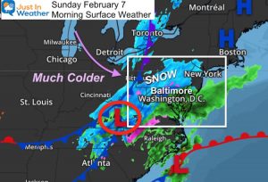
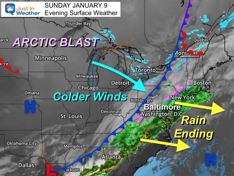
Surface Weather
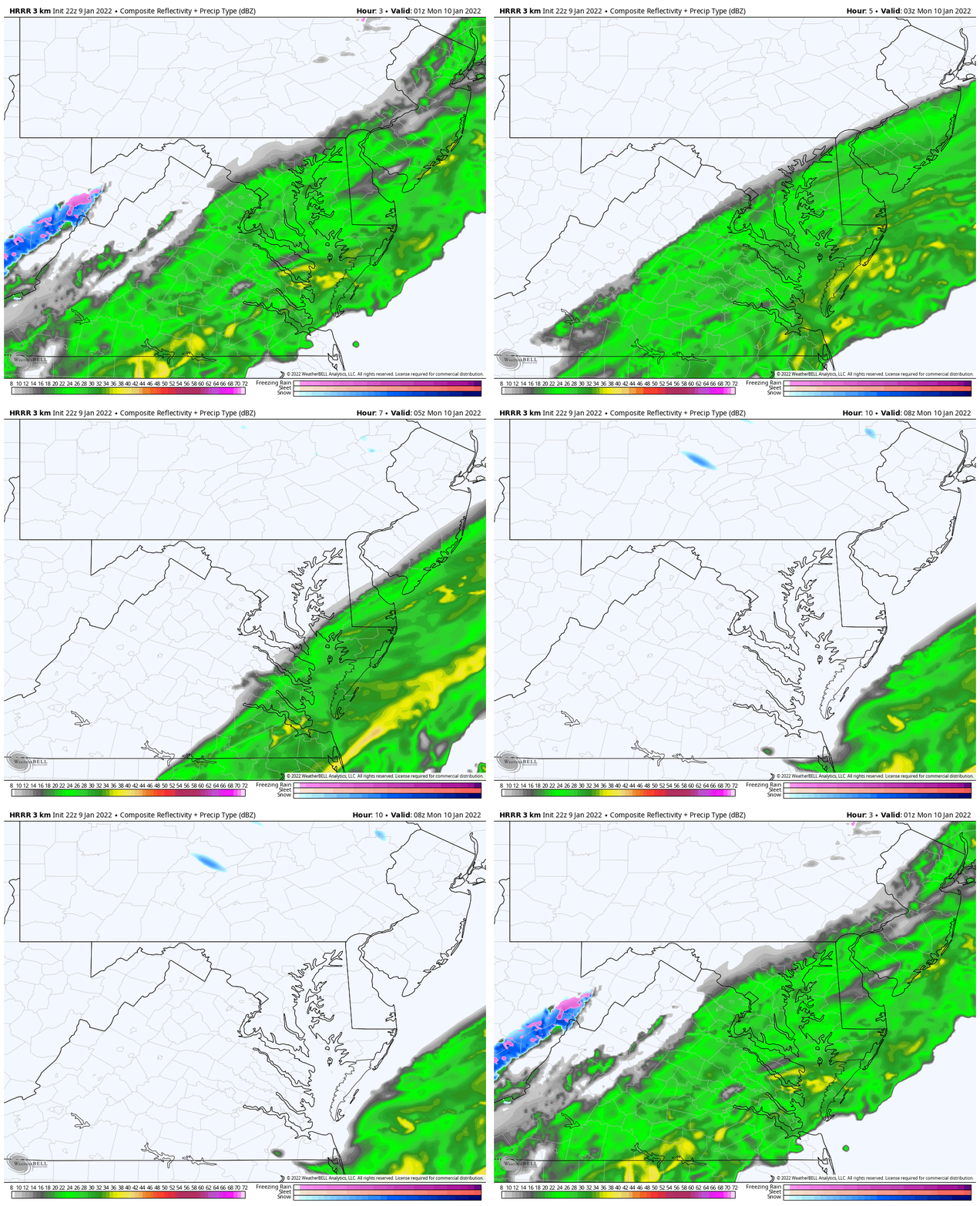
The line of rain is still over half of our region. See the forecast timeline radar simulation below.
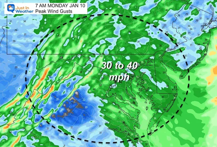
The cold from to the west is the leading edge of arctic air. We will get strong gusty winds overnight that could peak over 35 mph.
One thing for sure: It will feel like like true winter over the next few days!
Temperatures
Locally we range from the mid 30s to mid 40s.
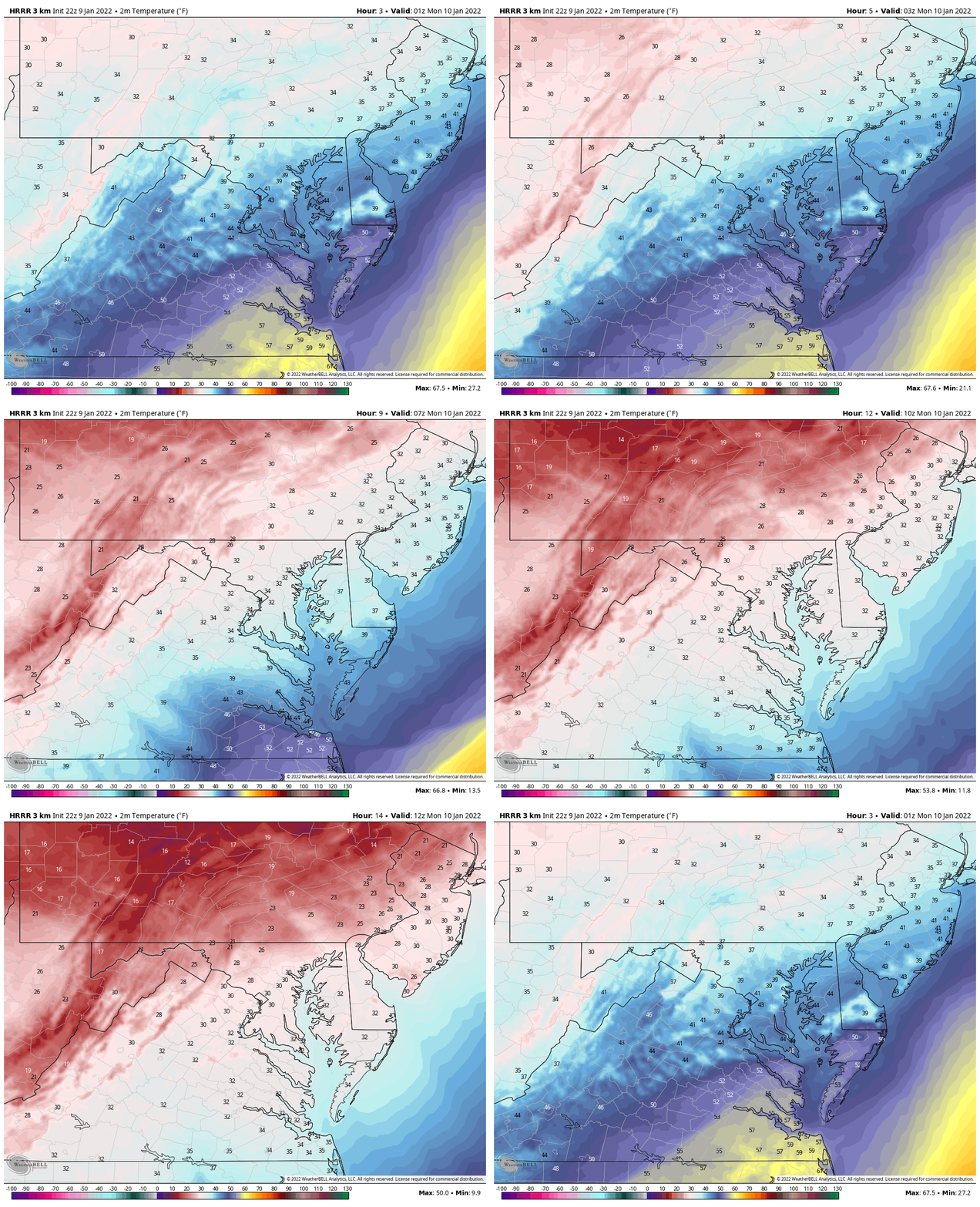
Freezing temps will arrive after midnight. The source of Arctic Air will push in our coldest temps on Tuesday.
Radar Simulaiton
The band of rain will be south of Annapolis by midnight and off of the coast by 3 AM
Temperature Animation:
Freezing temps will reach metro Baltimore between 1 AM and 3 AM. Then it will reach Annapolis to Salisbury between 4 AM and 6 AM.
Morning Snapshot
Lows will drop into the 20s for most of the region.
Freezing will reach southern Maryland to Delmarva.
Here’s the Dilemma…. The Winds
Will they be enough to dry out wet pavement before the cold temps can freeze any dampness?
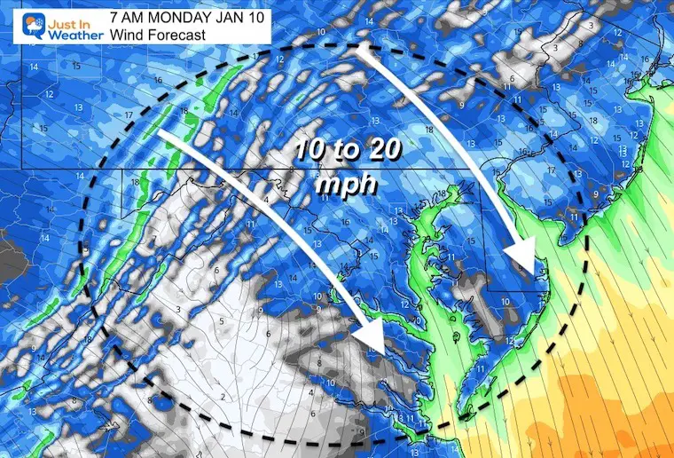
The cold air will arrive with strong, gusty winds from the Northwest.
At daybreak, this will average between 10 and 20 mph.
At the peak, they will gust over 35 mph.
Wind Speed And Direction
Peak Wind Gusts
So the question is still not answered. Yes, there is a chance there could be ice on untreated areas. This is going to require an early morning assessment.
Thankfully we have a few hundred thousand people on my social media outlets. I will put out the request early for local accounts. You can help with that too, if up early. I know most will be asleep, but I believe enough will be up with me to hopefully help out.
What to do:
Throw down salt on your steps, walkway, driveway, etc.
Kids and teachers, make sure your work is done!
If you have other work, you may want to allow a few extra minutes to check on conditions, and maybe thaw out your car. Wet doors can ice up quickly.
See you in the morning.
Weather posts straight to your inbox
Sign up and be the first to know!
ALSO SEE
What is Faith in the Flakes: History of December 5th Snow
ALL FITF GEAR
FITF THUNDERSNOW
Winter Outlook Series:
Last Winter Recap: My Old Outlook And Your Grades Of My Storm Forecasts
Winter Weather Page – Lots of resources
Solar Cycle Increasing Sunspots Suggests More Snow
Comparing 4 Different Farmer’s Almanacs: Majority colder winter outlook than NOAA
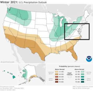
NOAA Winter Outlook- But Read The Fine Print
Signals For Early Start To Winter In November
Winter Outlook Series: La Nina Double Dip
Nor’easters May Give Hint For Winter La Nina Pattern
Winter Folklore Checklist


