Sunday January 9 2022 at 9 AM
The developing freezing rain this morning expanded to much more of metro Washington and central Maryland. This was another over performing event that short range models failed to accurately depict the coverage and timing this morning.
We are in Now-Casting Mode
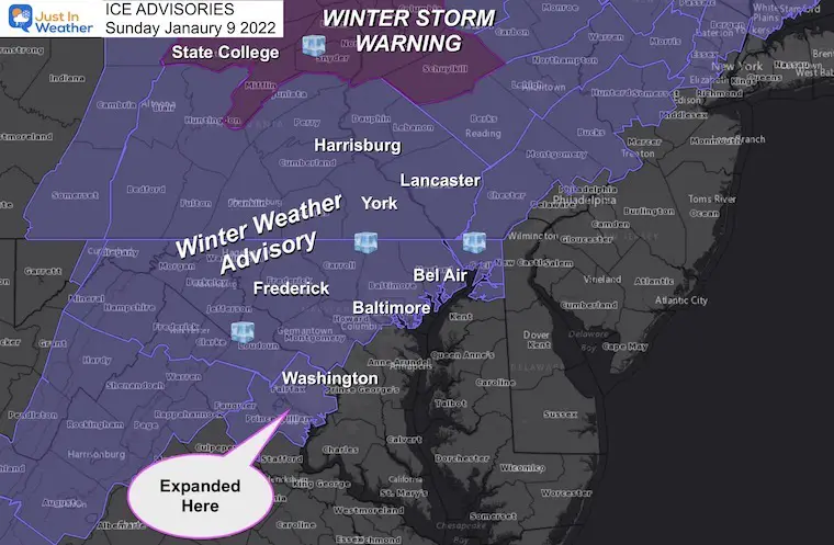
Ice Advisories UPDATED
Expanded Winter Weather Advisory in Northern Virginia
Prince William/Manassas/Manassas Park, Fairfax and
Southern Fauquier Counties.
Winter Storm Warning: Heavy Icing
Includes State College in central PA
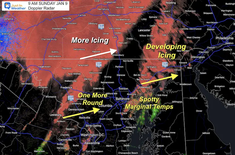
Doppler Radar at 9 AM
Ice has developing in many parts of metro Washington to Baltimore and Northeastern Maryland.
This included Anne Arundel County that was not in the Advisory.
Another round of freezing rain and sleet will move east over the next 2 hours.
Expecting thawing between 11 AM and Noon for most areas, but where ice develops it could take time to melt.
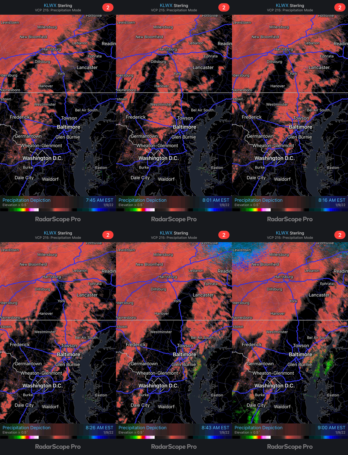
Radar Loop
2 Hours ending at 9 AM
Anne Arundel County got in on this
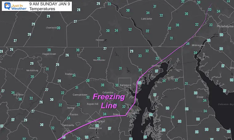
Temperatures at 9 AM
Radar Simulaiton —-> sldier
This is MISSING the freezing rain in central Maryland! Please use caution.
I am showing this for the transition timing to rain mid day.
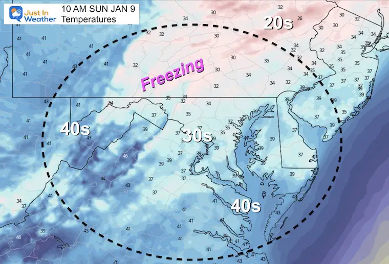
10 AM Temperatures
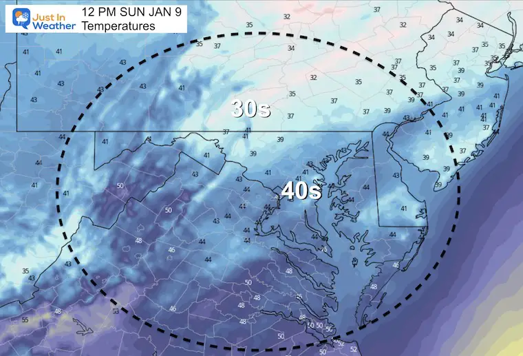
Noon Temperatures
HRRR Full Animation
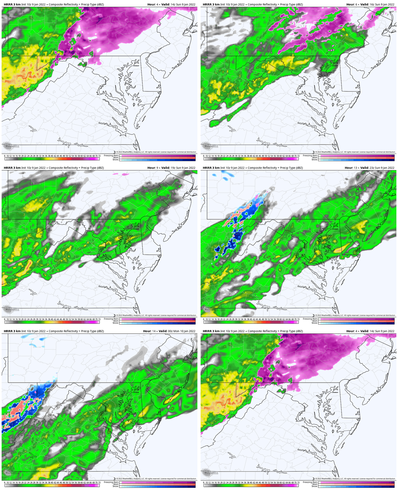
This is MISSING the freezing rain in central Maryland! Please use caution.
I am showing this for the transition timing to rain mid day.
10 AM to 7 PM
Here we can see the transition north of Baltimore between 10 AM and noon. Then a chilly rain, which could be heavy at times over Baltimore and Ravens game through the afternoon.
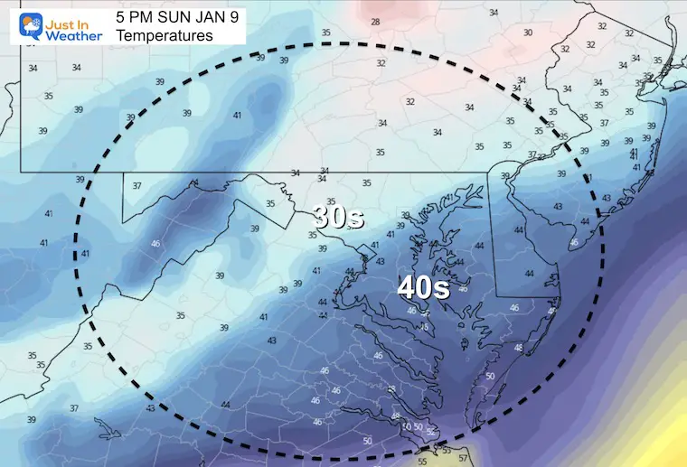
Afternoon Temp
This will be just a chilly rain (above 32ºF) this afternoon.
NOTE:
We will clear tonight and turn windy. Then the race will be on for the wind to dry the pavement or ice things up by morning.
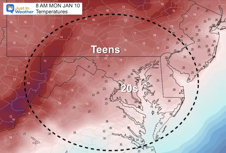
Monday Morning Temperatures
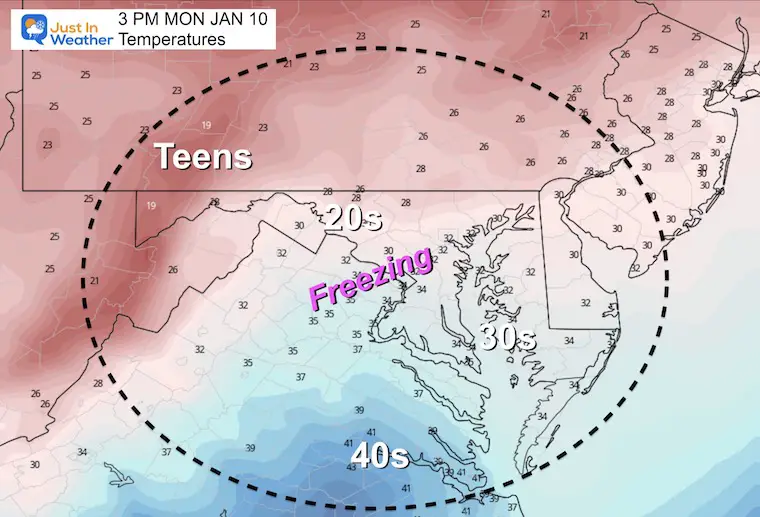
Monday Afternoon Temperatures
Weather Almanac: Climate Data
TODAY January 9
Normal Low in Baltimore: 24ºF
Record 2ºF in 1970
Normal High in Baltimore: 41ºF
Record 75ºF 1937
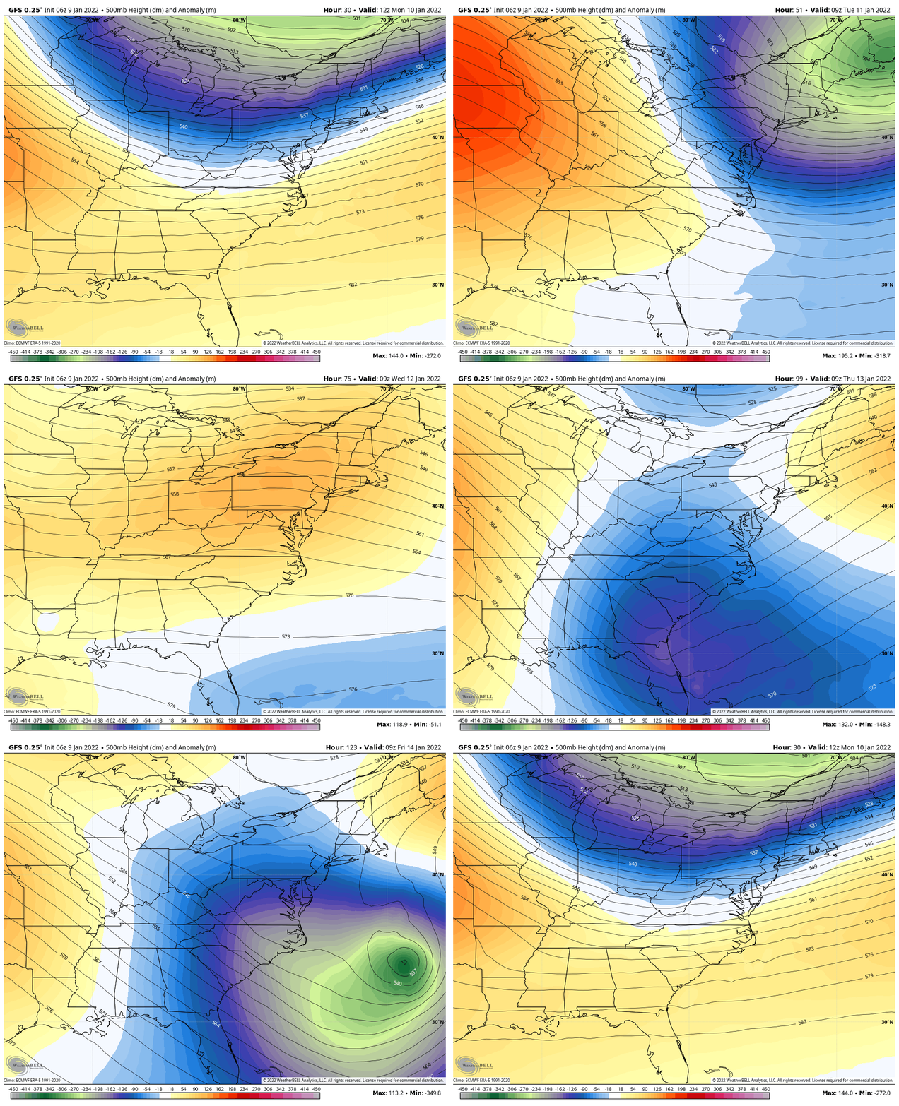
Jet Stream Next Week
We will get clipped by this Polar air mass Monday night into Tuesday.
Milder air arrives mid week, but we watch a storm off the coast likely miss us. However, that will help to pull back in colder air next weekend.
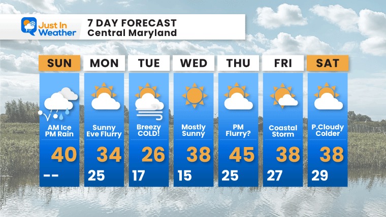
7 Day Forecast
Monday: Windy and colder. Evening flurries possible with arctic air.
Tuesday: Arctic air arrives: Bitter Cold!
Milder End Of Week, but update not as warm for long.
Weather posts straight to your inbox
Sign up and be the first to know!
ALSO SEE
What is Faith in the Flakes: History of December 5th Snow
ALL FITF GEAR
FITF THUNDERSNOW
Winter Outlook Series:
Last Winter Recap: My Old Outlook And Your Grades Of My Storm Forecasts
Winter Weather Page – Lots of resources
Solar Cycle Increasing Sunspots Suggests More Snow
Comparing 4 Different Farmer’s Almanacs: Majority colder winter outlook than NOAA
NOAA Winter Outlook- But Read The Fine Print
Signals For Early Start To Winter In November
Winter Outlook Series: La Nina Double Dip
Nor’easters May Give Hint For Winter La Nina Pattern
Winter Folklore Checklist


