


My First Call For Light Snow On Friday Afternoon And Evening And Model Total Maps
Wednesday December 3 Evening Update A little bit of snow can be a big problem, essentially when the thing is for a commute and the temperatures will be cold enough…
November 23 2021
Could the first flakes be on the way at the end of Thanksgiving Weekend? This may be a stretch for some, but it is worth having the conversation just to pay attention to at this time.
Last week I made a stand to NOT discuss a potential snow event 8 days away. That was because I did not trust the computer modeling. Many ‘potential’ weather events more than one week away got some excited, then would vanish. Well, that event would have been happened by today, and it did not. So I made the right call.
Fast forward to the topic of this post. Why would I ‘go there’?
There are a few reasons I am mentioning long range snow now.
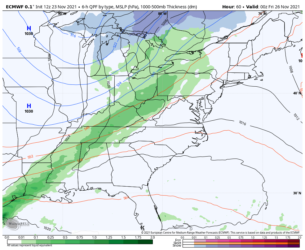
Rain arrives overnight After Thanksgiving, with snow to follow in the mountains on Friday.
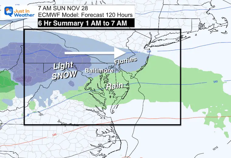
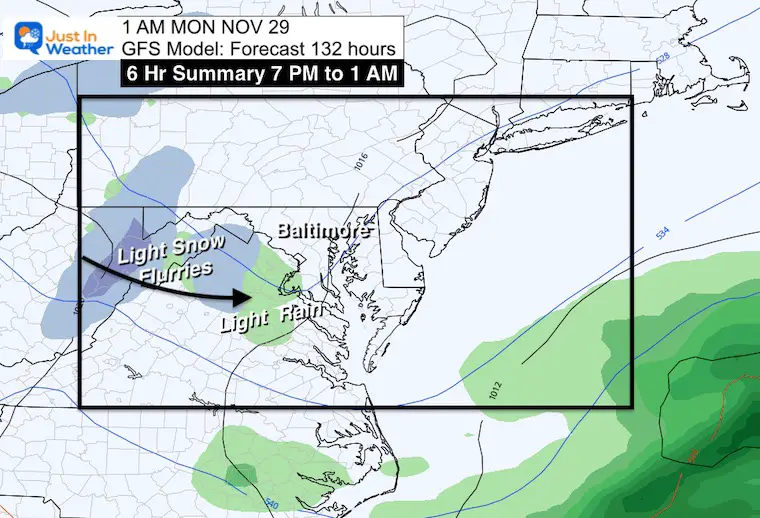
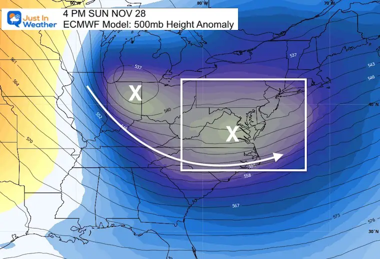
Watch the clipper race in from the upper MidWest to arrive Sunday morning. That is where we get the classic ‘snow inland and rain more likely by the water’.
This is NOT a major event and NOT for all. But, it could be the first flakes of the season in the region.
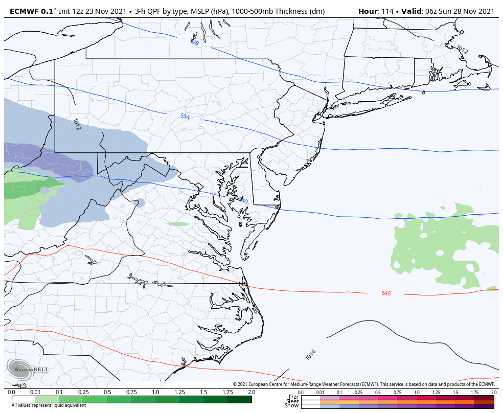
1 AM to 7AM SUNDAY
ECMWF 120 Hr Forecas
The American Model has just begun to hint at ‘something’.
This solution is LATER and LESS robust.
For argument sake, I am referring to the European Model from this point forward. It is considered to have a greater accuracy.
Before showing the the rest of the weather maps, I want to set the stage. A cold front will arrive on Friday morning. This will bing a brief hit of rain, followed by gusty winds and colder air into the weekend.
The system will be fast moving and expected to pass to our south. That is optimal when crossing the mountains.
Inland areas could get snow, but stickage would depend on the ground temps AND timing. What I will show below is mainly a Sunday morning thing. But I have seen models run slow then play catch up. So we could be dealign with something that ends up arriving later Saturday or overnight.
You can question whether we get snow or not, but it is hard to deny the reinforcing jet stream trough to supply colder air.
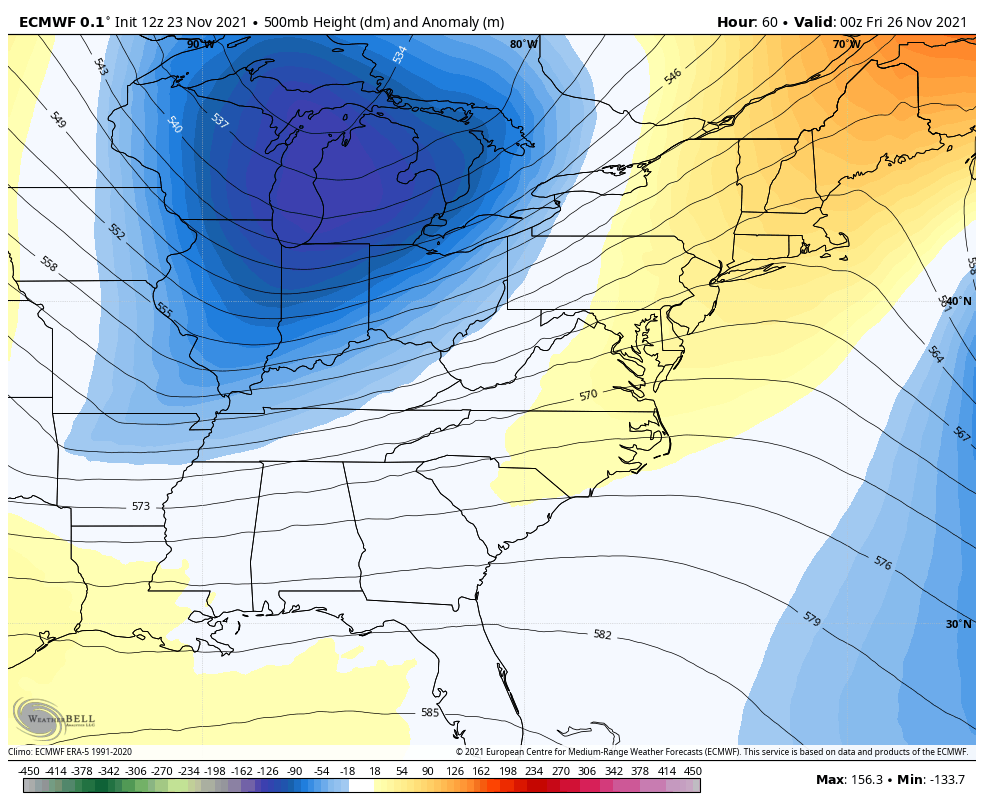
It does look like there will be two impulses. Both will be passing in the needed track to our south. The question will be how close to impact us.
This does NOT denote accumulation.
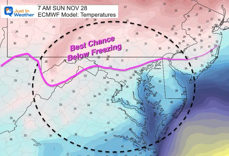
Cold air will be in place, but marginal with freezing in the north areas.
“North and West” event…
Early season systems also need to compete with a warmer Chesapeake Bay. The cities are a dividing line. If you live near or south of I-95 this is likely NOT going to be noteworthy with stickage. Rain or snow falling is still questionable there.
If you are traveling, no need to make any adjustments now. But may be worth watching if you are traveling in these areas:
Roads tend to have been paved on old geological demarcations. Here are the typical road/landmarks to keep in min.
More likely areas to get some light snow SundayL
I will keep track of this each day and let you know if the chances hold or of this falls apart.
Sign up and be the first to know!


Last Winter Recap: My Old Outlook And Your Grades Of My Storm Forecasts


