


May 6 Morning Fog Then Rain Returns Tonight
Monday May 6 Morning Report The pattern remains soggy with dense fog this morning. The next round of rain will return tonight into Tuesday morning. Then it should break up…
Friday Afternoon, February 16
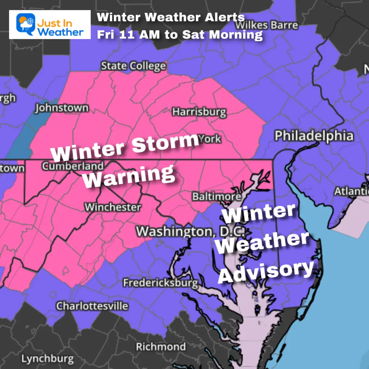
The expectation for colder temperatures to maximize snow accumulation is now being validated by The National Weather Service. The Winter Storm Warning now includes all of Central Maryland, including Baltimore. This is for the expectation of 4 to 6 inches of snowfall overnight.
Snowfall rates will be 1 to 2 inches per hour overnight as temperatures drop below freezing.
A Winter Storm Warning remains in place for Frederick County, Maryland, and westward for the highest totals to likely exceed 6 inches.
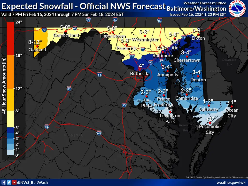
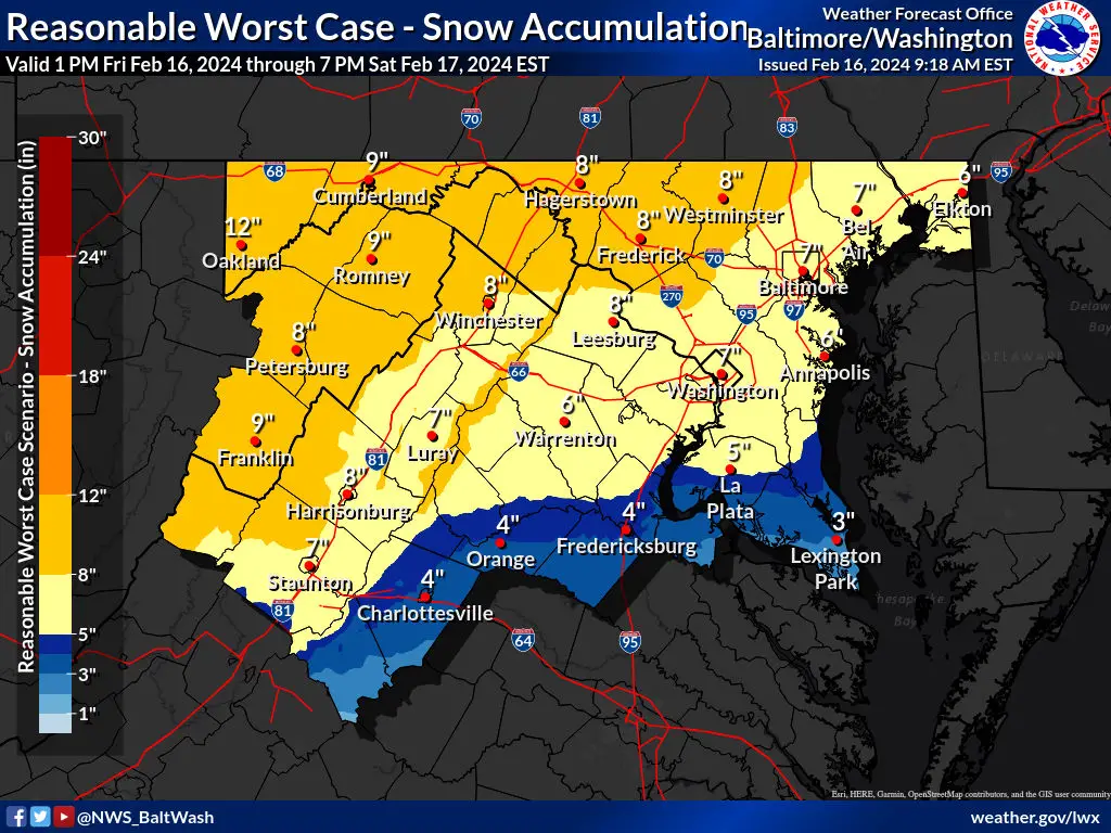
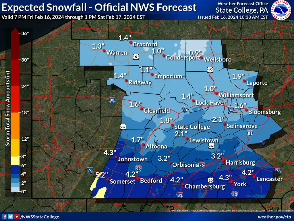
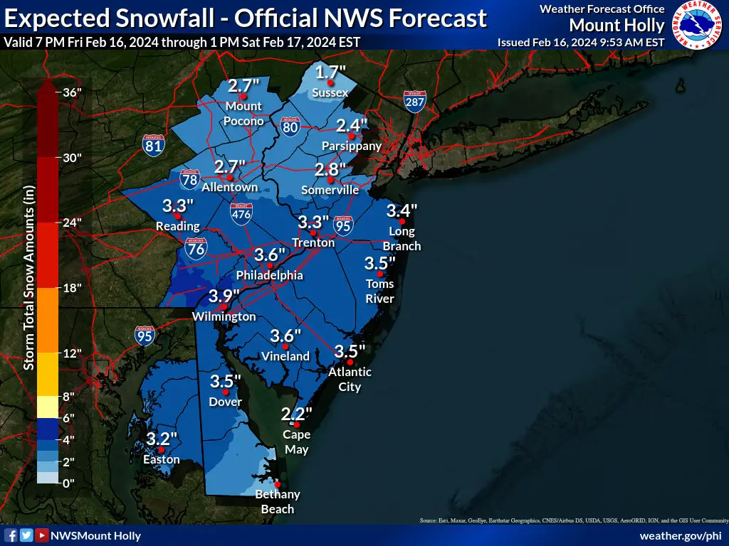
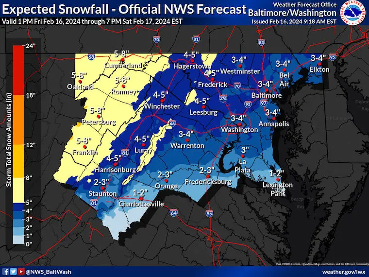
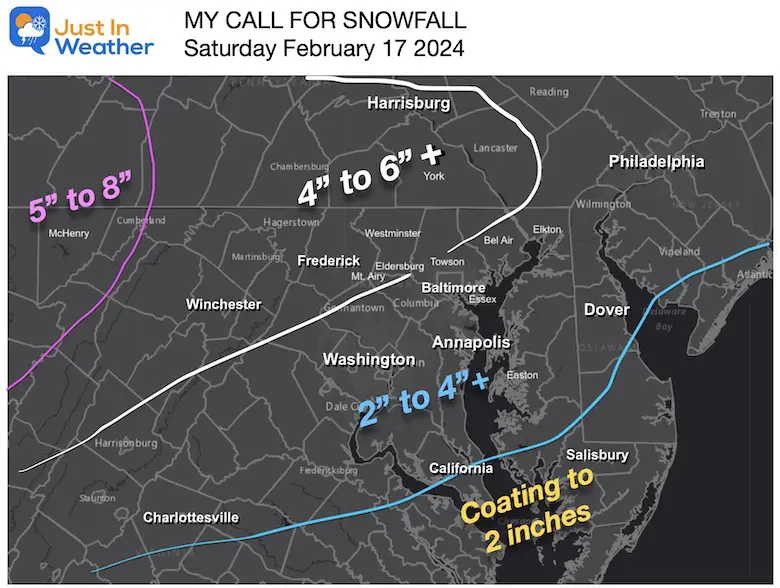
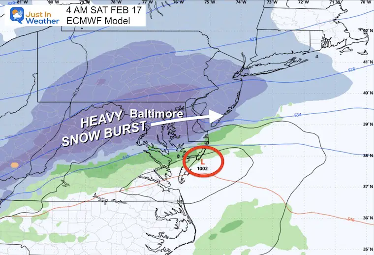
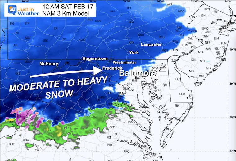
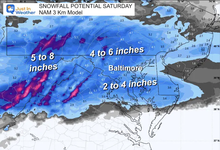
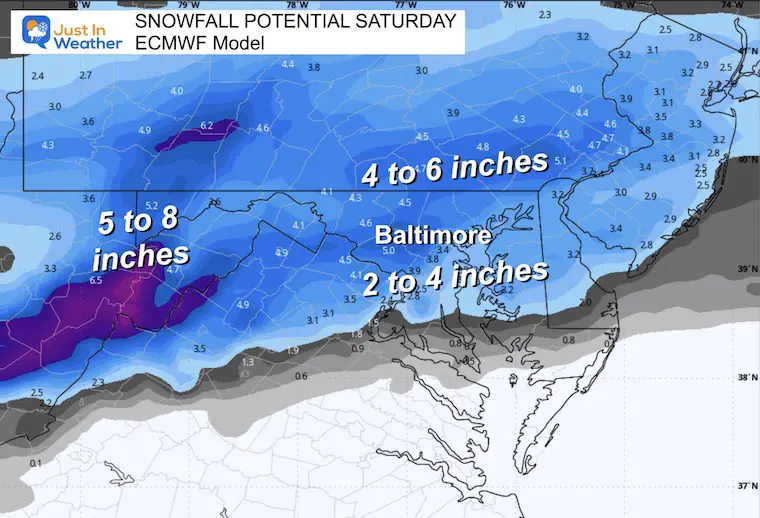
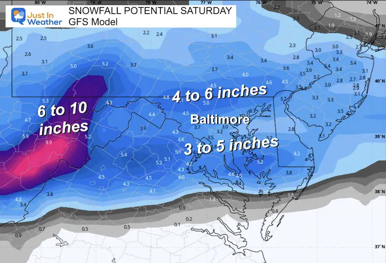
Here is the summary, then, compare My Call For Snowfall to the NWS Maps. Below are the model maps as well.
Note: Snow may fall at the rate of 1 to 2 inches per hour. Colder temperatures in the higher elevations will allow for a ‘dry flake’ and fluff up the totals higher.
Click here for the Preliminary Storm Reports: This FELL SHORT
It was FASTER and LES POTENT.
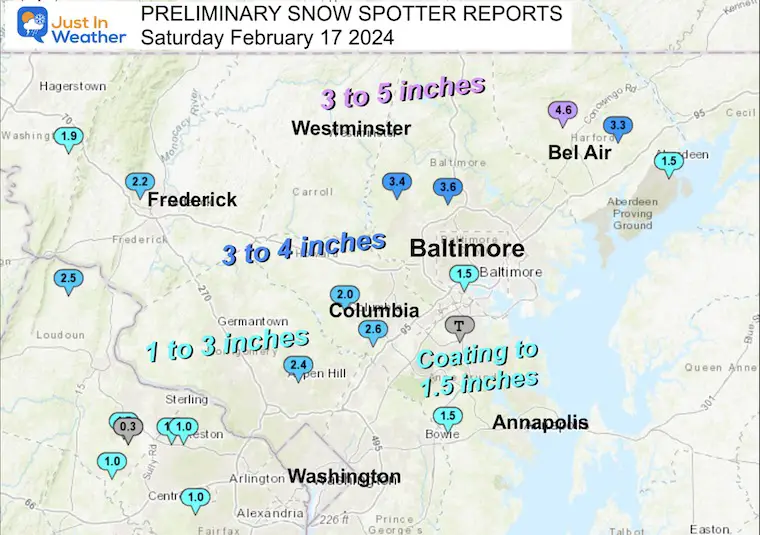
Central Maryland (new)
Snowfall 4 to 6 inches with some higher spots.
Frederick County Maryland
* WHAT…Heavy snow expected. Total snow accumulations of 3 to 6 inches. The highest totals are most likely under heavier snow bands and for elevations above 1000 feet where isolated total to 8 inches are possible.
Washington to Garrett County, MD: 4 to 8 inches of snow.
The heaviest snow will fall between 2 AM and 6 AM. Snowfall rates may be 1 to 2 inches per hour in some cells and bands.
See the local maps below.
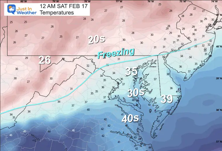
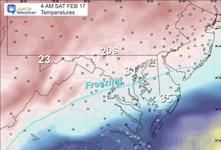
Temperatures will be dropping, with the freezing line expected to reach near Annapolis. This will allow for more stickage and accumulation in those areas south of I-95.
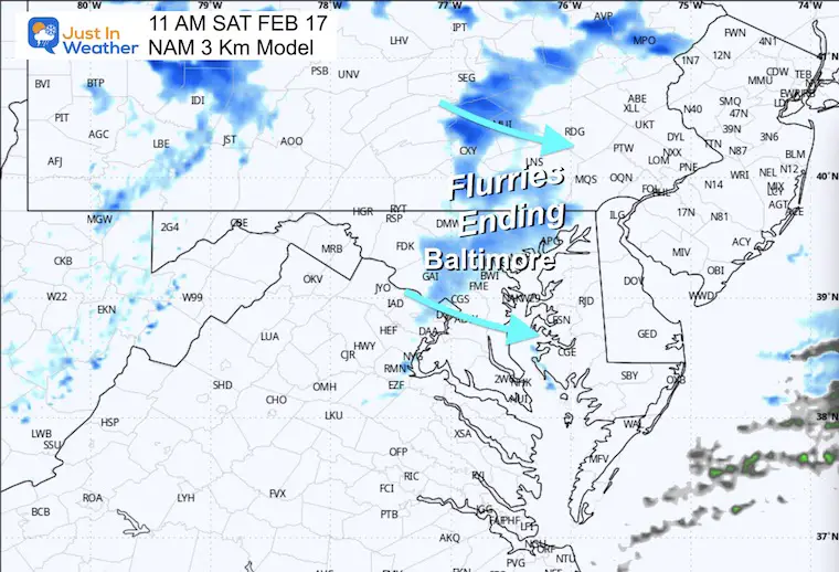
Snow will exit the coast, but the upper-level energy may keep snow showers and flurries inland for a few extra hours.

Snow should be coming to an end.
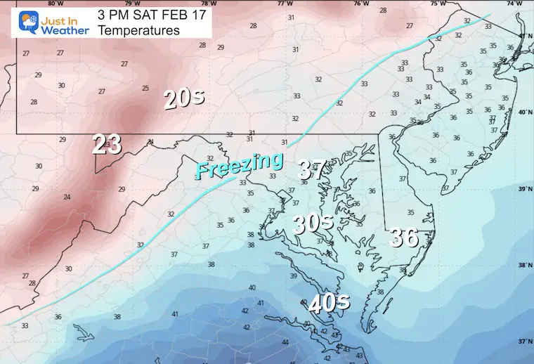
The daylight will help with melting on the roads.. but as it stays near freezing inland, expect icy spots in the shade and a quick refreeze in the evening.
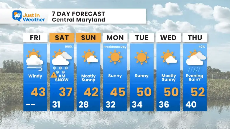
The main event will be Saturday Morning, then quiet as we head into next week.

Click to see more and ‘Book’ a visit to your school


Computer Models Support East Coast Storm Track

The latest NOAA report is confident in a Very Strong event. Possibly HISTORIC! This refers to the temperatures in the Pacific, with impacts on the US Winter Storm Track.

Winter Weather Folklore: Top 20 and more signals from nature for snow.
Winter Outlook 2024 From Two Farmers Almanacs Return to Cold and Snow
I am aware there are some spelling and grammar typos and occasional other glitches. I take responsibility for my mistakes and even the computer glitches I may miss. I have made a few public statements over the years, but if you are new here, you may have missed it: I have dyslexia and found out during my second year at Cornell University. It didn’t stop me from getting my meteorology degree and being the first to get the AMS CBM in the Baltimore/Washington region. One of my professors told me that I had made it that far without knowing and to not let it be a crutch going forward. That was Mark Wysocki, and he was absolutely correct! I do miss my mistakes in my own proofreading. The autocorrect spell check on my computer sometimes does an injustice to make it worse. I also can make mistakes in forecasting. No one is perfect at predicting the future. All of the maps and information are accurate. The ‘wordy’ stuff can get sticky. There has been no editor who can check my work when I need it and have it ready to send out in a newsworthy timeline. Barbara Werner is a member of the web team that helps me maintain this site. She has taken it upon herself to edit typos when she is available. That could be AFTER you read this. I accept this and perhaps proves what you read is really from me… It’s part of my charm. #FITF