


May 11 Aurora Viewing Forecast Weather And More Photos
Saturday May 11, 2024 The display of Northern Lights last night was historic. As the name implies, this is more common in the Northern Latitudes. On rare occasions we can…
Friday Evening Update February 16
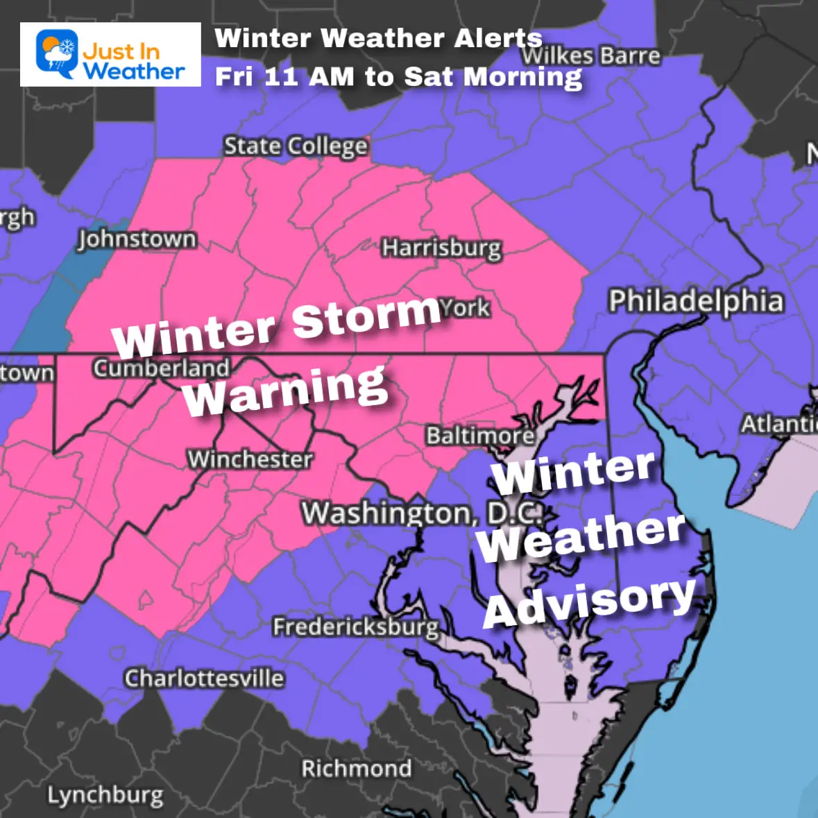
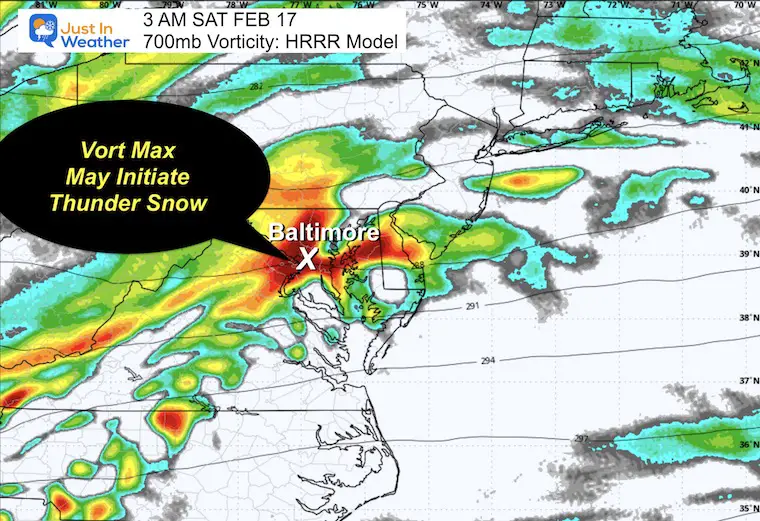
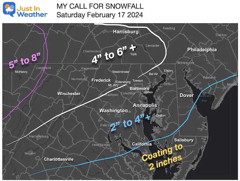
This quick update is simply to tighten up the expectations and add one more possibility for what you might expect with the snow storm tonight. The last two days has seen a rapid increase in expectations with this Clipper, and I want to add in the potential for thunder snow.
The burst of snow with rates of 1 to 2 inches per hour will have dynamics of rapidly rising air. The National Weather Service has boosted the snow expectation for Central Maryland up to 5 to 8 inches. One way to get there is that the energy aloft that can also give rise to brief lightning.
Yes, thunder snow is possible… If you an interested, there is no promise but the best chance may be between 2 AM and 5 AM.
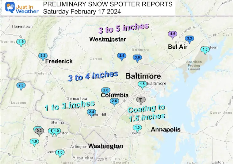
Click here for the Preliminary Storm Reports: This FELL SHORT
It was FASTER and LES POTENT.
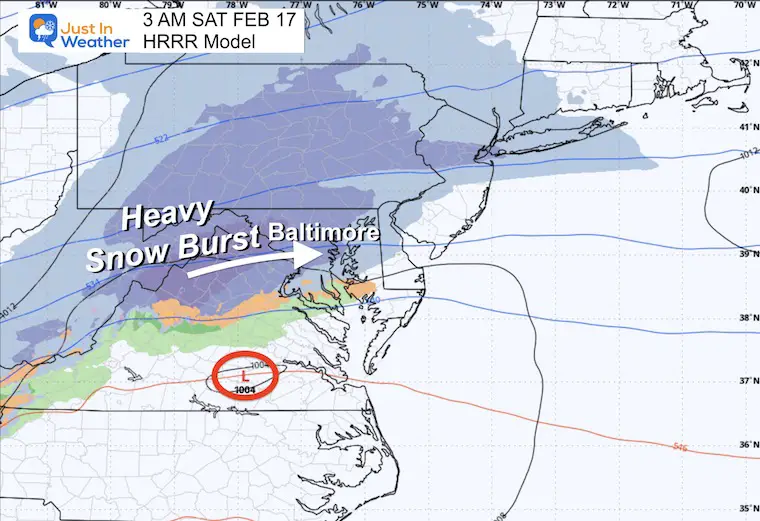
Low Pressure is loaded in eastern Tennessee and will be tracking through Southeast Virginia then off the coast before sunrise.
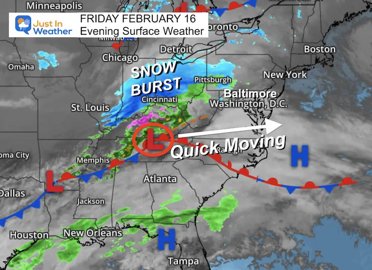
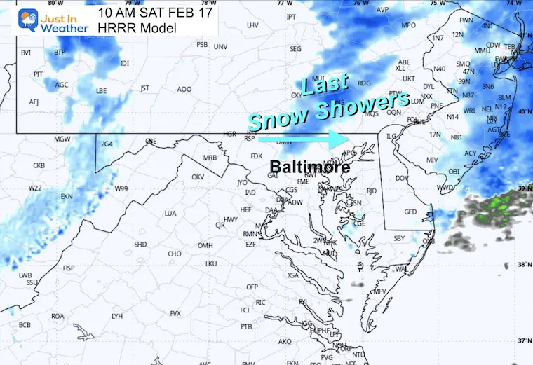
The burst of snow will be moving across the mountain and into metro areas by this time.
The circulation aloft, north of the Low Pressure Center is what will be enhancing this snowfall. While it brings rates of 1 to 2 inches per hour, this Vort Max may also kick off Thunder Snow between Washington and Baltimore.
The snow should be reaching Hagerstown to York and Harrisburg by this time. It will advance across metro Baltimore over the next 1 to 2 hours.
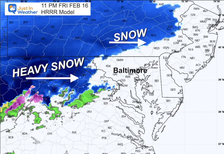
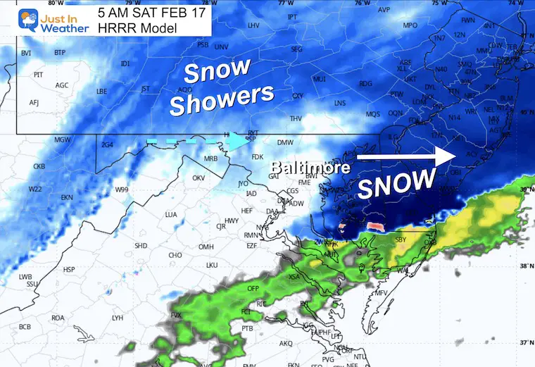
This will be fas moving event. The heaviest snow will fall over a few hours, then depart by sunrise. Some leftover snow showers or flurries may remain inland during the morning… with little to no accumulation.
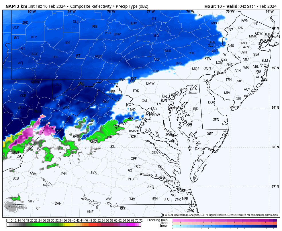
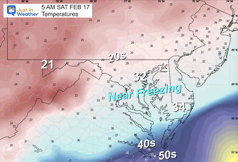
The freezing line should make it very close to Annapolis. Inland areas west and north will be in the 20s. This means ‘dry’ flakes will fluff up for greater accumulation than ratios than the normal 10 to 1.
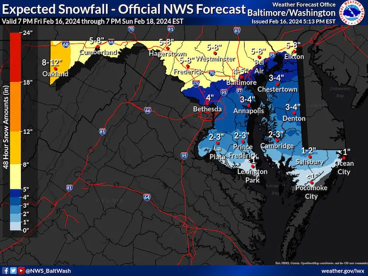
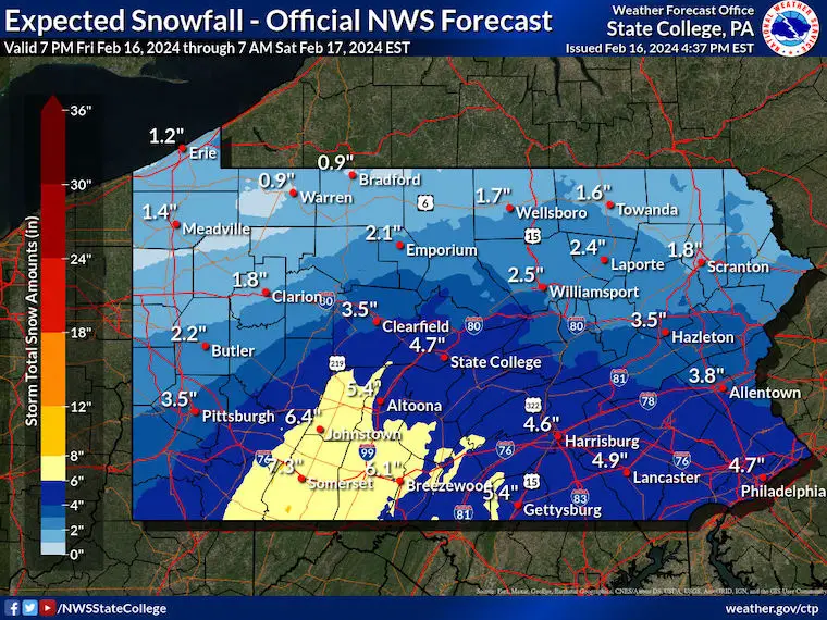
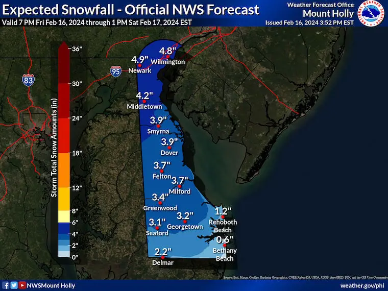
I am leaving this forecast with our adjustment to see how it holds up. In the zone I put 4 to 6 inches + there is potential to reach 8 inches in bursts.
In my 2 to 4 inch + range I expect the high end may be 6 inches.

Click to see more and ‘Book’ a visit to your school


Computer Models Support East Coast Storm Track

The latest NOAA report is confident in a Very Strong event. Possibly HISTORIC! This refers to the temperatures in the Pacific, with impacts on the US Winter Storm Track.

Winter Weather Folklore: Top 20 and more signals from nature for snow.
Winter Outlook 2024 From Two Farmers Almanacs Return to Cold and Snow
I am aware there are some spelling and grammar typos and occasional other glitches. I take responsibility for my mistakes and even the computer glitches I may miss. I have made a few public statements over the years, but if you are new here, you may have missed it: I have dyslexia and found out during my second year at Cornell University. It didn’t stop me from getting my meteorology degree and being the first to get the AMS CBM in the Baltimore/Washington region. One of my professors told me that I had made it that far without knowing and to not let it be a crutch going forward. That was Mark Wysocki, and he was absolutely correct! I do miss my mistakes in my own proofreading. The autocorrect spell check on my computer sometimes does an injustice to make it worse. I also can make mistakes in forecasting. No one is perfect at predicting the future. All of the maps and information are accurate. The ‘wordy’ stuff can get sticky. There has been no editor who can check my work when I need it and have it ready to send out in a newsworthy timeline. Barbara Werner is a member of the web team that helps me maintain this site. She has taken it upon herself to edit typos when she is available. That could be AFTER you read this. I accept this and perhaps proves what you read is really from me… It’s part of my charm. #FITF