


May 11 Weather Through Mothers Day Plus Aurora Photos and Forecast For More
Saturday, May 11 Morning Report We are stuck in this chilly and damp pattern. While we may have some sunny breaks and a little boost of temperatures back to the…
Wednesday Night Update February 14
As I write this on Valentine’s Day evening, I realize some of you might love this: Have you heard me talk about Atmospheric Memory? Well, check out this pattern: In January, we had two snow events 4 days apart. Now it looks like we may have a similar outcome.
The January 15 and 19 clusters fell on Monday and Friday. This week, we had snow on Tuesday and are now expecting more 4 days later, early on Saturday.
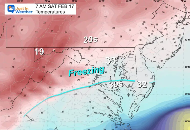
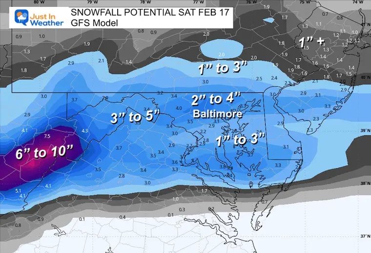
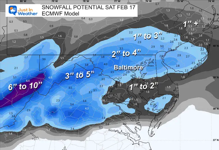
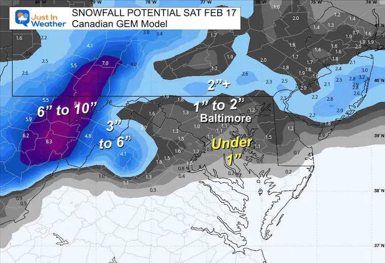
While we still don’t have arctic air in place, we have chilled down in the last few days and will have colder air in place with the snow on Saturday morning. This may assist in allowing more to stick.
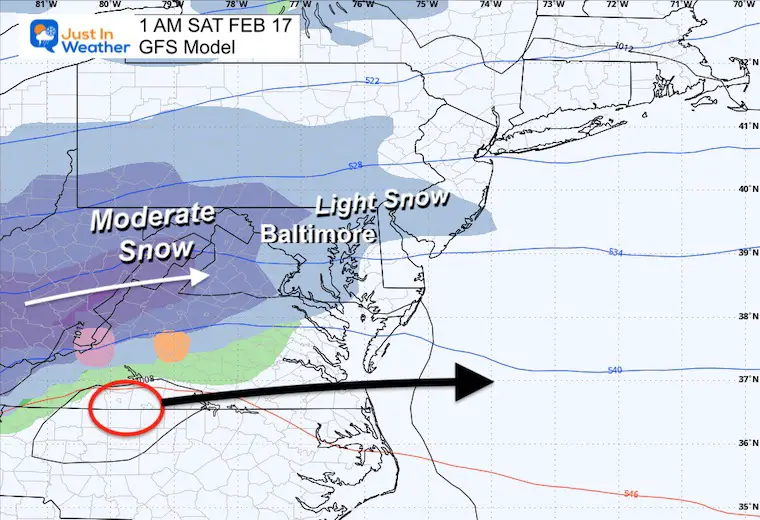
My first glance has me leaning towards impact snow with a range of 1 to 4 inches. If you have school sports activities or other events, they may be affected. The system should end for us as it moves away in the afternoon.
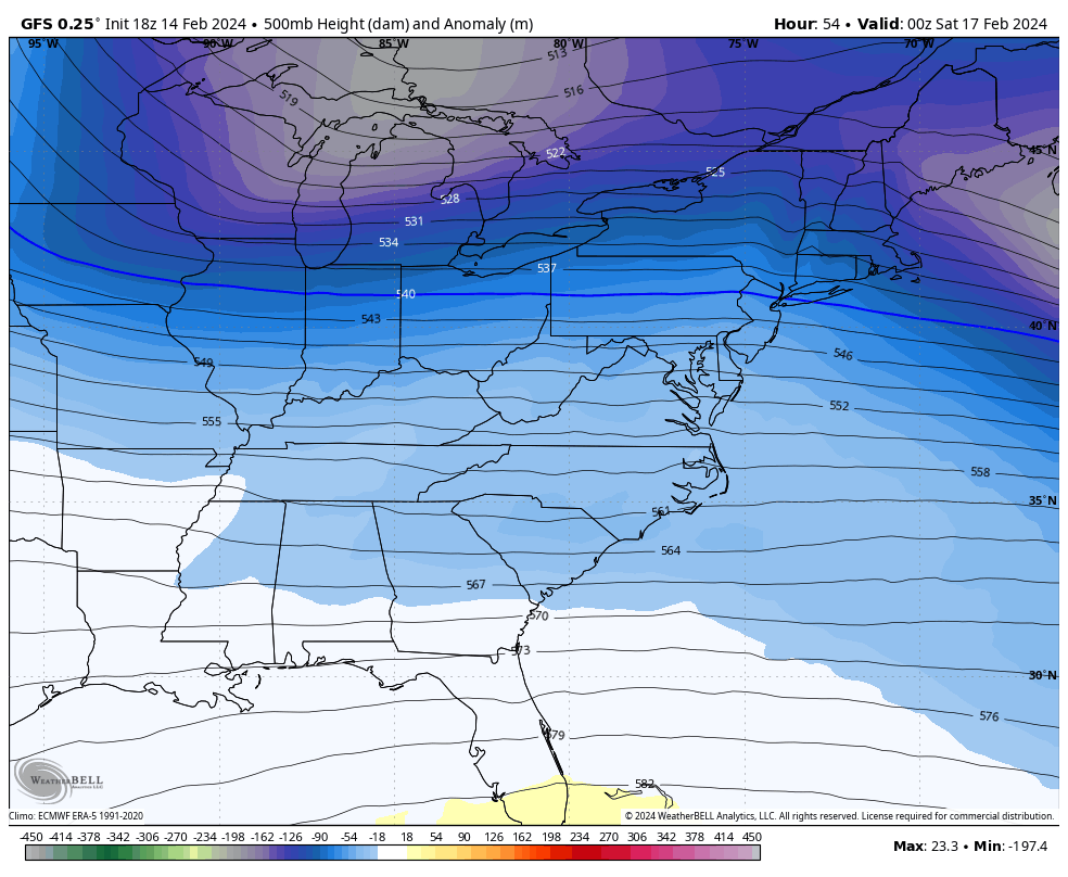
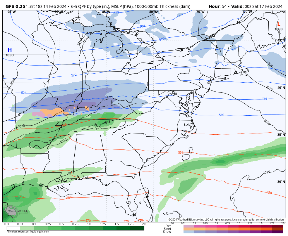
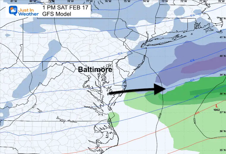
Low Pressure will track quickly through southern Virginia between midnight and Noon. This is a prime way to allow cold air to fill in across much of southern PA through much of Maryland.
This storm will ride a brief dip of cold air in the jet stream just in time to give us wintry weather.
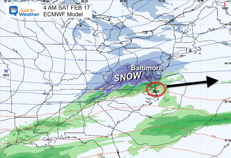
This is very similar to the ECMWF Track
Peak snow will develop before sunrise.
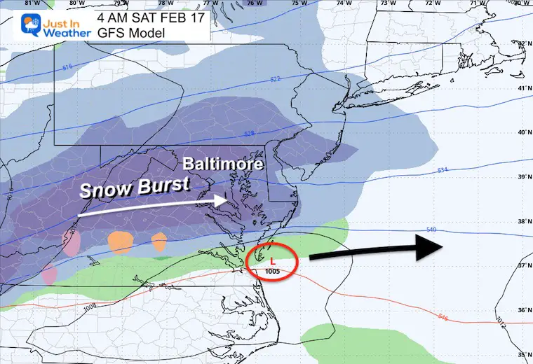
The heaviest snow may be around sunrise.
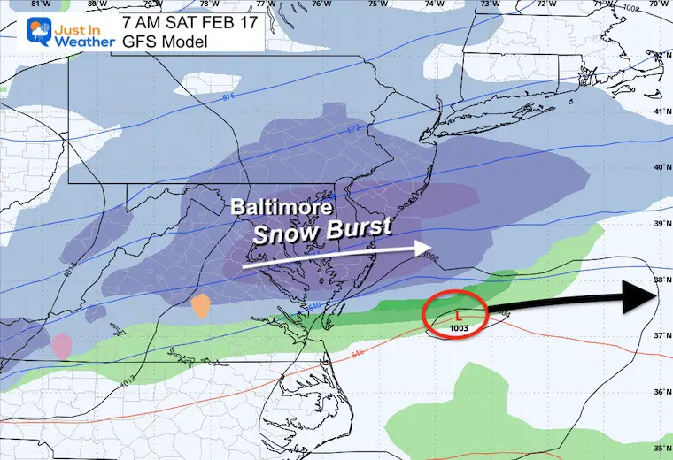
Much of the region will drop below freezing allowing for stickage and accumulation.
Late morning will show the snow ending from west to east.
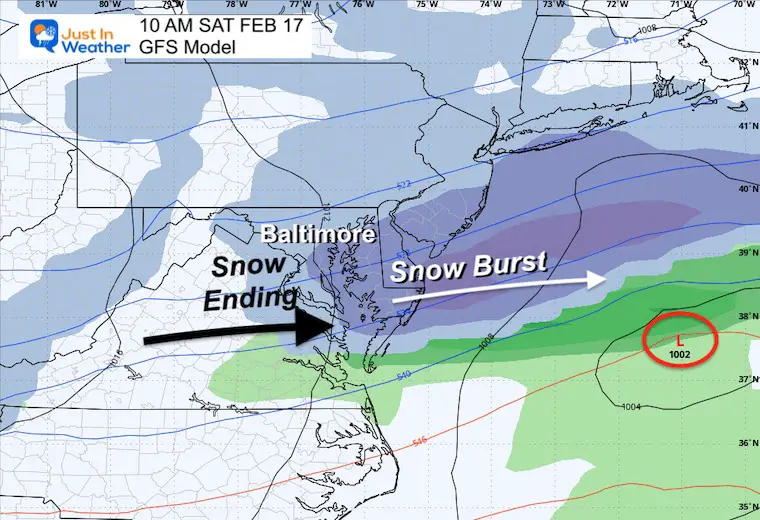
The afternoon should be clearing out.
As expected, there is some discrepancy. I would still expect a range of 1 to 4 inches across much of the region.
If any Winter Weather Watches or Advisories are issued, we may not see them until Friday for this early Saturday event.
Click here for the maps and full report
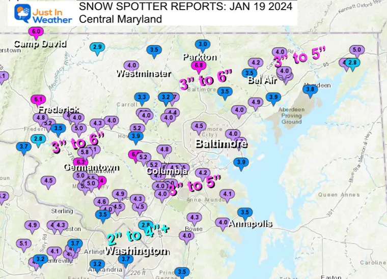
Click here or the map to see: The Snow Report Ending Jan 16


Click to see more and ‘Book’ a visit to your school


Computer Models Support East Coast Storm Track

The latest NOAA report is confident in a Very Strong event. Possibly HISTORIC! This refers to the temperatures in the Pacific, with impacts on the US Winter Storm Track.

Winter Weather Folklore: Top 20 and more signals from nature for snow.
Winter Outlook 2024 From Two Farmers Almanacs Return to Cold and Snow
I am aware there are some spelling and grammar typos and occasional other glitches. I take responsibility for my mistakes and even the computer glitches I may miss. I have made a few public statements over the years, but if you are new here, you may have missed it: I have dyslexia and found out during my second year at Cornell University. It didn’t stop me from getting my meteorology degree and being the first to get the AMS CBM in the Baltimore/Washington region. One of my professors told me that I had made it that far without knowing and to not let it be a crutch going forward. That was Mark Wysocki, and he was absolutely correct! I do miss my mistakes in my own proofreading. The autocorrect spell check on my computer sometimes does an injustice to make it worse. I also can make mistakes in forecasting. No one is perfect at predicting the future. All of the maps and information are accurate. The ‘wordy’ stuff can get sticky. There has been no editor who can check my work when I need it and have it ready to send out in a newsworthy timeline. Barbara Werner is a member of the web team that helps me maintain this site. She has taken it upon herself to edit typos when she is available. That could be AFTER you read this. I accept this and perhaps proves what you read is really from me… It’s part of my charm. #FITF